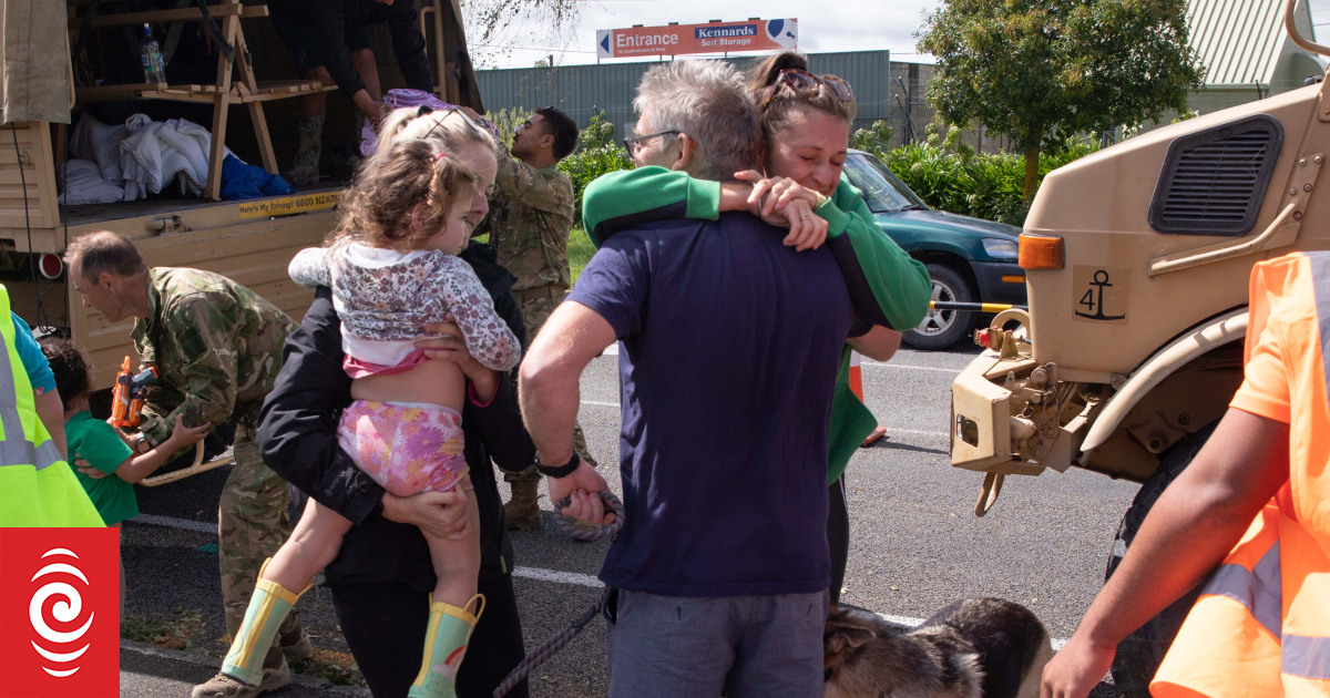
There were emotional scenes outside an evacuation centre in Hastings as people were reunited.
Photo: RNZ / Angus Dreaver
The full picture of the devastation from Cyclone Gabrielle is becoming clearer today. We’ve collected photos from RNZ journalists and readers from across the regions.

The Defence Force delivered truckloads of people to the evacuation centre in Hastings from Waiohiki.
Photo: RNZ / Angus Dreaver
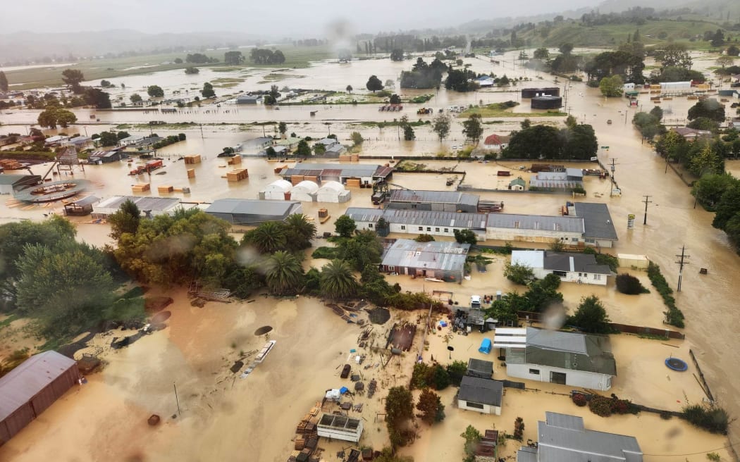
Flooding in Wairoa after the river burst its banks due to heavy rain from Cyclone Gabrielle.
Photo: Wairoa District Council’s Emergency Controller
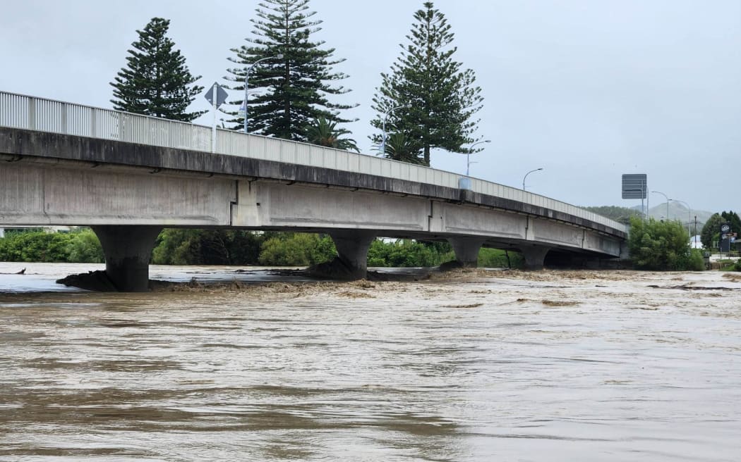
A bridge in Wairoa where the river burst its banks, inundating houses in the cut-off northern Hawke’s Bay town.
Photo: Hawke’s Bay Civil Defence Emergency Management Group
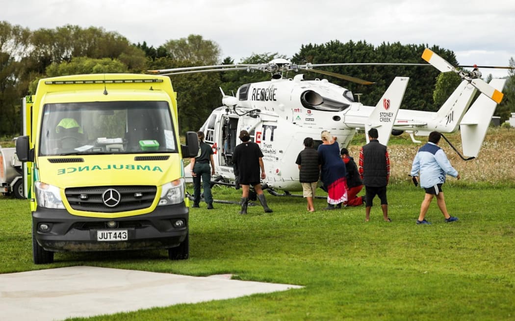
Evacuees on the East Coast prepare to board a rescue helicopter.
Photo: RNZ / Nate McKinnon
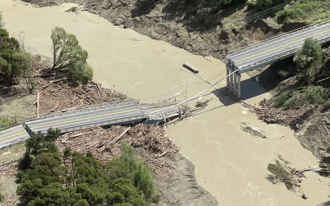
A damaged bridge seen during a flight over Gisborne after Cyclone Gabrielle.
Photo: East Coast MP Kiritapu Allan

People were on hand with warm food to offer evacuees from Waiohiki in Hawke’s Bay.
Photo: RNZ / Angus Dreaver
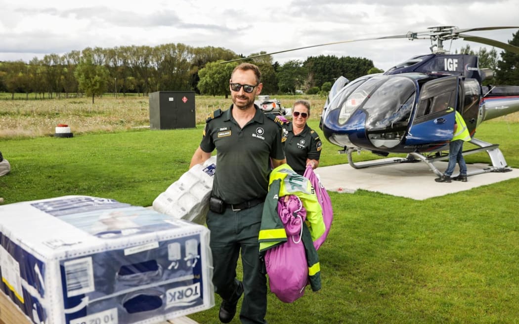
Medical supplies are dropped off on the east coast.
Photo: RNZ / Nate McKinnon
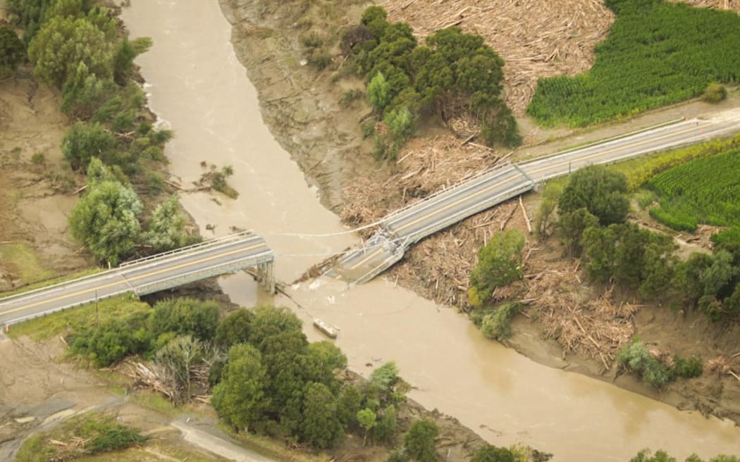
Damage to a bridge in the East Coast region.
Photo: RNZ / Nate McKinnon
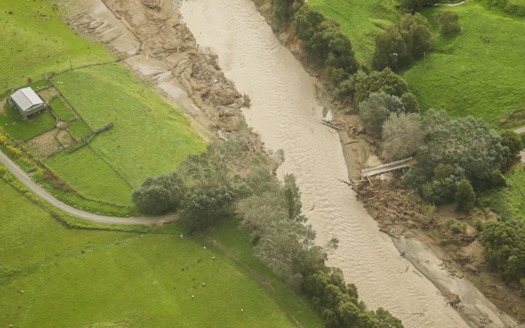
A bridge has been swept away in the East Coast region.
Photo: RNZ / Nate McKinnon
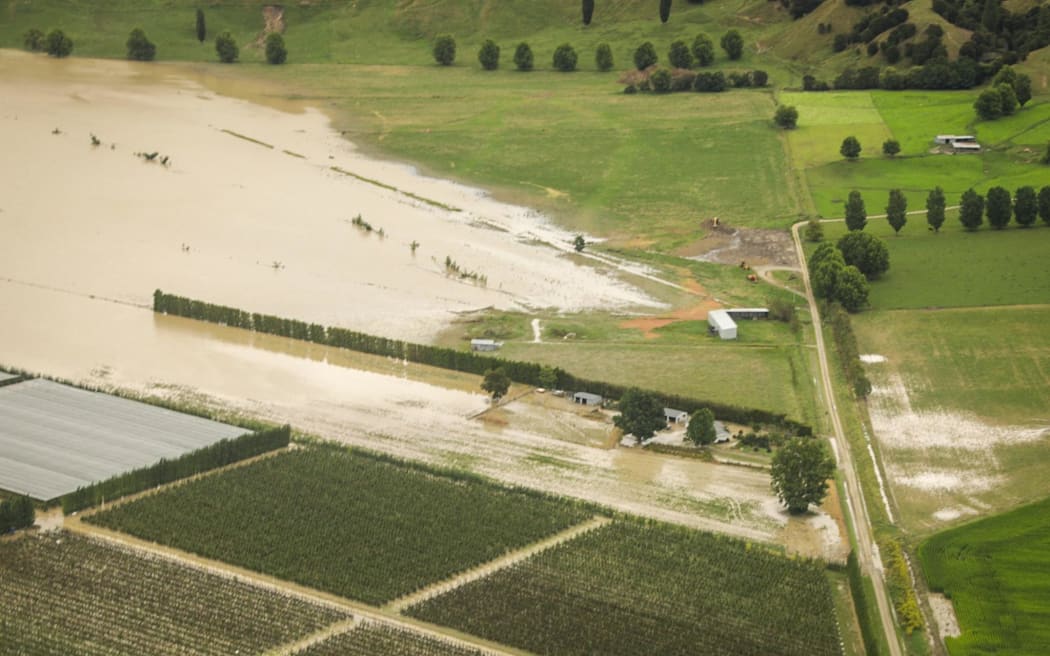
Photo: RNZ / Nate McKinnon
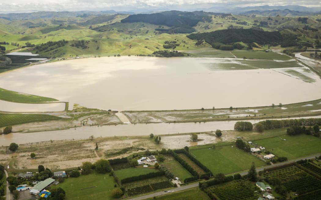
RNZ’s visual journalist captured these images from just outside Te Karaka, near Gisborne
Photo: RNZ / Nate McKinnon
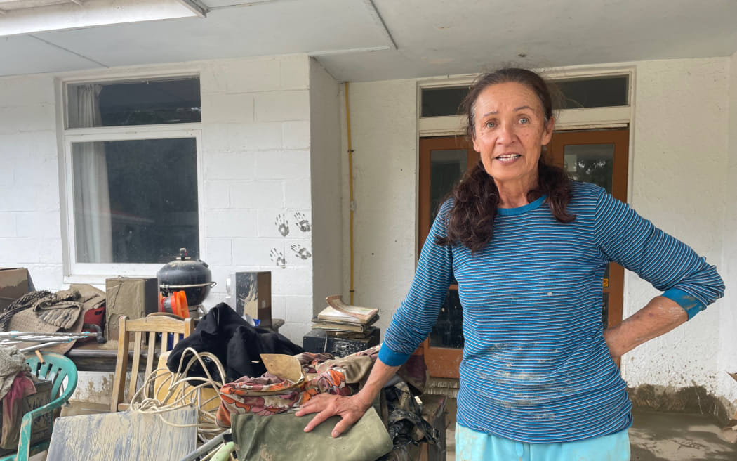
Raipoia Brightwell lives on Marion st, Gisborne. The silt is over a metre deep at their home next to the Waimata river
Photo: RNZ / Kate Green
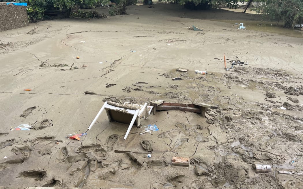
Raipoia Brightwell lives on Marion st, Gisborne. The silt is over a metre deep at their home next to the Waimata river.
Photo: RNZ / Kate Green
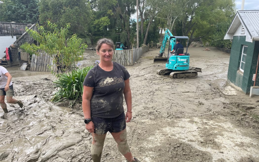
Amy Spence has help cleaning up her section on Graham Rd in Gisborne. There’s 1.5m of silt in the garden
Photo: RNZ / Kate Green
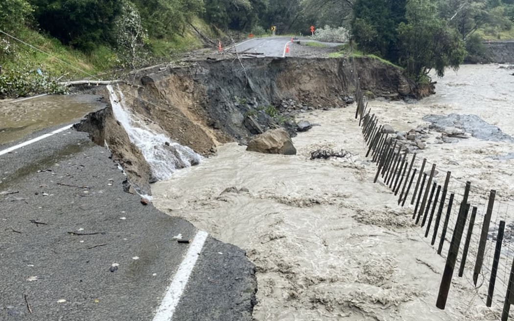
The road is flooded and washed out near Te Araroa, East Cape
Photo: Supplied
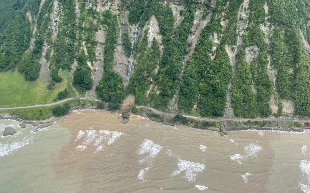
New slips on East Cape Road block access in and out near Te Araroa
Photo: RNZ / Māni Dunlop
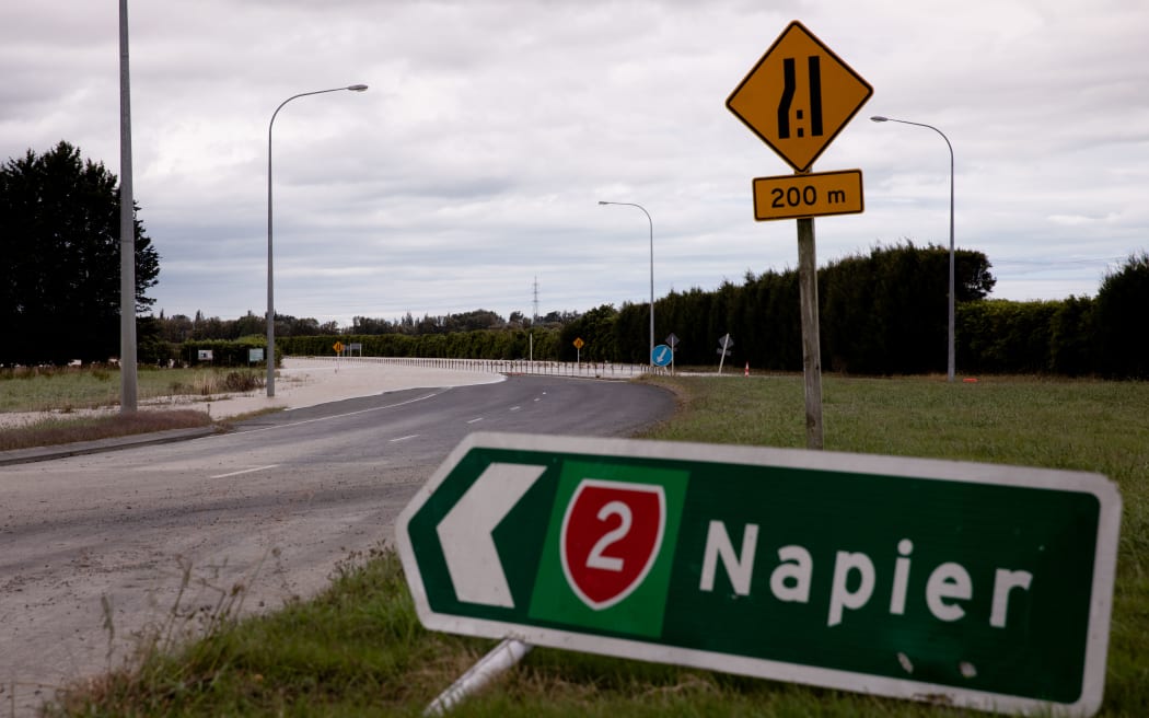
SH2 just south of the closed bridge between Napier and Hastings.
Photo: RNZ / Angus Dreaver
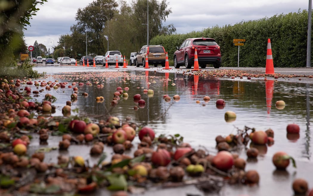
SH2 just south of the closed bridge between Napier and Hastings. Apples are jammed between the cables where the water level used to be
Photo: RNZ / Angus Dreaver
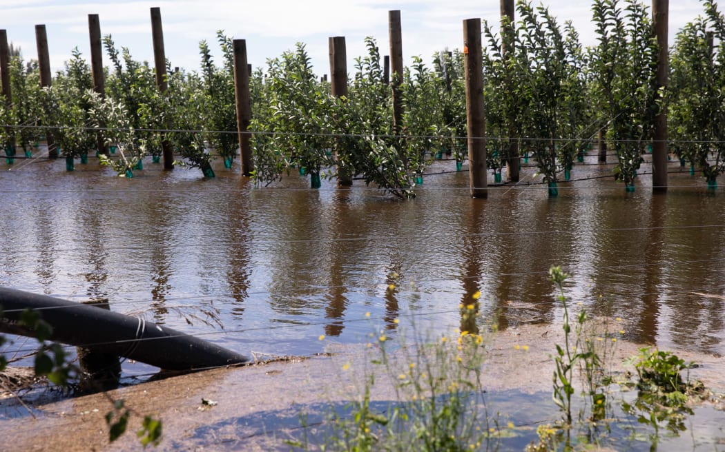
A flooded orchard and apples strewn over the road just outside Hastings.
Photo: RNZ // Angus Dreaver
This footage was taken by Dawson Bliss in the Fernhill area in Hawkes Bay. It shows Ngaruroro River with burst banks flooding homes and Omahu Marae
Also from Dawson Bliss, this flyover near Twyford shows a very large area flooded
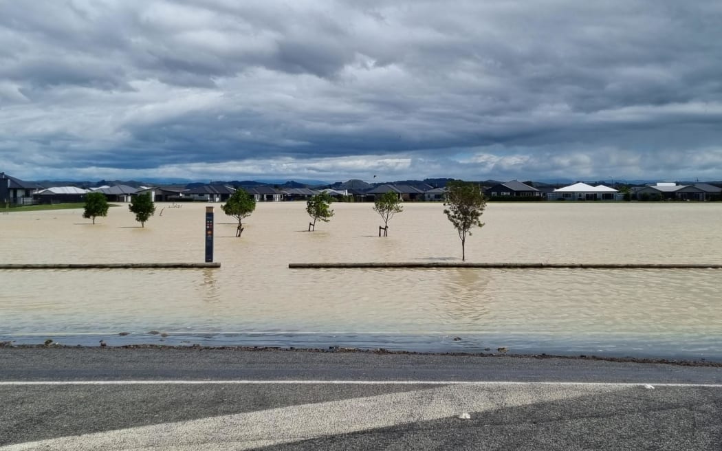
Flooding in Te Awa where people were evacuated on Wednesday
Photo: RNZ / Krystal Gibbens
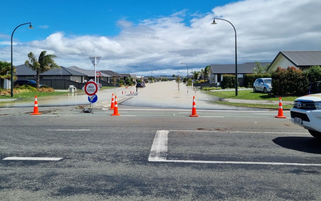
Blue skies over flooded Te Awa in Hawkes Bay
Photo: Krystal Gibbens
Rescued worker stranded for hours on roof as floodwaters rise
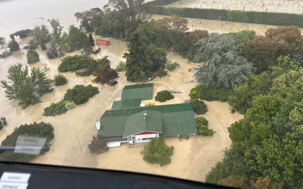
An NH90 helicopter and crew recover people from the rooftops of their homes in Esk Valley, Napier
Photo: Supplied / NZDF
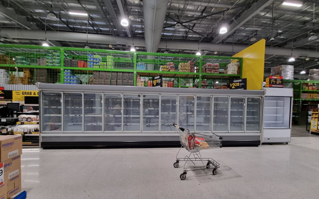
A shortage of supplies is evident, with empty shelves at Pak’nSave in Napier. Queues to get in stretched around the street, with the supermarket limiting the number of people inside at a time.
Photo: RNZ / Krystal Gibbens
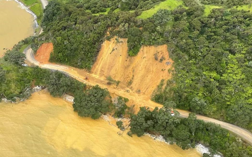
A significant slip on SH25 Thames Coast Road
Photo: Thames-Coromandel District Council
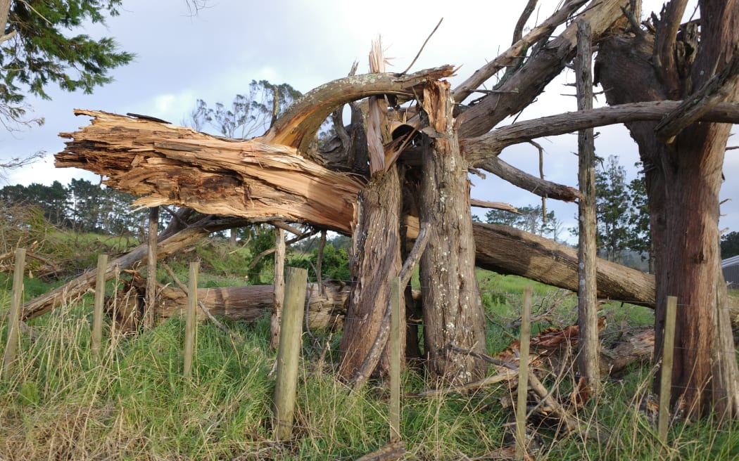
Trees snapped off in Kumeū during the high winds that came with Cyclone Gabrielle
Photo: Supplied / Jarred Bishop
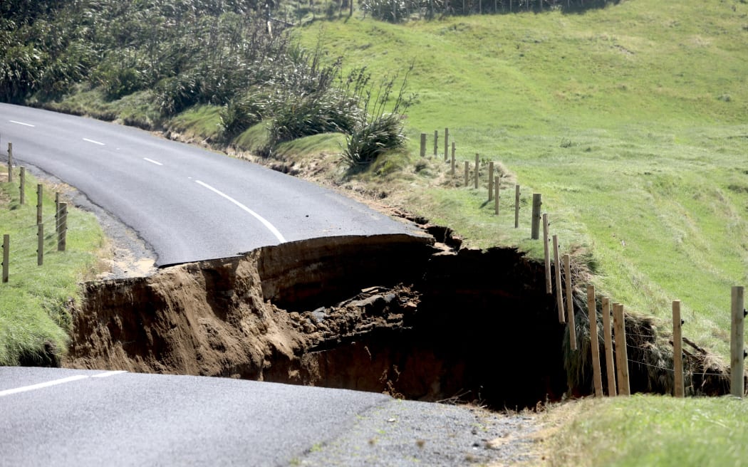
A major slip on Manukau Heads Road
Photo: RNZ / Marika Khabazi
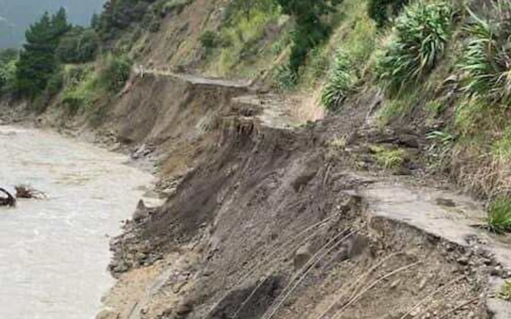
Severe damage on the road through Marainanga Gorge to Ākito, on the coast east of Dannevirke
Photo: Supplied
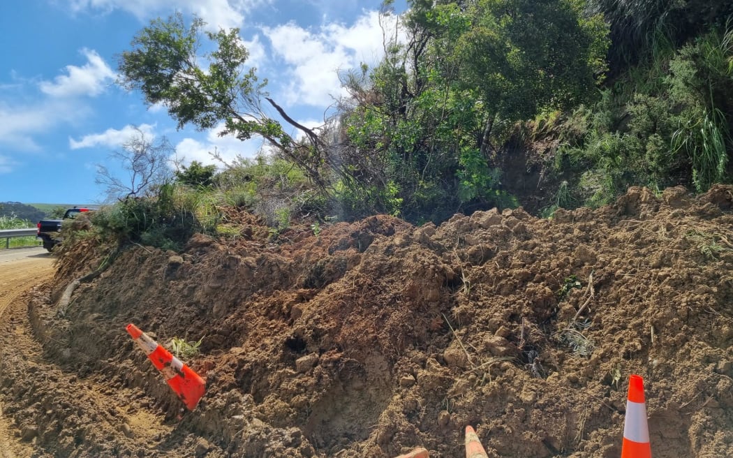
A large slip on Matakana Valley Road, blocking part of a route between Wellsford and Leigh
Photo: Soumya Bhamidipati




Discussion about this post