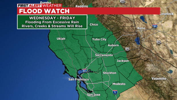
A strong atmospheric river event has the potential to be one of the most impactful storms Northern California has seen in a while. This storm will have multiple hazards and as of this writing, the following weather alerts are in effect:
Flood Watch – Valley & Foothills
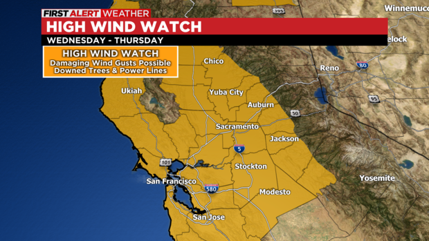
High Wind Watch – Valley & Foothills
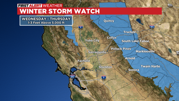
Winter Storm Watch– Sierra
HEAVY RAIN:
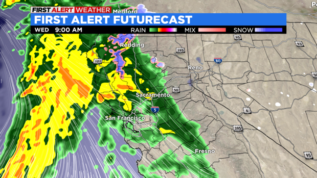
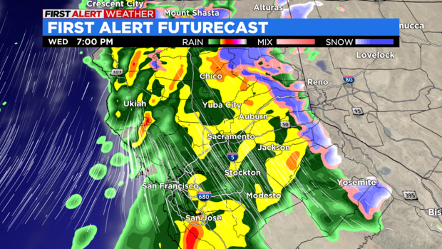
Rain will move into the area, becoming heavy at times Wednesday morning. Urban flooding and street flooding may rapidly develop, especially with already saturated soils. The first batch of rain will lift to the north and east with parts of the Valley getting a brief break midday. Another batch of very heavy rain will swing through later in the day and into the overnight. It is this batch that will pose the greatest threat of flooding in our area.
Additionally, strong winds may bring down lots of tree debris, potentially clogging storm drains or damming smaller creeks and streams. This could result in significant street flooding with some roads becoming impassable. Flooding in the Foothills may be similar to that of Saturday. Rockslides and road washouts will also be possible.
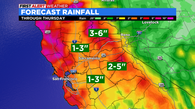
The rain will taper off Wednesday night with off-and-on showers Thursday. Rainfall totals will likely range from 1-3 inches in the Valley to 2-5 inches in the Foothills. Isolated rainfall amounts of 6 inches will be possible in the Foothills.
The Cosumnes and Mokelumne Rivers will both be ones to watch, especially where breaches/ breaks have occurred. Many small creeks and streams may approach the flood stage. This must be monitored as some may reach minor or moderate flooding.
STRONG TO DAMAGING WINDS:
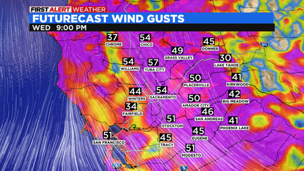
Southerly winds will increase Wednesday afternoon bringing a period of strong to damaging wind gusts. The Valley and Foothills may experience wind gusts approaching 50-60 miles per hour. The combination of high winds and wet grounds will have the potential to bring down numerous trees (with the root and everything) resulting in widespread outages. The timing of high winds will be from Wednesday afternoon into the overnight. The Sierra may have gusts exceeding 60 miles per hour at times.
It is important to reiterate that storm drains and ditches may become clogged with debris. This could exacerbate areal flooding in spots.
HEAVY SNOW:
Snow in the Sierra will become heavy Wednesday morning with snow levels as low as 3,500 feet. Snow levels will quickly rise to 7,000 feet Wednesday afternoon before falling back to 4,500 feet Thursday morning. Travel will be difficult with very low visibility, while chain controls and closures are expected.
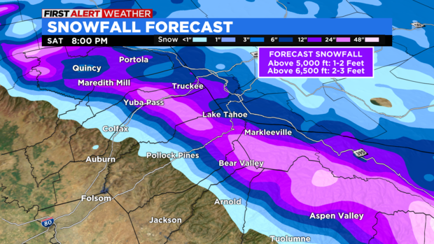
Snowfall will range from 1-2 feet above 5,000 feet to 2-3 feet above 6,500 feet. Snow will taper off on Thursday.
SUMMARY:
Widespread impacts are expected Wednesday and across the Greater Sacramento region. Widespread river flooding is not anticipated, although there will be some along the smaller creeks and streams. However, the combination of saturated grounds and potentially clogged drains from debris will result in significant street flooding. The Cosumnes and Mokelumne rivers should be monitored closely.
Most rivers will likely crest near or below flood stage Thursday with larger rivers cresting sometime on Friday.




Discussion about this post