With more than 10,000 kilometers of marked trails, Slovenia is undoubtedly a premier hiking destination in Europe. There’s something for everyone: adrenalin-inducing peak climbs, family-friendly valley walks, and arresting hikes to lakes, waterfalls, and alpine pastures.
The most spectacular place to hike in Slovenia is in the Slovenian Alps. The Slovenian Alps make up the south-easternmost part of the European Alp chain and the southernmost part of the Southern Limestone Alps. If you’ve visited the Dolomites, you’ll notice that Slovenia’s mountainous landscape is strikingly similar to that of northeastern Italy.
There are three significant mountain ranges in Slovenia: the Julian Alps, the Kamnik-Savinja Alps, and the Karavanke Alps (Karawanks).
The Julian Alps, home to Slovenia’s highest peaks, is the most famous range and attracts the most visitors each year. This is the heart of Triglav National Park. It’s also the most accessible mountain range, as there are daily buses that connect Ljubljana and Lake Bled to the main gateways of the Julian Alps like Lake Bohinj and Kranjska Gora.
The Kamnik-Savinja Alps are equally spectacular, yet often overlooked. The most well-known hiking destinations in the Kamnik Alps are probably Logar Valley and Velika Planina.
The Karawanks are the least visited range among international hikers, as most trailheads are only accessible by car. Though not as dramatic as the other Slovenian mountains, the Karawanks are nonetheless great for more offbeat adventures.
In this guide to the best hiking trails in Slovenia, hikes are ordered from easiest to the most challenging, starting with flat valley trails and ending with challenging hut-to-hut hiking routes.
If you have any questions about hiking in Slovenia, follow us on Instagram @moonhoneytravelers and leave us a comment or send us a DM.
If you want to integrate Slovenian hiking trails into a road trip, check out our 2 week Slovenia itinerary and our 5 day Slovenia itinerary.
Easy Walks in Slovenia (Family-Friendly)
Robanov Kot Valley Walk, Kamnik-Savinja AlpsPlanica to Planinski Dom Tamar Walk, Julian Alps
Easy Short Day Hikes in Slovenia
Slemenova Špica, Julian Alps Martuljek Waterfall, Julian AlpsKoča na Planini pri Jezeru Mountain Hut, Julian Alps
Moderate Day Hikes in Slovenia
Seven Lakes Valley, Julian AlpsČeška Koča Mountain Hut, Kamnik-Savinja Alps Viševnik, Julian AlpsMount Vogel, Julian Alps
Challenging Day Hikes in Slovenia
Kamniško Sedlo Mountain Saddle, Kamnik-Savinja AlpsLogar Valley to Ledinski Vrh, Kamnik-Savinja Alps Košutnikov Turn, Karawanks
Hut to Hut Hiking Trails in Slovenia
Mount Triglav Summit Hike, Julian Alps (2-day hike)Veliko Špičje & Seven Lakes Valley, Julian Alps (2-day hike)Traversing Triglav National Park, Julian Alps (4-5-day hut to hut hike)Traversing Kamnik-Savinja Alps (4-day hut to hut hike)
This post links to products and services we love, which we may make a small commission from, at no extra cost to you. Thank you for supporting our blog!! – Sabrina and Kati
Best Hikes in Slovenia Map
In the map below, we’ve plotted all the best day hikes in Slovenia. To see a map of the Slovenia hut to hut hikes, please take a look at these hiking guides: Triglav Trek and Kamnik Trek. The Triglav summit hike (2 days needed) is outlined below.
The most efficient way to travel between hiking destinations in Slovenia is with your own car.
We recommend using the Discovercars.com car rental reservation platform to search for and book car rentals in Slovenia. This easy-to-use booking platform compares car rental deals from 500+ trusted providers, so that you can choose the best option for your trip.
Tip: If you can only drive automatic transmission cars, as opposed to manual transmission cars (stick shift), book your can rental as early as possible.
Check car rental rates here.
Essential Gear for Hiking in Slovenia
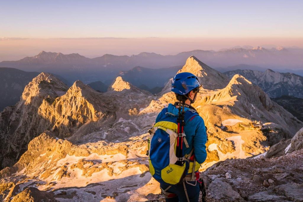
Mount Triglav
1. Robanov Kot Valley Walk, Kamnik-Savinja Alps
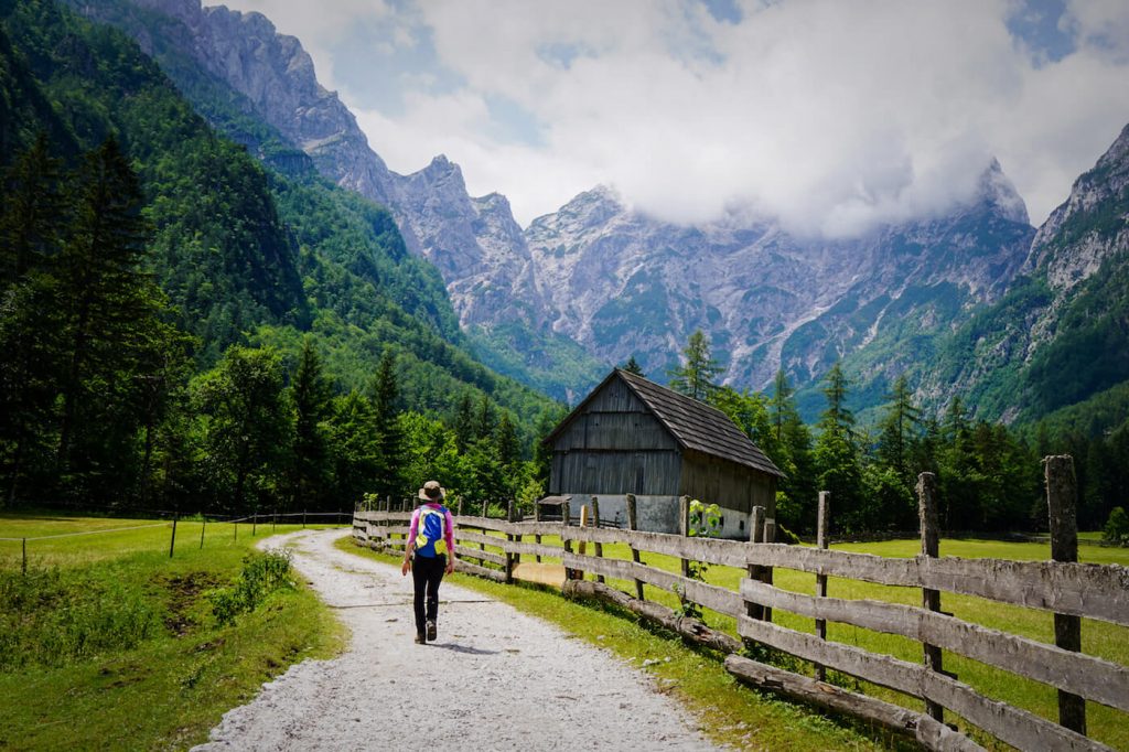 Robanov Kot
Robanov Kot is a glacial valley that neighbors Logarska Dolina in the Solčavsko Region of Northern Slovenia. The valley is named after Kmetija Roban Farmstead, which has been in operation for 800 years.
To start this lovely walk, either park at Turistična kmetija Govc -Vršnik or continue another 400 meters to the final parking area at Kmetija Roban in Robanov Kot valley.
From Roban Farm, follow the wide gravel trail for 3.3 km to the Robanova planina mountain pasture. Always continue straight towards the head of the valley, ignoring some of the diverging paths.
In summer, this trail is verdant and lush, lined with a myriad of wildflowers. During our walk, we saw Sternberg’s Carnations (Dianthus Sternbergii) and Common spotted-orchids (Dactylorhiza fuchsii).
About 30 minutes into the hike, you’ll walk by a large fenced-in pasture and a traditional stable made of stone and wood.
You may encounter cattle on the hiking trail. Please keep a safe distance and do not disturb, pet, or feed the animals. Also, make sure your dog is on a leash. In our Visiting the Alps in Summer guide, you’ll learn more about alpine pasture safety.
Continue following the wide path to Robanova planina mountain pasture, located at the foot of Ojstrica (2350), an arrowhead-shaped mountain that dominates the ridgeline. The wide mountain pasture is also home to an alpine dairy, which is only open in July and August.
Robanova planina is an ideal picnic location, but if you didn’t pack your lunch, eat a traditional Slovenian feast at Govc -Vršnik, after your hike. Govc Farm is one of our favorite places to eat in Slovenia. We’ve eaten here at least six times, and it never disappoints.
2. Planica Valley Walk to Planinski Dom Tamar (Planica Pot Po Dolini), Julian Alps
- Trailhead: Planica Nordic Centre. There’s a 2.50 EUR fee to park at Planica Nordic Center.
- Destination: Planinski Dom Tamar
- Distance: 7 km out-and-back
- Time Needed: 2 hours
- Elevation Gain/Loss: 170 meters
- Difficulty: Easy
- Minimum Elevation: 954 m
- Maximum Elevation: 1110 m
- Accessible by Public Transit: No
- Where to Stay: Apartment Plazar (budget), Hotel Pino Alpino (midrange), or Jasna Chalet Resort (luxury) in Kranjska Gora.
The valley walk to Planinski Dom Tamar begins at the Planica Nordic Centre, a nordic skiing complex in Planica Valley in the Julian Alps. Annual ski jumping competitions take place here in winter. Planica is only a 10-minute drive from Kranjska Gora.
Near the parking lot, you’ll see an infoboard with a map of the Planica Valley Trail (Planica Pot Po Dolini in Slovenian) and several trail signs. Follow trail 9 towards Tamar.
The wide gravel path leads through the upper Planica glacial valley through beech and pine forest.
As you progress, you’ll see info boards explaining various geological occurrences. There are also carved tree trunks that create visual pathways to various peaks in the Julian Alps.
There are some splendid mountain views along the way.
The Planinski Dom Tamar (1108 m) hut stands in clearing, below the impressive peaks of Velika Mojstrovka, Travnik, Šit, and Jalovec.
At the Planinski Dom Tamar mountain hut, you can order a drink and something to eat. The hut is open all year.
Return by the same path.
3. Slemenova Špica, Julian Alps
- Trailhead: Vršič pass
- Destination: Slemenova Špica
- Distance: 6 km out-and-back
- Time Needed: 3 hours
- Elevation Gain/Loss: 507 meters
- Difficulty: Moderate
- Minimum Elevation: 1609 m
- Maximum Elevation: 1909 m
- Accessible by Public Transit: Yes
- Where to Stay: Erjavčeva koča @ Vršič pass (budget), Hotel Pino Alpino (midrange), or Jasna Chalet Resort (luxury) in Kranjska Gora.
Slemenova Špica (1909 m) is a grassy hill in the Julian Alps, easily accessible from Vršič pass.
Vršič pass is the highest road pass in Slovenia and connects Kranjska Gora with Bovec. You can either drive here or take a bus (high season only). In high season, buses leave every 1-2 hours. Check the bus schedule here.
A number of hiking trails and via ferrata routes start at Vršič pass, including the moderate trail to Slemenova Špica and our Triglav National Park Hut-to-Hut Hike.
From Vršič pass, follow signs towards Sleme. After 30 minutes, you’ll reach the Vratica mountain saddle (1799 m), where the trail divides. Take the right path. After another 30 minutes, you’ll reach another junction, where you need to head left.
After ascending for another 15 minutes, turn right. This trail brings you to a high grassy pasture just below the summit of Slemenova Špica. Set amidst the limestone peaks of the Julian Alps, this panoramic hill is a lovely place for a picnic.
Return by the same trail.
4. Martuljek Waterfall and Gorge, Julian Alps
- Trailhead: Gozd Martuljek (near Kranjska Gora)
- Destination: Martuljek waterfalls and Brunarica pri Ingotu
- Distance: 7.8 km out-and back (to Slap Martuljek II)
- Time Needed: 3:15 hoursElevation Gain/Loss: 545 m
- Difficulty: EasyMinimum Elevation: 745 m
- Maximum Elevation: 1213 m
- Accessible by Public Transit: Yes
- Where to Stay: Rute Hotel and Apartments (budget), Špik Alpine Resort (midrange), or Triangel Boutique Hotel (luxury) in Gozd Martuljek.
Hiking to Martuljek waterfalls (Slap Martuljek in Slovenian) is a wonderful half-day excursion, suitable for the whole family. If you have a copy of the Cicerone Walking Guide: Julian Alps of Slovenia, this hike is listed as Walk 4.
To reach the waterfall trailhead, you can take a 10-minute bus ride from Kranjska Gora to the small village of Gozd Martuljek. Check the bus schedule here.
Alternatively, you can walk an hour to Gozd Martuljek. The walk follows path #5 along the Sava Dolinka River.
As you approach Gozd Martuljek, look for a dirt road leading off to the right. You’ll walk across open meadows for about 5 minutes before walking under an old stone railway bridge. From the meadow, you’ll have splendid views of the Julian Alps.
Next, you’ll pass a charcoal burning site with information boards about the history of the industry. Right after the site, the trail splits. Take the left trail. The trail passes by a man-made waterfall and then enters an enchanting gorge with steep walls.
You’ll hike through the Martuljek Gorge. and then ascend to a nice viewing area of the lower Martuljek falls (spodnji slap). Continue on the path until you reach a junction with a wide gravel road. Turn left and head in the direction of Brunarica pri Ingotu (there are signs).
Brunarica pri Ingotu is a mountain hut that’s situated on a meadow and surrounded by dairy cows. It’s one of those places out of a storybook. Stop here for a homemade stew, a drink, or simply the mountain view.
Next, you can either continue the journey for another hour to the upper Martuljek waterfall (zgornji), or return back to Gozd Martuljek. We didn’t hike up to the upper falls, however, we read that the hike requires a bit of scrambling.
5. Koča na Planini pri Jezeru, Julian Alps
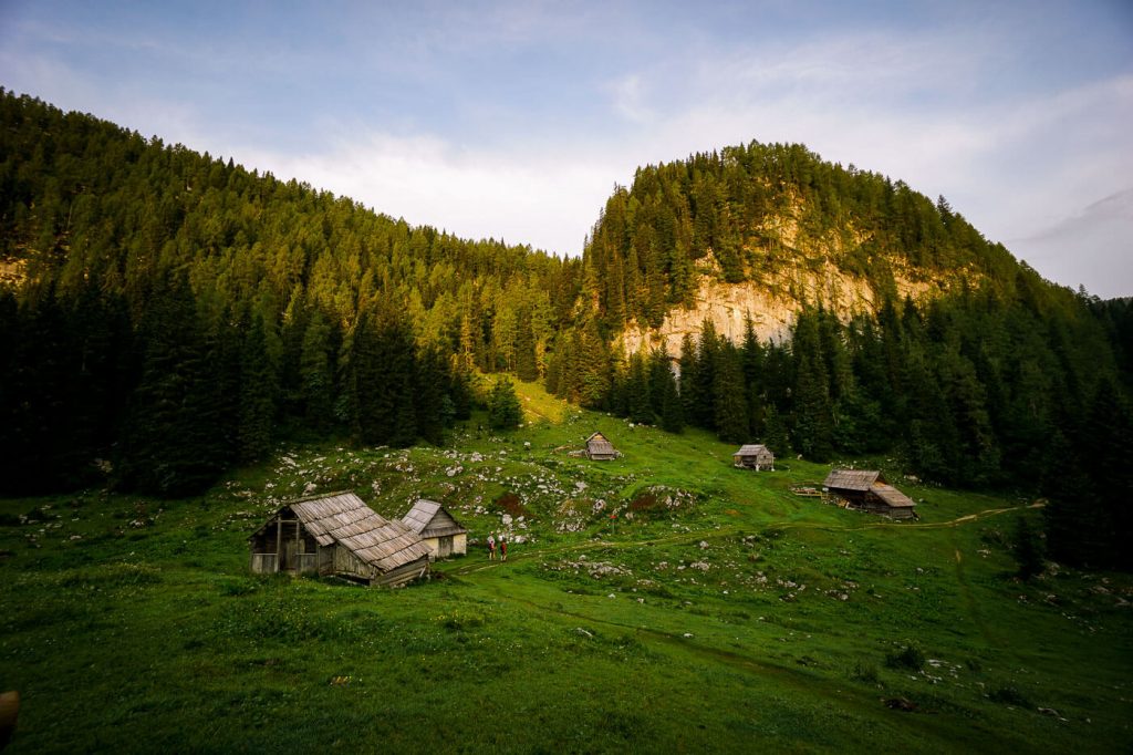 Planini Pri Jezeru
- Trailhead: Planina Blato (1,147 m), above Stara Fužina, Lake Bohinj. There’s a 12 EUR toll fee to drive from Stara Fužina to Planina Blato.
- Destination: Koča na Planini pri Jezeru (1,453 m)
- Distance: 5.2 km out-and-back
- Time Needed: 2 hours
- Elevation Gain/Loss: 327 m
- Difficulty: Easy-Moderate
- Minimum Elevation: 1141 m
- Maximum Elevation: 1469 m
- Accessible by Public Transit: Yes, in high season only. More info here.
- Where to Stay: Apartments and rooms Cerkovnik (budget), Hotel Bohinj (luxury) in Ribčev Laz, or Hotel Majerca (luxury) in Stara Fužina, Lake Bohinj.
Koča na Planini pri Jezeru is a mountain hut on an alpine pasture set above an alpine lake and surrounded by rustic wooden huts and spruce trees. It’s a fairy-tale-like scene that makes you want to linger, milk a cow, and travel back in time. The hut serves traditional Slovenian soups and stews. This is one of the best hikes in Slovenia because it’s tucked away from mainstream sites in an almost hidden wonderland of forest, rustic huts, and serene lakes.
To reach Koča na Planini pri Jezeru, you can start the hike in Stara Fužina, Lake Bohinj, or Planina Blato (shorter option). There’s a toll road that leads from Stara Fužina to Planina Blato. So if you have a car, this will trim a huge chunk of the hike (recommended). Note: there’s a 12 EUR toll to drive from Stara Fužina to Planina Blato.
If you start in Stara Fužina, you’ll hike through Planina Spodnji Vogar, which is another high alpine pasture. The hike should take 3-3:30 hours one-way. There’s a mountain hut at Vogar pasture called Kosijev dom na Vogarj. Stop here for a break.
From the hut, make sure to detour a few minutes to a lookout point of Lake Bohinj. From Vogar, the trail continues for another 10 minutes and intersects with an asphalt road. Hike up this road for 10 minutes and look for a trail leading off to the left. Follow signs to Koča na Planini pri Jezeru.
6. Seven Lakes Valley, Julian Alps
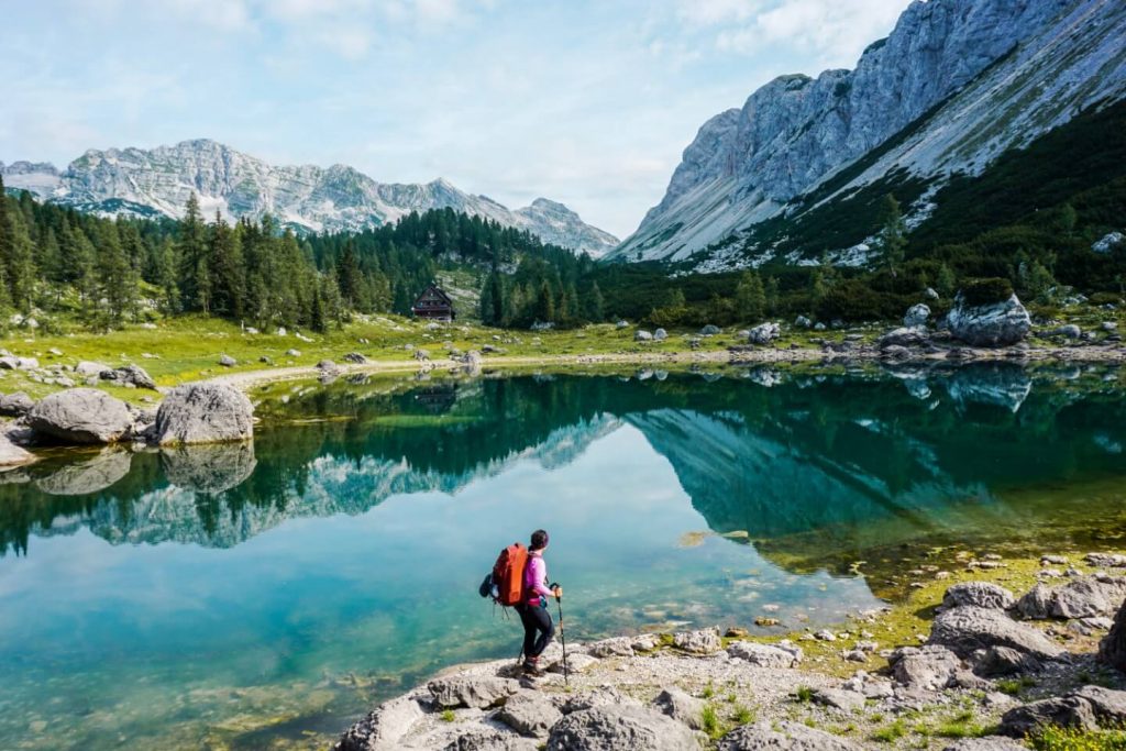 Double Lake
- Trailhead: Planina Blato (1147 m), above Stara Fužina
- Destination: Koča pri Triglavskih jezerih (1684 m)
- Distance: 15.3 km circuit
- Time Needed: 6 hours (without breaks)
- Elevation Gain/Loss: 1040 m
- Difficulty: Moderate
- inimum Elevation: 1146 m
- Maximum Elevation: 1857 m
- Accessible by Public Transit: Yes, in high season only. More info here.
- Where to Stay: Apartments and rooms Cerkovnik (budget), Hotel Bohinj (luxury) in Ribčev Laz, or Hotel Majerca (luxury) in Stara Fužina, Lake Bohinj.
Seven Lakes Valley, also known as Triglav Lakes Valley, is one of the most enchanting destinations in the Julian Alps and one of the best day hikes in Slovenia. The valley contains a string of seven lakes, each uniquely beautiful.
There are several different approaches to Triglav Lakes Valley, including the route starting at Koča pri Savici, accessible from Ukanc – a village on the western end of Lake Bohinj – and the one starting at Planina Blato, high above Stara Fužina.
We recommend hiking to Triglav Lakes Valley from Planina Blato, which is the easier approach. On route to Seven Lakes, you’ll hike across some of the loveliest alpine pastures in the Julian Alps, including Planina pri Jezeru, Planina Viševnik, and Planina Ovčarija.
From the Štapce saddle (1851 m), you’ll descend to Dvojno Jezero (Double Lake), where the Koča pri Triglavskih jezerih (Triglav Lakes Hut) is happily situated. Grab lunch here, or continue another 45 minutes to Veliko jezero (aka Jezero Ledvicah, or Kidney Lake), the largest lake in the Seven Lakes Valley. On a sunny day, this kidney-shaped lake dazzles resplendently with its deep teal and royal blue tones.
If you want to extend this hike, you can either overnight in the Triglav Lakes Hut, or hike all the way to the mountain hut Zasavska koča na Prehodavcih and spend the night there. Experienced hikers can tackle the Veliko Špičje summit and ridge and descend the Seven Lakes Valley the next day.
Learn More: Hiking to Seven Lakes Valley from Planina Blato
7. Češka koča, Kamnik-Savinja Alps
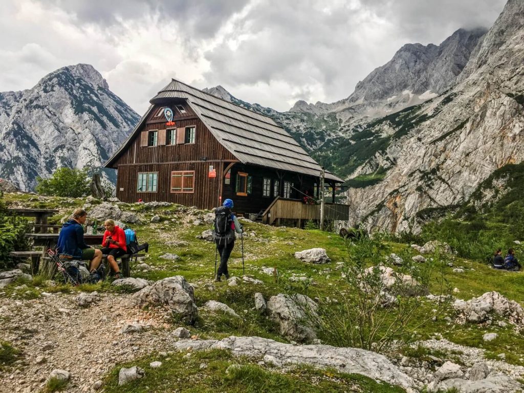 Češka koča na Spodnjih Ravneh
Češka koča na Spodnjih Ravneh (“The Czech Hut”) is a charming mountain hut located in the Kamnik-Savinja Alps. Constructed in 1900, this rustic wooden hut is perched high above the Ravenska kočna valley and surrounded by the Kamnik mountains.
Češka koča (1543 m) is a moderate half-day hike from the village of Jezersko, which is a 40-minute drive from Kranj.
We highly recommend hiking up here in the morning and eating lunch at the hut. Though their menu is limited to only a few items, their food is hearty and delicious.
Makekova Kočna to Češka koča ascent route
There are several ascent routes to Češka koča. If you want to hike directly from Zgornje Jezersko village, you can follow the Makekova Kočna route to the hut (2 hours one-way, 617 meters ascending). From the town center, cross the Jezernica river and follow the road and look for a trail leading to the left towards Makekov Marof (Turistični kmetiji Makek).
Ravenska Kočna to Češka koča ascent route
Alternatively, you can drive deep into the Ravenska Kočna valley to the parking lot located here: 46°23′05.31″N 14°32′11.61″E (46.384809, 14.536558). From the parking area, trails branch out in three directions. We hiked up to Češka koča via Štularjeva planina (alpine pasture), which is the trail on the right. This route takes 1:30 hours and you ascend 562 meters.
8. Viševnik Peak, Julian Alps
 Viševnik
- Trailhead: Rudno Polje (1347 m), Pokljuka
- Destination: Viševnik
- Distance: 6.4 km out-and-back
- Difficulty: Moderate
- Elevation Gain/Loss: 703 meters
- Time Needed: 1:30 – 2 hours one-way, 3-4 hours out-and-back
- Accessible by Public Transit: Yes. In summer, there’s a hop-on-hop-off bus to Rudno Polje from Lake Bohinj.
- Where to Stay: Hotel Pokljuka (midrange) in Pokljuka, or Majerca Hotel and Restaurant (luxury) in Stara Fužina.
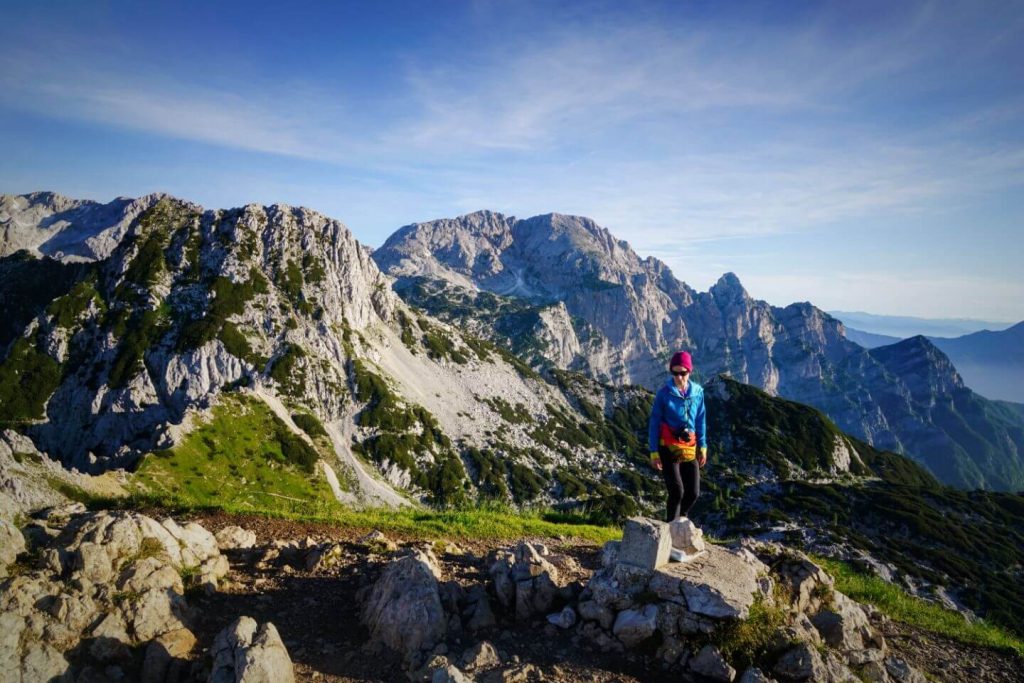
Viševnik (2050 m) is a mountain peak in the Julian Alps, easily accessible from Pokljuka Plateau.
This popular summit in the Julian Alps delivers one of the best views of Mount Triglav, Slovenia’s highest mountain, along with Mali Draški, the Rjavina ridge, and the Southern Julian Alps.
If you can hike here for sunrise, you won’t regret it.
9. Mount Vogel, Julian Alps
- Cableway Ascent/Descent: Vogel Cable Car in Ukanc, Lake Bohinj
- Trailhead: Vogel Cable Car mountain station
- Destination: Mount Vogel
- Distance: 11.2 km circuit
- Difficulty: Moderately Difficult
- Elevation Gain/Loss: 732 meters
- Time Needed: 5 – 6 hours
- Accessible by Public Transit: Yes
- Where to Stay: Rooms and Apartments Lake Bohinj (budget), Apartments Ukanc (midrange), or Hiša Erlah (luxury) in Ukanc.
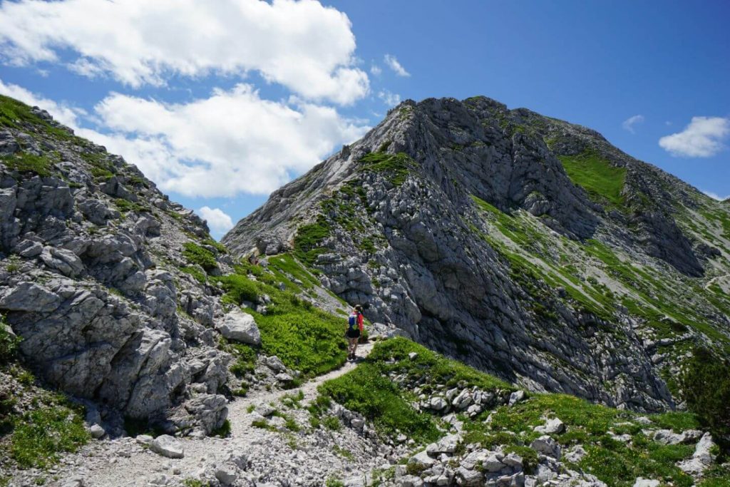
Mount Vogel (1922 m) is a mountain in the Southern Julian Alps and one of the many summits along the South Bohinj Ridge. The hike to Vogel begins with a swift cable car ascent to the Vogel Ski Resort, where you’ll have dazzling views of Lake Bohinj and the highest peaks of the Julian Alps, including Mount Triglav.
Given the accessibility of this peak, the trail to Mount Vogel is swarming with hikers during the day. We recommend hiking this trail as early as possible.
10. Kamniško Sedlo Hike, Kamnik-Savinja Alps
 Kamniška koča na Kamniškem sedlu
Logar Valley Ascent Route
- Trailhead: Parking lot at the end of the Logar Valley Road.
- Destination: Kamnik Saddle / Kamniška koča na Kamniški sedlu (1864 m) and Planjava (optional)
- Distance: 13 km out-and-back
- Difficulty: Difficult
- Elevation Gain/Loss: 1420 meters
- Time Needed: 4:30 hours one-way (9:30 hours – 10 hours total)
- Logar Valley – Okrešelj (1 hour) – moderate
- Okrešelj – Kamnik Saddle (1:30 hours) – difficult
- Kamnik Saddle – Planjava (1:45 – 2 hours) – very difficult
- Accessible by Public Transit: No
- Where to Stay: Guesthouse Planinski Dom Majerhold (budget), Lenar Farm (midrange), or Hotel Plesnik (luxury) in Solčava.
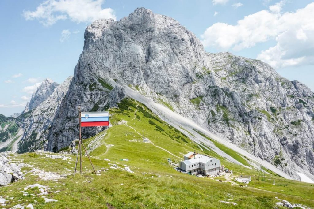
Kamniško sedlo is a picturesque mountain saddle in the Kamnik-Savinja Alps, situated between Mount Brana and Mount Planjava. Just below the saddle, there’s a koča (mountain hut) that serves food and refreshments.
We loved this hike in Slovenia because the mountain views from the saddle are spectacular. With panoramic views of the Kamnik Alps, Logar Valley, and the most perfectly situated mountain hut below, you’ll rejoice that you don’t have to share this special place with very many people.
The first time we hiked to the Kamnik Saddle, we started at Kamniška Bistrica. This route is described below. A more interesting, albeit more difficult approach, begins in Logar Valley. We highly recommend the Logar Valley ascent route for experienced hikers.
From the saddle, you can continue to the summit of Brana (1 hour) or Planjava (1:45 – 2 hours).
Kamniška Bistrica Ascent Route
- Trailhead: Dom v Kamniški Bistrici (600 m)
- Destination: Kamnik Saddle / Kamniška koča na Kamniški sedlu (1864 m)
- Distance: 11 km out-and-back
- Difficulty: Moderate
- Elevation Gain/Loss: 1264 meters
- Time Needed: 7 hours out-and-back
- Accessible by Public Transit: Yes
- Where to Stay : Guest House Kraljev Hrib (budget), Dom v Kamniški Bistrici (budget), or Skalca Tinyhouse (midrange) in Kamniška Bistrica.
The hike to the Kamnik saddle begins at the mountain hut Dom v Kamniški Bistrici, a 20-minute drive from the town Kamnik, or a 1:30-hour drive from Ljubljana. The trailhead is also accessible by public transit.
This hike takes 3.5 hours one-way. While the trail isn’t technically difficult, it is continuously uphill. The trail begins steeply and ascends through the forest via a narrow path. Simply follow the trail markers, which are red circles with white centers (like a “target”).
After 2 hours, you’ll pass the shelter Pastirji. Soon after, the trail enters a wide-open meadow and you’ll see Mount Brana and Mount Planjava. The trail ascends steadily to the saddle between Brana and Planjava. With every step, the views of the limestone mountains become increasingly more impressive.
After a well-earned lunch and Radler at Kamniška koča na Kamniški sedlu (1864 m), you can extend your hike to the summit of Mount Brana (2253 m). This difficult 45-minute climb to the summit is assisted with fixed cables and ropes and requires scrambling and use of both hands. Wear a helmet like this women’s helmet, or this men’s helmet.
To return to the trailhead, simply follow the same trail down. If you want to extend the hike, you can spend the night at Kamnik Saddle and hike the next day to Turska Gora (2251 m) and Cojzova koča na Kokrskem sedlu (1793 m). This is a very challenging hike. To learn more about this route, read Stage 2 of our Kamnik-Savinja Alps Hike.
11. Logar Valley to Ledinski Vrh, Kamnik-Savinja Alps
 Jezersko Saddle
- Trailhead: Parking lot at the end of the Logar Valley Road at Koča pod Slapom Rinka mountain hut.
- Distance: 9.4 km out-and-back
- Difficulty: Difficult
- Elevation Gain/Loss: 1178 meters
- Time Needed: 6:30 – 7 hours out-and-back
- Accessible by Public Transit: No
- Where to Stay: Guesthouse Planinski Dom Majerhold (budget), Lenar Farm (midrange), or Hotel Plesnik (luxury) in Solčava.
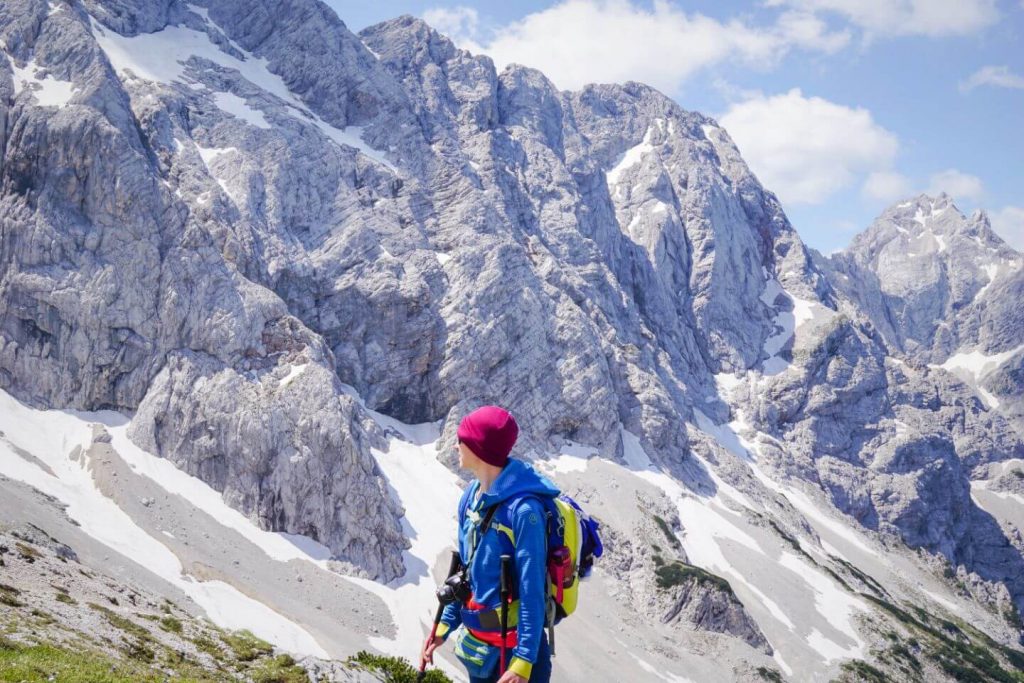
Ledinski Vrh (2108 m) is an approachable peak in the Kamnik-Savinja Alps, located on the border between Austria and Slovenia. On the Slovenian-side, you can hike to Ledinski Vrh from both Jezersko and Logar Valley.
The route from Logar Valley begins at the Slap Rinka waterfall. You’ll ascend to the Okrešelj glacial cirque and then over the Savinjsko Sedlo mountain saddle.
This is a strenuous full-day excursion for hikers who are confident navigating scree fields and steep, rocky trails.
12. Košutnikov Turn, Karawanks
 Planina Dolga Njiva
- Trailhead: Parking area below Planina Dolga Njiva, 35 min drive from Tržič
- Distance: 8.1 km Circuit
- Difficulty: Moderately Difficult
- Elevation Gain/Loss: 840 meters
- Time Needed: 4:30 hours
- Accessible by Public Transit: No
- Where to Stay: Apartma Jelendol (midrange) or Štorman Tourist Farm Apartments (midrange) in Tržič.
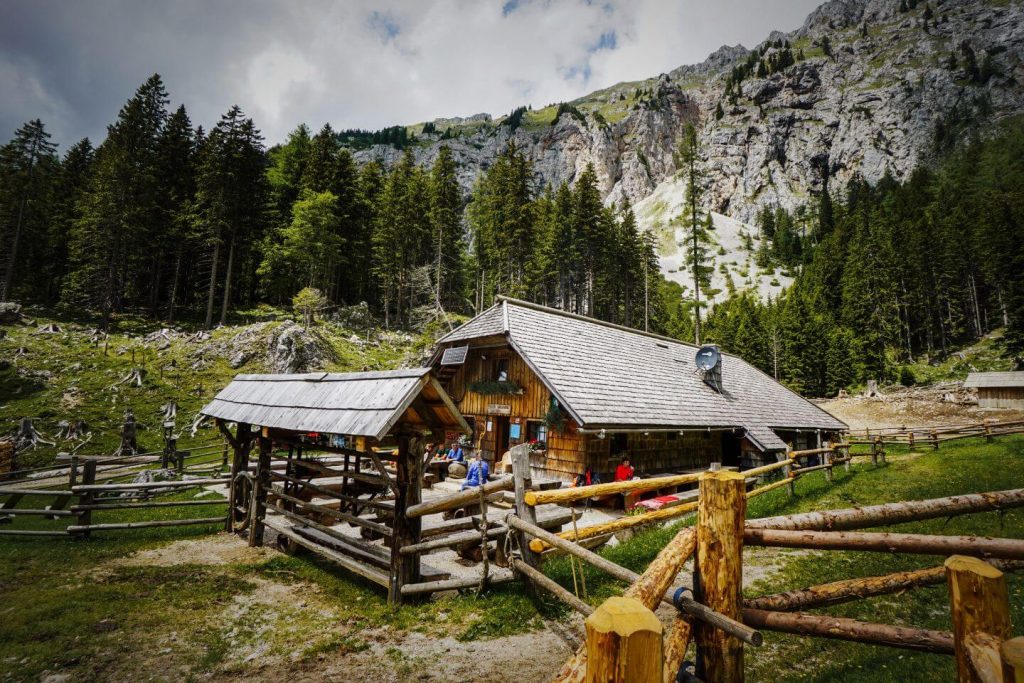
Košutnikov Turn (Koschutnikturm) is the highest summit along the Košuta ridge in the Karawanks mountain range. It’s somewhat of a journey to reach the trailhead, so you’ll likely only be sharing the trail with a few locals.
The circuit trail to Košutnikov Turn starts at Planina Dolga Njiva, an alpine dairy on the slopes of Košuta ridge. After you complete the hike, we recommend eating lunch here.
Though only 4:30 hours, the hike is somewhat demanding. You need a good head for heights as you scramble to the summit and descend along narrow paths back to the mountain pasture.
13. Mount Triglav Summit Hike, Julian Alps
 Trailhead: Rudno Polje, Pokljuka
- Destination: Mount Triglav
- Difficulty: Challenging
- Time Needed: 2 Days
- Accessible by Public Transit: Yes. In summer, there’s a hop-on-hop-off bus to Rudno Polje from Lake Bohinj.
- Where to Stay along the route: Dom Planika. Wild camping is strictly prohibited.
- Where to Stay before/after the trek: Hotel Pokljuka (midrange) in Pokljuka, or Majerca Hotel and Restaurant (luxury) in Stara Fužina.
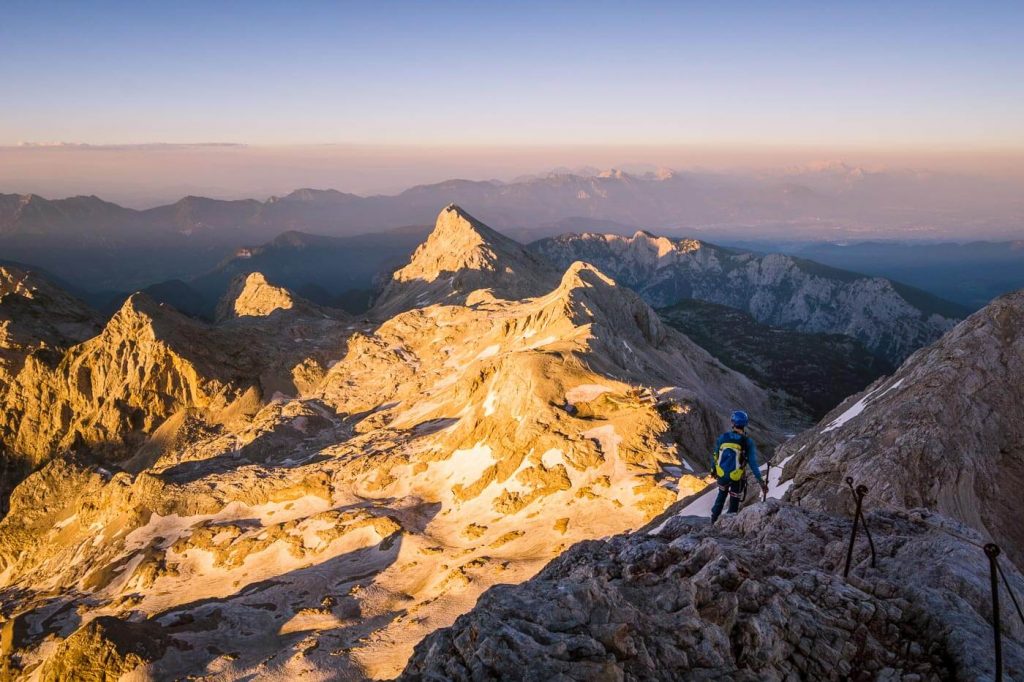
The Pokljuka ascent route to Mount Triglav is said to be the easiest and possibly the most scenic. However, the final 1:30 hours to the peak requires scrambling and hiking along a protected climbing route (via ferrata).
We thoroughly enjoyed this hike, and we’ve outlined everything you need to know about this route in our Triglav guide.
14. Veliko Špičje, Julian Alps
 Trailhead: Planina Blato
- Time Needed: 2 Days, 12:30 hours (without breaks)
- Where to stay along the route: Zasavska koča na Prehodavcih. Wild camping is strictly prohibited.
- Difficulty: Challenging Distance: 27.6 km circuit
- Accessible by Public Transit: Yes, in high season only. More info here.
- Where to Stay: Apartments and rooms Cerkovnik (budget), Hotel Bohinj (luxury) in Ribčev Laz, or Hotel Majerca (luxury) in Stara Fužina.
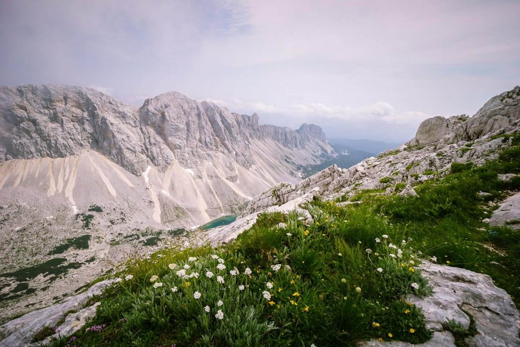
Veliko Špičje (2398 m), also called Lepo Špičje, is the highest point on the Špičje ridge, which rises between the deep Trenta Valley and the high Seven Lakes Valley (aka Triglav Lakes Valley) in Triglav National Park.
This adventurous 2-day tour combines the Špičje ridge with the Seven Lakes Valley, starting and ending at Planina Blato.
Day 1 ends at Zasavska koča na Prehodavcih, a mountain hut on the Prehodavci Pass. To learn more about staying in huts, read:
15. Triglav National Park Traverse, Julian Alps
 Kanjavec
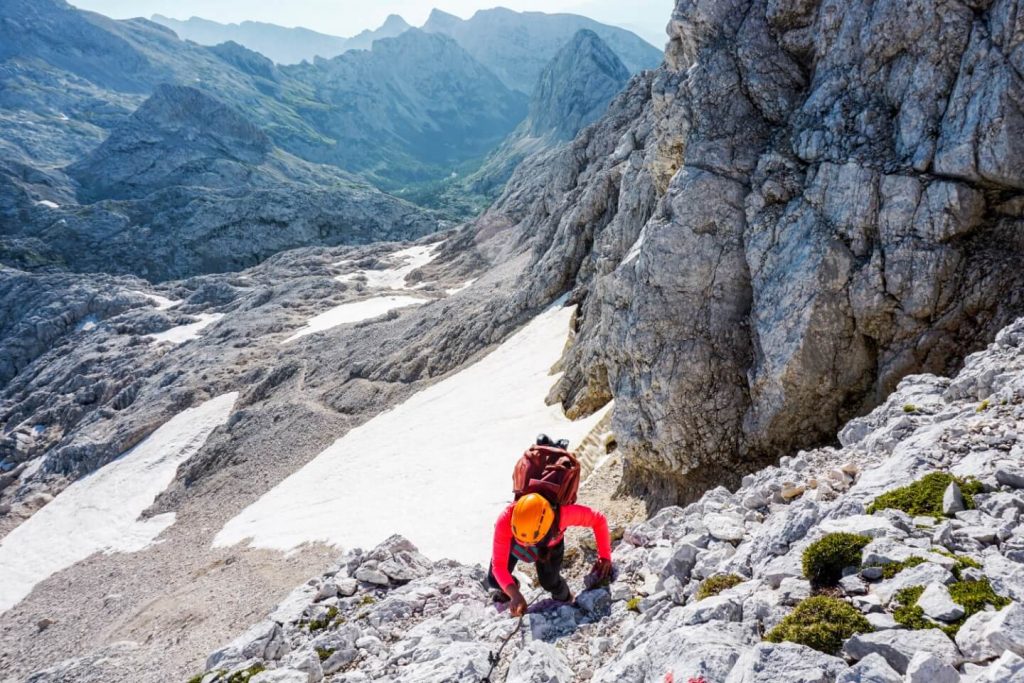
Triglav National Park is Slovenia’s one and only National Park. The park territory corresponds to the Eastern Julian Alps and can be accessed from Kranjska Gora, Trenta, Kobarid, Bovec, Pokljuka, Ukanc, Stara Fužina, and other towns. It’s free to enter the park, and you don’t need to acquire any permits.
There’s so much to see and experience in Triglav National Park and there’s no better way to do it than traversing the park in a few days. There are 35 mountain huts (koča, planinska koča) in Triglav National Park, so it’s easy to plan a multi-day hike across the park. Slovenian mountain huts offer private and dormitory-style rooms and serve warm food and drinks.
If you’re looking for an epic 4-day trek, check out our Triglav National Park hut-to-hut hike. This route starts at Vršič Pass (close to Kranjska Gora) and ends in Stara Fužina, Lake Bohinj.
Hiking hut to hut in the Julian Alps was an unforgettable experience. Major highlights of our route included:
If you’re trying to decide which best hike in Slovenia to tackle, choose this one.
16. Kamnik-Savinja Alps Traverse
 Spremova pot
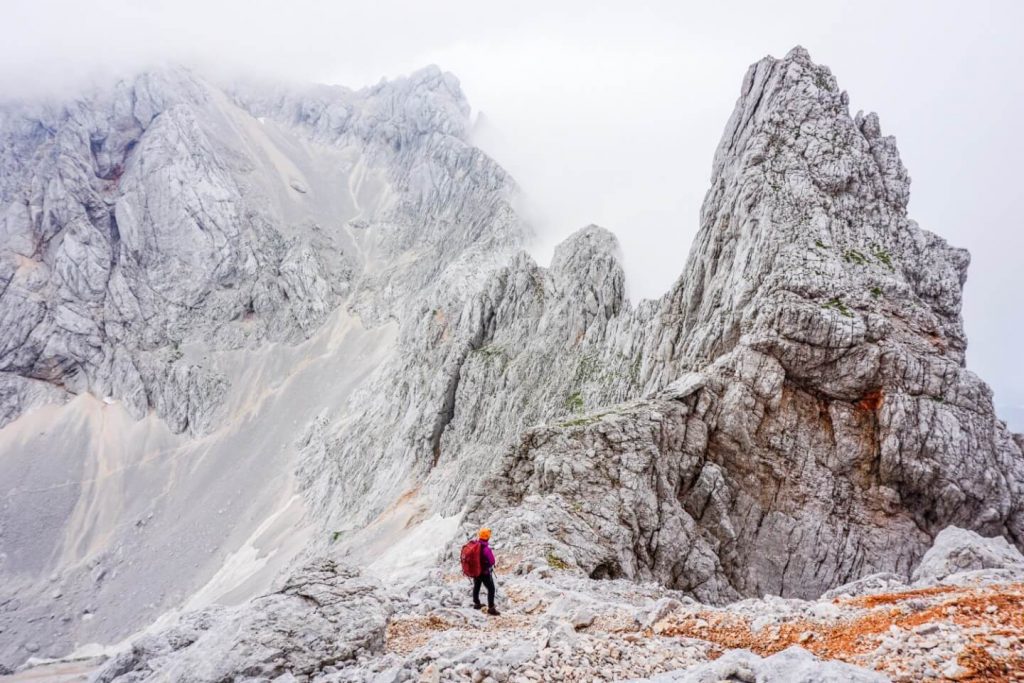
If you love hiking hut to hut and are an experienced alpine hiker, traversing the Kamnik-Savinja Alps is an unforgettable experience and arguably the best hike in Slovenia. We created a custom 4-day hiking route in which we started in Kamniška Bistrica and ended in Zgornje Jezersko.
This route contains steel cables and some pegs along highly exposed paths. A helmet and polarized glasses with UV400 protection are essential. You may also want a via ferrata kit. Here’s a quick overview of the hike:
Day 1: Kamniška Bistrica – Kamniška koča na Kamniškem sedluDay 2: Kamniška koča na Kamniškem sedlu – Cojzova koča na Kokrskem sedluDay 3: Cojzova koča na Kokrskem sedlu – Češka koča na Spodnjih RavnehDay 4: Češka koča na Spodnjih Ravneh – Zgornje Jezersko
Want to learn more about this hike? Read our Kamnik-Savinja Alps Hiking Route. This guide covers each day of the trek in depth. It also tells you how to prepare (e.g. making reservations for mountains huts), how to save money on accommodation, and what essential items to pack to make your hut to hut hiking trip in Slovenia a success.
Helpful Tips For Hiking in Slovenia
 Julian Alps
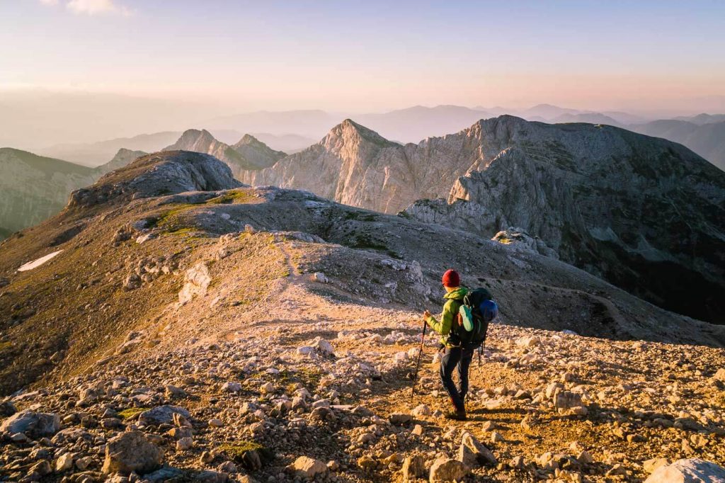
1. Buy Paper Trail Maps. Though Slovenia hiking trails are mostly well-marked and easy-to-follow, paper trail maps are absolutely essential for route planning. We recommend buying Sidarta and Planinska Zveza Slovenije (Alpine Association of Slovenia) trail maps.
2. Follow the Waymarks. Slovenian hiking trails are marked with the Knafelc waymark, which is a red circle with a white center (like a target).
3. Wear a Helmet. If you’re hiking in high alpine environments, you’ll likely encounter secured pathways. Many of these passages don’t require a full via ferrata kit, but some do. Please check with locals for advice on specific trails. Helmets, however, are always essential when hiking at high elevations in Slovenia. We recommend this women’s climbing helmet and this men’s climbing helmet. Also, half-finger gloves make hiking assisted climbing routes a whole lot easier (e.g. better grasp on steel cables).
4. Get Hiking Insurance. For peace of mind on the trail, make sure you have hiking travel insurance. When you have World Nomads insurance, you’ll get emergency medical insurance, emergency medical transportation, gear protection (in case of theft, loss, or damage), and trip protection (in case of cancellation). Learn more here.
5. Call 112 (European Emergency Number) if you have an emergency. The dispatcher will connect you with the local mountain rescue team.
6. Check for Trail Closures – This map indicates which Slovenian hiking trails are closed. The site is maintained by the Alpine Association of Slovenia.
Additional Slovenia Hiking Resources
When to Hike in Slovenia
 Triglav National Park in Late June
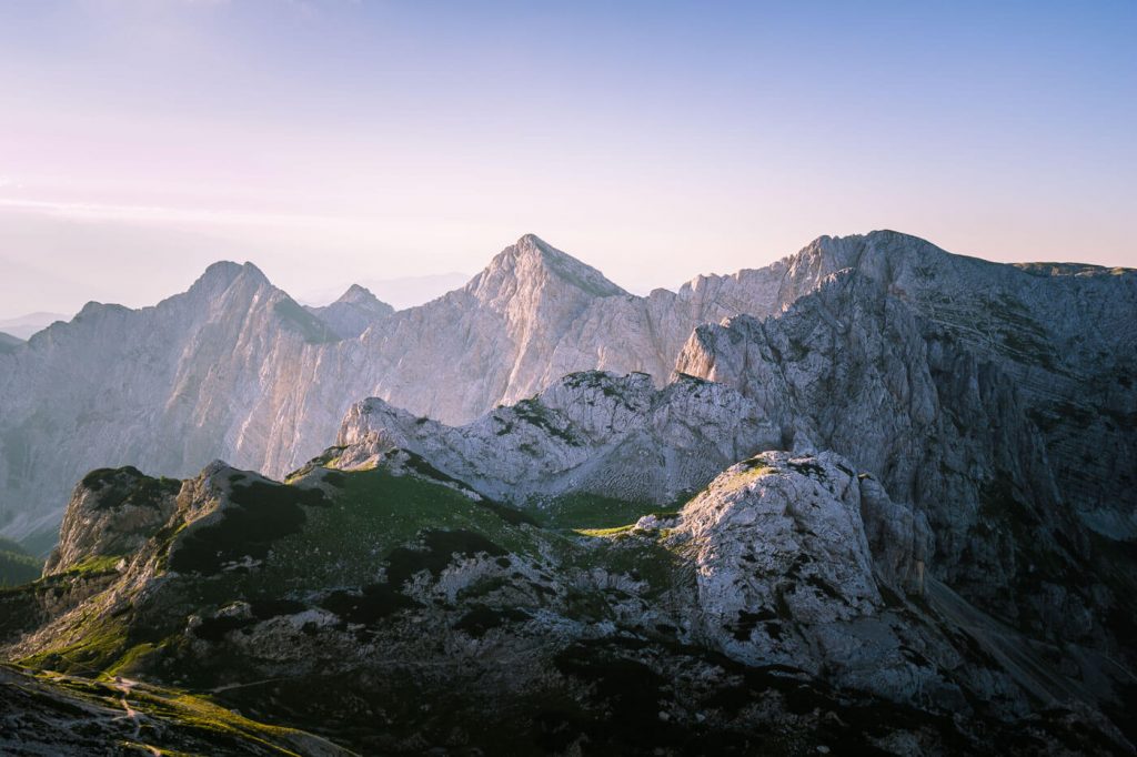
Slovenia hiking trails are best tackled between late June and late September. However, it’s possible to hike in Slovenia in Spring at lower elevations.
We’ve hiked in Slovenia in May, June, and July. Based on our personal experience, here are a few tips:
Hiking in Slovenia in May
In May, we encountered a lot of snow on mountain trails, especially above Lake Bohinj. Crampons and hiking poles were tremendously helpful for snowfield crossings. If you’re planning on hiking in Slovenia in Spring, make sure to check this website for trail closures and updates.
Hiking in Slovenia in June
In June, there will likely be snow at higher elevations, so extra gear might be necessary on high alpine routes. Also, thunderstorms are common in June. They tend to develop in the afternoon, so it’s best to get an early start on the trail. In June, we hiked to prominent peaks in the Karawanks and the Kamnik-Savinja Alps.
Hiking in Slovenia in July
When we hiked in Slovenia in July, conditions were generally excellent. However, afternoon thunderstorms were also quite common. Daytime temperatures hovered between 22°C (71.6°F) and 26°C (78.8°F) in the valleys.
One of the highlights of hiking in Slovenia in early Summer (late June – July) is the wonderful display of wildflowers. Trails are lined with Carniolan lilies, forget-me-not flowers, wolf’s bane, alpenrose, enzian, foxgloves, globe flowers, round-headed rampion, and countless others. Starting in mid-July, Edelweiss begin to bloom on high plateaus and peaks across the Slovenian Alps.
See more with this video :
Source: moonhoneytravelers
You might also like :











Discussion about this post