My first hike of the new year was to the Lexington Reservoir near Los Gatos. Fellow USGS postdoc Kayla Iacovino (@kalyai) came along to help search for blueschist-facies rocks in what’s locally known as Franciscan Complex melange. Now, I’m getting pretty good at spotting serpentinite – not that it isn’t fairly distinctive – but I’ve been hoping to see some blueschist as well. I found this USGS publication which shows a sample of blueschist from a spot “near” Lexington Reservoir in Santa Clara county, so that was where we headed.
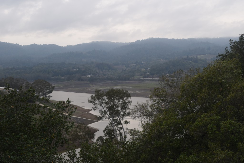
The Lexington Reservoir is a county park (there are so many parks around here you can barely go for a hike without ending up in one). It has its own fault zone, crosses several faults, and cuts right through some exposures of Franciscan rocks, including serpentinite, greywackes, and other things that result from taking chunks of the ocean floor, subducting them, and then spitting them out at sea level. Like every reservoir in California right now, it’s also well below capacity, as you can see in the next photo (that path leading down to the boat launch should be underwater, and boating has been banned indefinitely).
Lexington Reservoir, looking (like all the reservoirs around here) extremely dry
But we were after the blueschist. Andrew Alden has a couple of great posts on blueschist in the East and North Bay, including at Ring Mountain and exposures in Oakland and Ward Creek. Basically, blueschist is a category of metamorphic rocks that form at high pressures and low temperatures. In Callan’s diagram below, that includes pressures from around 1 to 2 Gigapascals and temperatures below 500°C. (The coolest magmas erupt at 700°C, so rocks in the blueschist zone aren’t even close to melting.) Glaucophane, a kind of amphibole is the mineral that makes it blue, but it can also contain things like lawsonite, chlorite, omphacite and epidote, which are green rather than blue. In the Franciscan rocks, it’s often found with serpentinite (what you get when you subject ultramafic rocks to the same sorts of temperatures and pressures).

Image redrawn and modified by Callan Bentley from Figure 3 of Bousquet, et al. (2008), which is modified from Oberhänsli, et al. (2004), and also from University of British Columbia (1997), which is modified from Yardley (1988).
The Lexington Reservoir’s geology is perfect for this kind of hunting: Franciscan melange crops out everywhere you see light blue fm units. The darker blue pods are volcanic units and the orange represents metasedimentary rocks (those graywackes again)
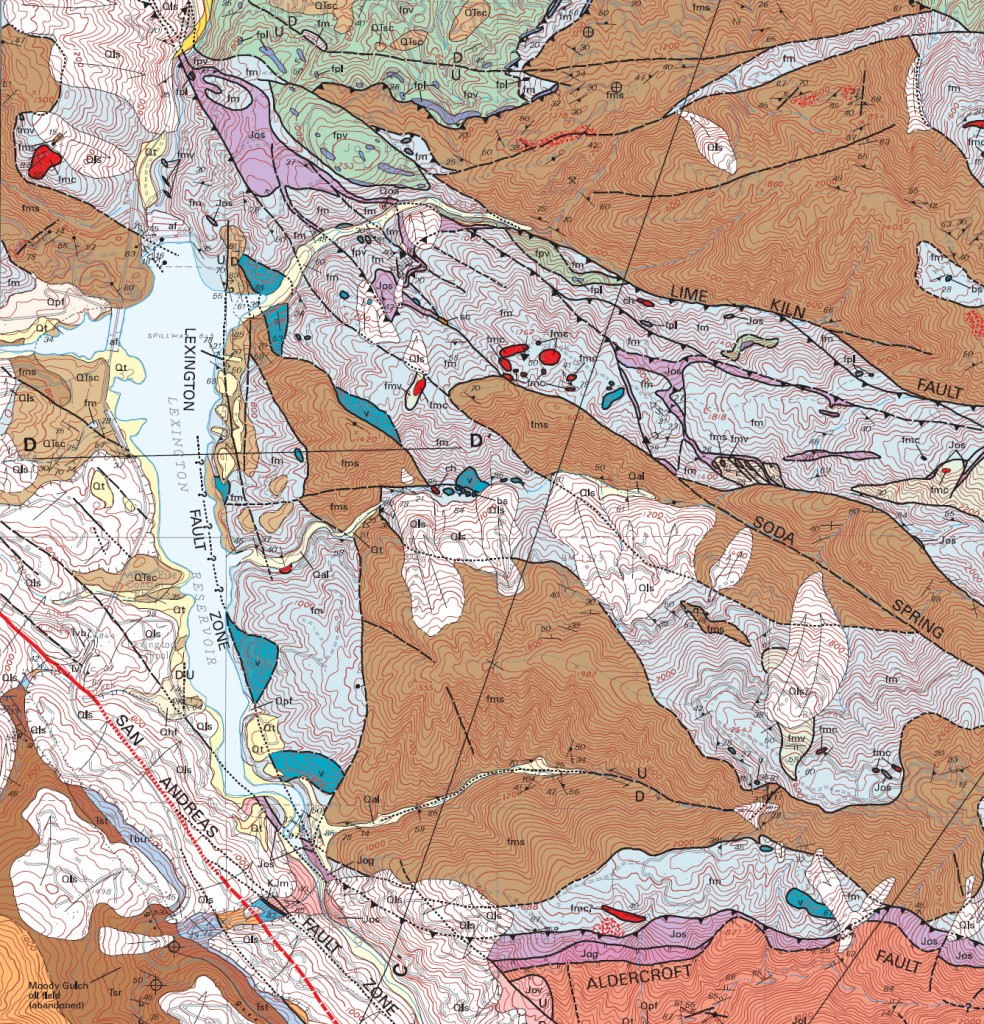
Los Gatos USGS quadrangle. I haven’t added a scale, but the faint gray boxes are 1000m on a side (it’s a 1:24000 map)
Here’s an oblique view of the geology superimposed on the landscape:
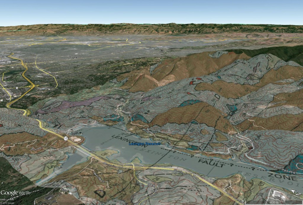
An oblique Google Earth image, looking northeast (toward San Jose), with the geologic map superimposed
One thing that’s immediately apparent here is the way the shoreline’s changed with the drought – there’s a lot more visible in the satellite image than mapped on the quadrangle, which is dated to 2002.
We decided to go up the Lime Kiln trail on the northeast drainage into the reservoir, seeing as it cut across some faults and a number of units and headed right into the fm (the light blue bit on the map). And we weren’t disappointed! In fact, what we found wasn’t just a great spot to see blueschist, but an excellent example of a small landslide and scarp. (I’m betting this was the location in the USGS report, because it mentioned that the sample was “naturally polished from the scour of recent fault motion along the base of a landslide.” As you’ll see, there are a lot of very smooth rocks in this area – and, clearly, a landslide.)
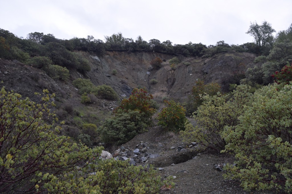
The scarp and landslide, which are much more visible in Google Earth.
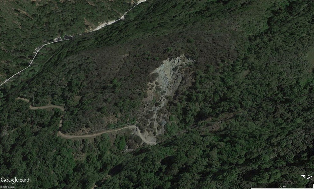
The scarp in Google Earth
It was very cloudy that day and unfortunately that’s bad for making the rocks stand out, but I’ll include some enhanced/unenhanced photo pairs to show off the amazing colors in the rocks. The glaucophane gives them that striking blue-jeans-blue shade, although in this outcrop, it was mixed in with a lot of serpentine and (possibly) lizardite.
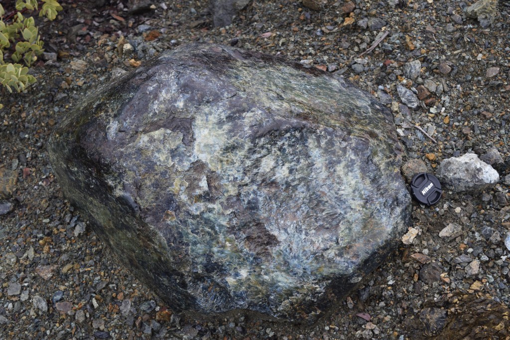
One of the beautiful smooth boulders…
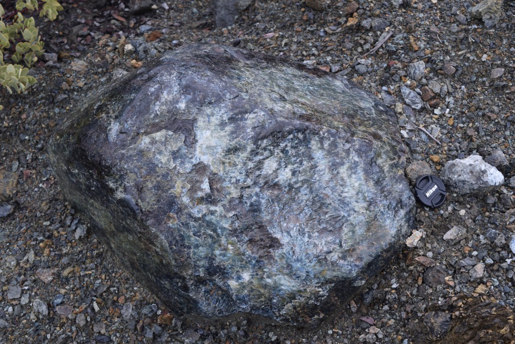
…and again with a 25% dark blue filter applied.
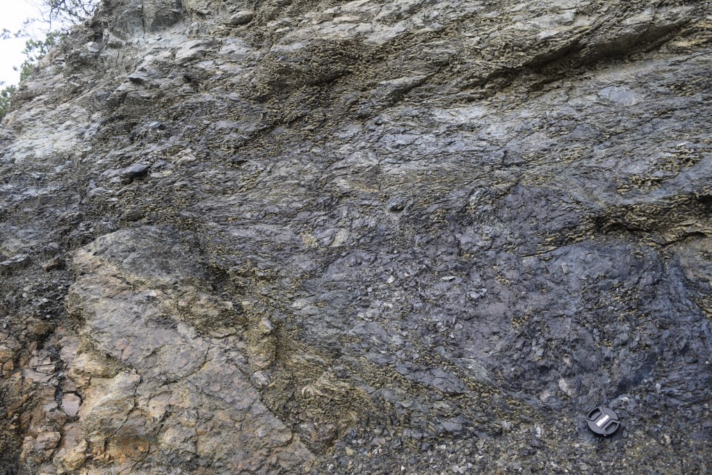
Here’s the source for the glaucophane without a filter…
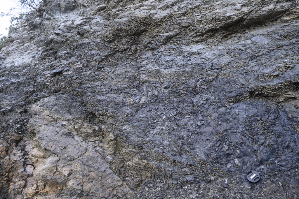
…and with one (25% dark blue again).
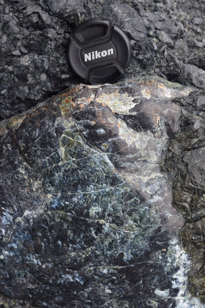
Another boulder in the blue bit of the debris deposit (this shows a bit more of the green serpentine)…
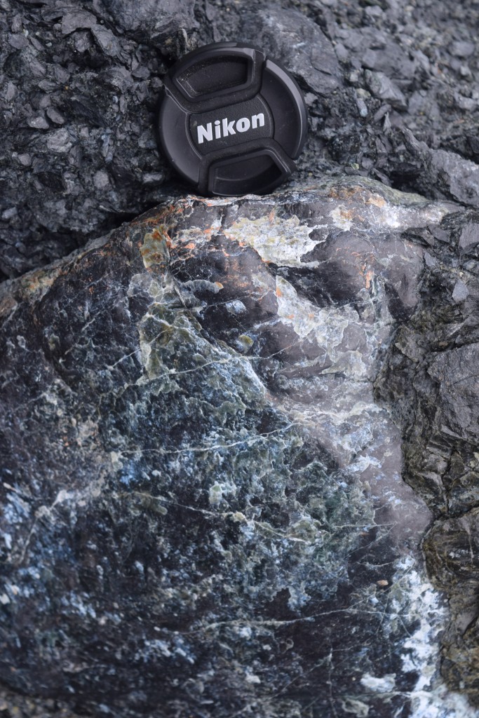
…and again, filtered. (25% dark blue)
The landslide/debris flow deposit was very soft and easy to climb, but I imagine that without the rain it would be more difficult to navigate (more loose dirt). At any rate, there were lots of easy-to-access boulders in the stream next to the path, and the bottom of the debris deposit was perfectly fine to scramble onto. If you go for a visit when it’s dry, I’d stay off the upper parts of the deposit.
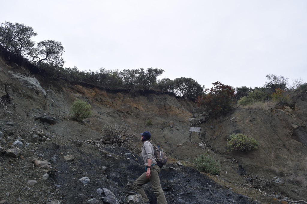
Kayla checking out the upslope terrain from the bluest bit of the deposit.
On our way down the path, we ran into what I’m pretty sure is a rough-skinned newt (Taricha granulosa granulosa), which are apparently known for the toxin they exude from their skin when threatened. This one was pretty chill, and though we took some pictures, we didn’t harass it unduly as it made its way across the path.
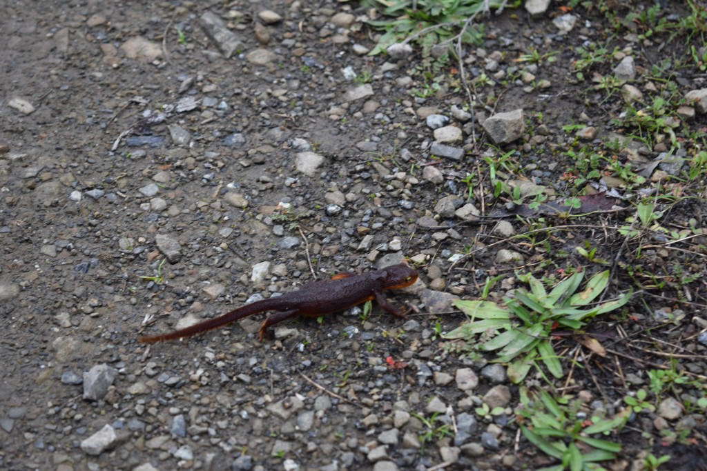
Taricha granulosa granulosa
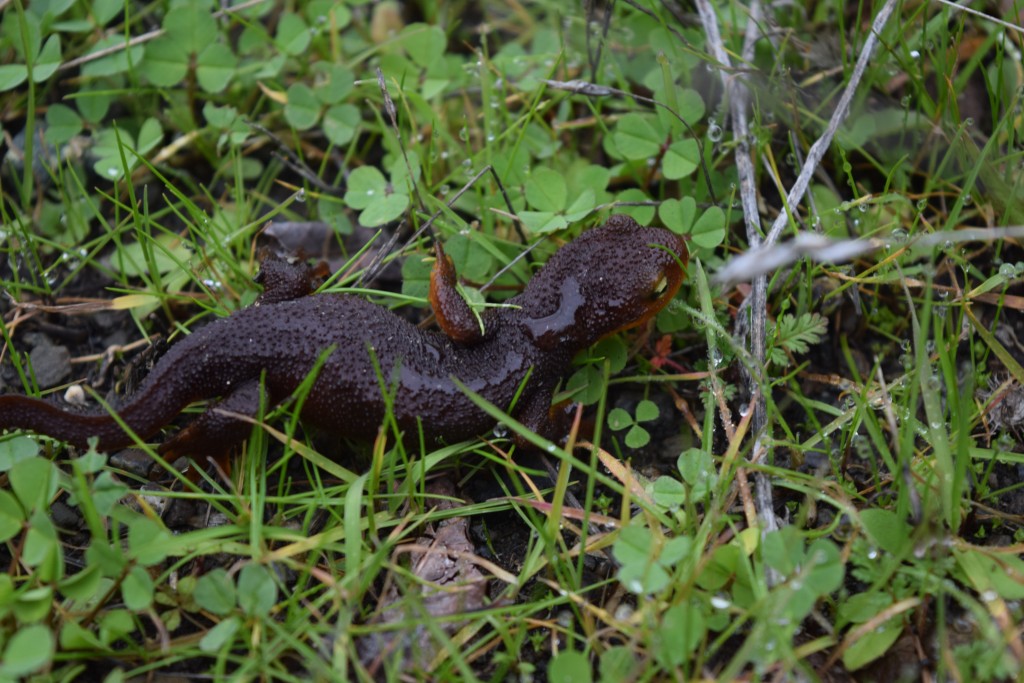
He (she) very obligingly allowed a closeup
The Lime Kiln trail continues up the Lime Kiln Fault and the drainage for quite a ways, and we hiked to an overlook so we could get a good view of the Vulcan Quarry that operates upstream. It looks like an aggregate (gravel) quarry, although the company website isn’t very illuminating. It’s hard to imagine what else they could be going for here, since they appear to be well into the greywackes and I’m not aware of any economic use for the blueschist-facies rocks that appear to be cropping out in the hillside.
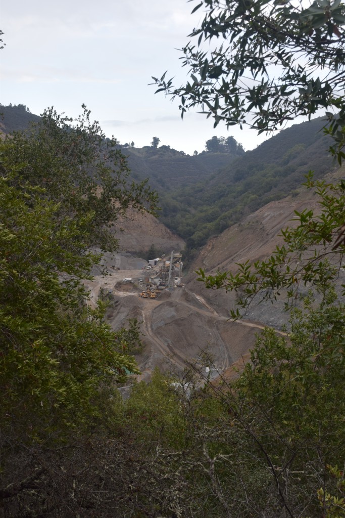
Quarry operations
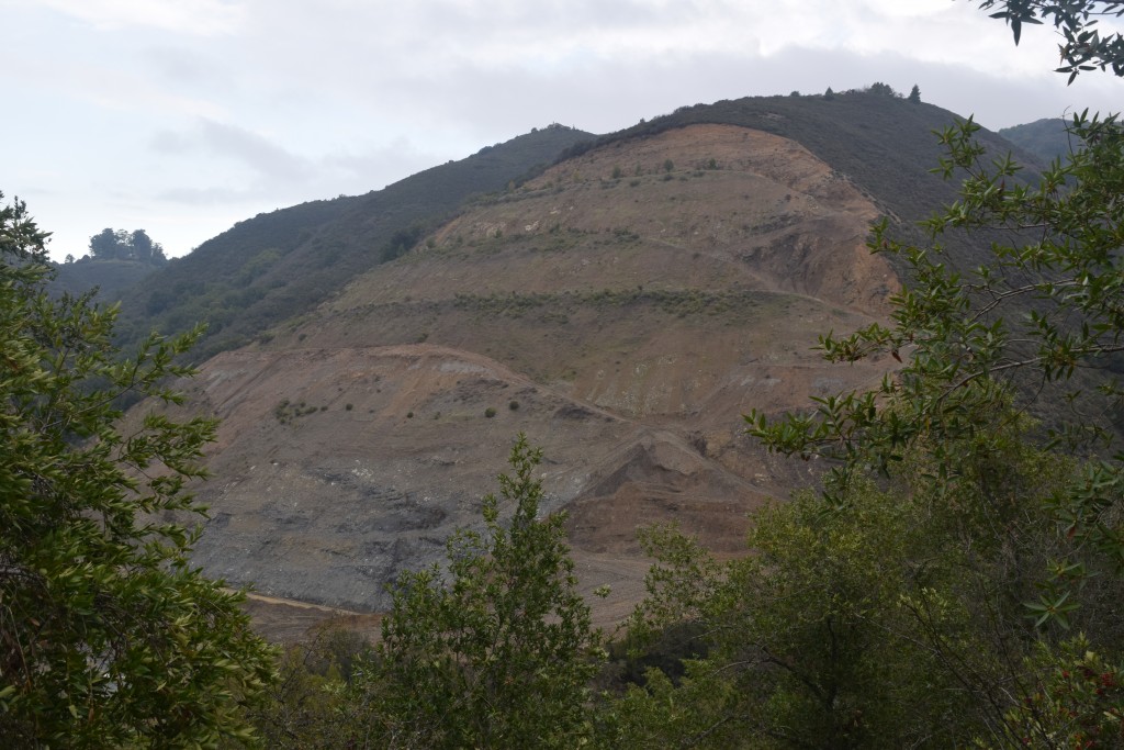
A nice cutaway view of the hill. The dark patch on the lower third of the hill is probably the same sort of rock we were looking at in the landslide.
I can’t say that the weather cooperated with us, but it was a great little hike for seeing a whole slew of Franciscan rocks. In doing my blueschist research, though, I’ve been particularly salivating over Andrew Alden’s amazing Ward Creek blueschist photo. That may have to be my next hike!


/https://tf-cmsv2-smithsonianmag-media.s3.amazonaws.com/filer_public/34/31/3431771d-41e2-4f97-aed2-c5f1df5295da/gettyimages-1441066266_web.jpg)


Discussion about this post