Rural land cover surrounding a city has the potential to reduce the “urban heat island” (UHI) effect and cool the city centre by more than 0.5C, new research shows.
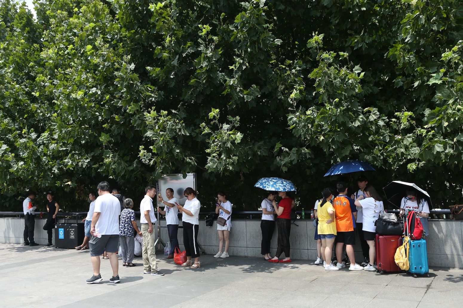
While heatwaves around the world are becoming more frequent and intense because of human-caused warming, they are made even more severe in cities by the UHI effect, which traps heat in urban areas and keeps them warmer than their rural surroundings.
The study, published in Nature Cities, analyses 20 years of data from 30 cities in China and finds that a ring of rural land around a city can bring the urban temperature down. A buffer ring that is at least half the city’s width can have the biggest cooling effect.
To optimise the land cover and reduce the UHI intensity, the authors recommend “joining up patches of rural land, planting more woodland around a city and having fewer, bigger lakes”.
Previous work on mitigating the UHI effect has mostly “focused on strategies that seek solutions within the city limits”, the study says.
However, a co-author tells Carbon Brief that as urban land is often limited, the findings show that making changes to land use “outside a city can make a big difference to temperatures downtown”.
Urban heat dome
Temperatures in cities are consistently higher than in the surrounding countryside due to the heat-trapping properties of urban infrastructure. Closely packed buildings, heat-absorbing surfaces, such as concrete, and human activity, such as driving cars, all contribute to the urban heat island effect (UHI).
The specific difference between the hotter city and cooler countryside is known as the UHI “intensity”. In London in summer, estimates suggest the temperature inside the city is an average of 5C more than surrounding rural areas at night and 3C more during the day.
In comparison, natural landscapes, such as trees or water bodies, can reduce surrounding temperatures through shade and water evaporation. Adding more green spaces inside a city can help to cool it down, but research shows the effects are generally limited without significant and well-distributed coverage.
Prof Shi-Jie Cao, director of the Center for Sustainable Built Environment at the School of Architecture, Southeast University in China and visiting professor at the University of Surrey’s Global Centre for Clean Air Research (GCARE), is a co-author on the new study. He tells Carbon Brief that “urban land is precious and limited” for heat mitigation strategies within cities. He continues:
“This study presents the first comprehensive quantification of how rural land cover mitigates the UHI and opens new avenues for addressing high-temperature urban catastrophes”.
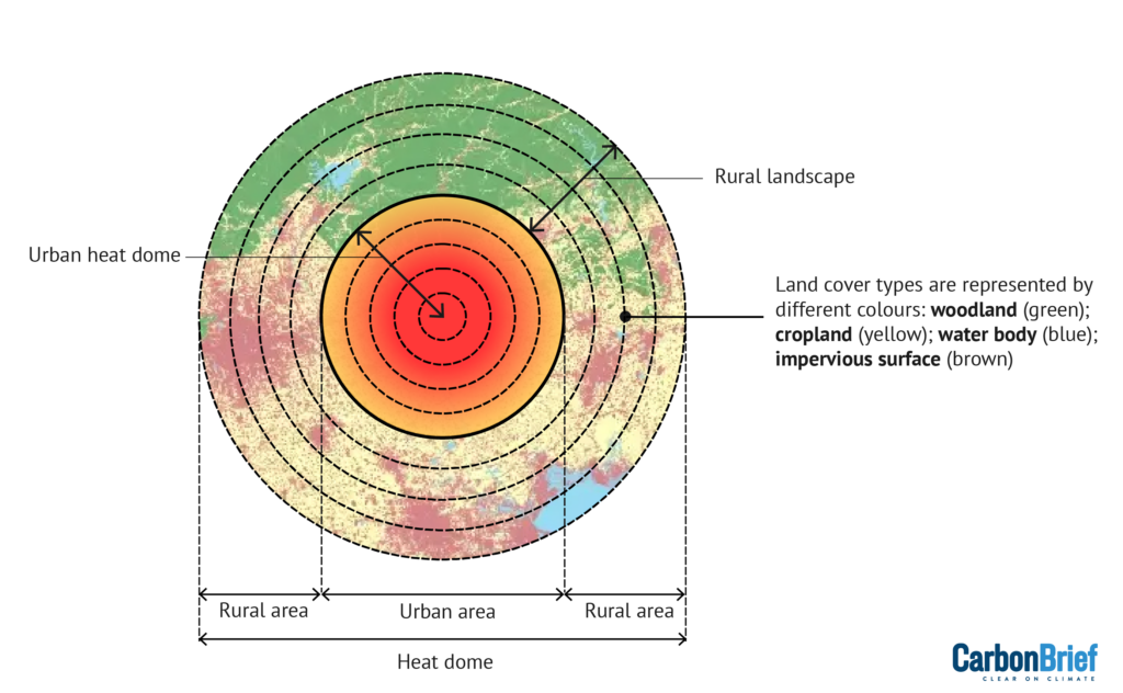
Higher temperatures in cities lead to the formation of a “heat dome”, roughly twice the size of the city boundary, the study says.
The diagram below shows how hotter (red) and colder air (blue) circulate through the dome. Cooler breezes from the neighbouring rural areas around the city blow into the urban centre, exchanging heat within the dome.
UHIs also exacerbate the effect of heatwaves, which are becoming more likely and more severe due to climate change. This increases the vulnerability of the more than 4.5 billion people living in urban regions globally.
Dr Eunice Lo, a researcher of climate change, extreme weather and human health at the University of Bristol, explained in a 2020 Carbon Brief guest post:
“Urban inhabitants can be more susceptible to heat-related illnesses and deaths in hot summers because of the UHI effect.”
Cooling green ring
Vegetation is often sparse in cities, typically becoming more plentiful away from the city centre. The study investigates how the location and type of rural land cover affects the temperature within the city.
The researchers model the land inside the heat dome with concentric rings, investigating the relationships between land cover and temperature in different zones.
Using satellite images of 30 major cities in China, the authors categorise the rural land cover into four types represented by colours in the rural area below – woodland (green), cropland (yellow), and water body (blue) and impervious surface (brown).

By changing variables including the size, diversity and fragmentation of the different land cover types in computer simulations of the environment, the study evaluates which variables have the biggest effects on UHI intensity and by how much they can reduce the temperature.
The authors divide up the landscape into “patches” – areas of land that differ from their surroundings. The size and fragmentation of the patches are “pivotal factors”, each with the potential to individually lower city temperatures by 0.5C, the study finds, noting that larger, less fragmented rural land patches produce a greater cooling effect.
Cao tells Carbon Brief that, in theory, this result means that by optimising both factors, UHI could be reduced by as much as 1C. However, he says the analysis does not account for “slight overlaps in the heat island mitigation effects among different landscape parameters”.
The authors also analyse how land cover at different distances from the urban boundary affects UHI intensity. They find that the best cooling effects come from the rural ring “within a 10-15 km radius from the urban boundary”. This range sits inside the heat dome, meaning the air flow and exchange of heat is most effective at these distances.
Rural land within this range can “contribute up to a 30% reduction of UHI intensity”, with the most significant cooling felt at the very centre of the city, the study finds.
To achieve these levels of reduction, “synergistic regulation” that coordinates best practices for multiple land management factors is needed, Cao tells Carbon Brief. Explaining the paper’s recommendations on how to effectively manage the rural buffer zone, he said in a press release:
“We found that urban overheating was mitigated more by joining up patches of rural land, planting more woodland scattered around a city, and by having fewer, bigger lakes rather than lots of little bodies of water.”
Global relevance
The study focuses on cities in China that exceed 200 square kilometres and have a single centre, so they could be more easily categorised into concentric rings according to urban population density.
While most of the cities selected – including Shanghai, Wuhan and Chengdu – experience a subtropical monsoon climate zone, the paper suggests that “the majority of mitigation strategies identified in China are transferrable to different climate zones”.
Consequently, the researchers claim the findings have “relatively high generalisability and applicability in different cities”, but advise that future research should investigate cities of “different shapes, development levels, geographical locations and climatic conditions”.
Dr Chloe Brimicombe – a climate science and extreme heat researcher at the University of Graz in Austria and visiting fellow at LSE’s Grantham Research Institute, who is not affiliated with the research – says the study could be improved by “adjusting more carefully for the climate of each city”. She adds:
“Small differences in elevation or proximity to the coast can influence the UHI effect. In addition, cities have different designs; if such a study was reproduced for Europe this could also be taken into account.”
Temperatures are rising across the globe, with 2024 now very likely to be the hottest year on record. Study co-author Prof Prashant Kumar, founding director of the University of Surrey’s GCARE and co-director of Surrey’s Institute of Sustainability, adds in the press release:
“We hope planners and governments can use our findings to help urban communities become more resilient against rising global temperatures. Our findings show that if we want to cool our cities down, we need a joined-up approach between urban and rural planning.”
Sharelines from this story


Discussion about this post