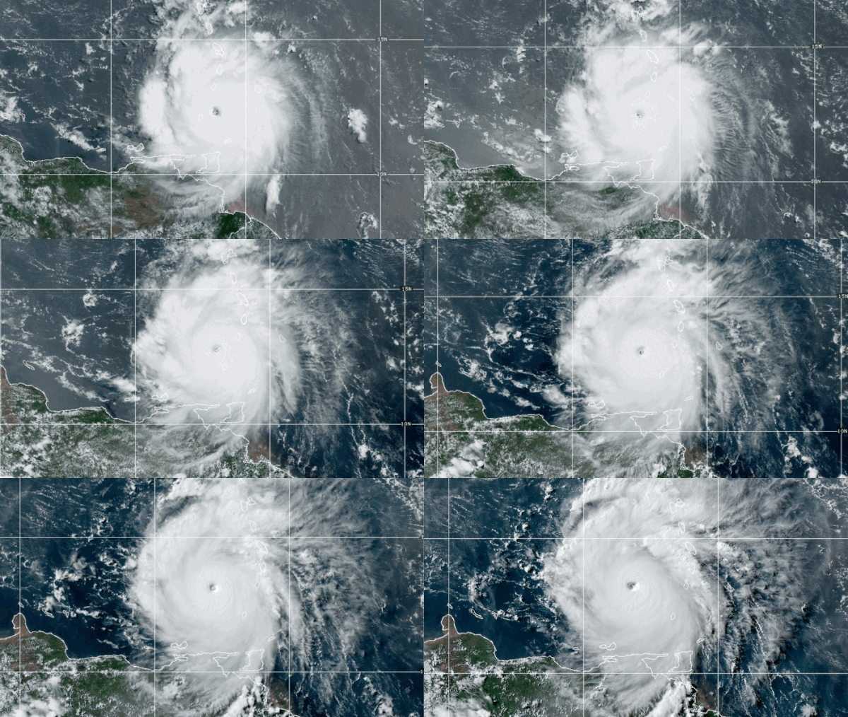
Satellites are monitoring Hurricane Beryl as it dumps destructive rain and winds on the Caribbean island of Carriacou in Grenada, where it made landfall on Monday (July 1) morning as “an extremely dangerous” Category 4 storm.
NOAA’s GOES-East satellite captured nearly real-time views of Beryl multiple times over the weekend as it closely tracked the powerful storm’s progress in the Atlantic ocean. The footage, taken from the satellite’s position about 22,236 miles (35,785 kilometers) above Earth‘s equator, shows the storm battering a group of islands in the Atlantic’s Caribbean Sea known as the Windward Islands, which include Grenada, St. Vincent, Martinique and a cluster of small islands called the Grenadines.
Extreme turbulence and frequent lightning was reported by hurricane hunters of the U.S. Air Force Reserve, who flew inside Beryl over the weekend to provide data useful for National Hurricane Center (NHC) weather forecasting.
.@NOAA’s #GOESEast has been closely watching extremely powerful #HurricaneBeryl as it moves through the Lesser Antilles. Track #Beryl and other tropical systems with our Hurricane Tracker: https://t.co/6nmkHtpJKt https://t.co/CCi0o1nAmZ pic.twitter.com/Oqw1TWbP3NJuly 1, 2024
Brian McNoldy, a tropical meteorology researcher at the University of Miami, told the Associated Press that warm ocean waters are the highest on record for this time of year. It is these waters, McNoldy explained, that are fueling Beryl. That ocean heat quickly strengthened Beryl into a Category 4 storm on Sunday (June 30), bumping it up from tropical depression status on Friday (June 28). Even before it made landfall on Monday, Beryl set a record as the strongest hurricane to attain Category 4 this early in a year, when the 6-month hurricane season usually just begins.
Related: 2024 hurricane season should be busy, NOAA says
“This is a serious threat, a very serious threat,” hurricane specialist Michael Lowry told WNBC. “Beryl is an extremely dangerous and rare hurricane for this time of year in this area,” he told CBS News. “Unusual is an understatement.”
.@NOAA’s #GOES16🛰️ caught a stunning view of the mesovortices swirling in #HurricaneBeryl’s eye as it made landfall on Carriacou Island today. For the latest on #Beryl, go to https://t.co/bf9oyNUeIP https://t.co/2saKR24rAK pic.twitter.com/bL1ulPa2WtJuly 1, 2024
Views of Hurricane #Beryl from this morning’s mission aboard WP-3D Orion #NOAA43 “Miss Piggy.”📸: Lt. Cmdr. Kevin Doremus, NOAA Corps pic.twitter.com/bRF7VyXZkCJuly 1, 2024
In Carriacou, forecasters warned Beryl will bring about 9 feet of rain (3 meters) and destructive winds up to 150 miles per hour (240 kilometers per hour). The hurricane blew off roofs, downed power lines and uprooted trees in Carriacou and elsewhere, the Associated Press reported. A weather station at Grenada airport reported wind speeds of 92 miles per hour (148 kilometers per hour), NHC said in its latest advisory, issued Monday afternoon.
“This is an extremely dangerous and life-threatening situation,” the NHC said. “Residents should not leave their shelter and remain in place through the passage of these life-threatening conditions.”
Devastating scenes from Carriacou (#Grenada) as Cat 4 #HurricaneBeryl batters the island. PM Mitchell reports widespread damage & families battling winds/rain.If you’re in affected areas, stay indoors and heed warnings from emergency officials. @uniceflac #HurricaneRelief pic.twitter.com/Iunk22OetlJuly 1, 2024
Grenadian Prime Minister Dickon Mitchell asked residents to remain indoors and seek shelter in bathrooms, if necessary. Thousands stayed at emergency shelters scattered throughout the island, local media reported.
“If everything else fails and your bathroom is still standing, we ask you to stay there until you are given the all-clear,” said Mitchell. “With God’s blessing, we hope the damage will be minimal. It is absolutely critical that we remain indoors, that we hunker down, that we find the safest places within our homes, within the shelters, within wherever you are to try and remain safe.”
Astronauts aboard the International Space Station (ISS) also got a good look at the hurricane when the orbital lab was overhead on Monday morning. “We flew right over the top of Hurricane Beryl today,” Matthew Dominick, a NASA astronaut who is currently on the ISS as part of the SpaceX Crew-8 mission, said in a post on the X platform. “Peering down into the eye with the 50 to 500 mm lens gave me both an eerie feeling and a high level of weather nerd excitement.”
Hurricane Beryl, a Category 4 storm with winds around 130 miles per hour, is seen over the Caribbean from the space station as it orbited above at about 9 a.m. EDT Monday morning. pic.twitter.com/eYH36rMU3EJuly 1, 2024
Hurricane warnings remain in effect for St. Vincent, where forecasters have predicted up to 10 inches (25 centimeters) of rain, as well across the Grenadine Islands and Barbados, which may be buffeted by strong gusts and about 6 in (15 cm) of rain. Similar conditions are also expected in Jamaica, where the government has issued a hurricane watch.
“It should be emphasized that Beryl is forecast to remain a significant hurricane during its entire trek across the Caribbean region,” the NHC said.


Discussion about this post