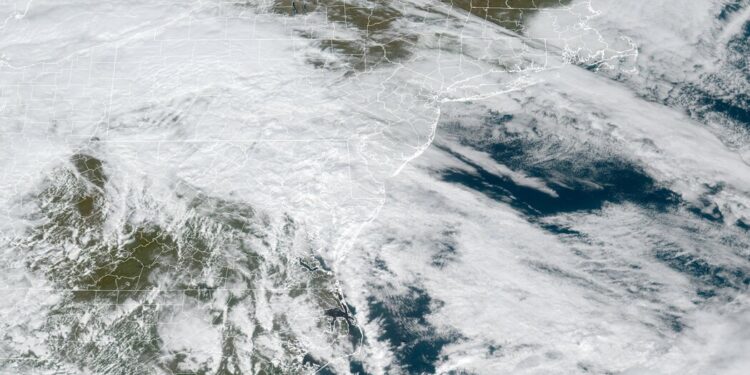
A large storm pushing through the Mid-Atlantic to parts of the Northeast over the weekend is expected to bring flooding, especially to coastal regions, the National Weather Service said.
Heavy rain during high tides could lead to “astronomical surges” of ocean water, said Matt Doody, a National Weather Service forecaster in the agency’s Eastern Regional Operations Center in Bohemia, N.Y.
Maryland, including Baltimore, could experience some of the biggest tidal flood events in almost two decades, the Weather Service said, adding that residents should be prepared for “exceptional tidal inundation.” Some regions could see more flooding than in 2003, when Hurricane Isabel inundated the Mid-Atlantic.
The storm system could also bring the highest water levels ever observed to the Delaware and Chesapeake Bays, Mr. Doody said. What makes this storm so prone to flooding is how slow it is moving, he said.
Forecasters in the Chesapeake and Delaware Bay areas said that water level records could vary from area to area but added that records had been set by hurricanes or other named storms, such as Hurricanes Sandy, Ida and Isabel.
The unnamed storm on Friday prompted coastal flooding and heavy rain warnings from Virginia to parts of New Jersey. Excessive rainfall warnings into Saturday were posted for Pennsylvania, Washington, D.C., West Virginia and much of Maryland.
The rain is expected to spread northeast into New England on Saturday afternoon, with a marginal risk in some places for two to four inches of rain, forecasters said.
“Flooding may become severe enough to cause some structural damage along with widespread roadway flooding near tidal waterways,” the National Weather Service said.
Delaware has been preparing for the storm for a few days, A.J. Schall, director of Delaware’s Emergency Management Agency, said on Friday.
Many coastal parts of the state are prone to light flooding from high tides on a regular basis. He said he was worried that the slow-moving storm could worsen flooding conditions because it would drench the state during high tide between 5 and 9 p.m.
“Where the normal runoff would go is now being held up by the high tides,” Mr. Schall said.
Water levels along the Delaware River could reach 11.5 feet around 10 p.m., according to a National Weather Service gauge in Burlington, N.J., near where the Delaware borders parts of Pennsylvania.
The National Weather Service warned that numerous roads could become impassable and that “some neighborhoods may be isolated” as a result of the flooding.
No roads in Delaware have yet been closed, but officials said they expected to close some later on Friday. Counties have been warning residents since Wednesday to move their cars to higher ground, Mr. Schall said.
In Annapolis, Md., the city was already experiencing flooding in dock parking lots as early as 9 a.m. on Friday. Alexandria, Va., was also distributing sandbags with a limit of five bags per address, according to a statement from the city.
Flooding is a complex phenomenon with many causes, including land development and ground conditions.
While determining all the factors of a single flood event requires extensive scientific analysis, climate change, which is already causing heavier rainfall in many storms, is an increasingly important part of the mix. A warmer atmosphere holds and releases more water, whether in the form of rain or heavy winter snowpack.
Between 2000 and 2015, the incidence of high-tide flooding in the Mid-Atlantic doubled from an average of three days per year to six, according to a 2018 NOAA report.
According to the report, high-tide flooding has steadily risen in regions mostly along the coasts of the Northeast and Southeast Atlantic and the Gulf of Mexico. The report predicted that in the next 80 years, high-tide flooding in coastal cities will occur every other day.


Discussion about this post