An international team of climate change experts says global models which are used to help nations prepare for the impact of climate change are overlooking small island nations.
Writing an editorial comment in the influential peer review journal Nature Climate Change the group says there is “urgent” need for higher resolution models of small island nations’ climates to allow them to plan for and adapt too climate change.
“Small island states and territories are at the forefront of climate change impacts,” the team writes. “There is a critical need for more accurate and comprehensive climate change projections for the islands.
“We call for rapid global and regional cooperation to develop high-resolution projections compatible with small island scales.
“Small island states and territories need more reliable, higher-confidence projections of changes in all relevant climate hazards to understand and adapt to the risks they pose to human societies and ecosystems.”
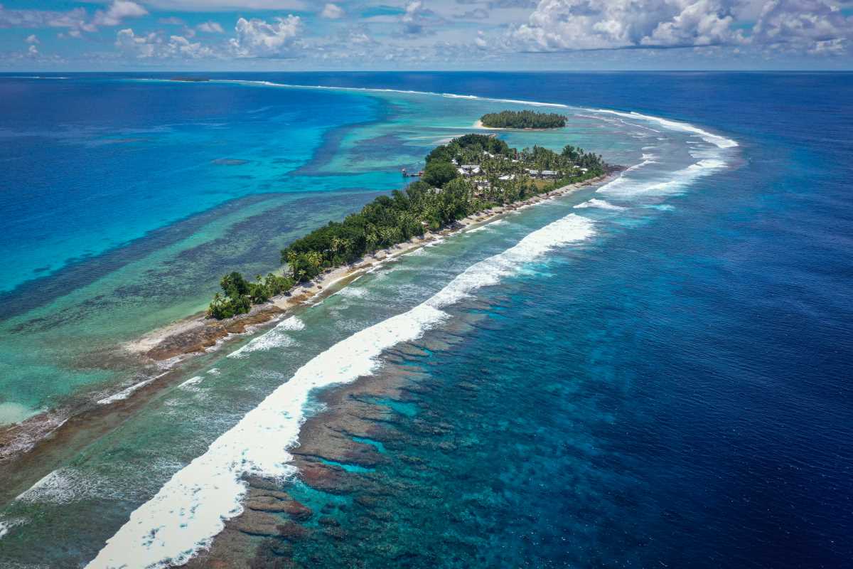
At present global cooperation for regional climate projections is coordinated through CORDEX: The Coordinated Climate Downscaling Experiment. Its projections enable resolutions ranging from 50km to 12.5km, which captures larger islands but still skips over small islands, atolls and lagoons, particularly in the Pacific Ocean.
For example, the researchers write: “The problem extends to coastal and lagoon areas, which are inaccurately represented in low resolution models as open and deep ocean rather than as an island and shallow waters.
“This lack of accuracy fails to capture the differences in climate between islands and the surrounding ocean. These differences include the presence of steep mountains influencing rainfall, tropical cyclones making landfall, and the specific hydrodynamic processes taking place in lagoons and coral reefs.”
How these island climate processes will change with global warming remains largely unknown, say the researchers, but it’s this missing information that is the key to understanding how climate change risks will evolve over small island states and territories.
They estimate that for most islands, this will require projections at convection-permitting (about 1km) resolution nested within large domains simulated at resolutions in the 10−20km range, and islands surrounded by lagoons will require embedding at even higher resolution.
The team included representatives from Australia, France, Jamaica, New Zealand, and New Caledonia.
One of the authors, Professor Jason Evans from the University of New South Wales Climate Change Research Centre , told Cosmos that examples of the issue might be that Tuvalu doesn’t know how long droughts might become. This could threaten fresh water supply for the islands.
“And Noumea doesn’t know how intense or long future heatwaves will be – this presents health risks that the medical services need to be adapted to,” says Evans.
“Regional modelling efforts can reach the required resolution but take considerable computational and human resources […] that small island states generally do not have.
“Modelling would need to be done by research groups in countries that have the required compute and people resources – generally the wealthier countries, while the small island states need to provide observational climate data and local knowledge.”
Evans says even countries like Papua New Guinea would find value in better models, although it wasn’t included in the research.
He says the collaboration should extend to development outcomes: “We need to add some effort into training people from small island states to access and use the data appropriately.”
The authors of the Nature Climate Change editorial say a funded, coordinated, international collaborative effort is needed to ensure that small island states and territories can move beyond sea-level rise impacts and understand their full spectrum of climate change-related risks.
Can small island nations survive climate change?


/https://tf-cmsv2-smithsonianmag-media.s3.amazonaws.com/filer_public/34/31/3431771d-41e2-4f97-aed2-c5f1df5295da/gettyimages-1441066266_web.jpg)


Discussion about this post