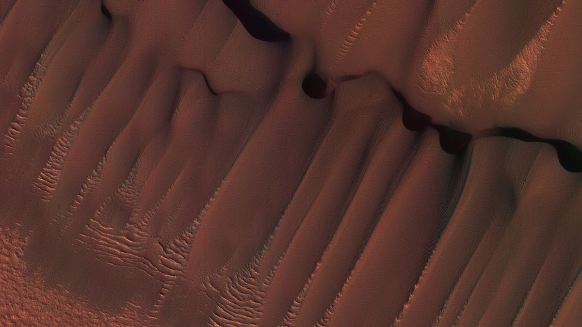
What it is: Dunes on Mars
Where it is: Around Planum Boreum, the north polar ice cap on Mars
When it was shared: Aug 6, 2024
Why it’s so special: This week, researchers at the University of Arizona (UA) shared one of the most beautiful images of dunes on the surface of Mars ever taken. The team snapped the image using theHigh-Resolution Imaging Science Experiment (HiRISE) camera, which is operated by UA scientists and lives on board NASA’s Mars Reconnaissance Orbiter (MRO).
As it swoops around the Red Planet, MRO searches for evidence that there was once widespread water on Mars’ surface and traces how much dust and water are distributed in its atmosphere, according to NASA. Originally taken on Sept. 1, 2008, and reshared this week, this image shows a dune field near the base of Mars’ north polar ice cap, Planum Boreum. About 620 miles (1,000 kilometers) in diameter, it contains canyons, chasms and spiral troughs, according to NASA. Encircling the ice cap are large, windblown dune fields that may form from the dusty ice layers eroded by strong polar winds.
Related: Bizarre sand dunes on Mars are ‘almost perfectly circular,’ and scientists don’t know why
In this image, winds from the polar cap have created long, parallel dunes closest to it and crescent-shaped dunes farther away. The dunes lack frost because the image was taken during summer in Mars’ northern hemisphere.
MRO delivers the most beautiful, extreme-close-up photography of the Martian surface. Its previous images include almost perfectly circular sand dunes and rocks that look like a teddy bear.
MRO launched on Aug. 12, 2005, and began orbiting Mars on March 12, 2006. Its primary mission ended in 2010, but it still forms part of NASA’s communications network at Mars and sends back images from HiRISE. UA’s Lunar Planetary Laboratory plans HiRISE’s images, sends commands, and processes raw data into images.


/https://tf-cmsv2-smithsonianmag-media.s3.amazonaws.com/filer_public/d1/82/d18228f6-d319-4525-bb18-78b829f0791f/mammalevolution_web.jpg)


Discussion about this post