


The Novato landslide in California: digital elevation model data demonstrates a much older, larger landslide
Loyal reader and long time online friend Funkenbeachin has extracted the 1 metre digital elevation model (DEM) data for the site of the Novato landslide in California. He has made a a video that shows the site, which he’s posted to Youtube:-
.
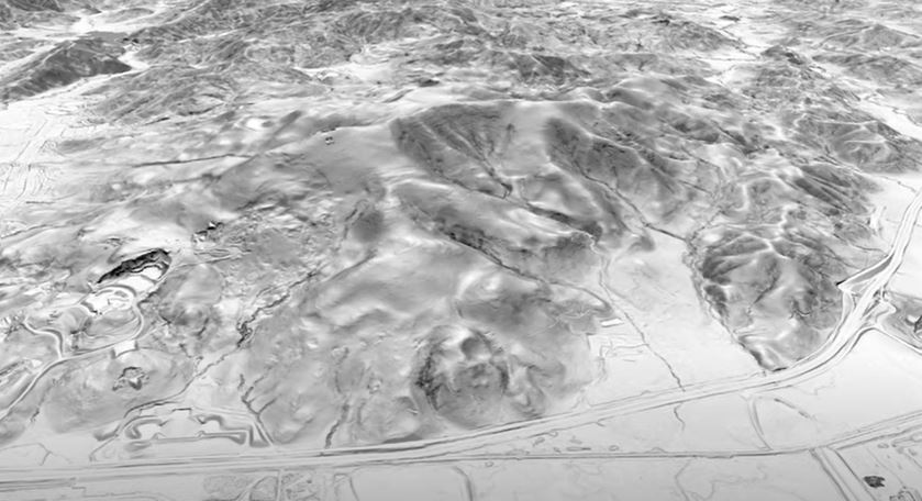
This video really demonstrates the power of DEM data, which highlights beautifully that the most recent slide is a reactivation of the lower portion of a much larger, ancient landslide. I wonder whether the engineers who designed and constructed the slope on the uphill side of the road were aware of this. This landslide can clearly be seen in the still from the video below:-
1 m DEM data for the site of the Novato landslide in California. Still from a video posted to Youtube by loyal reader funkenbeachin.
.
This is landslide country – there are many other landslides visible in the image above, a consequence of active tectonics that have created a dynamic landscape, weak rocks, regular high intensity rainstorms and occasional earthquakes.
There are certainly lessons to be learnt from the Novato landslide.


