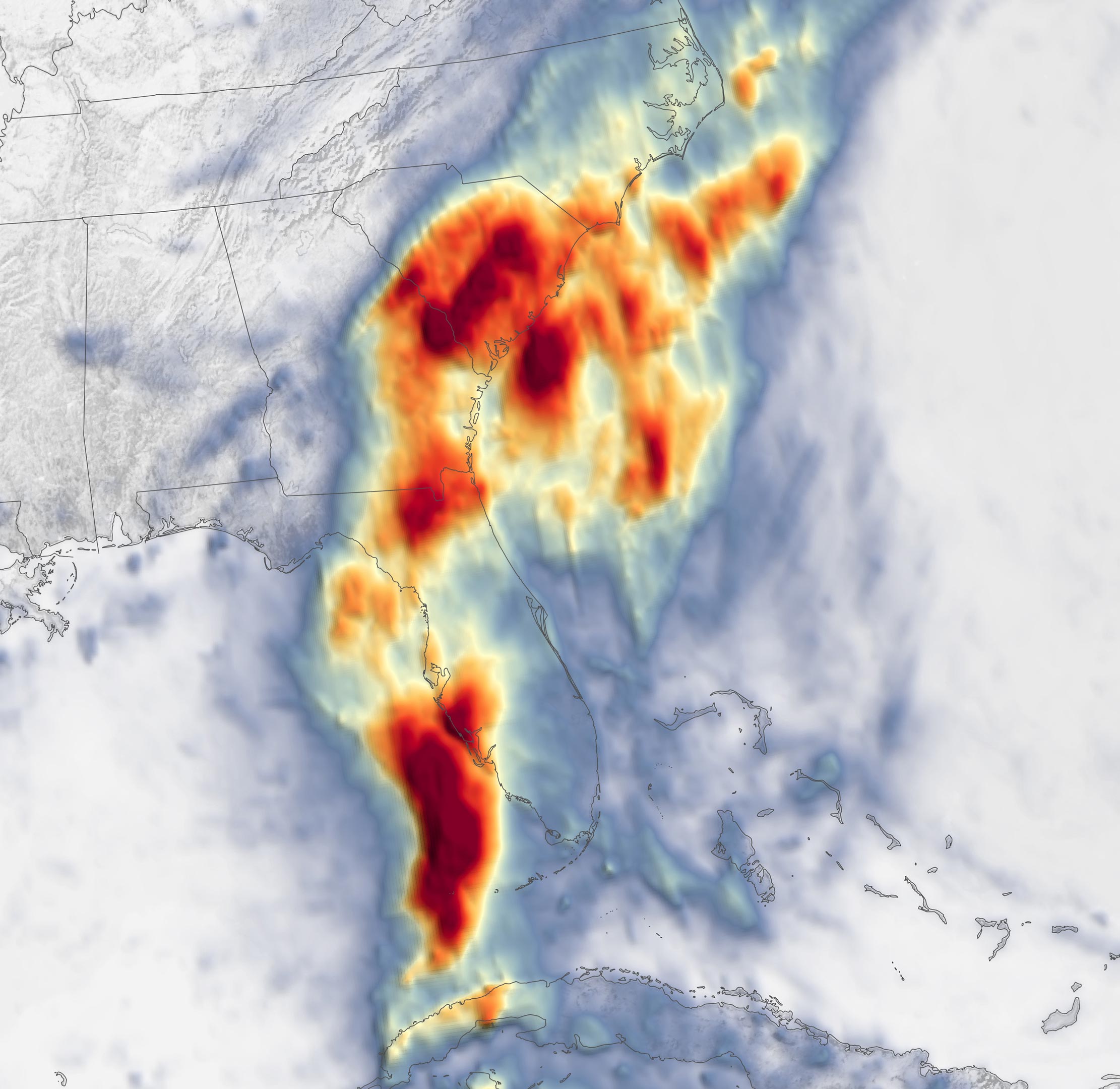
Satellite map of total rainfall over August 3 – 7, 2024, using data from the Integrated Multi-Satellite Retrievals for GPM. Tropical Storm Debby delivered rainfall totals of more than a foot to parts of Florida, Georgia, and the Carolinas before marching toward the mid-Atlantic and Northeast.
Tropical Storm Debby struck the U.S. Southeast in early August 2024, bringing with it over a foot of rainfall across several states. After initially hitting Florida, the storm caused extensive flooding in the Carolinas. National Weather Service (NWS). In South Carolina, the town of Summerville saw 18.25 inches (464 millimeters).
Second Landfall and Continued Threat
The deluge continued as the storm made a second landfall, this time coming ashore northeast of Charleston, South Carolina, early on August 8. Having picked up more moisture during its stint over the Atlantic Ocean, Tropical Storm Debby continued dropping heavy rain on parts of the Carolinas.
As Debby continues northward as a tropical depression, forecasts call for heavy rain to move across the mid-Atlantic and Northeast on August 9–10. According to the NWS, flash flooding spurred by the heavy rainfall continued to be the storm’s biggest threat.
NASA’s Disasters program has been activated in response to Tropical Cyclone Debby, supporting stakeholders such as the Federal Emergency Management Agency (FEMA). As new information becomes available, the team will be posting maps and data products on its open-access mapping portal.
NASA Earth Observatory image by Lauren Dauphin, using IMERG data from the Global Precipitation Mission (GPM) at NASA/GSFC.


Discussion about this post