Photo: Screenshot / MetService
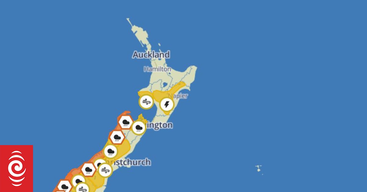
A heavy rain warning is in place for western and northern parts of the South Island and significant rainfall expected for southern Westland.
An active front preceded by a strong and very humid north to northeast flow was forecast to move over the South Island overnight tonight and Sunday.
From midnight Saturday to 6pm Sunday, Westland south of Otira can expect 220 to 300mm of rain to accumulate about the ranges and 80 to 140mm about the coast.
This could potentially be a significant event, MetService said.
Maximum rainfall accumulations could reach 300 to 400mm or more in isolated higher parts of the ranges between Fox Glacier and Waitaha, it forecasts.
Buller can expect 60 to 90mm of rain about the ranges from 11am to 8pm Sunday, with lesser amounts nearer the coast. Peak rates of 15 to 25 mm/h are expected.
From 2pm to 10pm Sunday, Tasman west of Motueka can expect 70 to 100mm of rain about the ranges and lesser amounts nearer the coast, with peak rates of 15 to 25 mm/h.
Fiordland north of Doubtful Sound can expect 80 to 130mm of rain from 11pm Saturday to 2pm Sunday, with peak rates of 20 to 30 mm/h during Sunday morning and possible thunderstorms.
Severe gales to parts of central and southern New Zealand are also forecast.
Strong wind gusts from 9pm tonight were forecast for Fiordland. MetService said wind could damage trees, powerlines and unsecured structures and conditions could be dangerous for driving.
MetServices advises people to keep up to date with the latest forecasts in case any changes are made, or further areas are added.


Discussion about this post