I was lucky enough to receive a most welcome media drop from the Durbanville Wine Valley.
A bottle of their highly anticipated 2026 Durbanville Sauvignon Blanc, the signature collaborative vintage from Cape Town’s premier Northern Cape vineyards.
Officially signed off for release, the much-anticipated public unveiling took place at the region’s Sauvignon Soirée on Friday, May 8, marking a major milestone as the project celebrates its fifth consecutive year. This half-decade partnership has enabled the region to achieve remarkable consistency in quality, offering consumers a familiar, world-class style they have come to recognise and admire. Through the regions’ windmakers refining their collective craft over the past five years, the participating winemakers have further cemented Durbanville’s reputation as the home of South Africa’s Super Sauvignon Blanc.
The annual Sauvignon Soirée showcases the 12-winery collective and the region’s dominance in cool-climate viticulture. The collaboration in the creation of this blend began in 2022 with the goal of combining the finest fruit from across the valley with the region’s most formidable winemaking talents. The 2026 vintage continues this tradition, featuring premium grapes from a prestigious lineup comprising Diemersdal, De Grendel, D’Aria, Durbanville Hills, Groot Phesantekraal, Klein Roosboom, Maastricht and Nitida.
The responsibility for the final blend was entrusted to Diemersdal, an estate internationally acclaimed for its mastery of the variety. Winemaker Juandré Bruwer oversaw the blending process, while respected veteran winemaker Charles Hopkins of De Grendel led the panel of participating wineries during the preparatory tastings.
It’s a particularly exciting time for the region. Not only is the 2026 vintage backed by a history of high-level local and international awards, but, according to Juandré, the collaboration represents the region’s very heartbeat. He notes that the project is a testament to a progressive community dedicated to mutual support, resulting in a wine that embodies the soils, personalities, and values of Durbanville.
The release of the new vintage was timed to coincide with International Sauvignon Blanc Day on May 1, when enthusiasts worldwide celebrate the variety. After five years of meticulous production, the Durbanville collaboration stands as a premier example of what can be achieved through shared vision and a commitment to excellence. As for Sauvignon Blanc day – isn’t that every day?
Tracing the region’s connection from ocean to vineyard to table, my gift box included:
Durbanville Sauvignon Blanc 2026 – the latest release from the valley’s collaborative project, now five vintages in. With consistency established, the focus has shifted to precision – a wine that reflects Durbanville’s cool-climate identity with clarity, structure and restraint.
A Sauvignon Blanc from HillcrestEstate – included alongside the blend to offer a more individual expression of the same landscape.
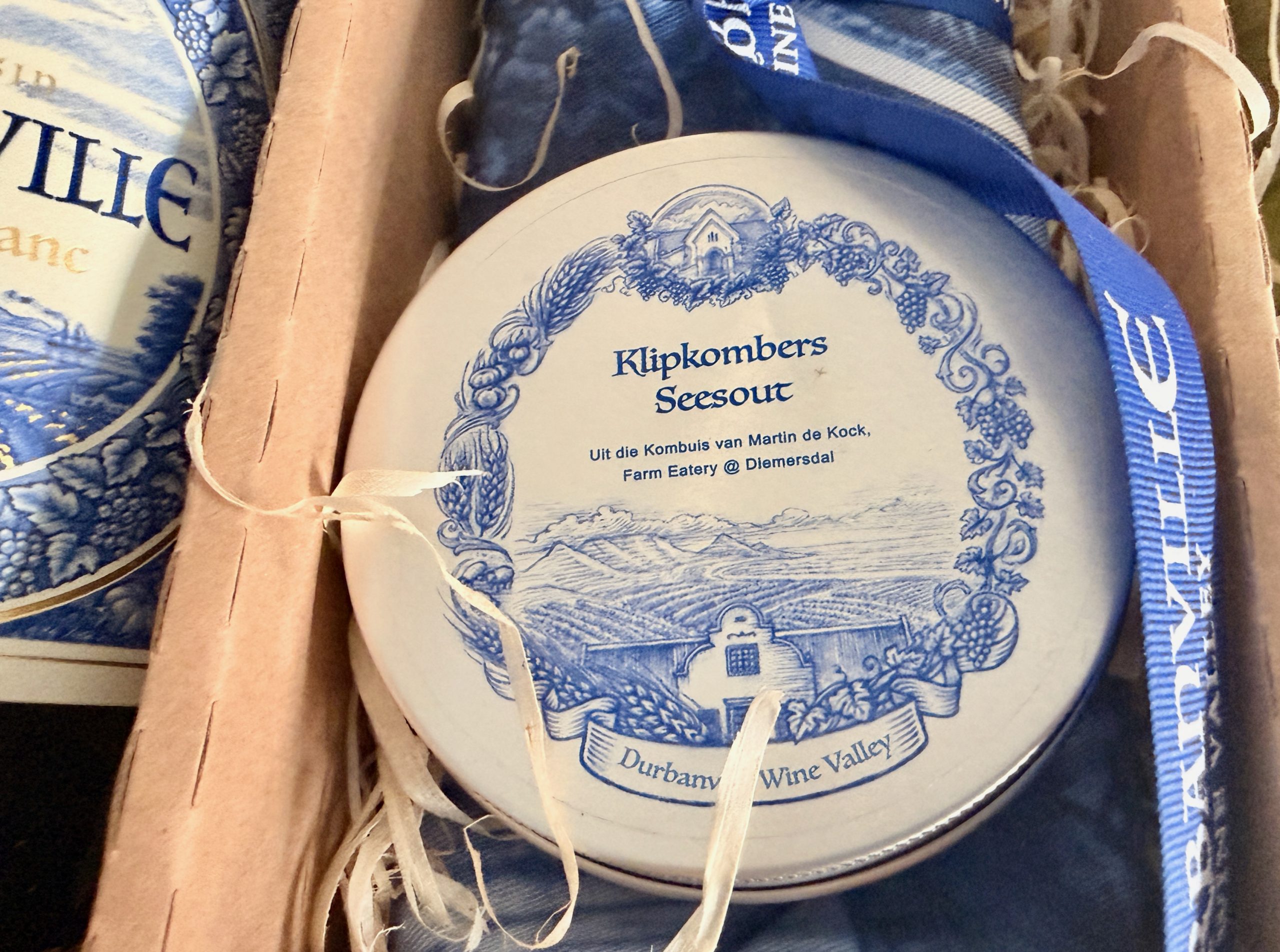
Klipkombers Seesout – developed in the Diemersdal kitchen by Chef Martin de Kock using klipkombers, an indigenous West Coast seaweed. Its saline, mineral character reflects the same oceanic influence carried through the vineyards.
Delft dish towel – a subtle nod to the label’s Delft-blue design, drawing a line between heritage, place and the everyday rituals that frame how wine is ultimately enjoyed.
An absolute treat, and I look forward to enjoying the wine, trying the Seesout and placing my Sauvignon Blanc-inspired creation on the most beautiful Delft blue dish towel. A treat indeed. Thank you, Durbanville Wine Valley, and I will continue to seek out your offerings in the Sip Sip Hooray spirit!
For more information about Durbanville Wine Valley, visit www.durbanvillewine.co.za or send an email to info@durbanvillewine.co.za.
The Sagres to Vila do Bispo walk is a part of the Fishermen’s Trail, a multi-day hiking route along the coast in Southern Portugal. The stage can be walked as a day hike. This easy 20-kilometer walk mostly along the cliffs offers spectacular scenery; dramatic cliffs, unspoiled beaches, and breathtaking lookout points. The route goes through Cabo de São Vicente (St.Vincent Cape), a south westernmost point of mainland Europe.
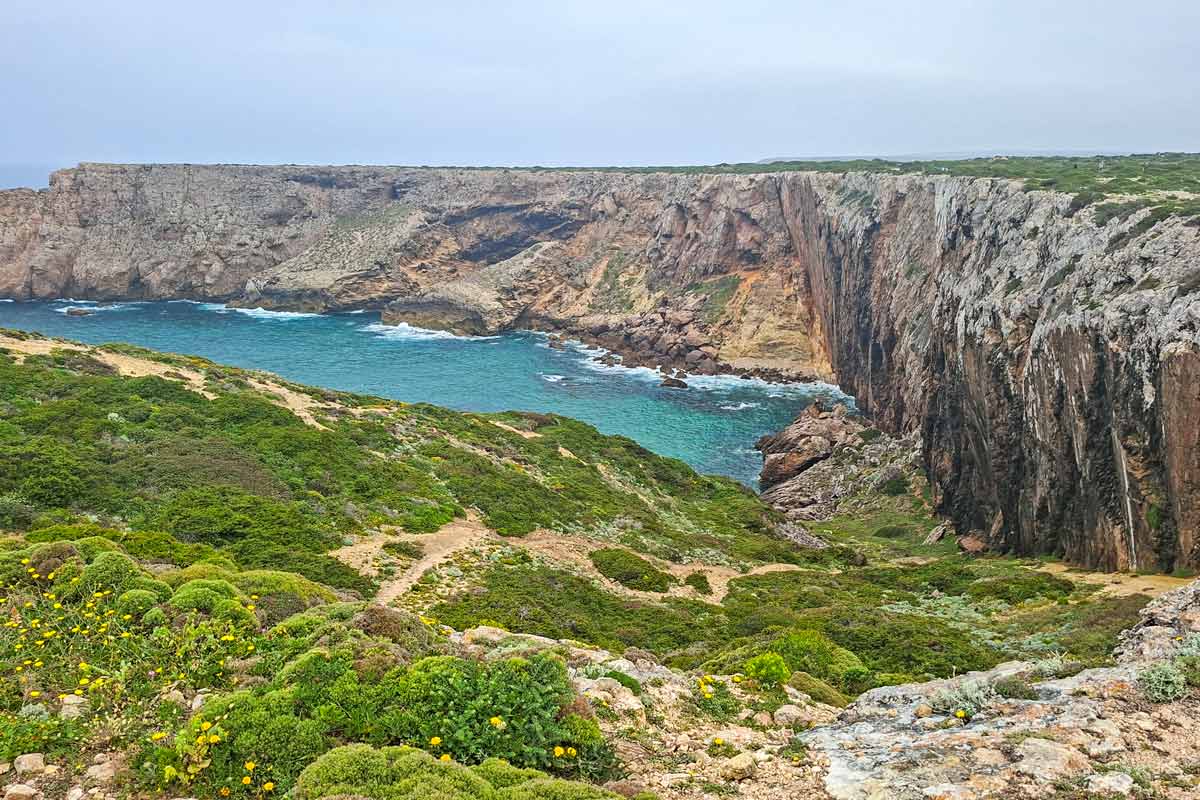
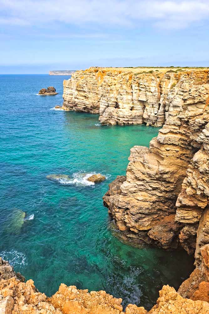
Spectacular scenery on the way from Sagres to Cabe Sao Vicente.
Stingy Nomads participates in the Amazon Services LLC Associates Program and other affiliate programs. If you click on the link and purchase the item or make a booking, we will receive an affiliate commission at no extra cost. Thank You for supporting us and assisting us to produce quality, free content.
Sagres to Vila do Bispo route overview
Distance – 20 km/12.4 mi
Time – 5-6 hours (moving time)
Total ascent – 244 m
Total descent – 199 m
Difficulty – easy
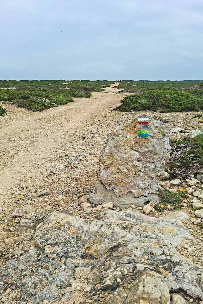
Route markings – the coastal part is marked with green and blue stripes painted on light poles, rocks, and walls; the inland part is marked with white and red stripes.
Walking surface – 10 km/6.2 mi – footpath; 5.5 km/3.4 mi – gravel road; 4.5 km/2.7 mi – asphalt.
Walking by the sea – 14 km/8.6 mi
Walking route – Sagres – Cabo de São Vicente – Vila do Bispo.
The coastal part of the route is marked with a blue and green stripe; the inland part – with a white and red.
GPX file of the Sagres to Vila do Bispo trail
Where does the trail start?
The easiest is to start at the tourism information office in Sagres at Jardim de Sagres Square (Mareta Beach). There is a wooden board with a map of the trail. From there you can walk out of town following the route indicators (blue and green stripes) painted on the poles, walls, and ground.
Where does it finish?
Once you’re in Vila do Bispo you can head to your accommodation (if you’re staying there). If you walk the trail as a day hike and have to get back you can finish at a bus stop on Rua Ribeiro do Poco (100 m from ALDI supermarket). Buses leave every hour or so. Note! There is a 2-hour gap between 2 pm and 4 pm.
How to get to Sagres?
You can take a direct bus from Lisbon to Sagres. The journey takes 4 hours. Buses leave from Sete Rios bus stations in Lisbon. You can find up-to-date itinerary and buy tickets on the website.
There are direct buses from Portimao to Sagres through Lagos.
If you’re already in Western Algarve you can get to Sagres by bus #47 from Lagos, Luz, Salema, Burgau, and Vila do Bispo. You can check for the timetable here.
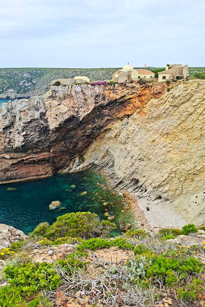
Beliche Fort is one of the highlights of the Sagres to Vila do Bispo trail
The highlights of the Sagres to Vila do Bispo route
Great views from the cliffs on the route between Sagres and Cabo Sao Vicente.
Praia do Beliche, a sandy beach 3.5 km from Sagres with a long staircase leading down to the beach.
Beliche Fort.
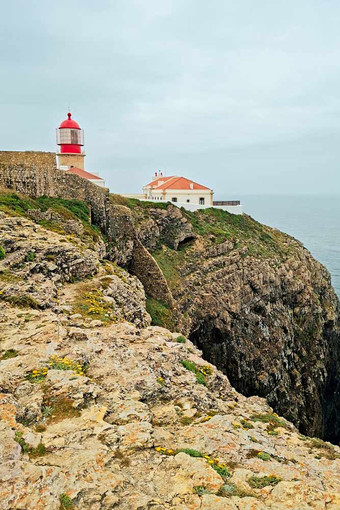
The lighthouse at Cabo de São Vicente.
The spectacular coastal views at the cape.
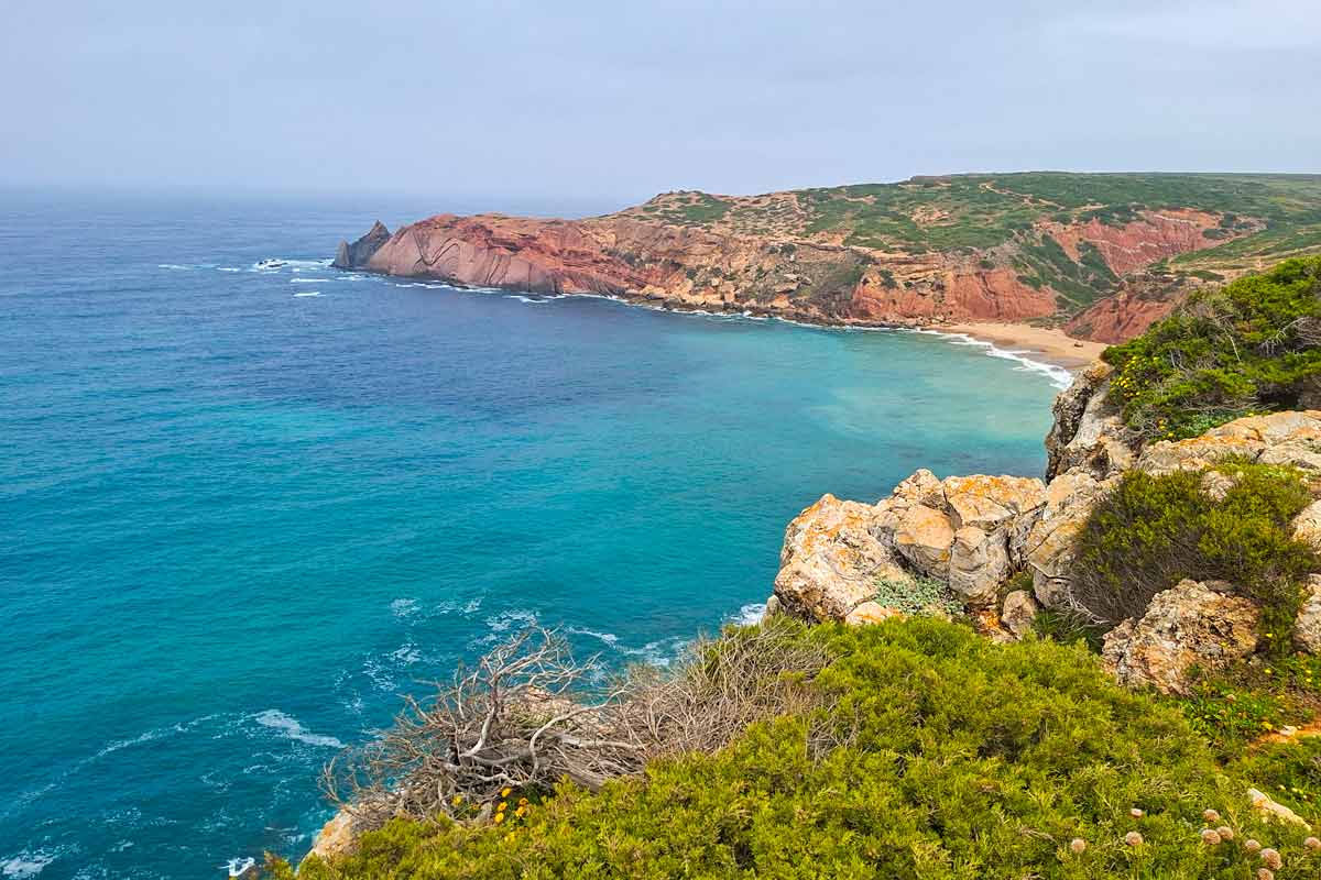
Dramatic drops, rugged cliffs, and a couple of hidden beaches on the trail from Cabo de S.Vicente.
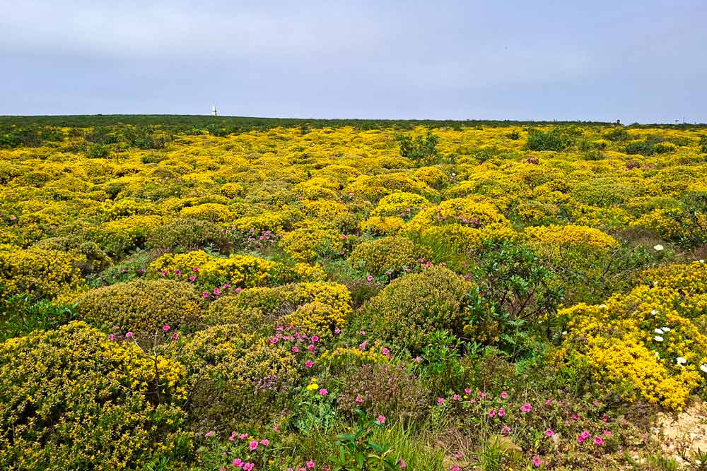
Fields of wildflower on the last 6 km/3.7 mi to Sagres (if walking in spring).
Stunning views of the cliffs and the sea on the trail from Sagres to Cabo de Sao Vicente
The challenges of the trail
The stage from Sagres to Vila do Bispo is one of the easiest stages of the Fishermen’s Trail. The only challenge I would highlight is walking on the rocky/sandy ground for 2 km/1.2 mi from the lighthouse.
In which direction to walk?
If you do this trail as a day hike I think walking from Vila do Bispo to Sagres is a better option. Because you get to walk the least interesting part (6 km inland through the fields) at the start of the day.
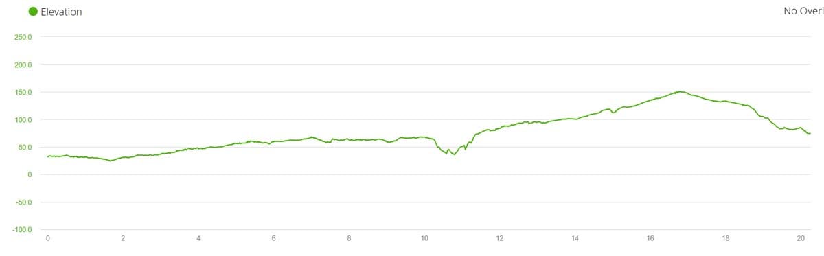
Elevation profile of the route
Elevation profile of the walking trail from Sagres to Vila do Bispo. As you can see the route is very flat with one very gradual ascent and descent
Stops along the trail
7 km/4.3 mi – the lighthouse at Cabo de São Vicente with several food stalls.
Breathtaking views of the coast on the route from Cabo de Sao Vicente to Vila do Bispo
Sagres to Vila do Bispo route description
Part 1. Sagres to Cabo de São Vicente
The trail goes on a sidewalk along the road out of Sagres for about 0.8 km.
0.8 km/0.5 mi – the route continues on the path along the cliffs.
3.5 km/2.1 mi – Beliche Beach.
3.5-5 km/2.1-3.1 mi – on the sidewalk along the road.
5-6 km/3.1-3.7 mi – on a footpath along the cliffs.
5.6 km/3.4 mi – Beliche Fort
6-7 km/3.7-4.3 mi – on the sidewalk along the road.
7 km/4.3 mi – the lighthouse at Cabo de São Vicente. There are several food stalls outside the lighthouse. Inside the lighthouse you can find a restaurant and a paid toilet.
The lighthouse at Cabo de Sao Vicente
Part 2. Cabo de São Vicente to Vila do Bispo
7-14 km/4.3-8.6 mi – along the cliffs with spectacular views.
7-8.5 km/4.3-5.2 mi – on the rocky terrain along the cliffs.
8.5-9.5 km/5.2-5.9 mi – on a sandy/rocky trail along the cliffs.
9.5-13 km/5.9-8 mi – on a footpath.
13-18.5 km/8-11.5 mi – on a gravel road with very few cars.
14-20 km/8.6-12.4 mi – inland.
18.5-20 km/11.5-12.4 mi on a tire road with very few cars.
20 km/12.4 mi – Vila do Bispo, a small town with several restaurants, hotels, and supermarkets.
Wildflowers on the last 6 km of the route to Vila do Bispo
Where to stay in Vila do Bispo
Vila do Bispo is a small town with a couple of supermarkets, several restaurants, and a couple of rental apartments/houses. There are significantly fewer places to stay here compared to Sagres. Many places in Vila do Bispo have a minimum of 2-nights+ stay.
Questions or Comments?
Got any questions or comments? We would love to help! All questions and comments will be answered by us personally in Buy Me a Coffee. Click below and ask away.
Feel free to support our site by buying us a coffee!
The pretty half of Stingy Nomads, responsible for all our land adventures (hiking, climbing, walking the Camino) and following them write-ups. Alya loves walking since she was a child, she prefers to walk 1000 km with a backpack rather than to do a 10 000 km road trip (actually any road trip). Alya is a big fan of Latin America, the Spanish language, and dancing. Every time we go away she desperately misses our dog Chile.
Exploring South Africa with your dog offers a unique way to experience the country’s breathtaking landscapes, from coastal drives to bushveld retreats. With a growing number of pet-friendly destinations, it has become increasingly accessible for dog owners to include their companions in travel plans. However, a successful trip requires careful preparation, especially when considering climate, wildlife, and local regulations.
Understanding local conditions and safety
South Africa’s natural beauty comes with certain challenges, particularly when travelling with animals. Wildlife is one of the most important considerations. Even in areas that appear safe, encounters with wild animals can occur, so keeping your dog on a leash is strongly advised in unfamiliar environments.
Climate is another key factor. Summers can be extremely hot, especially in inland regions. Dogs are vulnerable to heatstroke, so travel activities should be planned during cooler parts of the day, such as early mornings or late afternoons. Always carry sufficient fresh water and ensure your dog has access to shade.
Ticks and fleas are common in many parts of South Africa, particularly in bushy or rural areas. Preventative care is essential before and during your trip. Regular checks and appropriate treatments help reduce health risks and keep your dog comfortable throughout the journey.
Choosing dog friendly accommodation and transport
South Africa offers a wide range of pet-friendly accommodation, from self-catering cottages to boutique lodges. However, policies can vary significantly, so it is important to confirm rules regarding pets in advance. Some places may have restrictions on dog size or the number of animals allowed.
When travelling by car, safety should remain a priority. Use a secure harness or travel crate to prevent injury during sudden stops. Long drives are common in South Africa, so frequent breaks are necessary to allow your dog to stretch, hydrate, and relieve itself.
Air travel within South Africa is also an option, although it typically involves stricter requirements. Each airline has its own regulations regarding pet transport, and advanced booking is usually required. Ensuring your dog is comfortable in a crate beforehand can help reduce stress during flights.
Nutrition and maintaining your dog’s routine
Maintaining a consistent diet while travelling is essential for your dog’s health. Sudden changes in food can lead to digestive issues, which can quickly disrupt your trip. Bringing along familiar food is often the best approach. Many pet owners rely on trusted options such as Jock dog food to ensure their dogs receive consistent, high-quality meals even while on the road.
In addition to choosing quality food, keeping a routine as close to normal as possible can help your dog adjust to new environments. Regular feeding times, walks, and rest periods provide a sense of stability, even when surroundings are constantly changing.
Making the most of pet friendly activities
South Africa has a variety of dog-friendly experiences to enjoy. Many beaches, hiking trails, and parks welcome dogs, provided they are under control. Coastal regions such as the Garden Route are particularly popular for travellers with pets, offering scenic walks and open spaces.
Wine farms in certain regions also allow dogs, often providing designated outdoor seating areas where pets are welcome. Exploring these locations can add a relaxed and social element to your trip.
It is important to remain respectful of local rules and other visitors. Cleaning up after your dog and ensuring it behaves well in public spaces contributes to a positive experience for everyone and helps maintain access to pet-friendly locations.
A rewarding way to explore South Africa together
Travelling with your dog in South Africa can transform a standard holiday into a shared adventure filled with memorable moments. With proper planning, awareness of local conditions, and attention to your dog’s needs, the journey becomes both safe and enjoyable. Travellers looking for reliable travel tips will find that planning ahead makes all the difference when bringing a dog along.
From preparing for the climate to selecting suitable nutrition and accommodation, each step contributes to a smoother experience. South Africa’s diverse landscapes and welcoming atmosphere make it an ideal destination for those who want to explore the world alongside their four-legged companions.
Do you have more tips for travelling with dogs in South Africa ?
Sara Essop is a travel blogger and writer based in South Africa. She writes about family travel and experiences around the world on her blog “In Africa and Beyond”. Although she has been to 53 countries thus far, she especially loves showcasing her beautiful country and is a certified South Africa Specialist.
Marrakech’s Hidden Doors and Courtyards You’ll Want to Photograph
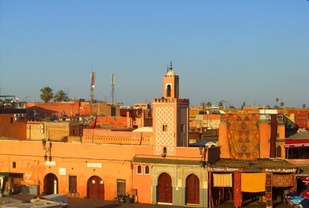
Marrakech is a city that exists in layers. To the casual observer, it is a whirlwind of sound — the persistent hum of motorbikes, the rhythmic clinking of mint tea glasses, and the call to prayer echoing across the Jemaa el-Fnaa. But for those who carry a camera, the true magic of the “Ochre City” isn’t found in the noise. It is found in the silence of its shadows and the sudden, breathtaking symmetry of a hidden courtyard.
The Medina is a fortress of privacy. From the outside, the streets are often nothing more than windowless walls made of sun-baked mud and lime. This is intentional; Islamic architecture historically prioritises the “inner” world over the “outer” display. However, if you know where to look, or if a heavy cedar door happens to swing open at the right moment, you are treated to a visual feast of emerald tiles, citrus trees, and intricate carvings that feel like a well-kept secret.
Finding Your Way Through the Ochre Maze
Marrakech
Navigating the labyrinthine alleys of the old city can be overwhelming for first-timers. The streets don’t follow a grid; they curve, narrow into dead ends, and occasionally open up into bustling squares. While getting lost is part of the quintessential Marrakech experience, it can be helpful to have a local expert point out the historical nuances of the architecture that you might otherwise walk right past. For those who want to get their bearings and discover the history behind the city’s famous gates, joining free walking tours in Marrakech is an excellent way to find those tucked-away corners that aren’t always pinned on a digital map.
The Art of the Moroccan Door: A Photographer’s Obsession
If you spend even an hour walking through the Mouassine or Kaat Benahid districts, you will realize that doors in Marrakech are more than just entry points. They are statements of craftsmanship and symbols of the family’s status.
The doors here are typically made of heavy cedar wood, often weathered by decades of North African sun into a soft, silvery grey or stained a deep, resonant brown. What makes them so photogenic are the details:
The Khamsa Knockers: Look for brass knockers shaped like the Hand of Fatima. They are meant to provide protection and are often positioned against dark, textured wood that makes the metal pop in photos.
Geometric Studding: Many doors feature iron studs arranged in complex Islamic geometric patterns. In the harsh midday light, these studs cast tiny, sharp shadows that add incredible depth to a close-up shot.
The Arched Frame: The horseshoe arch, or Moorish arch, is the defining silhouette of the city. Framing your subject within one of these arches provides an instant, professional-grade composition.
Why the Doors Are So Small
You might notice smaller doors “cut” into much larger ones. Historically, the large gates were for livestock or carriages, while the smaller door (the postern door) was for people. This forced anyone entering to bow their head slightly, a sign of respect to the household within. Capturing a local resident stepping through one of these small portals provides a wonderful sense of scale and “human” storytelling in your photography.
The Secret World of the Courtyard (The Riad)
The word Riad actually comes from the Arabic word for garden (ryad). In Marrakech, the courtyard is the lungs of the house. Because the city can be punishingly hot, these central spaces are designed to be cool, shaded oases.
Le Jardin Secret: A Study in Symmetry
Located in the heart of the Medina, Le Jardin Secret is one of the most magnificent examples of palatial architecture. It was rebuilt in the 19th century and recently restored to its former glory. For a photographer, the “Islamic Garden” section is a dream. The water channels, which represent the four rivers of paradise, provide perfect leading lines that draw the eye toward the lush greenery and the traditional gazebos.
The contrast between the “Majorelle Blue” accents and the terracotta walls creates a colour palette that requires very little editing. The best time to visit is during the “Golden Hour” when the light hits the upper towers of the complex, casting a warm glow over the marble walkways.
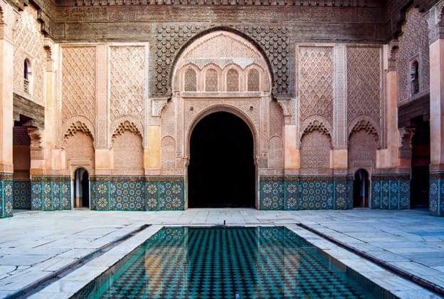
Ben Youssef Madrasa: The Pinnacle of Zellige
No photographic journey through Marrakech is complete without a visit to the Ben Youssef Madrasa. This 16th-century Islamic college is a masterclass in Zellige (terracotta tilework).
Essential Stops for Your Photography List
If you are planning a dedicated “photo walk,” ensure these spots are on your itinerary:
Bab Agnaou: The most beautiful of the nineteen gates of Marrakech. Its stone carvings turn a deep shade of rose-gold in the late afternoon.
Dar El Bacha: A palace that houses a museum and a world-famous coffee room. The floor tiles here are some of the most intricate in the country.
The Tannery Alleys: While the tanneries themselves are a sensory overload, the narrow streets leading to them often feature walls draped in colorful dyed wools drying in the sun.
Riad Yasmine: Though it is a private hotel, its iconic green-tiled pool has become a symbol of the “hidden Marrakech” aesthetic.
Practical Tips for Respectful Photography
Ask Permission: If you want to include a person in your shot, especially a shopkeeper or an artisan, a simple “S’il vous plaît?” and a smile goes a long way. Many locals prefer not to be photographed for religious or personal reasons.
Watch the Light: The sun in Morocco is intense. Between 12:00 PM and 3:00 PM, the shadows are harsh and “blown out.” Aim for early morning (7:00 AM) when the streets are empty, and the light is soft, or late afternoon.
Mind the Mopeds: It’s easy to get lost in your viewfinder, but the narrow alleys are shared with scooters. Always keep one ear open for the sound of an engine so you can tuck into a doorway.
Marrakech is a city that rewards the patient. It requires you to put down the map, slow your pace, and look for the subtle details — the way a vine of bougainvillea spills over a crumbling wall, or the intricate geometry of a brass door handle. When you stop looking for the “big” sights and start looking for the hidden thresholds, you’ll find the true soul of Morocco.
Sara Essop is a travel blogger and writer based in South Africa. She writes about family travel and experiences around the world on her blog “In Africa and Beyond”. Although she has been to 53 countries thus far, she especially loves showcasing her beautiful country and is a certified South Africa Specialist.
Looking for the best things to do in Ho Chi Minh City? See my recommendations below.
Ho Chi Minh City — still widely known as Saigon—is Vietnam’s largest and most dynamic city and home to around 10 million people. The city’s traffic is legendary—an endless stream of motorbikes weaving through intersections in a carefully choreographed chaos that can be both overwhelming and fascinating. As Vietnam’s economic hub, it presents a mix of history, culture, and modern life. The main tourist sites are genuinely worth visiting, but some of the most memorable experiences come from simply walking around and seeing what you find.
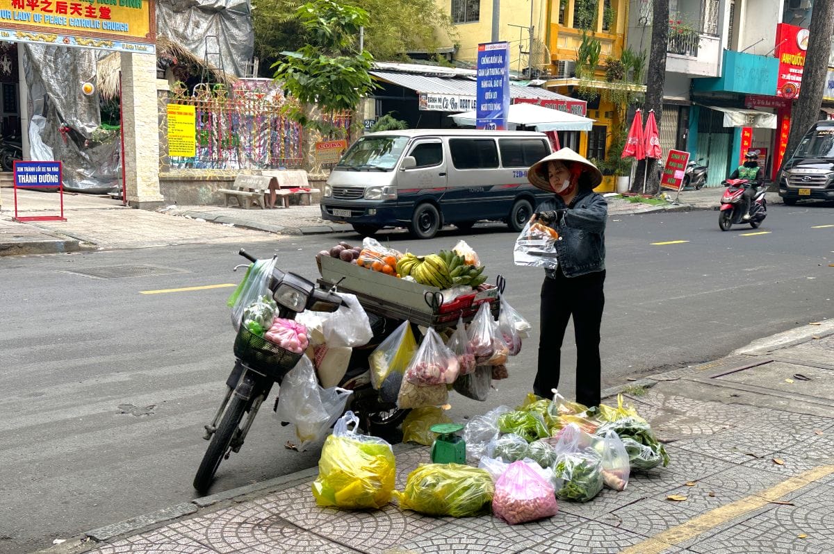
Fruit and veg seller
We flew to Ho Chi Minh City from Da Nang and spent two days there before continuing on to Jakarta.
9 Best Things to Do in Ho Chi Minh City
1. The Reunification Palace
Reunification Palace
This is one of the most significant historical sites in Vietnam. The building was the seat of the South Vietnamese government and the residence of its president until 30 April 1975, when North Vietnamese tanks drove through its gates and effectively ended the war.
The palace has been preserved largely as it was at that moment, and it is part history museum and part time capsule. Visitors can walk through the formal reception rooms, the presidential living quarters, the war operations centre in the basement (with its original communications equipment, maps and situation boards intact), and up to the rooftop helipad.
2. The War Remnants Museum
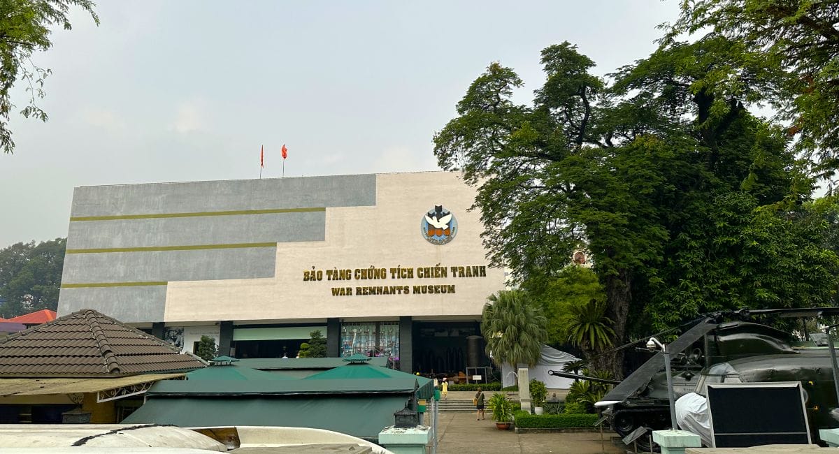
War Remnants Museum
The War Remnants Museum is essential viewing for anyone wanting to understand Ho Chi Minh City and the country it belongs to. The museum documents the American War — the term used in Vietnam for the Vietnam War — through photographs, military hardware, official records and personal testimonies. The factual records are thorough and the photographs speak for themselves. The courtyard outside displays aircraft, tanks, artillery and a UH-1 Huey helicopter.
📌 Worth Knowing: The Independence Palace and the War Remnants Museum are roughly a 10-minute walk apart so visiting both on the same day makes sense.
3. The French Colonial Quarter
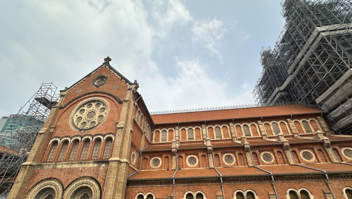
Notre Dame Cathedral of Saigon
France controlled Vietnam for close to a century, and its architectural influence on Ho Chi Minh City is still highly visible. The area around Dong Khoi Street and the riverfront in District 1 contains the highest concentration of colonial-era buildings, set along wide, tree-lined boulevards that still follow the original French urban plan.
The Central Post Office, designed by Gustave Eiffel’s engineering firm in the 1880s, is the centrepiece — a grand vaulted hall that is fully operational and free to enter. The Notre-Dame Cathedral is adjacent to it.
4. Nha Rong Wharf and the Ho Chi Minh Museum
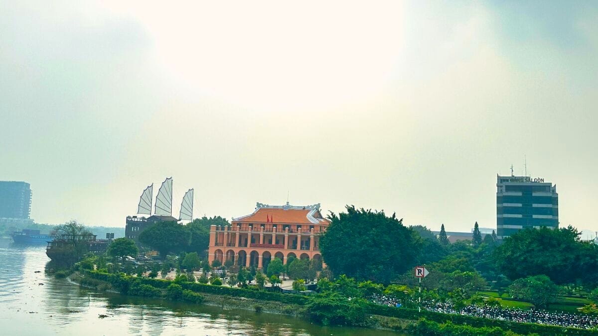
Nha Rong Wharf
On the southern bank of the Saigon River, the Nha Rong Wharf building is one of the city’s most recognisable colonial structures, distinguished by the pair of dragons on its roofline that give it its name — Nha Rong meaning Dragon House. It was built by the French in 1863 as a commercial port headquarters, and it was from this wharf that the young Ho Chi Minh departed Vietnam in 1911, beginning a 30-year journey through Europe, America, the Soviet Union and China before returning to lead the independence movement.
The building now houses a museum documenting Ho Chi Minh’s life and travels through photographs, artefacts and personal effects. The riverside location and the views from the wharf make it worth a visit.
5.Ben Thanh Market
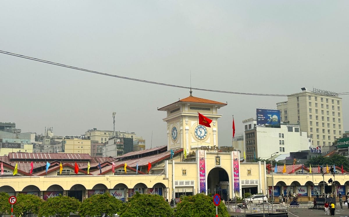
Ben Thanh Market
Ben Thanh Market is a huge covered market dating back to the early 20th century. It houses hundreds of stalls selling fresh produce, dried goods, spices, Vietnamese coffee, clothing, and souvenirs. The fresh food section in the morning is a working, functional space where local vendors have traded for generations. Prices throughout the market are higher than elsewhere in the city, and bargaining is standard practice. The area around Ben Thanh also hosts a popular night market after dark.
6. Landmark 81
Standing at 461 metres, Landmark 81 is the tallest building in Vietnam and one of the tallest in Southeast Asia. Located in the Binh Thanh district on the banks of the Saigon River, the skyscraper is visible from much of the city and is part of a larger complex that includes a shopping mall, hotel and residential apartments. The main draw for visitors is the SkyView observation deck on floors 79 to 81, which offers panoramic views across the city, the river and the surrounding flatlands. Entry to the observation deck requires a ticket and it is worth booking in advance, particularly on weekends.
Bitexco Financial Tower
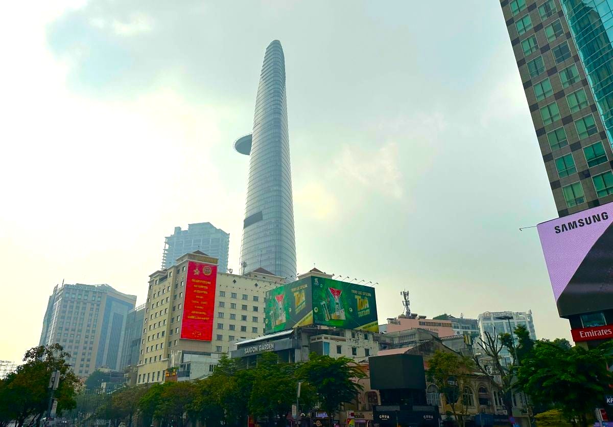
The Bitexco Financial Tower is the second tallest building in the city and The Saigon Skydeck observation deck on the 49th floor also has impressive 360-degree views over the city and the river below.
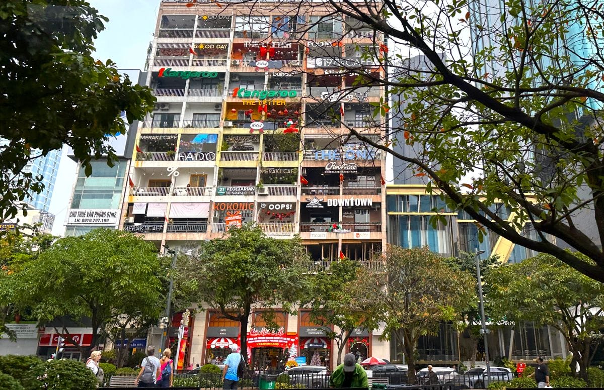
7. Café Apartments at 42 Nguyen Hue
Café Apartments at 42 Nguyen Hue
The Cafe Apartments at 42 Nguyen Hue is a nine-storey residential building that has been almost entirely taken over by independent cafés, boutiques and small creative businesses. Each apartment has been converted into its own individual space, meaning no two floors are quite the same — you might find a specialty coffee shop next to a vintage clothing store next to a flower café. The building sits right on Nguyen Hue Boulevard, one of the city’s main pedestrian promenades.
8. Sunset cruise on the Saigon River
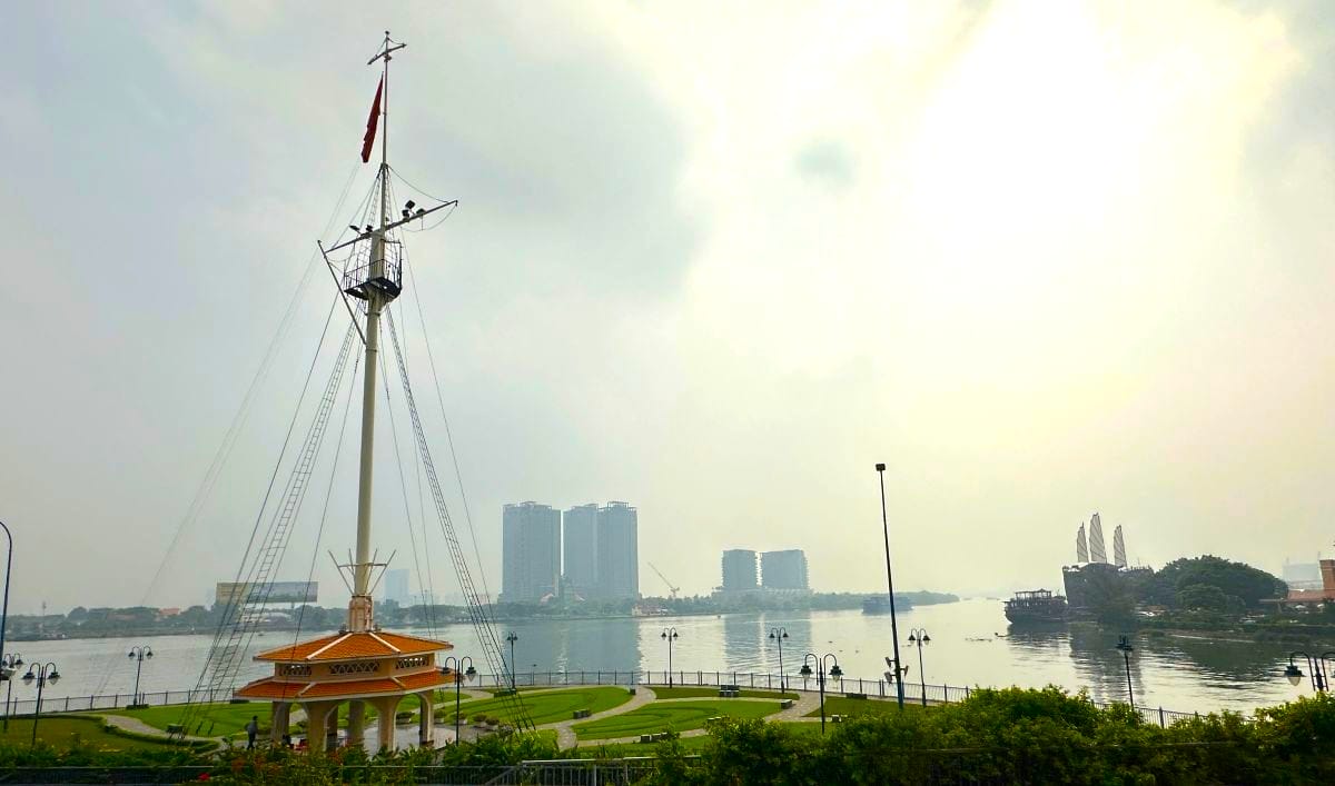
Saigon River
A sunset cruise on the Saigon River is a relaxing way to experience Ho Chi Minh City from a different angle. As the city’s skyline lights up in the early evening, the river provides unobstructed views of many of its landmarks — all of which look more striking from the water than from the street. Several operators run dinner cruises with live traditional music, while shorter sightseeing cruises are also available.
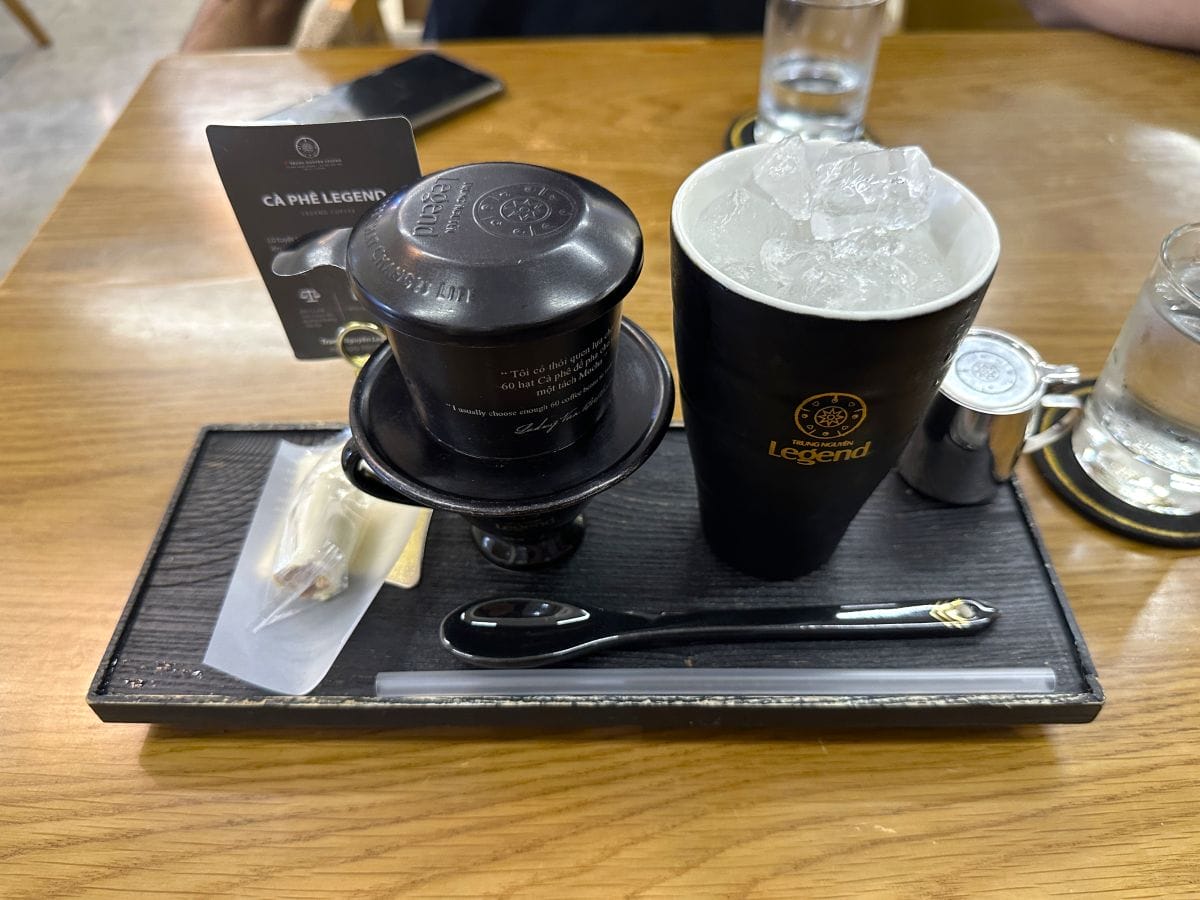
9. Coffee at Trung Nguyen Legend Café
Trung Nguyen Legend Café
Trung Nguyen is Vietnam’s most well-known coffee brand—a franchise coffee shop with pricey but delicious coffee. Their tagline is “The Energy Coffee That Changes Life”. The Vietnamese coffee here is slow-dripped through a small metal filter directly into the cup, producing a strong, concentrated brew that is traditionally served iced with sweetened condensed milk. It’s quite different from espresso-based coffee traditions, and it was amazing.
The Legend Café in District 1 is their flagship. The café spans multiple floors and is elegantly fitted out with dark wood and Vietnamese artwork.
How to get around Ho Chi Minh City
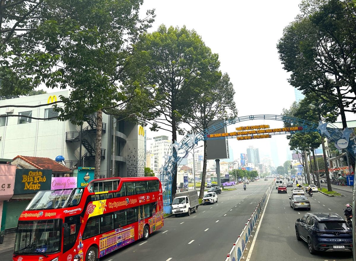
City Sightseeing Bus Saigon
We used the City Sightseeing Bus to see the main attractions and the Grab app (the regional equivalent of Uber) to get around at other times.
Day trips from Ho Chi Minh City
These are the two most popular day trips from Ho Chi Minh City. Unfortunately, we didn’t have time to do them.
1. Cu Chi Tunnels
The Cu Chi Tunnel network is located approximately 40 kilometres northwest of the city centre. During the war, Viet Cong fighters constructed over 250 kilometres of underground tunnels by hand — a system that included sleeping areas, kitchens, field hospitals, weapons workshops and command centres, all built beneath active combat zones and largely undetectable from the surface.
Sections of the tunnels have been preserved and opened to visitors. Guests can crawl through passages that have been widened slightly from their original dimensions — narrow, low and warm — which provides a direct physical sense of what it meant to inhabit them. The site also includes displays of wartime equipment and examples of the tunnel defence systems used during the conflict. Most visitors do Cu Chi as a half-day trip from the city, either through an organised tour or by private vehicle. Allow 4–5 hours in total including travel time from the city centre.
2. The Mekong Delta
The Mekong Delta begins roughly two hours away from Ho Chi Minh City. It is a flat, green landscape of rice paddies, coconut palms and waterways, where communities have lived by the river for centuries and daily life still moves largely by boat.
A standard day trip from HCMC covers the towns of My Tho and Ben Tre, with boat rides through the narrower canals, visits to local cottage industries (coconut candy production, honey farms, rice paper making) and lunch at a riverside restaurant.
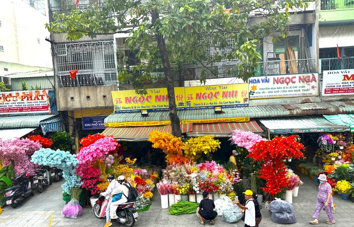
Flower Market
See how to apply for a visa for Vietnam.
See how to plan a trip to Vietnam.
See things to do in Hanoi.
See things to do in Huế.
See things to do in Hoi An.
Read about our cruise in Ha Long Bay.
Sara Essop is a travel blogger and writer based in South Africa. She writes about family travel and experiences around the world on her blog “In Africa and Beyond”. Although she has been to 53 countries thus far, she especially loves showcasing her beautiful country and is a certified South Africa Specialist.
Via de la Plata is a 1000-kilometer route across Spain. It’s one of the most challenging Camino routes. The route is a perfect Camino for those seeking solitude and tranquility. Most of the route is through the quiet non-touristy part of Spain. In this post I give a detailed description of the walking stages of Via de la Plata from Seville to Merida.
Via de la Plata PDFs
You can download our PDF files with walking stages and places to stay along the Via de la Plata to make you planning easier.
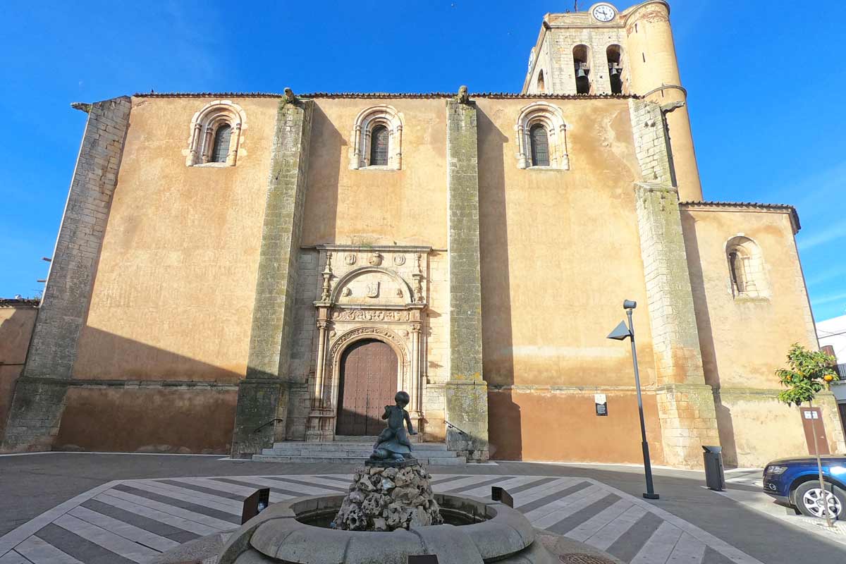
A church in one of the Spanish town on the Via de la Plata from Seville
GPX files of the route (Seville to Merida)
You can download our GPX files for the part of the route from Seville to Merida. Check out our detailed guide on How to use Stingy Nomads GPX files to navigate with your phone.
Seville, the beginning of the Via de la Plata
Seville is a beautiful city with a lot to see and to do, spending here a couple of days before starting the Camino is a great idea. My favorite way to spend time in Seville is sitting at one of the street restaurants near the Cathedral with a glass of wine and a couple of delicious tapas.
Things not to miss in the city: Plaza de España, Royal Alcázar, Cathedral, La Giralda, Torre de Oro, Parque de María Luisa, Santa Cruz barrio (neighborhood), Triana neighborhood, Plaza de Toros, Casa de Pilatos.
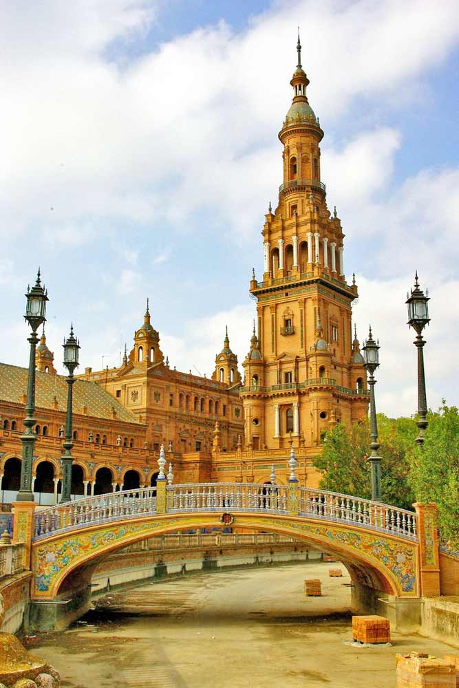
Plaza de Espana is a not-to-miss place in Seville
Seville tours & activities
There are many great tours around the city and to the nearby attractions.
Places to stay in Seville
There is no public albergue in Seville but there are several hostels and private albergues. They are not exclusively for pilgrims anybody can stay there but most of the people staying at albergues are pilgrims.
We stayed at El Viajero en Sevilla, a small hotel in the historical center. It’s a great place, very neat, comfortable, and cozy. If we go to Seville we’ll stay here again.
Note! If you arrive in Seville during the Semana Santa (a week before Easter), book your tickets and accommodation well in advance.
Accommodation – public and private albergues, hotels
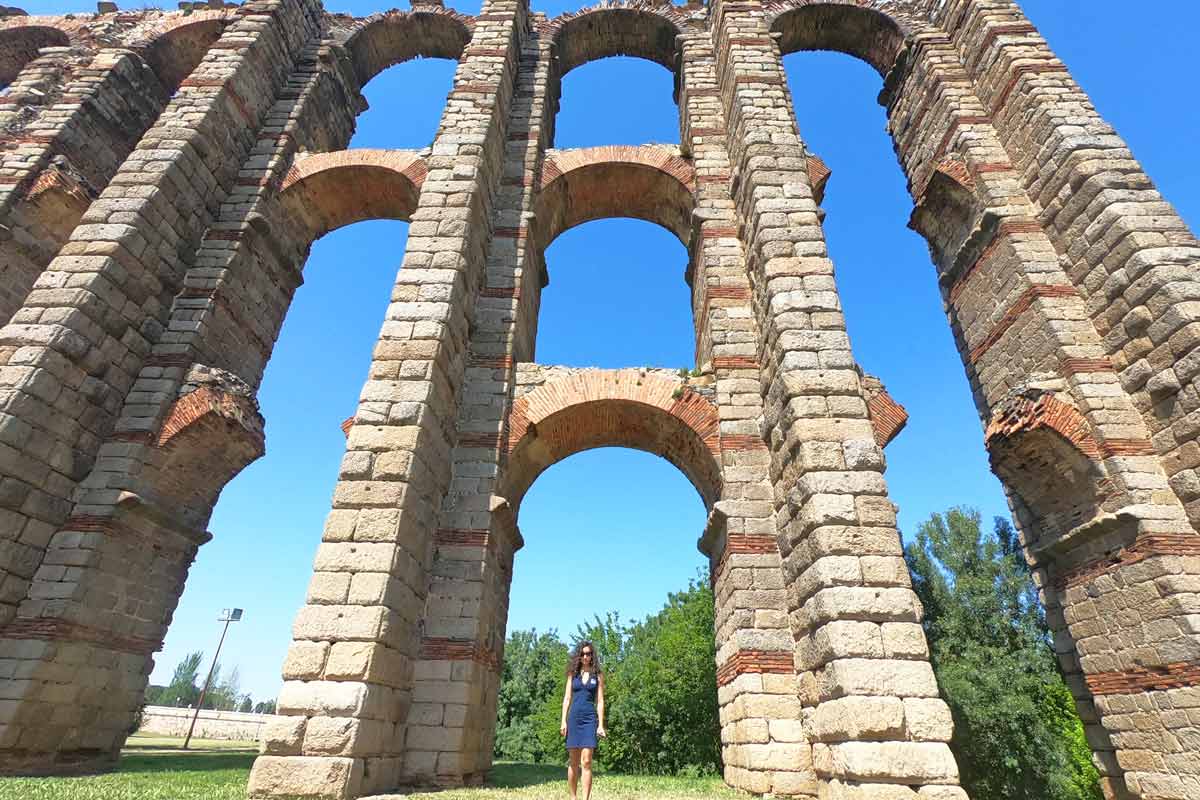
Alya in front of the Roman Aqueduct in Merida
Via de la Plata walking stages (Seville to Merida)
We’ve walked only 9 first stages on the Via de la Plata, from Seville to Mérida, here you can find a detailed itinerary for these days. We’re planning to finish the route next year and will update the post after that.
Stage 1. Seville – Guillena, 23 km/14 mi
Time – 5 hours (moving time)
Walking on the road – 3 km/1.8 mi
Walking on asphalt – 10 km/6.2 mi, the rest on footpath/gravel
Ascent – 158 m
Descent – 124 m
Difficulty level – 2 out of 5
Highlights
Stunning Gothic cathedral of Seville
Triana district in Seville
The Roman ruins of Italica, Santiponce
Challenges
3 km/1.8 mi of walking on the road after Santiponce.
No places to stop or to refill water between Santiponce and Guillena, for 13 km/8 mi.
Elevation profile Day 1 Seville – Guillena
Stage 1 route description
The walk startsfrom the cathedral in Seville, there are a couple of yellow arrows and a shell at the corner of Avenida de la Conctitución and Calle García de Vinuesa. To our surprise it was quite easy and quick to walk out of the city, it took us about 30 min. and we didn’t go through any industrial or residential areas of the city. Most of the day the route went through the fields but there was an unpleasant walking on the road for about 3 km/1.8 mi after Santiponce.
Santiponce is the only town on the way, it’s about 9 km/5.5 mi from Seville and it’s worth stopping here and visiting the famous Roman ruins; the Roman Therms and the Roman Amphitheatre. The Amphitheater, by the way, was featured in season 7 of Game of Thrones as the Dragonpit. Unfortunately, we couldn’t visit them because it was closed on Monday. For more information on the ruins of Italica and opening hours visit the official website.
If you want to stop for lunch Santiponce is the only place on the way, don’t forget to refill your water there will be nowhere to do it till Guillena.
Guillena places to stay
Guillena is a small town with good infrastructure though we were here on Sunday and everything was closed.
| Municipal Albergue de Guillena | Albergue Luz del Camino | Hostal Francés |
Sage 2. Guillena – Castilblanco de los Arroyos, 18 km/11 mi
Time – 4 hours
Walking on the road – 0 km, the last 3 km/1.8 mi are on the footpath next to the road
Walking on asphalt – 2 km/1.2 mi
Ascent – 386 m
Descent – 91 m
Difficulty level – 2 out of 5
Highlights
Walking through the forest and the fields
Castilblanco is a charming town with traditional white houses and cobbled streets
Communal dinner at the albergue
Challenges
A very muddy and slippery path between 3 km/1,8 mi and 5 km/3 mi
Nothing between Guillena and Castilblanco
Elevation profile Day 2 Guillena – Castilbalnco de los Aroyos
Stage 2 route description
We didn’t pay for breakfast in the albergue we stopped on the way at one of the local bars S.C.A. Kibarpe, next to the supermarket Dia, they have good coffee and sandwiches, we paid 5 Euro for both.
It was a relatively short and easy walking day with a slight ascend of about 386 m throughout the day. In the beginning, you walk through Guillena town till the bridge, then cross the bridge after that turn right, away from the road, and there will be a Camino sign. The route through the town is not marked very well, here and there you see an arrow but it’s not difficult you basically just follow the main street from the albergue all the way out.
At about 3 km/1.8 mi after crossing the road you get to a very muddy path through the olive tree plantations. At about 8 km/5 mi a beautiful forest substitutes the plantations. There are no villages on the way no places to stop for coffee or food. At 10 km/6.2 mi there is a place to refill water you won’t miss it there is a big sign on the right-hand side. The last 3 km/1.8 mi before Castilblanco are on the footpath along the road.
Castilblanco de los Arroyos places to stay
A nice small town with several bars and restaurants on the main street and a beautiful church with many storks’ nests on the roof.
| Municipal Albergue | Albergue La Posada de Escardiel (+34 641 024 128) | Casa Salvadora (+34 615 500 963) |
A typical scenery on the Via de la Plata; fields, olive tree plantations, and a gravel road
Stage 3. Castilblanco de los Arroyos – Almadén de la Plata, 28.7 km/18 mi
Time – 6-7 hours
Walking on the road – 16.5 km/10.2 mi
Walking on asphalt – 16.5 km/10.2 mi
Ascent – 649 m
Descent – 521 m
Difficulty level – 3 out of 5
Highlights
Natural Park Sierra Norte
Challenges
Walking on the road for the first 16.5 km/10.2 mi.
No place to stop for food or water for 28 km/17.3 mi.
Steep but not long ascent just before Almadén de la Plata.
Elevation profile Day 3 Castilblanco de los Arroyos – Almadén de la Plata
Stage 3 route description
I suggest making sure you have enough water before you leave Castilblanco as well as taking some snacks with you and having breakfast in the town before you leave. There is literally nothing on the way; no place to refill water, no place to buy food till you reach Almadén de la Plata.
It was quite a long day of walking. The first part was on the road after an hour or so it got quite monotonous but it wasn’t as bad as we thought, the road was not very busy. The second part, after 16.5 km/10.2 mi, is through Natural Park Sierra Norte. The scenery in the park is beautiful; green hills, trees, many flowers (in spring), and a couple of smallish rivers. Unfortunately, we couldn’t really enjoy the scenery as it was raining non-stop all the time we were in the park.
Almadén de la Plata places to stay
This town is smaller than Castilblanco, it has a couple of restaurants and shops, a square with a church, and a Jamon factory.
| Municipal Albergue | Albergue La Caja del Reloj (+34 692 552 659) | Hotel Casa Concha | Hotel El Romeral |
Sierra Norte Natural Park, a patch of a green forest on the Via de la Plata.
Stage 4. Almaden de la Plata – Monesterio, 35 km/21.7 mi
Time – 8 hours
Walking on the road – 2 km/1.2 mi short bit here and there on the last 8 km/5 mi
Walking on the asphalt – 4 km/2.4 mi through the towns and a little bit along the road
Ascent – 850 m
Descent – 575 m
Difficulty level – 4 out of 5 it was a long walking day
Highlights
A beautiful walk through the countryside and forest
The castle in El Real de la Jara
Challenges
A long walking day, 35 km/21.7 mi and it did feel long and tiring.
Elevation profile Day 4 Almadén de la Plata – Monesterio
Stage 4 route description
Option! If you think walking 35 km/21.7 mi in one day is too much you can split this day into two. Walk 13.5 km/8.3 mi to Real de la Jara and the next day 21 km/13 mi to Monasterio.
A second long day in a row, most pilgrims we started with walked 13 km/8 mi and stayed in Real de la Jara, many people split this day into two. At the beginning of the day, we continued walking through Natural Park Sierra Norte with beautiful scenery and many smallish ups and downs.
Luckily, today there are two stops on the route so you can put down your backpack and sit down, drink coffee, eat something, and refill your water. At Real de la Jara you leave the region of Andalusia and enter Extremadura.
The last 8 km are next to the road mostly on the footpath crossing the road here and there.
Monesterio places to stay
Don’t be confused by the name, the actual monastery is 5 km/3 mi outside the town you won’t see it unless you walk there or take a taxi. The town itself is quite big compared to most towns on the Via de la Plata.
| Albergue Las Moreras (+34 690 304 314) | Hostal DP El Pilar | HOTEL RESTAURANTE MOYA |
Ruins of a castle just outside El Real de la Jarra on the border between Andalusia and Extremadura
Stage 5. Monesterio – Fuente de Cantos, 20.6 km/12.8 mi
Time – 5 hours
Walking on the road – 0 km
Walking on the asphalt – 2 km/1.2 mi through the towns
Ascent – 291 m
Descent – 432 m
Difficulty level – 2 out of 5
Highlights
Very peaceful area with no people, cars, or houses only fields and nature.
Challenges
Nothing on the way for 20 km/12.4 mi you have to carry enough water with you for the whole day.
Elevation profile Day 5 Monesterio – Fuente de Cantos
Stage 5 route description
We started the day quite late, it took us about 10 min. to walk out of the town, at the exit there is a restaurant that opens at 7 am, they have coffee or hot chocolate with churros for 3 Euros. Make sure to have enough water and there will be nothing on the way. The walk was easy and nice with light ups and downs, through a very quiet countryside with olive tree plantations, wheat fields, cows, sheep, etc. far from the road and any other disturbing noises.
Fuente de Cantos places to stay
A cozy little white town with a small square and a church on it and narrow cobblestone streets.
| Hotel Rural La Fábrica | El Zaguán de la Plata |
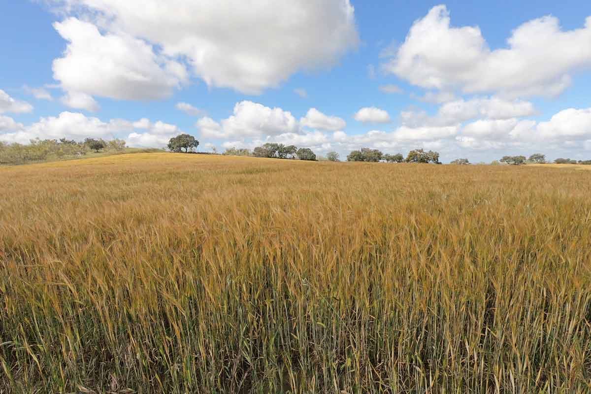
Alya in the wheat fields, the dominating scenery on the Via de la Plata in Extremadura
Stage 6. Fuente de Cantos – Zafra, 24.7 km/15.3 mi
Time – 6 hours
Walking on the road – 0 km
Walking on the asphalt – the last 4 km/2.4 mi to Zafra
Ascent – 212 m
Descent – 288 m
Difficulty level – 2 out of 5
Highlights
Peaceful scenery; olive tree plantations, vineyards, pasture fields, etc.
The historical center of Zafra; Plaza Grande, Plaza Chica, Convento de Santa Clara. If you happen to be here on the weekend go to one of the squares and drink a glass of wine or beer, there are many restaurants and bars here, and on weekends they are full of locals, it has a great holiday vibe.
Challenges
14 km in the middle of the day with nothing on the way
Elevation profile Day 6 Fuente de Cantos – Zafra
Stage 6 route description
It was an easy walking day through the countryside most of the time make sure to have enough water between 6 km/3,7 mi and 20 km/12,4 mi there is nothing on the way except a shelter at 15 km/9,3 mi where you can stop and rest, drink water or eat something.
Zafra places to stay
It’s more of a city place, much bigger than other stops on the way. The historical part of Zafra is nice; cobblestone streets, two beautiful squares, a cathedral, a fortress, and several small parks.
| Municipal Albergue | Albergue Convento San Francisco (+34 680 663 806) | Hostal Arias | Hostal Carmen |
A typical scenery in the first half of the Via de la Plata
Stage 7. Zafra – Villafranca de los Barros, 20.5 km/12.7 mi
Time – 5 hours
Walking on the road – 400 m
Walking on asphalt – 8 km/5 mi; the first 7 km/4.3 mi from Zafra and the last 1 km/0.6 mi
Ascent – 246 m
Descent – 339 m
Difficulty level – 1 out of 5 a short and easy walking day
Highlights
Cathedral and cobblestone streets of Los Santos de Maimona
Olive tree plantations and vineyards
Challenges
Nothing on the way for 15 km/9.3 mi between Los Santos de Maimona and Villafranca de los Barros, make sure to carry enough water as the route goes through the fields with no shadow.
Elevation profile Day 7 Zafra – Villafranca de los Barros
Stage 7 route description
It was an easy walking day except for the very beginning, the route through Zafra is not marked very well, and everybody got a bit lost (we left first and stopped at a bar for breakfast and could see other fellow pilgrims wandering around in search of yellow arrows), in the end, we had to ask locals.
We followed the arrows to the Plaza Grande and then lost them, the same happened to everybody. I’d suggest once you’re on the Square ask around will point you the right way. You walk out of the town following Calle San Francisco you can find it on the map.
The rest of the day was very similar to the previous two walking days. After 4.5 km/2.7 mi there is a small town where you can stop for coffee, it’s the only stop on the route.
Villafranca de los Barros places to stay
A typical town with a square, a couple of churches, and many restaurants and bars. We were here on Sunday everything was closed even restaurants didn’t serve food between 4 pm and 8.30 pm because kitchens are closed at this time of the day.
| Municipal Albergue (temporary closed) | CASA PERIN – HOSTAL RURAL | Hotel Diana Centro Ciudad |
Endless wheat fields on the Via de la Plata between Seville and Merida
Stage 8. Villafranca de los Barros – Torremejía, 27.5 km/17 mi
Time – 6-7 hours
Walking on the road – 0 m
Walking on the asphalt – 3 km/1.8 mi in the towns
Ascent – 105 m
Descent – 221 m
Difficulty level – 3 out of 5, a long walking day with no places to stop for food or water
Highlights
Beautiful sunrise on the way out of the town (if start early enough).
Vineyards and olive tree plantations, to be honest after a couple of days this scenery started to get quite monotonous.
Challenges
Quite a long distance with no places to stop or to refill water on the way.
Elevation profile Day 8 Villafranca de los Barros – Torremejía
Stage 8 route description
Note! There is a town Almendralejo about halfway with a couple of hotels but it’s 4 km/2.4 mi off the route to get there and then back on the Camino you’ll have to walk 8 km extra.
The walk wasn’t difficult but it’s quite long we’d strongly recommend starting walking early to skip the midday heat. We walked the Via de la Plata at the end of April and it was already quite hot after 10 am. Make sure you have enough water to last you the whole day there will be no place to refill it. The scenery was very similar to the previous days; vineyards, olive trees, fields, and not much else.
Torremejía places to stay
Another small white town with a couple of hotels, one albergue, restaurants, and supermarkets.
| Albergue Rojo Plata | Casa Trini |
Campbell on the Puente Romano, an old Roman bridge at the entrance to Mérida
Stage 9. Torremejía – Merida, 15.6 km/9.6 mi
Time – 4 hours
Walking on the road – 2 km/1.2 mi
Walking on the asphalt – 5 km/3.1 mi
Ascend – 79 m
Descend – 175 m
Difficulty level – 1 out of 5, short and easy walking day
Highlights
The Roman bridge at the entrance to Merida
Several Roman ruins in Merida; aqueduct Los Milagros, Roman Theatre and Amphitheatre, Circo Romano, Alcazaba.
Challenges
at the beginning of the day 2 km/1,2 mi of walking on the road out of 7 km/4,3 mi of walking next to the road.
Elevation profile Day 9 Torremejía – Mérida
Stage 9 route description
To walk out of the town you can go left from the albergue and follow the gravel road for a little bit or go right towards the restaurant and follow the road, both routes join after about 500 m. It wasn’t the most beautiful walking day, the first half was along the road, sometimes on the road, the second half past some sort of industrial area or factories. And again nowhere to stop on the way we’d recommend having breakfast in Torremejía and carrying enough water.
Merida places to stay
It’s a World Heritage city with several impressive Roman sights. If you have time I’d suggest stopping here for 2 days if not try to start walking early in the morning to have more time to explore the city. We stayed for 2 nights here; the first night at the municipal albergue Molino de Pancaliente and the second is a guest house.
We finished the Via de la Plata in Mérida where we stayed for 2 days to have time to explore the Roman ruins. From Merida, we went to Portugal where we spent two weeks walking the Fisherman’s Trail, a spectacular coastal route in the south.
We’re planning to finish the Via de la Plata one day.
The pretty half of Stingy Nomads, responsible for all our land adventures (hiking, climbing, walking the Camino) and following them write-ups. Alya loves walking since she was a child, she prefers to walk 1000 km with a backpack rather than to do a 10 000 km road trip (actually any road trip). Alya is a big fan of Latin America, the Spanish language, and dancing. Every time we go away she desperately misses our dog Chile.
Why Cardiff Is the UK’s Most Underrated City Break
Ask someone to name the best UK city break and you’ll hear the same answers every time. Edinburgh. Bath. York. Maybe Brighton if they’re feeling adventurous. Cardiff barely gets a mention, and that’s a mistake.
The Welsh capital has a medieval castle in the middle of town, Victorian shopping arcades that put most high streets to shame, a completely transformed waterfront and a food scene that’s grown at a serious pace over the past few years. It punches well above its weight, and it won’t empty your wallet the way a weekend in Edinburgh will. Let’s take a closer look at what makes Cardiff such a strong contender.
First, How to Get There
Cardiff is well connected by rail from most major UK cities. From London Paddington, the journey takes around two hours, and services run frequently throughout the day. You can also reach Cardiff directly from Bristol in under an hour, or from Birmingham in roughly two hours. If you’re looking to keep costs down, it’s worth booking a train to Cardiff in advance, as early fares can be significantly cheaper than buying on the day. From Cardiff Central station, the city centre is a five-minute walk, so you won’t need a taxi.
Getting around once you’re there is easy too. The city centre is compact enough to cover on foot, and Cardiff Bay is a short bus or train ride from Queen Street station.
A Castle Right in the City Centre
Cardiff Castle sits in the heart of the city, surrounded by parkland, and it’s genuinely unlike any other castle you’ll visit in the UK. The site started life as a Roman fort, became a Norman stronghold and was later transformed into a lavish Victorian Gothic fantasy by the architect William Burges for the Marquess of Bute. The result is a bizarre and brilliant mix of ancient walls, a 12th-century keep and interiors dripping with gold leaf, murals and elaborate wood carvings.
With standard admission, you can walk around the grounds and climb the Norman keep for stunning views across the city, or pay for a house tour to see the over-the-top state rooms. It’s the kind of place where every room looks like it belongs in a different film set. Budget around two hours here, and don’t skip the wartime tunnels beneath the castle walls.
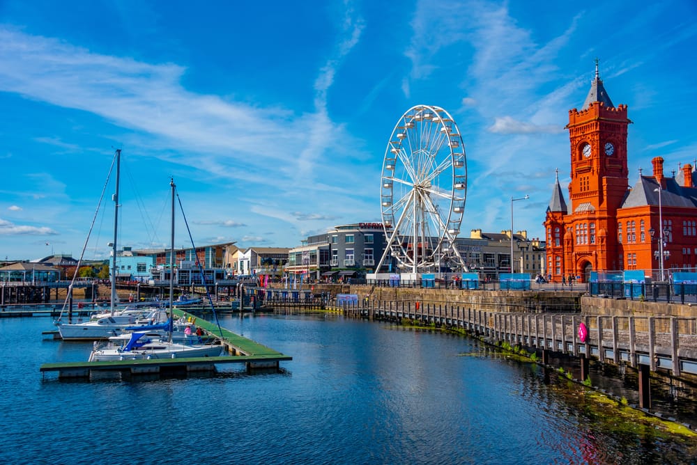
Mermaid Quay
Victorian Arcades Worth a Detour
Cardiff’s network of Victorian and Edwardian arcades is one of its best-kept secrets. The city has more covered arcades than anywhere else in the UK, including the beautifully restored Castle Arcade, the High Street Arcade and the Royal Arcade. They’re packed with independent shops, coffee roasters, record stores and small bars.
What makes them special is the atmosphere. These aren’t soulless shopping centres. They’ve got original tiled floors, ornate ironwork and glass canopies, and they feel like stepping into a different era. Wally’s Delicatessen in the Royal Arcade has been trading since 1948 and is worth a visit on its own. You’ll find things here you won’t find on any high street.
Cardiff Bay Has Changed Beyond Recognition
If you visited Cardiff Bay 25 years ago, you’d barely recognise it now. What was once derelict dockland has become a thriving waterfront district with restaurants, public art, the Senedd (Wales’s parliament building) and the Wales Millennium Centre. The Millennium Centre is hard to miss, with its huge bronze-coloured steel facade and lettering in both Welsh and English. It hosts opera, ballet, musicals and comedy, and it’s worth checking the programme before you go.
On a warm day, the waterfront is a great spot for a long walk. The Norwegian Church, a small white timber building where Roald Dahl was christened, sits at the edge of the bay and now serves as a cafe and arts venue. If you’re there on a weekend, the street food stalls along the barrage are a good shout for lunch.
A Food Scene That Deserves More Credit
Cardiff’s restaurant scene has come a long way. Dusty Knuckle on City Road serves some of the best pizza in Wales from a converted shipping container. The Potted Pig, tucked away in a former bank vault beneath the city centre, does excellent Sunday roasts and has a gin list that’ll keep you busy. For something more casual, Pettigrew Tea Rooms in Bute Park is a lovely spot for brunch.
The city’s indoor market, Cardiff Market, is another highlight. It’s been running since 1891 and sells everything from fresh fish and Welsh cakes to vinyl records and vintage clothes. Grab a coffee from one of the stalls and wander around. It’s got more character than most food halls trying to be trendy.
St Fagans: A Free Museum You Won’t Want to Leave
About twenty minutes from the city centre by bus, St Fagans National Museum of History is one of the best free attractions in the UK. It’s an open-air museum spread across 100 acres, with over 40 original buildings from different periods of Welsh history that have been moved here brick by brick. You can walk through a row of ironworkers’ cottages, step inside a medieval farmhouse and visit a working bakery that sells fresh bread.
It’s the kind of place families could spend a full day at, but even a couple of hours will give you a real sense of Welsh life through the centuries. Don’t rush it. The grounds alone are worth the visit.
Concluding Remarks
Cardiff has everything you’d want from a city break: history, good food, green space and a waterfront that’s genuinely enjoyable to spend time around. It’s cheaper than most popular UK alternatives, easier to reach than people think and still feels like a bit of a discovery rather than a well-trodden tourist trail. If you’ve been defaulting to the same cities every time you fancy a weekend away, Cardiff deserves a serious look.
Images via DepositPhotos.
Sara Essop is a travel blogger and writer based in South Africa. She writes about family travel and experiences around the world on her blog “In Africa and Beyond”. Although she has been to 53 countries thus far, she especially loves showcasing her beautiful country and is a certified South Africa Specialist.
The walk from Praia da Luz to Salema is a part of the Fishermen’s Trail. It’s a beautiful route along the coast past some spectacular beaches. The trail can be done as a day hike or as a part of the multi-day route. The first part from Praia da Luz to Burgau is an easy walk with very few hills, the second part is a bit more challenging.
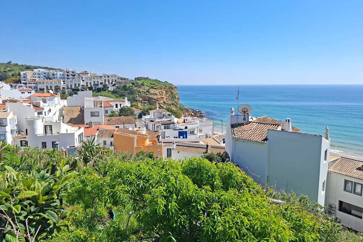
The view of Burgau from the trail
Affiliate disclosure. Some links in this post are affiliate. If you click on one of them and make a booking we will get a small commission at no extra cost to you. Thank you!
Praia da Luz to Salema route overview
Distance – 12 km/7.4 mi
Time – 4 hours
Total ascent – 404 m
Total descent – 405 m
Difficulty – moderate
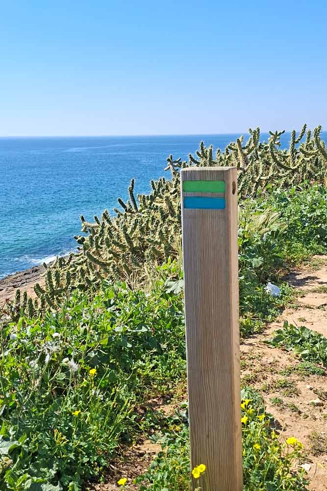
Route markings – marked with green and blue stripes painted on poles, rocks, and walls.
Walking route – Praia da Luz – Burgau – Salema.
The traditional Fishermen’s Trail route marking on the way from Luz to Salema
Navigate from Luz to Salema
GPX file of the route
You can download our GPX file of the trail and use it on your phone or watch for navigation.
Where does the trail start?
The easiest is to start on the promenada at Luz Beach, near Habana Bar. There is a parking lot on the left (facing the town) where you can leave your car. The trail goes along the promenade out of the town. Just follow the blue and green route markers on light poles and walls.
Where does it finish?
The route finishes on the promenade at Salema Beach, at the wooden board with the map of the Fishermen’s Trail near Atlantico Restaurant. From there you can take a taxi/Uber to get back to Praia da Luz.
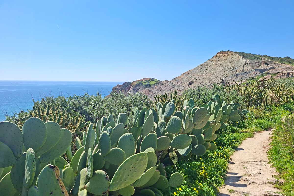
A footpath along the cliffs on the Fishermen’s Trail from Luz to Salema
How to get to Praia da Luz?
If you have a car you can drive there and park at the public car parking at the beach (it’s marked on the map above). In summer try to be there early before 9 am to make sure you get a spot.
You can get to Luz from Lagos using a public bus or taxi/Uber. Public bus #4 operates the route between Lagos and Burgau and stops at the church in Luz (near the beach and the trail). An Uber ride costs 6-8 euros.
The highlights of the trail
Praia da Luz beach and promenade
Spectacular views of the rugged coast line and beaches from the cliffs
Burgau beach and town
Cabanas Velhas Beach
Boca do Rio Beach
Salema beach and town
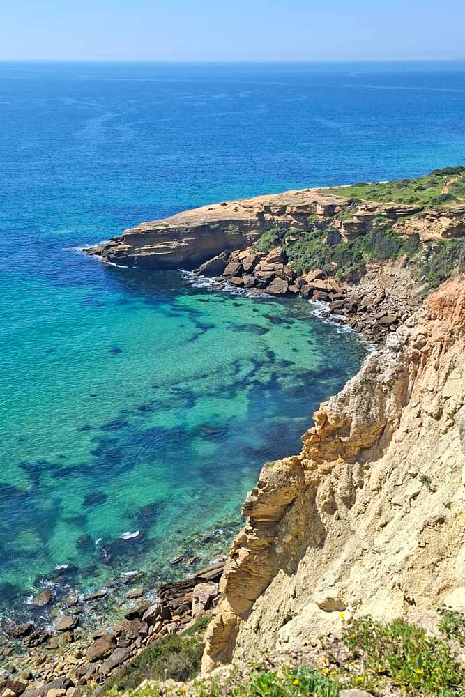
Cabanas Velhas Beach, one of the highlights of the walk from Luz to Salema
The challenges of the walk
A steep ascent with a subsequent descent at 3.5 km/2.1 mi.
An ascent at 6.1 km/3.7 mi.
Another ascent at 6.8 km/4.2 mi.
A steep descent at 8 km/5 mi to Cabanas Velhas Beach.
An ascent from Cabanas Velhas Beach to the top of the cliffs with a subsequent descent at 8.2 km/5.1 mi.
A steep and rocky descent to Boca de Rio Beach at 9.5 km/5.9 mi.
A river crossing (at high tide) at Boca de Rio Beach.
A gradual descent just before Salema.
In which direction to walk?
I’ve walked the trail both ways from Salema to Luz and from Luz to Salema. The scenery is spectacular both ways from that point of view it doesn’t matter. From the practical point of view I find it’s better to walk from Salema because you get most hills in the first half of the trail not at the end of the walk. The part between Burgau and Salema has quite a lot of ascents and descents and it’s easier to walk then while you’re still fresh. The second part from Burgau to Luz is flat with one hill.
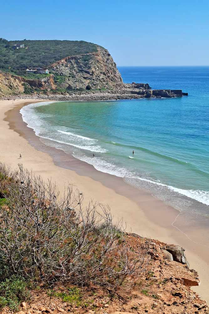
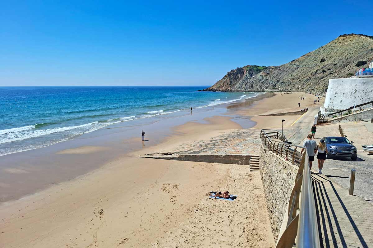
Burgau Beach, one of the highlights of the route
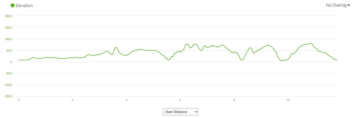
Elevation profile of the Luz to Salema trail
Elevation profile of the route from Praia da Luz to Salema.
As you can see from the graph the first half of the trail barely has any hills while the second half has many ups and down.
Stops along the route
5 km/3.1 mi – Burgau, a small town with several restaurants and cafes, and a beautiful sandy beach.
8.2 km/5.1 mi – Cabanas Valhas Beach with a restaurant.
12 km/7.4 mi – Salema.
Spectacular coastal views from the cliffs on the route from Praia da Luz to Salema
Praia da Luz to Salema route description
Part 1. Praia da Luz to Burgau
The first part of the route is easier than the second half. If you’re looking for a nice breezy walk I suggest doing the Luz to Burgau part. The route is flat with one hill all the way along the coast.
The first 1 km/0.6 mi is on the promenade through the town of Luz, past many cafes and restaurants.
1.4 km/0.8 mi – once out of Luz you continue on a footpath along the coast.
3.5 km/2.1 mi – an ascent to the top of the hill with a subsequent gradual descent.
5 km/3.1 mi – you arrive in Burgau.
Part 2. Burgau to Salema
5-6 km/3.1-3.7 mi – through the town. First you go down to the beach and then up through the town to the top of the cliffs. Don’t miss a left turn at Aires restaurant (a small yellow building). From there you go up the stairs to the top of the cliffs.
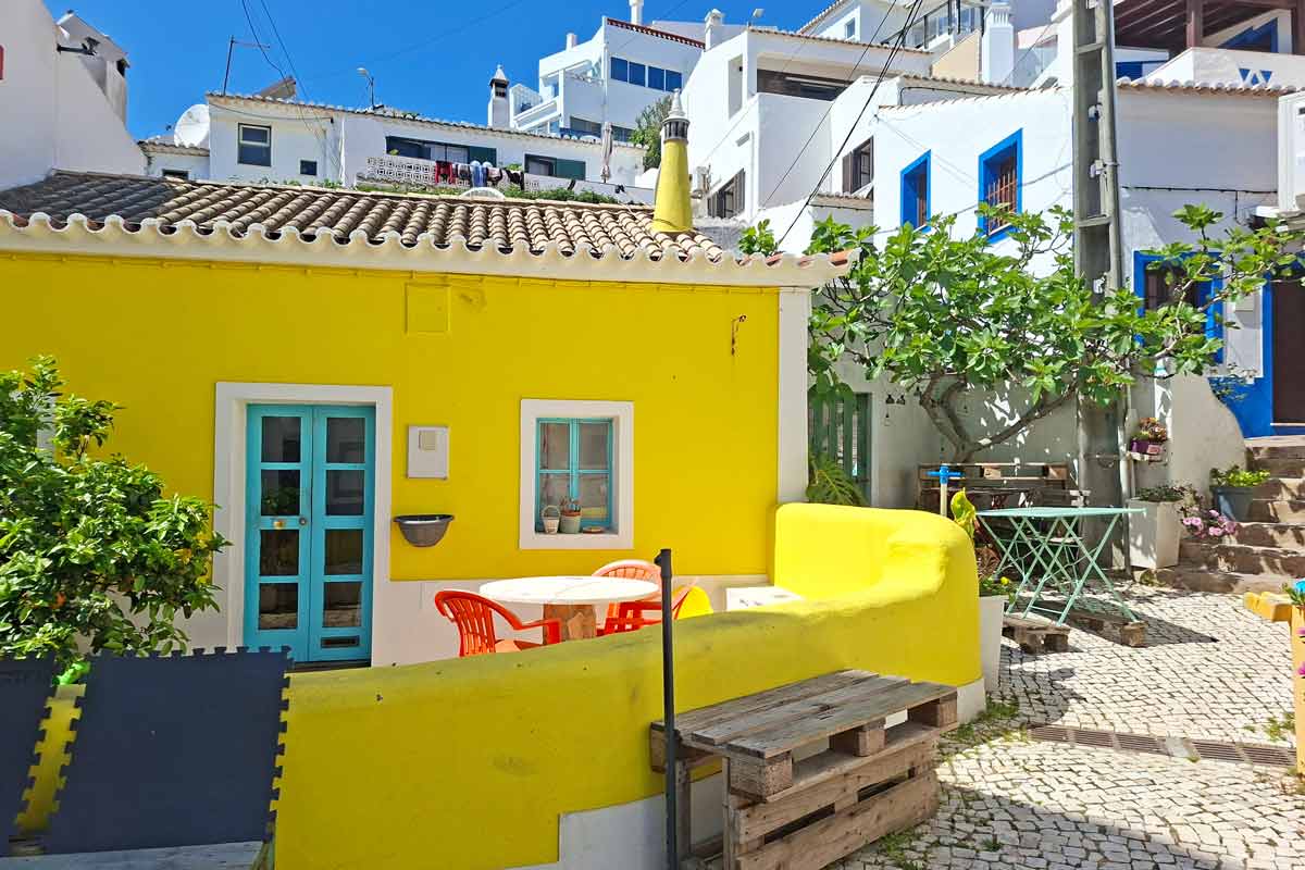
A yellow house in Burgau where you should turn left and go up the stairs
6.1 km/3.8 mi – an ascent to the top of the cliffs with a subsequent small descent
6.8 km/4.2 mi – another ascent.
8 km/5 mi – a steep rocky descent to the beach.
8.2 km/5.1 mi – Cabanas Velhas Beach with a restaurant, a nice place to stop.
8.2 km/5.1 mi – an ascent to the top of the cliffs with a subsequent descent.
9.2 km/5.7 mi – the ruins of the Fortress São Luís de Almádena.
9.5 km/5.9 mi – a steep and rocky descent to the beach.
A small river that you have to cross during the high tide at Boca do Rio Beach
9.7 km/6 mi – a river crossing. During the high tide the water is ankle deep you have to take off your shoes to cross it. At low tide usually there is no water.
9.7 km/6 mi – Boca de Rio Beach.
Between 10 km/6.2 mi and 11 km/6.8 mi a couple of short ascents and descents.
12 km/7.4 mi – Salema Beach, the end of the route.
Where to stay in Salema?
Salema is a small place with very few budget accommodation options. Most of the places are apartments or villas that are rented for more than 2 days.
The pretty half of Stingy Nomads, responsible for all our land adventures (hiking, climbing, walking the Camino) and following them write-ups. Alya loves walking since she was a child, she prefers to walk 1000 km with a backpack rather than to do a 10 000 km road trip (actually any road trip). Alya is a big fan of Latin America, the Spanish language, and dancing. Every time we go away she desperately misses our dog Chile.
My first visit to Qatar was in 2011. When I returned in 2025, I was amazed by just how much the country had changed over the years. The skyline had evolved dramatically, transforming from a modest cluster of buildings into a futuristic cityscape of glass, steel and ambition. Doha felt bigger, bolder and more confident — yet it retained a sense of calm that makes it such an appealing destination.
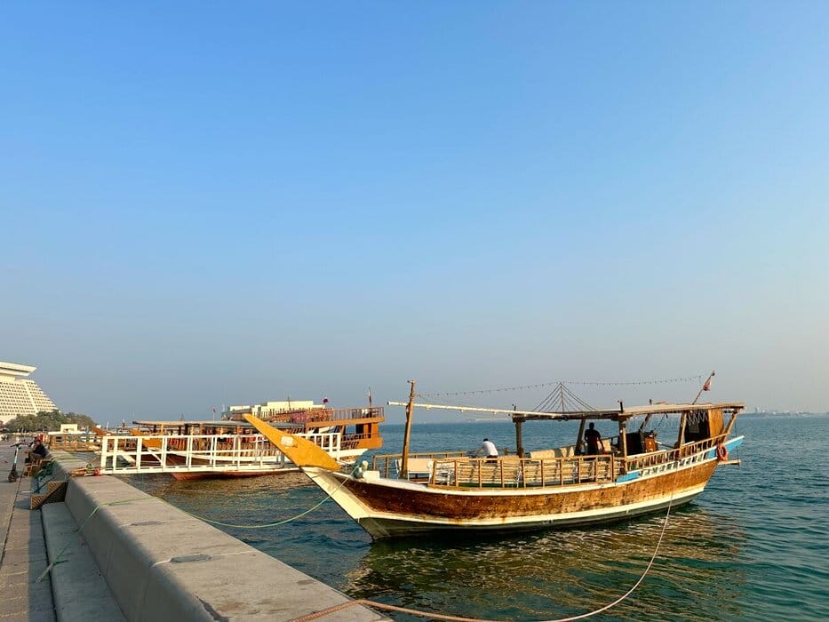
Doha Corniche
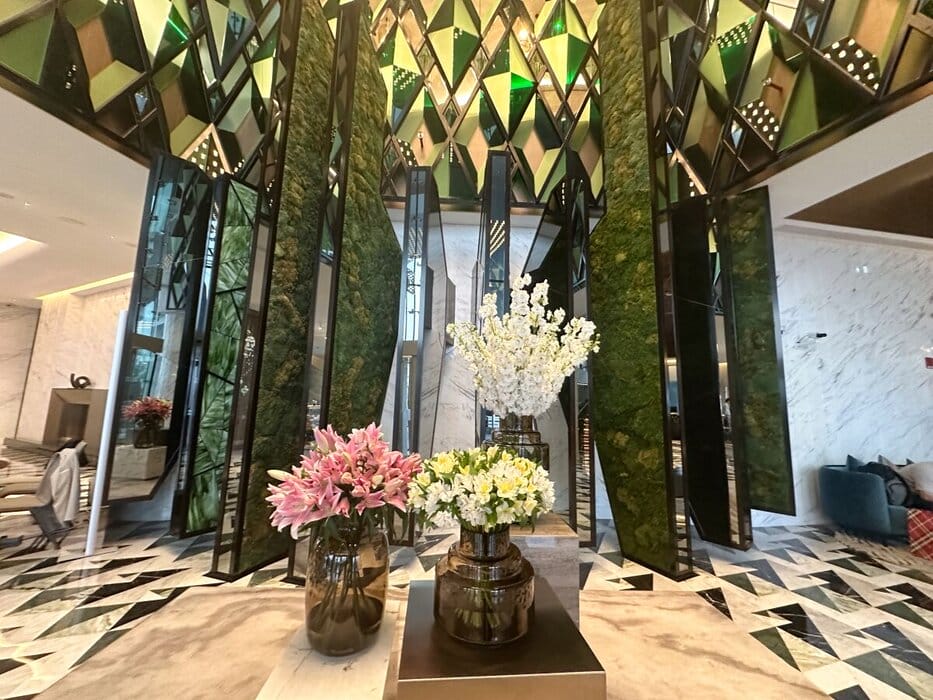
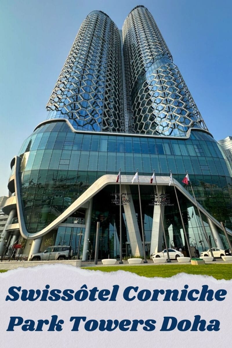
Set directly on the Doha Corniche, with beautiful views of the Arabian Gulf, Swissôtel Corniche Park Towers is a new addition to the city that reflects its transformation. The hotel’s distinctive honeycomb façade pays tribute to the industrious bee, a symbol of community and purpose, while the interiors draw inspiration from the Sidr, Qatar’s national tree, revered for its strength and healing properties.
Hotel Foyer
The only Swissôtel in Qatar, the hotel opened in October 2025 and offers 342 accommodation options, including hotel rooms, suites and serviced apartments, catering to both short stays and longer visits.
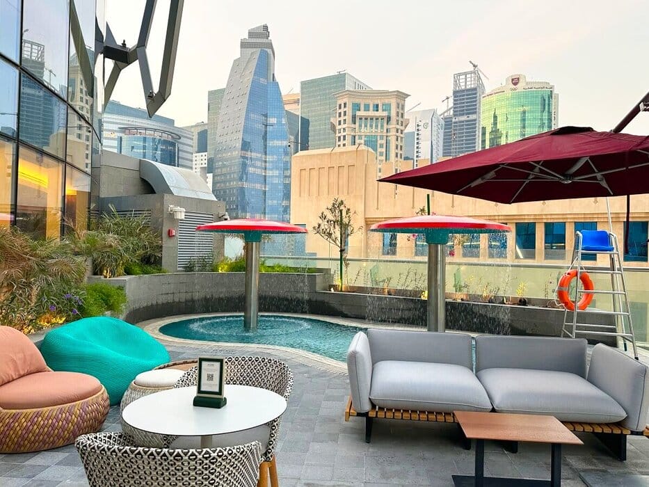
Pool Deck
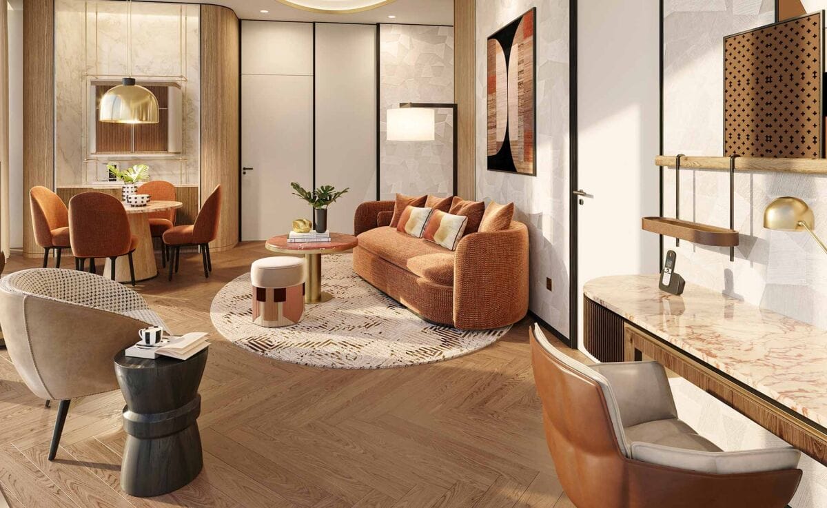
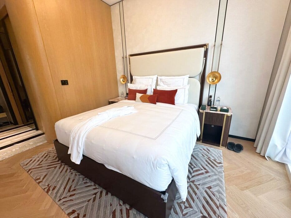
We arrived shortly after midnight, exhausted after a long flight. Despite the late hour, check-in was seamless and efficient, and we were soon shown to our room — a one-bedroom Signature Suite. At 65 m², the generously sized suite felt more like a stylish urban apartment than a conventional hotel room. It comprised a spacious en-suite bedroom with Swissôtel’s signature bed, along with a separate living room and a guest bathroom.
Our living room
Floor-to-ceiling windows provided views of the Corniche and the Doha skyline and filled both rooms with abundant natural light during the day. Modern, high-tech touches included remotely controlled curtains, an automated toilet that sensed when to open and close, and a Smeg bean-to-cup coffee machine — the first time I’d ever seen one in a hotel!
Our bedroom
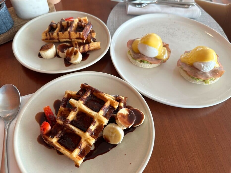
Swissôtel Corniche Park Towers Doha is home to an impressive collection of dining venues, each offering a distinctly different experience. We began each day with a decadent breakfast at The Quarter, which consisted of an extensive buffet of local and international dishes, accompanied by a hot meal menu. Lunch was also served there. On the morning we left to catch an early flight, the staff thoughtfully prepared takeaway breakfast packs for us.
Breakfast at The Quarter
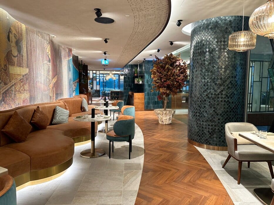
Azal Restaurant offers authentic Persian cuisine in a beautifully designed space that evokes a traditional Persian atmosphere. Adjacent to the restaurant is a stylish hookah lounge, complete with plush seating and bespoke shisha flavours.
Azal Restaurant
Embers, the hotel’s grill restaurant, celebrates live-fire cooking with a menu focused on flame-grilled steaks, seafood and wood-fired specialities.
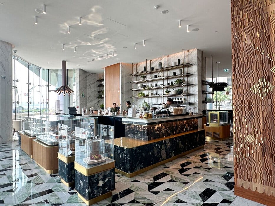
Those with a sweet tooth will be drawn to Chezelle, a coffee shop and patisserie showcasing an irresistible selection of gourmet chocolates and exquisitely crafted cakes. Meanwhile, L’Assiette, the hotel’s airy all-day dining restaurant, serves familiar global favourites with an emphasis on fresh, seasonal ingredients, and Node Coffee offers healthy grab-and-go snacks alongside freshly brewed coffee for guests on the move.
Chezelle
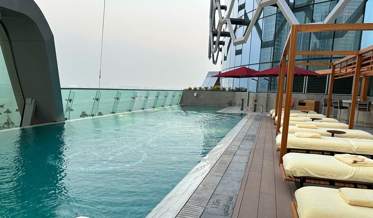
After all this indulgence, you can burn off some calories in the well-equipped gym or cool off in the outdoor swimming pool.
Swimming Pool
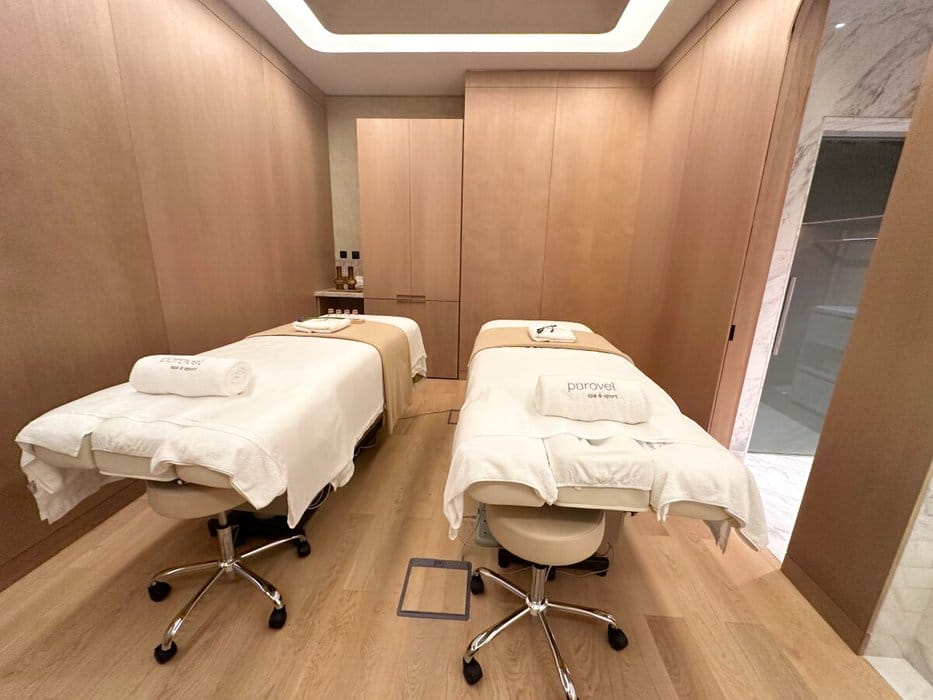
Alternatively, unwind at the Pürovel Spa, where the treatments are inspired by Swiss alpine traditions and designed to restore balance and renew energy. Hotel guests also enjoy complimentary access to the sauna and steam room facilities.
Pürovel Spa
Families are catered for with family rooms and apartments, and a dedicated kids’ club to keep the young ones entertained.
Kids’ Club
The hotel’s idyllic location provides easy access to Doha’s major attractions as well as the airport. Early mornings are perfect for a stroll along the Corniche. West Bay’s business district is close by, while cultural highlights such as the Museum of Islamic Art and the historic bazaar of Souq Waqif are both within easy reach. The nearby metro station makes getting around Doha effortless, even for first-time visitors, and we took advantage of it. In between exploring, we would return to the cool comfort of the hotel for breaks.
With its impressive design, friendly-staff, world-class dining, wellness facilities, and unbeatable location, Swissôtel Corniche Park Towers Doha is an ideal base, whether you’re visiting Doha for business or leisure. And we were privileged to be among the first guests to experience it.
See my reel on the hotel here:
For more information, visit Swissôtel Corniche Park Towers Doha or book here.
Disclosure: 7
Sara Essop is a travel blogger and writer based in South Africa. She writes about family travel and experiences around the world on her blog “In Africa and Beyond”. Although she has been to 53 countries thus far, she especially loves showcasing her beautiful country and is a certified South Africa Specialist.