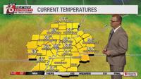
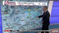
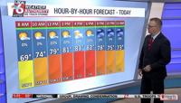
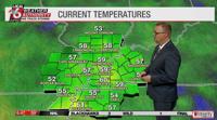
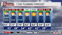
Good morning and happy Thursday! Temperatures are currently in the upper 60s throughout the Local 6 region.
Trent Okerson
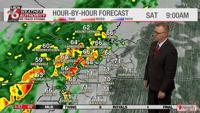
With showers to the west of the area, there’s a possibility of rain this afternoon.
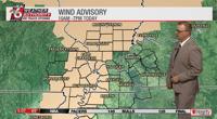
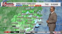
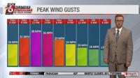
Parts of the area are under a wind advisory from 10 a.m. to 7 p.m. Wind gusts are expected to pick up by 9 a.m. throughout the region, potentially reaching speeds of up to 40 m.p.h. by the afternoon.
Trent Okerson
Trent Okerson
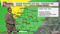
Severe weather is possible heading into the evening, with possible tornadoes, damaging wind and large hail, particularly in the southern Illinois and southeast Missouri regions. Potential storms in southern Illinois and southeast Missouri are labeled as a Level 2 slight risk, with the rest of the area under a Level 1 marginal risk.
Trent Okerson
The slight risk upgrade in Illinois and Missouri is due to wind shear.
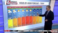
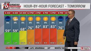
Afternoon temperatures are expected to be in the upper 80s, with scattered storms moving through by 3 p.m.
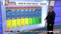
A few showers will linger overnight, but Friday is predicted to begin with mostly clear conditions.
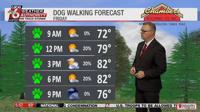
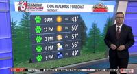
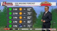
Good morning! It’s a bright and clear Friday morning, with a current temperature of 72 degrees. It should be a decent day for a walk with the pups, as conditions will remain mostly dry for the remainder of the day.
Trent Okerson
Afternoon highs are expected to be in the low 80s, and a few clouds will roll in by 3 p.m. Scattered showers are not out of the question for the afternoon hours.
Rain is expected to move in from the west Saturday morning, expanding into the majority of the area by the afternoon. Temperatures are predicted to be cooler tomorrow, with conditions likely to remain in the 60s throughout the day.
Trent Okerson
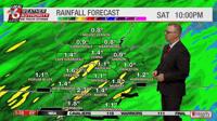
Rainfall is expected to total around an inch to an inch and a half.
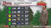
Good morning and happy Thursday! It should be a decent day for a walk with the pups, but isolated rain chances begin to increase this afternoon.
Trent Okerson
It’s currently 71 degrees. The afternoon high is expected to be in the low 80s.
Wind gusts could reach almost 40 m.p.h. around noon, making today the windiest day of the week.
Trent Okerson
Severe weather is possible heading into the afternoon, with possible tornadoes, damaging wind and large hail, particularly in the southern Illinois and southeast Missouri regions. Potential storms in southern Illinois and southeast Missouri are labeled as a Level 2 slight risk, with the rest of the area under a Level 1 marginal risk.
Trent Okerson
Showers could linger into the evening and overnight.
Spring kicked into high gear in March, with warm weather and high pollen counts, mostly dry conditions and emerging drought impacts, and the first severe storms of the year.
Warm Weather Blossoms
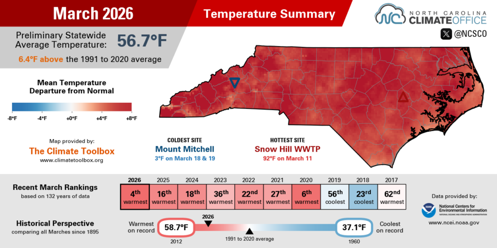
With winter’s chill now behind us, March brought spring-like weather and overall above-normal temperatures across North Carolina. Data from the National Centers for Environmental Information (NCEI) shows a preliminary statewide average temperature of 56.7°F and our 4th-warmest March since 1895.
A number of local stations statewide had one of their top five warmest Marches on record, including the 2nd-warmest in Hickory, the 3rd-warmest in Charlotte and Raleigh, and the 4th-warmest in Greensboro. In Lincolnton, it was the warmest March on record out of the past 70 years.
The first sustained warmup of the month occurred between March 4 and March 12 as high pressure built in across the Southeast US. By March 6, our high temperatures climbed into the 80s in many areas, including the earliest 80-degree day in Asheville since 1999.
The hottest weather all month occurred on March 11, with record highs of 86°F in Greensboro and 89°F in Raleigh. There were even a handful of 90°F readings, including the earliest 90-degree day in Greenville since 1974, and the earliest on record for Fayetteville dating back more than a century.
The March 2026 temperature summary for North Carolina.
That unseasonable warmth was followed by a pair of mid-month cooldowns, including nighttime lows in the 20s across the Piedmont on March 18. That offered a chilly reminder that despite spring’s early surge, our average last freeze dates aren’t until April across most of central and western North Carolina.
Heat returned later in the month, with highs hitting the low 90s in the Sandhills on March 22, including a maximum of 91°F at our Hamlet ECONet station. We also saw widespread mid-80s on March 27, including the tenth 80-degree day of the month in Charlotte – tied with 1945 and 2012 for the most there in any March.
The prolonged warm periods were a timely cue for trees to begin producing pollen. At their pollen lab in Raleigh, the North Carolina Division of Air Quality made 14 consecutive weekday measurements of High or Very High tree pollen levels, including a maximum of 1,522 grains per cubic meter on March 24. That surpassed last year’s peak of 1,325 grains from April 4, 2025.
The primary contributors were pine, oak, and birch trees, which are among the worst offenders for turning the landscape yellow and activating allergy symptoms at this time of year.
Exacerbating the pollen problem, breezy conditions and a lack of rain late in the month kept those tiny spores airborne and swirling around. History suggests that tree pollen will remain near peak levels through mid-April, then grass pollen will proliferate through May.
Pollen turned a small lake yellow at Carpenter Village in Cary last month. (Photo courtesy WRAL)
Dryness Drags On
The start of spring brought a few showers but limited precipitation overall, making this our seventh consecutive drier-than-normal month statewide dating back to last September. NCEI reports a preliminary average precipitation of 1.86 inches for our 5th-driest March out of the past 132 years.
Several sites had less than an inch of precipitation in total last month, including just 0.75 inches in Monroe in its driest March on record dating back 128 years. In Newport (0.78 inches) and Beaufort (0.80 inches), it was their driest March so far this century.
Elsewhere, Lumberton managed only 1.00 inches in its 6th-driest March locally, Fayetteville had 1.01 inches in a tie for its 4th-driest March on record, Charlotte had 1.35 inches and its 7th-driest March, and Raleigh‘s 1.61 inches made it the 8th-driest March on record there.
Most of our monthly precipitation fell from just three events, and true to the nature of springtime showers and storms, that meant brief, heavy downpours instead of slow, soaking rainfall.
On March 12, most of the state received a half-inch to an inch of rain, including 1.05 inches in Wallace – its greatest single-day total since August 13 of last year, just before our prolonged drought began.
The next event on March 16 brought a line of storms across eastern North Carolina, dropping more than 2 inches of rain in some southern coastal areas. On the backside of that system, as colder air built in, the Mountains picked up several inches of snow.
The March 2026 precipitation summary for North Carolina.
And as a cold front sagged southward on March 27, it brought around half an inch of rain in parts of central and eastern North Carolina, with lower totals elsewhere.
With continued dry weather, plus warm temperatures that increased evaporation rates and accelerated drying across the landscape, we saw further drought degradation in March, including the expansion of Severe Drought (D2) across most of the Coastal Plain and the introduction of Extreme Drought (D3) in the far western Mountains.
Along with streamflow levels remaining near daily record lows and topsoil moisture content declining, the warm and windy days late in the month triggered a spike in fire danger and prompted a statewide burn ban beginning on March 28.
Adding to the danger, most of the state went the final 15 days of the month without a wetting (quarter-inch or more) rain event, and thanks to the dryness plus a few frost events, green-up is barely halfway complete, keeping vegetation more flammable as it comes out of dormancy.
With those unfavorable weather factors converging during the final weekend of the month, several large wildfires ignited in the Mountains and Foothills, including a 600-acre fire in Wilkes County that prompted local evacuations and the 420-acre Jumping Branch fire in a Helene-damaged part of McDowell County.
US Drought Monitor maps from March 3, 2026, (left) and March 31, 2026, (right) for North Carolina.
Tornadoes Touch Down
Over the past 30 years, the average date of our first tornado is February 22. However, during our mostly cold and dry winter, we had few opportunities for thunderstorms, so we quietly passed that meteorological milepost with no severe weather in sight.
That changed in March with two mini outbreaks that each spawned multiple tornadoes in parts of the state. Those events were associated with strong cold frontal passages on March 12 and March 16, with the thunderstorm potential fueled by big temperature differences on either side of the fronts.
At one point on Friday, March 12, we observed a 58-degree difference between our coolest ECONet stations in the west and our warmest in the east. As a line of storms along the frontal boundary reached eastern North Carolina that afternoon, five short-lived tornadoes spun up in Onslow, Craven, and Pamlico counties.
Four of the five reached EF1 strength, and they snapped a number of trees while damaging several residences. An EF0 tornado in Jacksonville caused a critical failure to the roof and door of the American Legion building.
Damage at the American Legion building in Jacksonville, NC, after a tornado on March 12, 2026. (Photo by NWS Morehead City via Damage Assessment Toolkit)
The following Monday, March 16, another potent-looking setup along a frontal system put central North Carolina under a Moderate Risk for severe weather for the first time since 2021. Cloud cover that morning limited the extent of any severe activity, but there were still three tornadoes in the western half of the state.
That day started with a pair of EF0 tornadoes in Madison County, which only had five other confirmed tornadoes in its history since 1950, and none until now since June 2013. A third EF0 tornado touched down in Mecklenburg County, where it damaged an industrial building and a warehouse along a 1.45-mile track through northern Charlotte.
That event was also a major windmaker, with gusts of up to 94.5 mph on Grandfather Mountain, 55 mph in Raleigh, and 59 mph in Greensboro. That was part of a stormy resurgence in the Triad, which went almost six months – between September 25 and March 12 – without even hearing thunder.
Despite the quiet start to the year, that quick succession of severe weather suddenly put us well ahead of our typical spring pace. Between 1996 and 2025, the average date for the year’s eighth tornado was May 20; this year, we hit that mark more than two months earlier, on March 16.
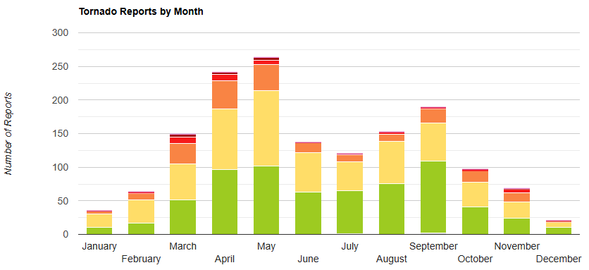
North Carolina’s historical tornado climatology, by month, from 1950 to 2024. (From our Severe Storm Reports Tool)
While April is climatologically one of our most active months for tornadoes, it has been hit or miss in recent years. Both 2022 and 2025 saw no tornadoes in April, while we saw five tornadoes on April 22, 2023, and a memorable region-wide outbreak that reached North Carolina on April 13, 2020.
Historically, La Niña events like the one that’s currently ending tend to see a slight increase in springtime tornado and hail activity across North Carolina, with a bigger boost in the Southern Plains. The latest monthly outlook from the Climate Prediction Center gives us equal chances of above or below-normal precipitation in April.
Given our ongoing drought, we could certainly use some April showers this month – but perhaps we’d be happy to do without any more damaging thunderstorms, high winds, and tornadoes.
Good Tuesday morning to you and your pups! Expect more warm weather today, with a current temperature of 70 degrees.
Trent Okerson
Afternoon highs are expected to be in the low 80s. Breezy conditions are also expected heading into the afternoon.
Trent Okerson
Wednesday brings a slight chance of isolated showers, as rain chances increase by Thursday evening. Most areas are expected to see about an inch of rain by the weekend.
Expect cooler weather on this Monday morning. The current temperature is 43 degrees. North wind gusts could reach up to 20 m.p.h.
Trent Okerson
Afternoon highs are expected to be in the upper 50s so it’s still a good day to get those walks in!
Trent Okerson
Sunny skies will stick around for the majority of the day, with a few clouds moving in this evening.
Trent Okerson
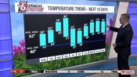
Morning temperatures are expected to be in the 40s for the next couple of days, with afternoon temperatures steadily warming up heading toward the middle of the week.
There’s a chance of record breaking temperatures again this Thursday and a chance of rain on Friday.
It’s time to spring up and get those walks in! Happy first day of Spring! It’s going to be a beautiful day.
Trent Okerson
It’s currently 62 degrees. Afternoon highs are expected to reach 82 degrees.
Trent Okerson
Expect sunny conditions following a few morning clouds. Winds are moving in from the southwest at 6 m.p.h.
Trent Okerson
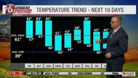
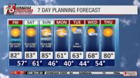
Warm weather will continue into the weekend, as temperatures hit the 80 degree mark again on Saturday and Sunday, with potential record high temperatures on Sunday. A cold front is predicted to move in on Sunday evening, causing temperatures to drop back down into the 60s on Monday.
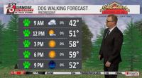
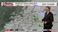
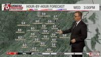
We’re finally going to have a doggone good day for a walk! It’s currently around 42 degrees. Afternoon highs are expected to reach almost 60 degrees.
Trent Okerson
Morning clouds and light precipitation are expected to move out by midday, allowing for a sunny afternoon.
Trent Okerson
Trent Okerson
Temperatures will continue to warm over the next few days. Thursday brings a slight chance of morning showers, with gradual clearing and an afternoon high of 72 degrees. Conditions are expected to be sunny and mild heading into the weekend. Spring is almost here so enjoy those walks!