
[ad_1]
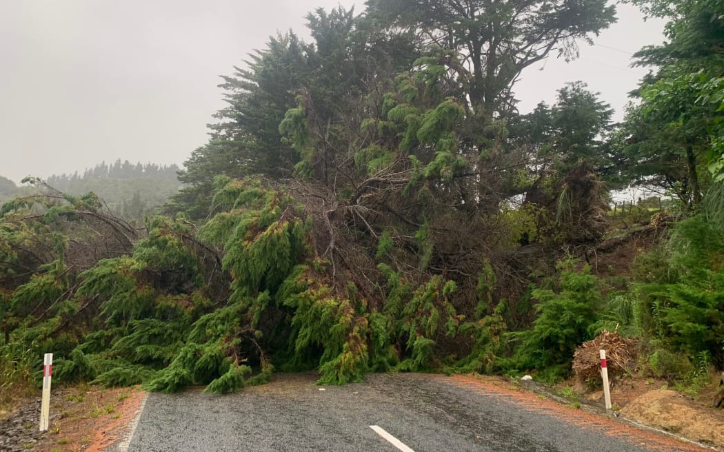
A tree is blocking both lanes of Nook Road in Parua Bay in Northland.
Photo: Whangarei District Council / Claudia Oliver
Bad weather is now hitting Northland, Coromandel Peninsula and Great Barrier Island and is also forecast to reach Marlborough and the North Canterbury coastline, from tomorrow morning.
The rainfall in Coromandel is getting heavier, with more to come.
Thames Valley Civil Defence controller Garry Towler said a total of 400 millimetres of rain is expected by 10pm – the equivalent of the total rainfall over the past week.
He said further road closures could be expected later today.
The State Highway on the eastern coast between Hikuai and Whitianga was likely to close, as well as State Highway 25 going into Thames.
Towler said the damage to roads was significant in a one in 20-year storm event.
MetService predicts the severe weather in the region will ease later this evening.
Several roads across Northland are now closed as Cyclone Hale continues to affect the region.
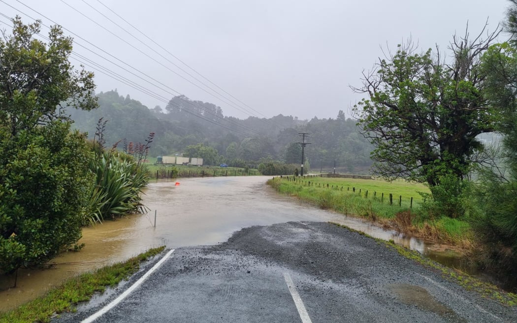
Flooding along Grahamtown Rd in Whangārei this morning.
Photo: RNZ / Sam Olley
State Highway 15 between Loop Rd, Otaika and Mangatapere, south of Whangārei is closed due to flooding.
Kokupu Block Road is also closed due to flooding and police are advising motorists to avoid travel around Northland unless urgent.
Police say two vehicles that were stuck in flooding on Waiteitei Road in Wellsford have since made it out. There are no reports of injuries.
A heavy rain warning remains in place for the region till 7pm today.
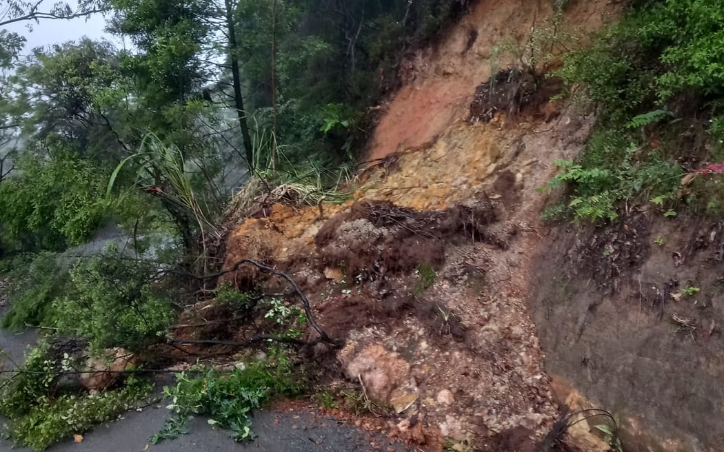
The 309 Road was blocked by a slip on Tuesday morning.
Photo: Supplied / Shanx Paarman
More than 100 homes in Coromandel were without power earlier.
“We had quite a lot of impact last night,” Towler told Morning Report.
The eastern seaboard has been most affected, he said, and it was highly likely the entire eastern seaboard would close after high tide, he said.
“We’ve got widespread flooding, we’ve got a number of slips all the way from Hikuai all the way up to Whitianga. Widespread phone and power outages as well.
“The impact is quite dramatic in terms of what is still to come but also we’ve got to keep this in context because we had over 400mm of rain last week and there’s just no capacity to absorb some of this stuff.”
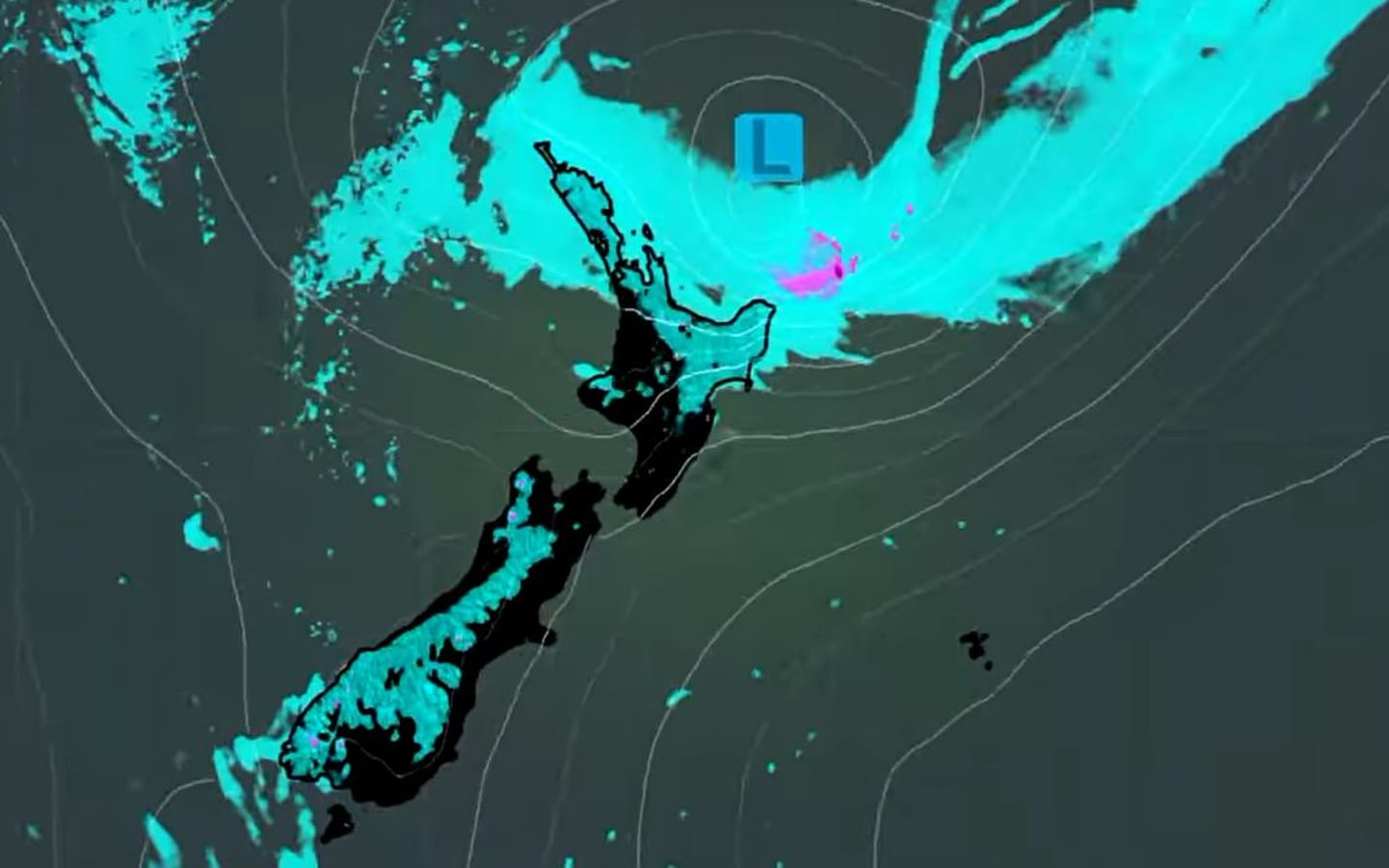
This Niwa screenshot shows how the weather will be affecting the upper North Island around 5pm today.
Photo: Niwa
In Whitianga 136 properties in the town of Whenuakite have been without electricity since 2am today. The network company was investigating the cause of the outage.
At 11am police advised residents to stay indoors and away from the coast as high tide was due at 11.15am.
Several roads in Thames-Coromandel district have been closed because of the storm.
As well as Coromandel, wide impact is also expected in Gisborne and Hawke’s Bay as the weather front fans out across the island.
MetService issued severe weather warnings for Gisborne, Coromandel, Northland up to the Bay of Islands, Auckland including Great Barrier Island, and Hawke’s Bay.
It forecast heavy rain, gale-force winds and storm surges. The rain is predicted to peak in most areas this afternoon.
It has also now added a heavy rain warning for Marlborough and the Canterbury coast from Cape Campbell to Kaikōura.
⭕ Cyclone Hale doesn’t look particularly dramatic on this true colour imagery, as it lacks a visible eye
However, the clouds sweeping out from the low centre and spreading over the North Island are carrying bands of heavy rain and the winds are still strong pic.twitter.com/aMoGYldbDY
— MetService (@MetService) January 9, 2023
The past 6 hours of rain radar imagery shows rain with embedded heavy falls moving across much of the North Island from the east https://t.co/prKU7NLNY1 ^PL pic.twitter.com/N5wBI8SZTd
— MetService (@MetService) January 9, 2023
There are flooding and slips on Aotea Great Barrier Island.
Aotea Great Barrier Local Board chairperson Izzy Fordham said there are a few slips being dealt with by contractors, but campgrounds on the island had already cleared out after last week’s storm.
The local emergency management team is on call and Fordham said residents are hunkered down, waiting for the storm to pass.
In Tairāwhiti, between 200 and 250 millimetres of rain is expected through to 2am tomorrow, along with four to six metre swells.
Unpaved roads are closed, campers near the coast have headed home, and Tairāwhiti Civil Defence is asking people to check on their neighbours.
Gisborne District Council is urging extreme caution on the region’s roads after several people were rescued when their vehicle became stuck in a flooded stream.
The council posted on social media that police and the fire service were called to help those trapped in the vehicle after severe weather hit last night.
Cyclone Hale is predicted to continue to lash Tairāwhiti and other areas of the North Island today.
Southeast winds are picking up over northern NZ ahead of Cyclone Hale. Here are some of the highest gusts so far https://t.co/Yjbq0jgaoz ^PL pic.twitter.com/eI1wq46Ejr
— MetService (@MetService) January 9, 2023
Gisborne businesses are waiting to hear if unsealed roads will be reopened to trucks today.
Tairāwhiti Civil Defence announced the 24-hour closure, which kicked in at 8pm yesterday, because of Cyclone Hale.
Forestry company Ernslaw One has backed the decision.
Regional manager Bill Wheeler said workers were meant to return from holiday yesterday, but that has now been delayed until Thursday.
Hawke’s Bay Civil Defence Emergency Management controller Ian Macdonald said his region was expecting heavy rains and strong winds from tonight.
Emergency services were co-ordinating preparations and residents should stay home during the worst of the weather, he said.
Tuesday’s emojicast:
️
️
️️
️️️️
️️️️
☁️️️
☁️☁️
☁️
☁️☁️
☁️☁️
☁️☁️☁️ ☁️
☁️☁️
️☁️️
️️️
☁️— NIWA Weather (@NiwaWeather) January 9, 2023
[ad_2]
Source link