
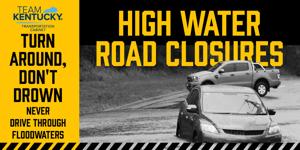
The Kentucky Transportation Cabinet District 1 reports several roadways across western Kentucky are experiencing severe flooding due to heavy rainfall passing through the region.
WPSD Local 6 activated a Weather Authority Alert for Saturday, Feb. 15, due to the potential for significant flash flooding from heavy rain and a slight chance of a few severe thunderstorms.
“If you see high water, turn around, don’t drown,” the transportation cabinet said. “Because of the large number of flooded roadways, the Kentucky Transportation Cabinet District 1 strongly advises motorists to avoid any overnight travel.”
However, now the transportation cabinet is preparing drivers for another Weather Authority Alert set for Tuesday, Feb. 18, into Wednesday, Feb. 19, due to the likelihood of a significant winter storm bringing several inches of snow to parts of the area and widespread travel impacts. Click here to read more.
The transportation cabinet announced that crews plan to pre-treat “A” Snow and Ice Priority Routes, which include interstates and major four-lane highways, ahead of the next snowfall.
“The National Weather Service expects icy conditions may develop overnight and during the Monday morning commute as temperatures are expected to drop into the 20s. Any water left on the roadways could freeze, creating slick spots. Drive slowly and use caution,” the transportation cabinet added.
The Kentucky Transportation Cabinet District 1 covers Fulton, Hickman, Carlisle, Ballard, McCracken, Graves, Calloway, Marshall, Livingston, Crittenden, and Lyon counties.
Here is a list of state routes impacted across western Kentucky as of 5:30 p.m. on Sunday, Feb. 16:
Ballard County
- KY 62 is closed at mile marker 1.3 in the community of Lovelaceville.
Calloway County
- KY 464/Almo Road is closed at mile marker 13 at Clark’s River.
- KY 299/Butterworth Road has one road open with signs posted at mile marker 0.7, north of KY 94 W.
Carlisle County
- KY 1820 is closed between mile markers 1 to 3, Wilson Creek, near the intersection of KY 1628.
- KY 1628 is closed between mile markers 3 to 4, Wilson Creek, between KY 1820 and U.S. 62.
- KY 1820 is closed at mile marker 6, east of U.S. 62.
- U.S. 62 is closed at mile marker 4 near the West Fork Creek Bottoms.
- U.S. 62 is closed at mile marker nine at the KY 307 intersection.
- KY 1820 is closed at mile marker 6, east of U.S. 62.
- KY 1591 is closed at mile marker 1.5 due to a sinkhole between KY 877 and Cherry Road.
- U.S. 62 is open with high water and signage at mile marker 12.5 near KY 1820.
Fulton County
- KY 94/Lower Bottoms is closed between mile markers 9.1/Parker Lane and 10.1/1099 Bypass.
- KY 94 is closed due to a slide at mile marker 12.0 from Kentucky Street to Cumberland Street in downtown Hickman.
Graves County
- KY 1283 is closed between mile markers 2.9 to 3.2 from Frazier Road to KY 58.
- KY 408 is closed between mile markers 9.2 and 10, between Ethel Road and McCracken County Road, approximately one mile east of U.S. 45.
- KY 1241 is closed at mile marker 10/Mayfield Cree, west of U.S. 45 and at the intersection 1820.
Hickman County
- KY 123 is closed between mile markers 14 to 16 in the Hailwell Corner area.
- U.S. 51 S is closed between mile markers 4 and 5.
- KY 3061 is closed from mile markers 0 to 2.366 due to pipe failure.
- KY 239 is closed between mile markers 0.518 to 3.75.
- U.S. 51 N is closed between mile markers 14 and 15 near the Hickman-Carlisle County Line
Livingston County
- KY 60 is open at mile markers 11 and 12 with high water and posted signs.
- KY 917/Stringtown Road is open at mile markers 1 and 2, north of U.S 62 near the Livingston-Lyon County Line, with high water and posted signs.
- KY 723 is open at mile markers 4 and 5 with high water and posted signs.
- KY 70 is open at mile markers 3 and 4 with high water and posted signs.
Lyon County
- KY 1943 is closed between mile markers 3 and 4 near Skinframe Creek Bridge.
- KY 819 is closed between mile markers 2 and 3.
Marshall County
- KY 1462/Benton-Birmingham Road is closed between mile markers 0 and 1.3. The flooded roadway is between KY 408/E. 12th Street and KY 1477/Benton Briensburg Road.
- KY 1949/Wadesboro Road is closed at mile marker 7.4 at the I-69 Tunnel.
- U.S. 641/Main Street in Benton is between mile markers 9.2 to 9.7, Benton Ford and Pizza Hut.
- KY 58 is closed at mile marker 1.3 due to flooding impacts (pavement washed out), about a mile east of the Graves-Marshall County Line.
McCracken County
- KY 1255/Bonds Road is closed between mile markers 0.0/KY 348/Hardmoney Road and 2.3/KY 450/Oaks.
- KY 339 is closed between mile markers 0 to 2.
- KY 787 is closed between mile markers 0 to 1.3/Bypass Road.
- KY 348 closed between mile markers 7.2/Graves-McCracken County Line to the 5.6/McNeil Road.
- KY 131 is closed between mile markers 1.2/Bypass Road over the McCracken-Graves County Line to 12.9/KY 348 in Symsonia.
- KY 1255/Bonds Road is closed at the intersection with KY 450/Oaks at mile marker 2.3.
- KY 450/Oaks Road is closed between mile markers 3/Shemwell Road to the 1.2/KY 348 intersection over the McCracken-Graves County Line.
Trigg County
- KY 1507/Barefield Road is closed at mile marker 1 between U.S. 68/Hopkinsville Road and KY 958/Montgomery Church Road.
- KY 128 is closed between mile markers 0.0, at U.S. 62 and 1, just past the intersection of Dunkerson Road.
- KY 525/New Hope Road is closed at mile marker four near the Prather Roa intersection.
- KY 124/Cerulean Road is closed between mile markers 9 and 10 near the Trigg-Christian County Line.
- KY 1253/Hardy Road is closed between mile markers 3 to 5.
- KY 126 is closed at mile marker 4.
- KY 272 is closed between mile markers 6 and 7.
- KY 139 is closed between mile markers 16 and 17, near U.S. 68.
- KY 276 is closed between mile markers 13 and 14.
- KY 276 is closed between mile markers 9.1/KY 128 intersection, near Wallonia.
- KY 958 is closed between mile markers 1 and 2.
The Kentucky Transportation Cabinet District 1 reminds drivers that high water remains possible even for roads that are not listed. As nightfall comes, flooded roads will be more challenging to see.
Drivers who must venture out early Sunday morning should use extreme caution. Falling temperatures overnight could cause water on roadways to freeze, especially on bridges and overpasses.
This report is being updated accordingly. KYTC District 1 will provide updates via its Facebook page.