
We recently returned from another fantastic circuit of Iceland, a journey through one of the most geologically extraordinary landscapes on Earth.
Over nine days, we travelled around the island exploring volcanoes, glaciers, waterfalls, lava fields, geothermal areas, black-sand beaches and some wonderfully improbable geology. We crossed Iceland from the recent eruptions of the Reykjanes Peninsula to the remote volcanic wilderness of Askja and the geothermal landscapes around Mývatn, with side trips to the Westman Islands and into Vatnajökull National Park.
Iceland owes its remarkable geology to an unusual combination of circumstances. The Mid-Atlantic Ridge rises above sea level here, separating the North American and Eurasian tectonic plates, while a mantle hotspot beneath the island provides an additional source of volcanic activity. Add huge glaciers, powerful rivers and a sub-Arctic climate and you have a landscape that rarely seems to sit still for long.
During the trip we stood on young lava and old lava, encountered rather a lot of pumice, crossed the plate boundary, explored volcanic craters and geothermal areas, watched enormous waterfalls thunder through the landscape and visited glaciers descending from Europe’s largest ice cap.
The Icelandic weather also kept us entertained, but it delivered one particularly memorable bonus: the Northern Lights on three consecutive nights!
We’ve selected 40 photographs from the trip, along with a little of the geology behind what we were looking at. We hope you enjoy joining us on our journey around Iceland.
Day One: Arrival in Iceland
Our group arrived in Keflavik on the Reykjanes Peninsula, itself one of Iceland’s most geologically active areas, ready to begin our circuit of the island.
Day Two: Reykjanes and the Golden Circle
Our first full day introduced us immediately to the forces creating Iceland. On the Reykjanes Peninsula we explored the Mid-Atlantic Ridge and geothermal landscapes before travelling inland to Thingvellir National Park, where the North American and Eurasian plates are pulling apart. From there we continued to the geothermal area at Geysir, which gave its name to geysers around the world, before finishing with the spectacular Gullfoss waterfall..
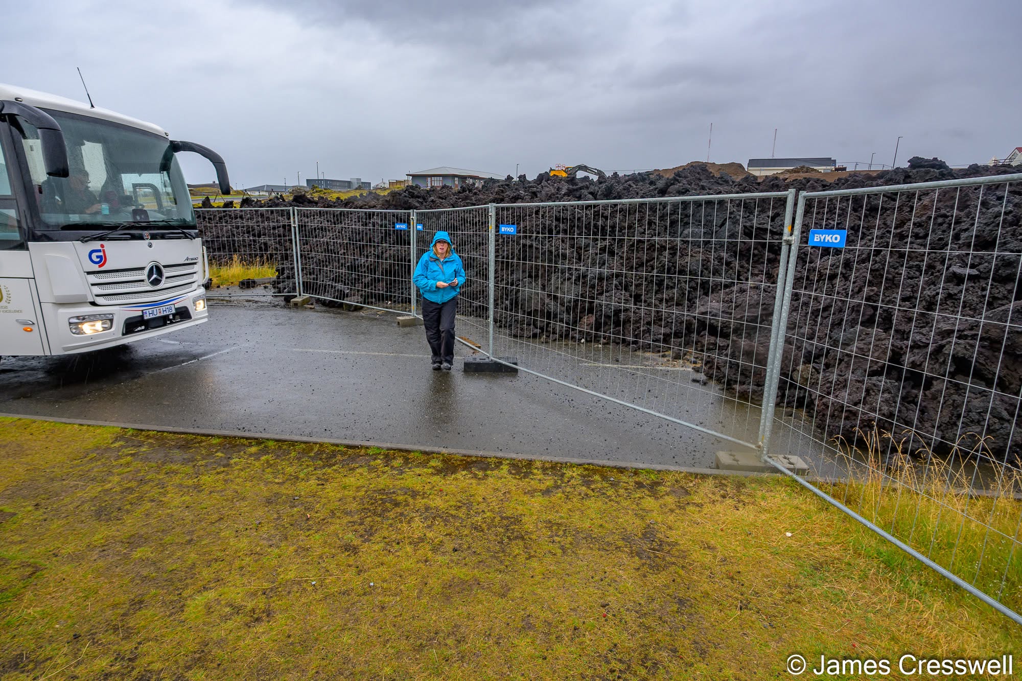
Left: Efrahóp lava field, Grindavík. After around 800 years without an eruption on the Reykjanes Peninsula, volcanic activity returned at Fagradalsfjall in 2021. From late 2023, activity shifted to the Svartsengi volcanic system and the Sundhnúkur crater row, immediately north of Grindavík. The town was evacuated in November 2023 as magma intruded beneath it, and on 14th January 2024 a fissure opened close to the town. Lava destroyed three houses and engulfed this road. Our tour bus stopped at the exact point where the road now disappears beneath the new lava flow.
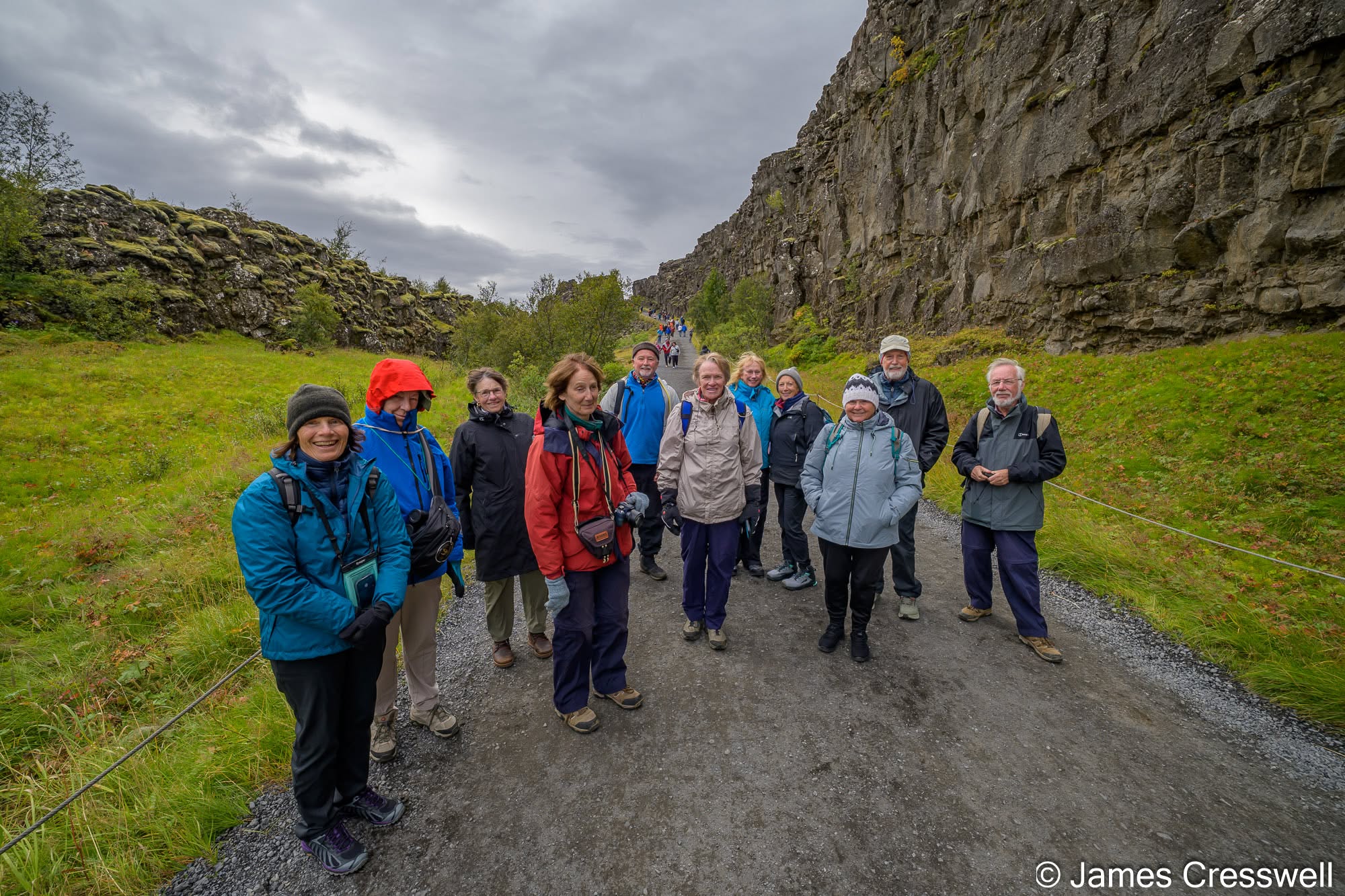
Top right: Our group in Almannagjá, Þingvellir UNESCO World Heritage Site. Þingvellir is one of Iceland’s classic geological localities, where the crust is being pulled apart within the Mid-Atlantic rift zone. Almannagjá is the major normal fault on the western side of the rift valley, with around 40m of vertical displacement. Þingvellir is also of huge historical importance as the site of Iceland’s early parliament, the Alþingi.
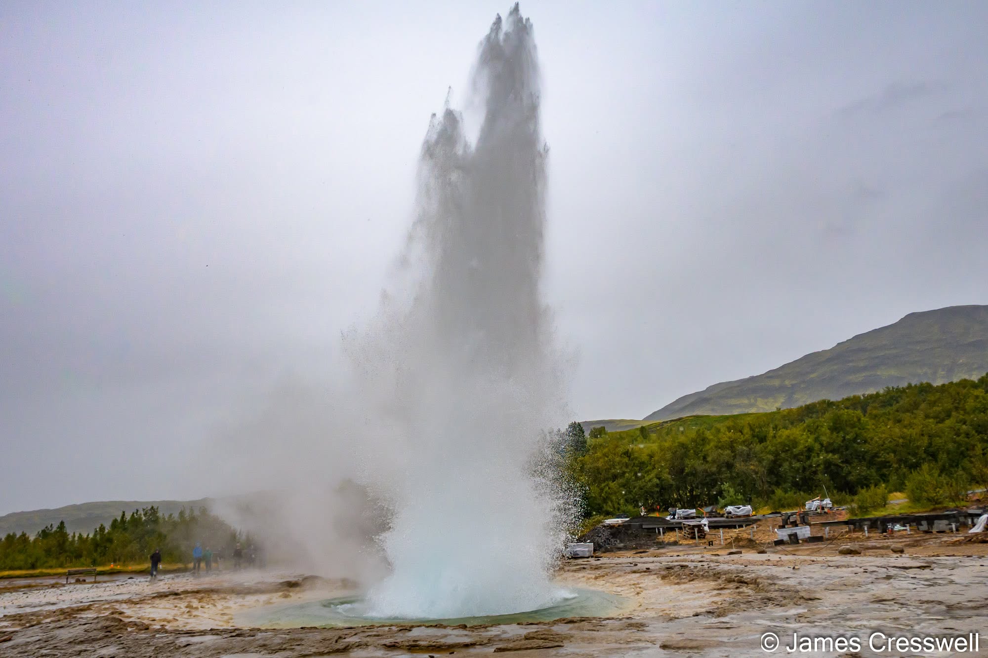
Middle right: Strokkur erupts in the Haukadalur geothermal area. Just next door is Great Geysir, the famous hot spring that gave its name to geysers around the world. Great Geysir is now only rarely active, but Strokkur erupts every 5–10 minutes, usually sending boiling water and steam 10–20 m into the air, and sometimes much higher. Its eruptions are driven by pressure changes in the underground conduit, causing superheated water to flash into steam and force the water column upwards.
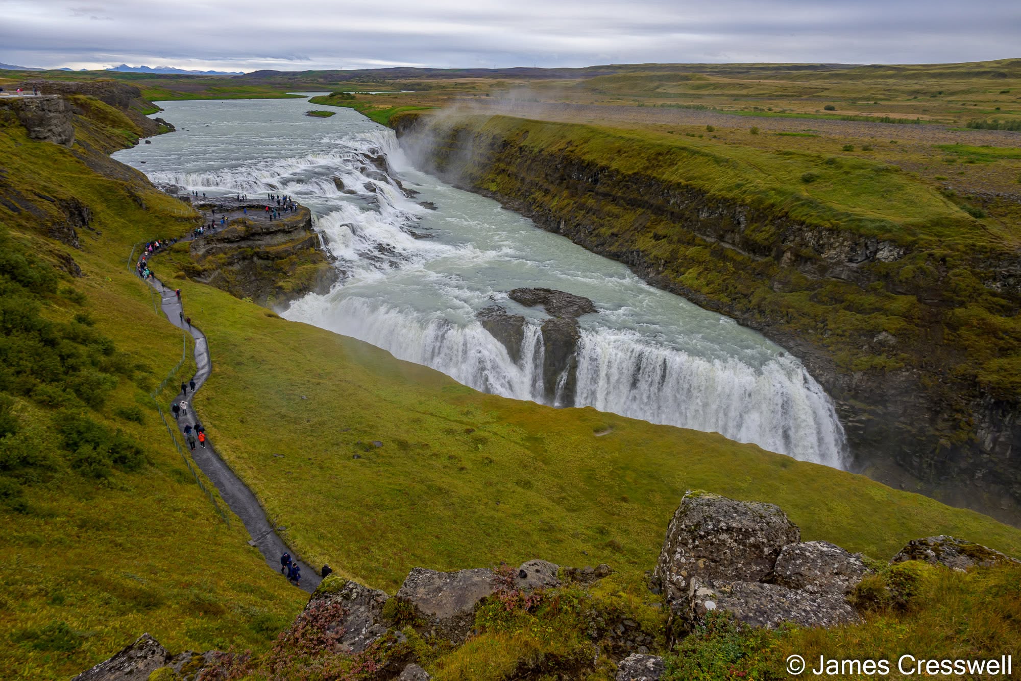
Bottom: Gullfoss, on the Hvítá river. This spectacular two-tiered waterfall drops a total of 32 m into a narrow canyon. Its form is strongly controlled by three different orientations of faulting: the two steps of the waterfall probably follow earthquake faults, while the main canyon appears to follow an older extensional fracture or normal fault. The cliffs also expose young river sediments that were later buried beneath lava flows and subsequently re-exposed as the river cut down through the landscape.
Day Three: Volcanoes of the Westman Islands
We took the ferry to Heimaey in the Westman Islands to explore the remarkable story of the 1973 Eldfell eruption. The eruption buried buildings beneath lava and ash and threatened to close the island’s harbour, before an extraordinary operation involving billions of litres of seawater helped divert the advancing lava. We also visited the Eldheimar Museum and, when conditions allowed, looked towards Surtsey, the volcanic island that emerged from the sea during eruptions beginning in 1963. Back on the mainland, our journey continued past Seljalandsfoss and along the southern flank of Eyjafjallajökull.
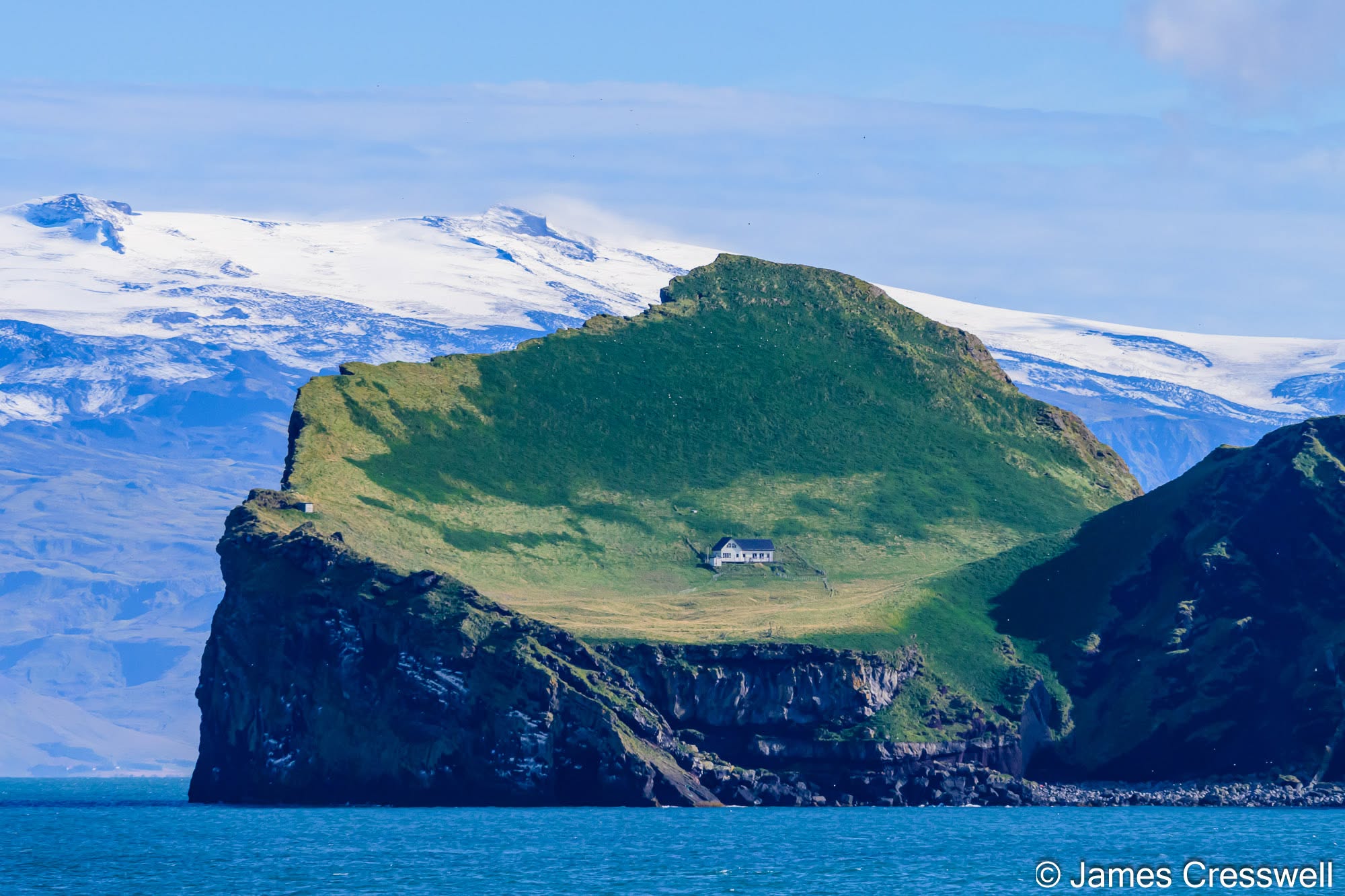
Left: Elliðaey, one of the Westman Islands, with Eyjafjallajökull volcano rising behind. The island is the deeply eroded remnant of an old volcanic edifice, and its broad curving form probably reflects part of the original crater. Marine erosion has since cut the volcano back into the steep sea cliffs seen today. The isolated white building is a hunting lodge used during the traditional puffin-hunting season.
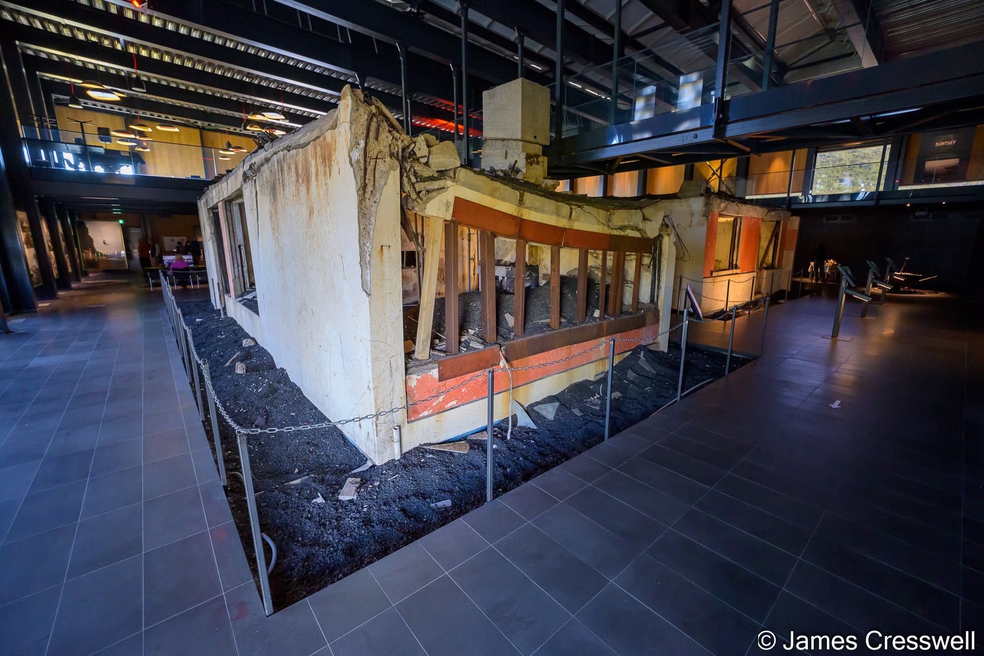
Top Right: Eldheimar Museum, Heimaey. The museum is built around the remains of a house on Gerðisbraut that was buried during the 1973 Eldfell eruption and excavated more than three decades later. Sometimes described as the “Pompeii of the North”, Eldheimar tells the story of the eruption, the evacuation of Heimaey, and the remarkable efforts to save the town and harbour. It also includes the story of the 1963-67 Surtsey eruption.
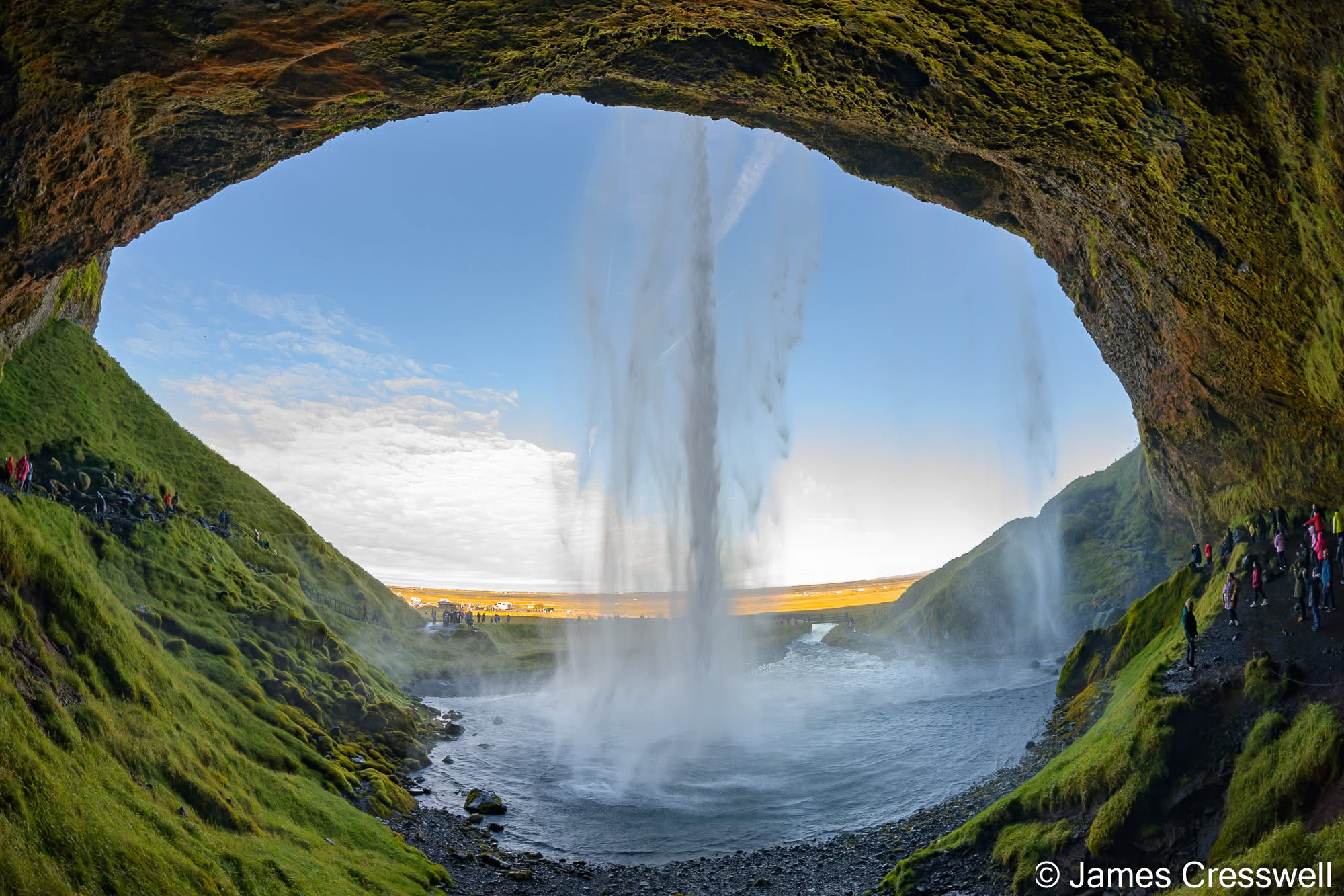
Bottom Right: Seljalandsfoss, in the Katla UNESCO Global Geopark. The waterfall plunges around 60m over former sea cliffs on the flank of Eyjafjallajökull volcano. The cliffs are made largely of hyaloclastite – fragmented basaltic volcanic glass produced when lava erupted beneath ice or water and was rapidly quenched. Much of the rock here formed subglacially, although the lowest part of the sequence may have formed beneath the sea.
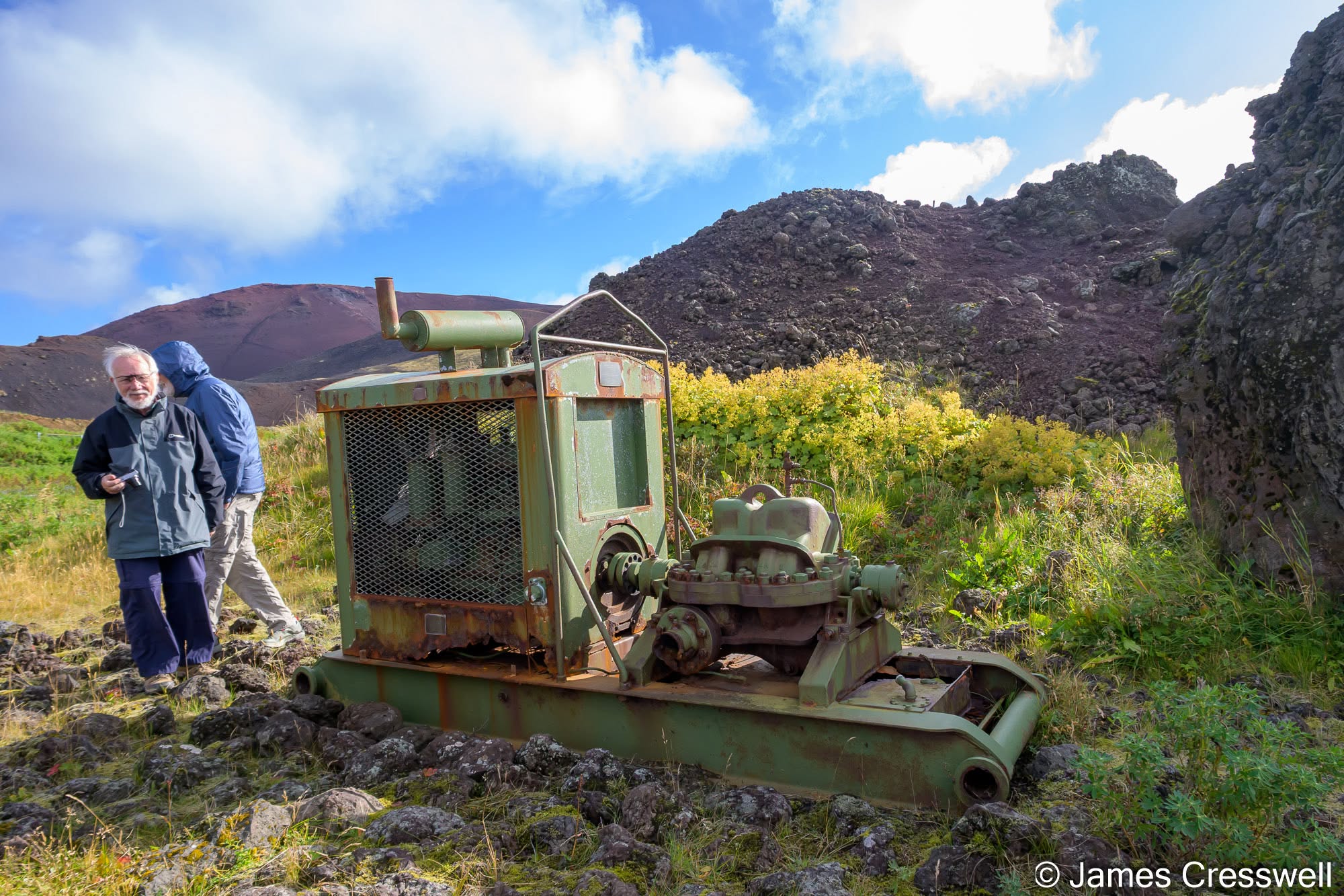
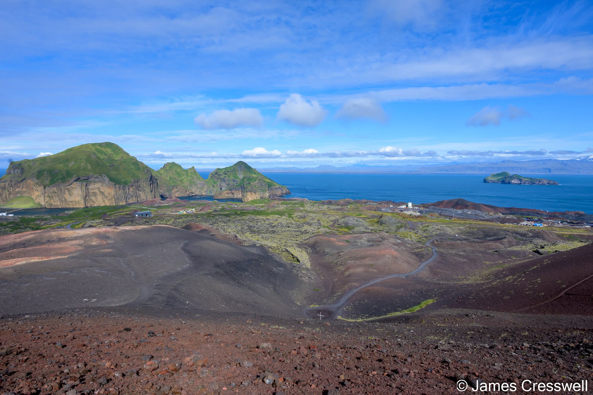
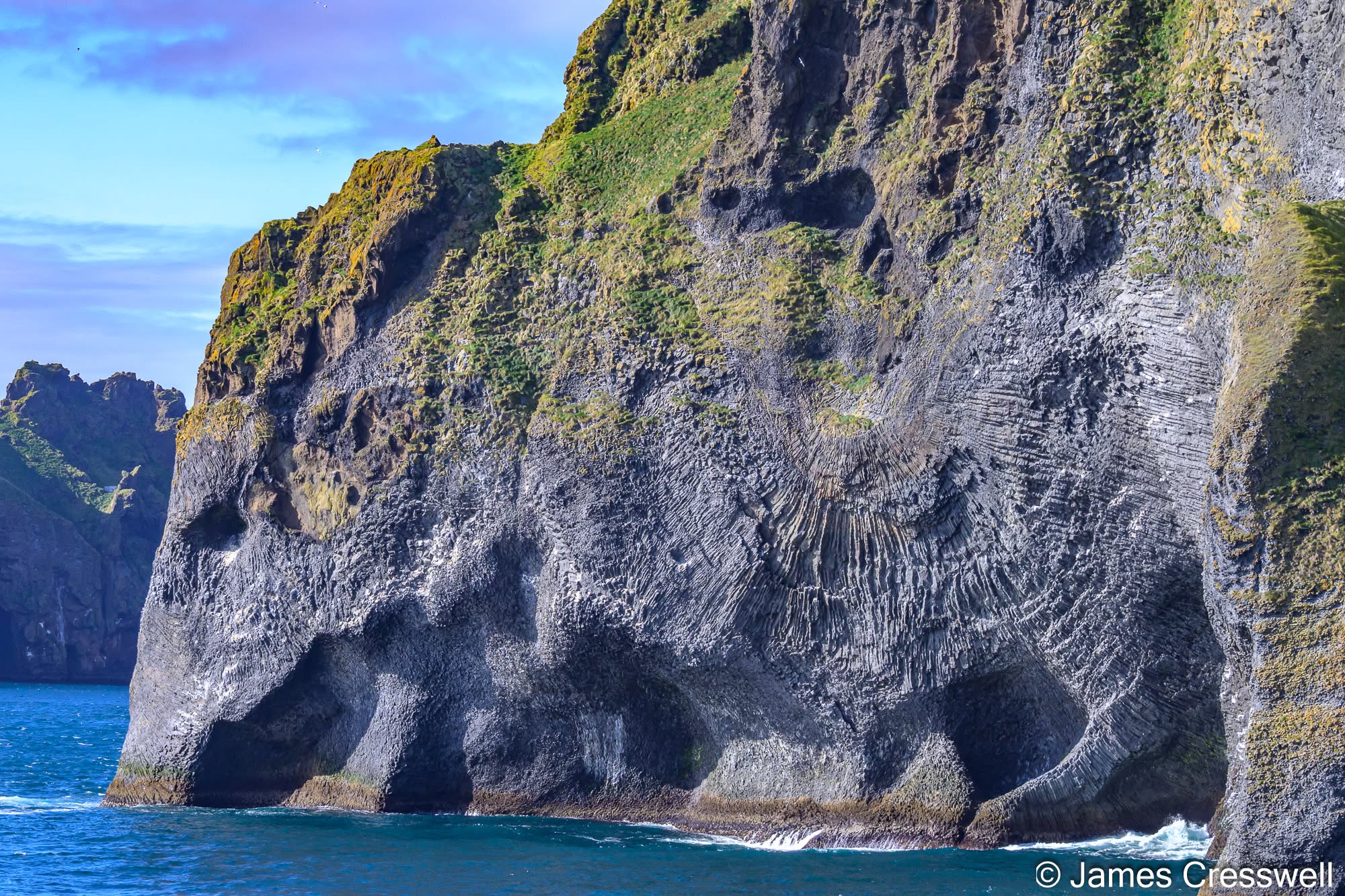
Left: Hraunkæling Memorial, Heimaey. From this viewpoint you can clearly see which parts of the town survived the 1973 Eldfell eruption and which were buried by lava. A preserved pump here is one of those used in the remarkable lava-cooling operation, when about 6.2 million tonnes of seawater were sprayed onto the advancing flows. This is one of the rare examples where people were able to alter the behaviour of a lava flow. The main danger was that the lava would seal off Heimaey’s harbour, home to Iceland’s largest fishing fleet. Instead, the flow stopped short of closing the entrance and ultimately improved the harbour by narrowing its mouth and reducing wave action inside.
Top Roght View from the summit of Eldfell, Heimaey. Eldfell was created during the sudden 1973 eruption, which began on 23 January and continued for just over five months. In the first 12 hours alone, around 30 million tonnes of tephra and lava were erupted. By the end, about 0.25 km³ of magma had been produced and the area of Heimaey had increased by roughly 20%
Bottom Right: Elephant Rock, Heimaey. This sea cliff has become a popular tourist sight because of its striking resemblance to an elephant, complete with a trunk dipping into the sea. The North Cliffs (Norðurklettar) expose some of the oldest geology on Heimaey, built by material from at least seven eruptions between about 13,000 and 15,000 years ago. The area originally consisted of two separate volcanic islands that were later joined together. The elephant’s “wrinkled skin” is formed by columnar jointing in an old basalt lava flow, while the yellow-brown material higher in the cliff is probably palagonitised hyaloclastite or tuff.
Day Four: Glaciers, Black Sand and Vatnajökull
South Iceland delivered one spectacular landscape after another. Beginning at Skógafoss, we continued towards the black sands and columnar basalt of Reynisfjara before crossing the great volcanic and glacial landscapes of southern Iceland. At Vatnajökull National Park we walked to Svartifoss, where the waterfall plunges past striking columns of basalt, before continuing towards the enormous Vatnajökull ice cap. Fjallsárlón and Jökulsárlón gave us a completely different view of Iceland’s geology, with glaciers flowing down from the ice cap and icebergs breaking away into the lagoons below.
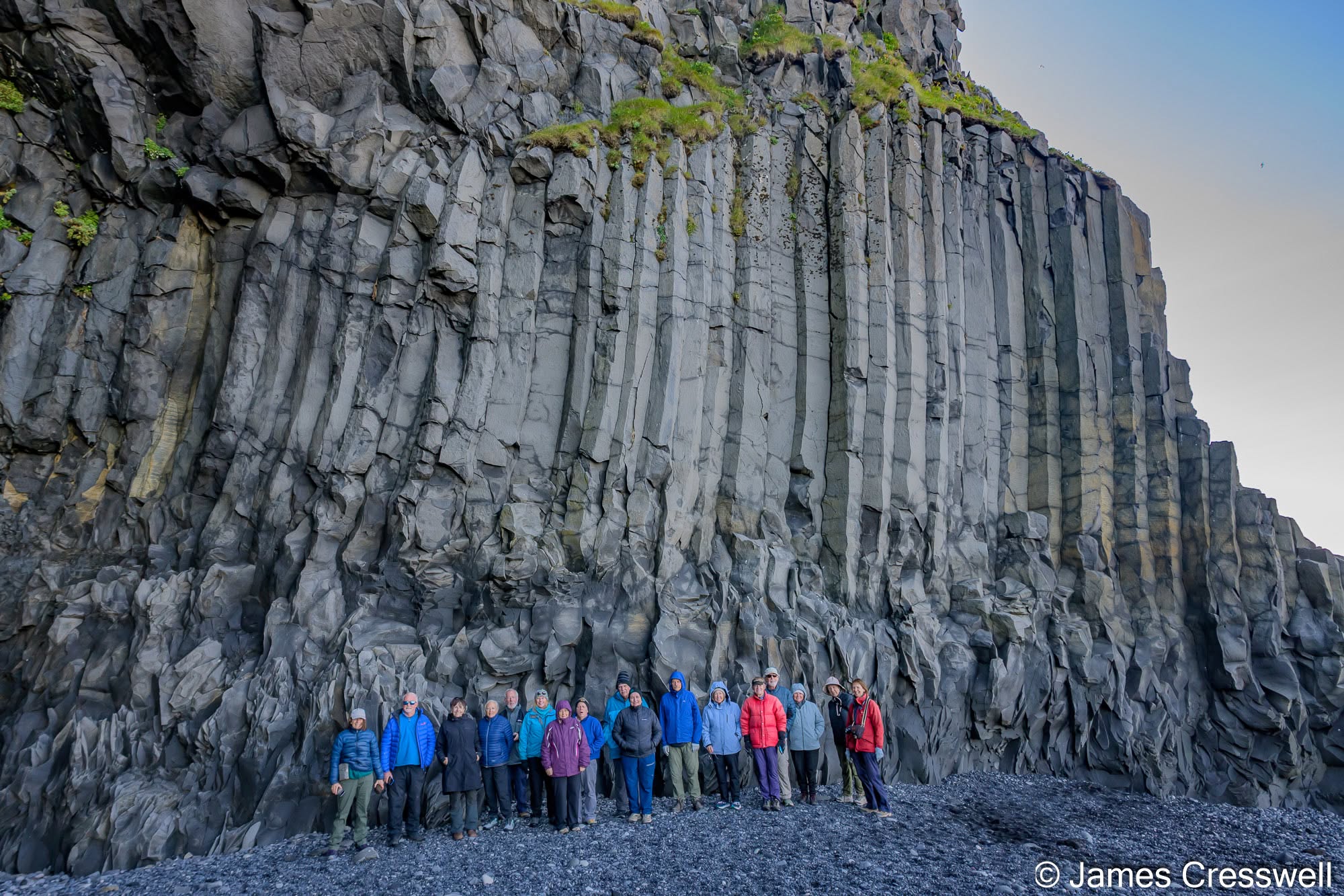
Left: Our group beneath the basalt columns at Reynisfjara. Reynisfjall is a hyaloclastite mountain formed by repeated basaltic eruptions, probably partly beneath the sea and partly beneath ice, during the last ~200,000 years. Marine erosion has cut into the mountain and exposed its internal structure, including pillow breccias, dykes, an inclined sheet and this sill at the base of the cliff. The spectacular columns formed as the magma cooled and contracted, with the joints developing roughly at right angles to the cooling surfaces.
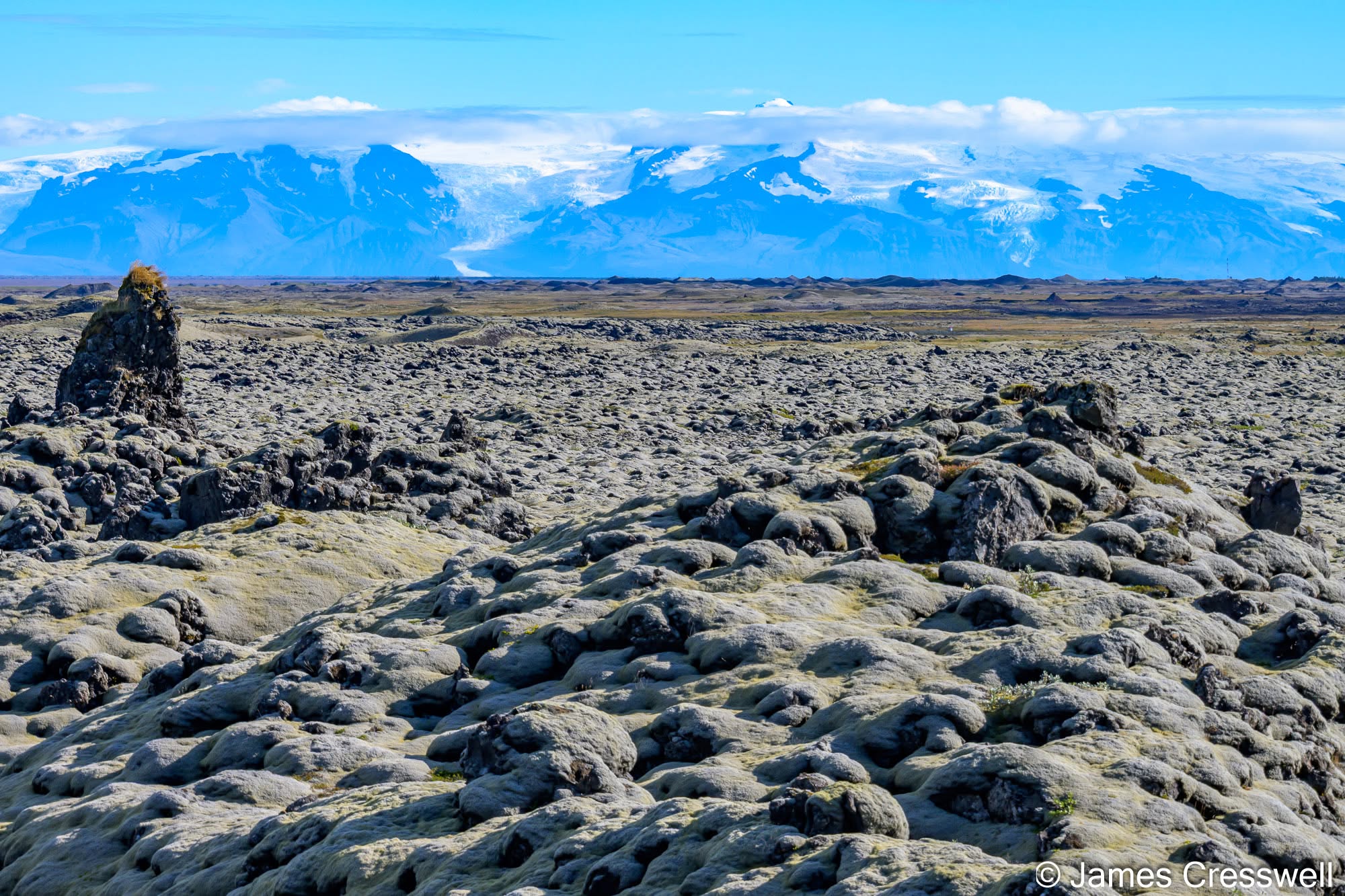
Right: Laki lava fields, with Öræfajökull in the distance. In the foreground are moss-covered lavas from the 1783-84 Laki eruption, part of the Grímsvötn volcanic system. Lava poured from a 27 km-long fissure, producing about 15 km³ of basalt and releasing enormous quantities of sulphur dioxide, causing severe atmospheric pollution and significant Northern Hemisphere cooling. It may even have contributed to the agricultural and economic stresses preceding the French Revolution. The moss can also conceal deep cracks and hollows in the lava, making these fields hazardous to cross. In the middle distance are rootless cones in the Eldgjá lavas, erupted in 934-940 AD from the Katla volcanic system along a fissure system about 75km long. Laki and Eldgjá were both among the largest basaltic eruptions of the last millennium. On the skyline is Öræfajökull, a glacier-covered stratovolcano whose summit is the highest point in Iceland. It lies in the Öræfi Volcanic Belt, an embryonic rift east of the present plate boundary that may represent the future location of spreading as Iceland’s rift system continues to migrate eastwards.
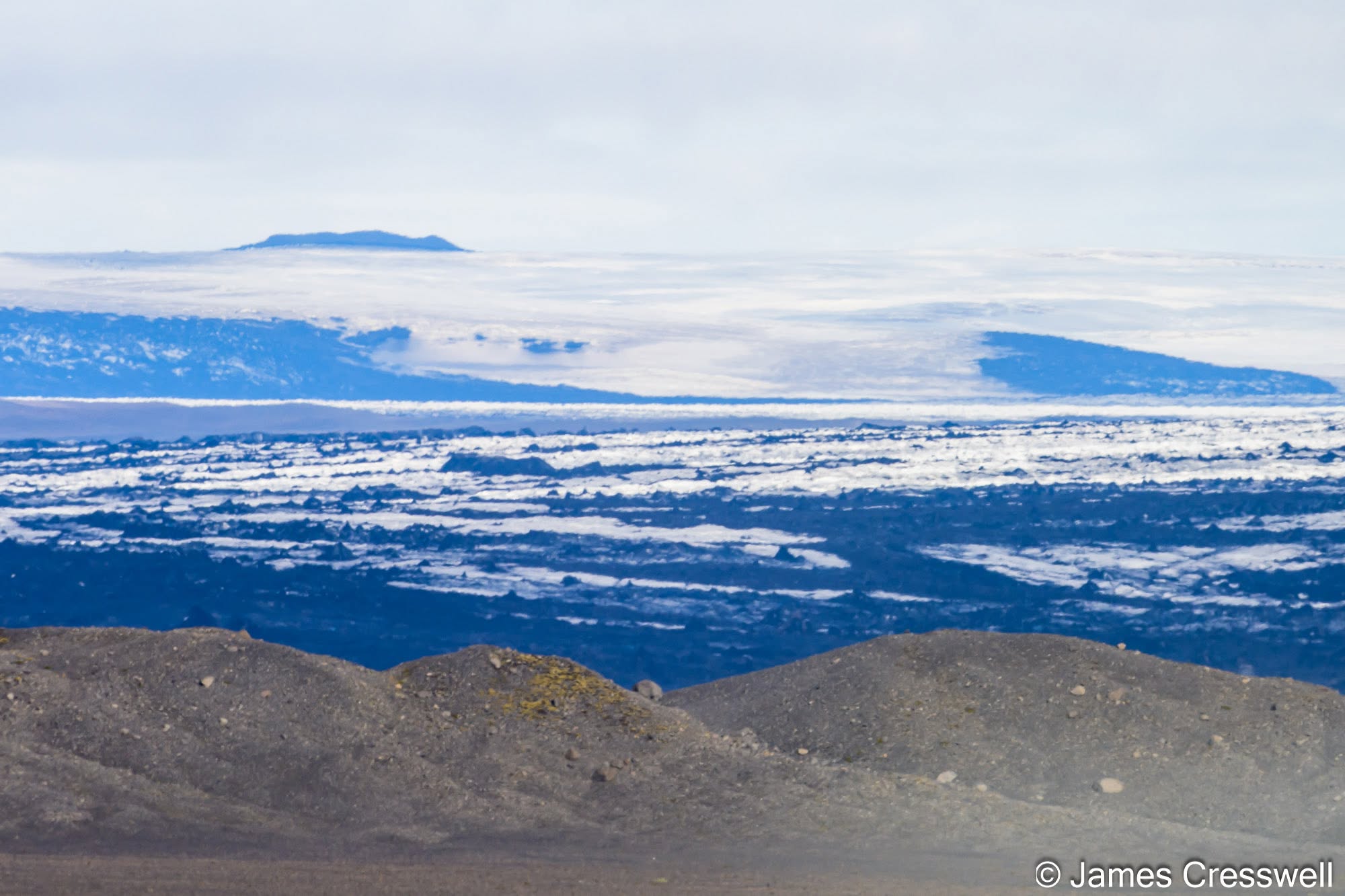
Left: Vatnajökull ice cap, with Grímsvötn in the distance. The dark ridge projecting above the ice is the exposed southern rim of Grímsvötn, a large subglacial caldera and Iceland’s most frequently active volcano. Grímsvötn lies directly above the central Iceland hotspot, beneath the Vatnajökull ice cap. In the middle distance are crevassed glacier ice and moraine, while the broad ridge in the foreground is a terminal moraine marking a former position of the Vatnajökull ice margin.
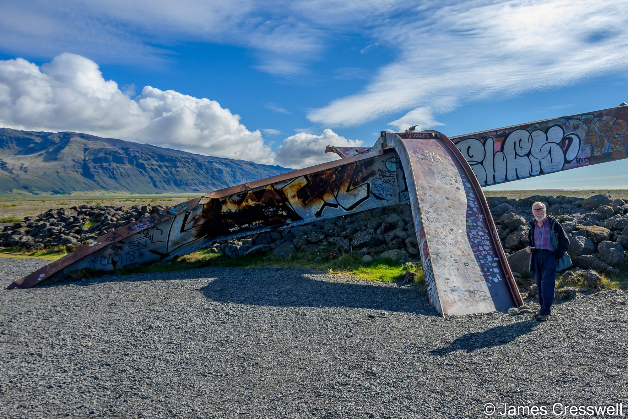
Right: Skeiðará Bridge Monument, Skeiðarársandur. This twisted section of bridge is a remnant of the 1996 jökulhlaup, a catastrophic glacial outburst flood that swept across Skeiðarársandur after meltwater from the Gjálp eruption accumulated beneath Vatnajökull and drained through the Grímsvötn system. The flood destroyed sections of Iceland’s Ring Road and badly damaged major bridges across the plain. Skeiðarársandur is Iceland’s largest sandur, a vast glacial outwash plain built by sediment-laden meltwater from Skeiðarárjökull. Although the braided rivers continually transport large quantities of sediment, far greater volumes can be moved during jökulhlaups. Such floods here have been caused both by drainage of subglacial water from Grímsvötn and by sudden drainage of ice-dammed marginal lakes such as Grænalón.
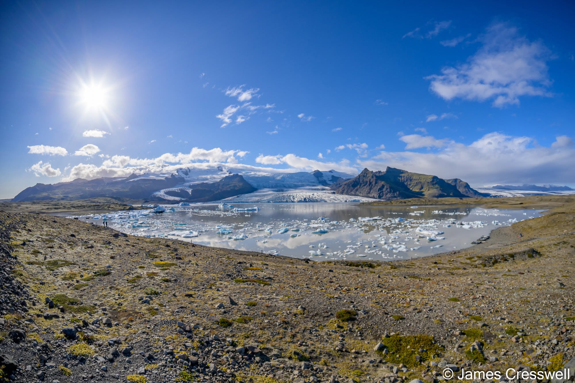
Top Left: Fjallsárlón glacial lagoon, on the southern side of Vatnajökull. The lagoon lies in front of Fjallsjökull, an outlet glacier flowing down from the Öræfajökull massif. Icebergs calved from the glacier drift across the lake, while the surrounding landscape records the rapid retreat of the ice margin in recent decades. High on Öræfajökull, rhyolitic lava domes can also be seen on the summit area.
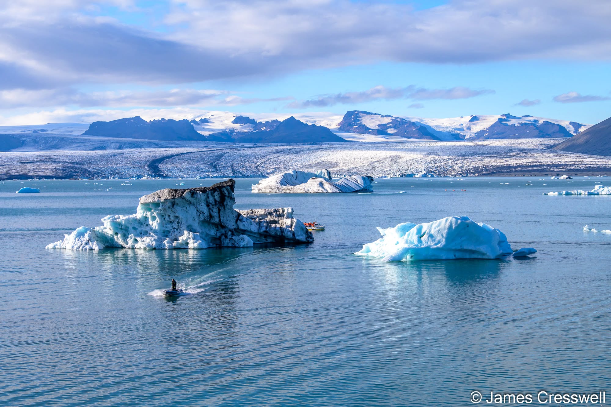
Top Right: Jökulsárlón glacial lagoon, at the front of Breiðamerkurjökull. Breiðamerkurjökull is one of the major outlet glaciers draining Vatnajökull, Europe’s largest ice cap by volume, which covers about 7,500km² (around 7% of Iceland). The glacier has retreated by more than 8km since the late 19th century, leaving behind Jökulsárlón, which only began to form in the 1930s and has expanded rapidly ever since. Icebergs calve from the retreating glacier front and drift across the lagoon before eventually reaching the Atlantic. Jökulsárlón is also exceptionally deep, reaching around 250m below sea level.
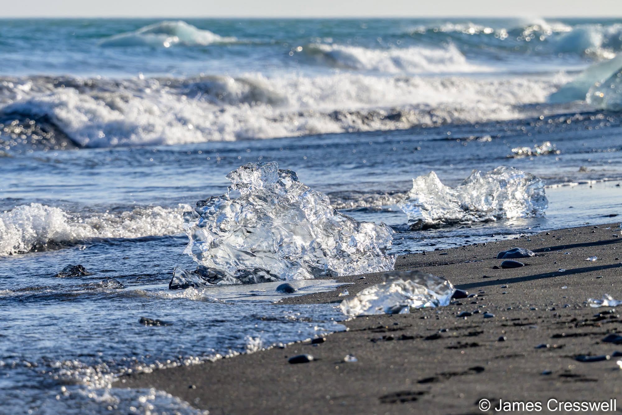
Middle Right: A chunk of glacier ice, or “growler”, resting on Diamond Beach (Eystri-Fellsfjara). These pieces of ice are the remnants of icebergs that calved from Breiðamerkurjökull into Jökulsárlón, drifted out through the lagoon’s narrow channel and were then washed back onto the black volcanic sand by the Atlantic. It is one of the relatively few places in the Northern Hemisphere outside the high Arctic where glacial ice can regularly be found washed up on an ocean beach.
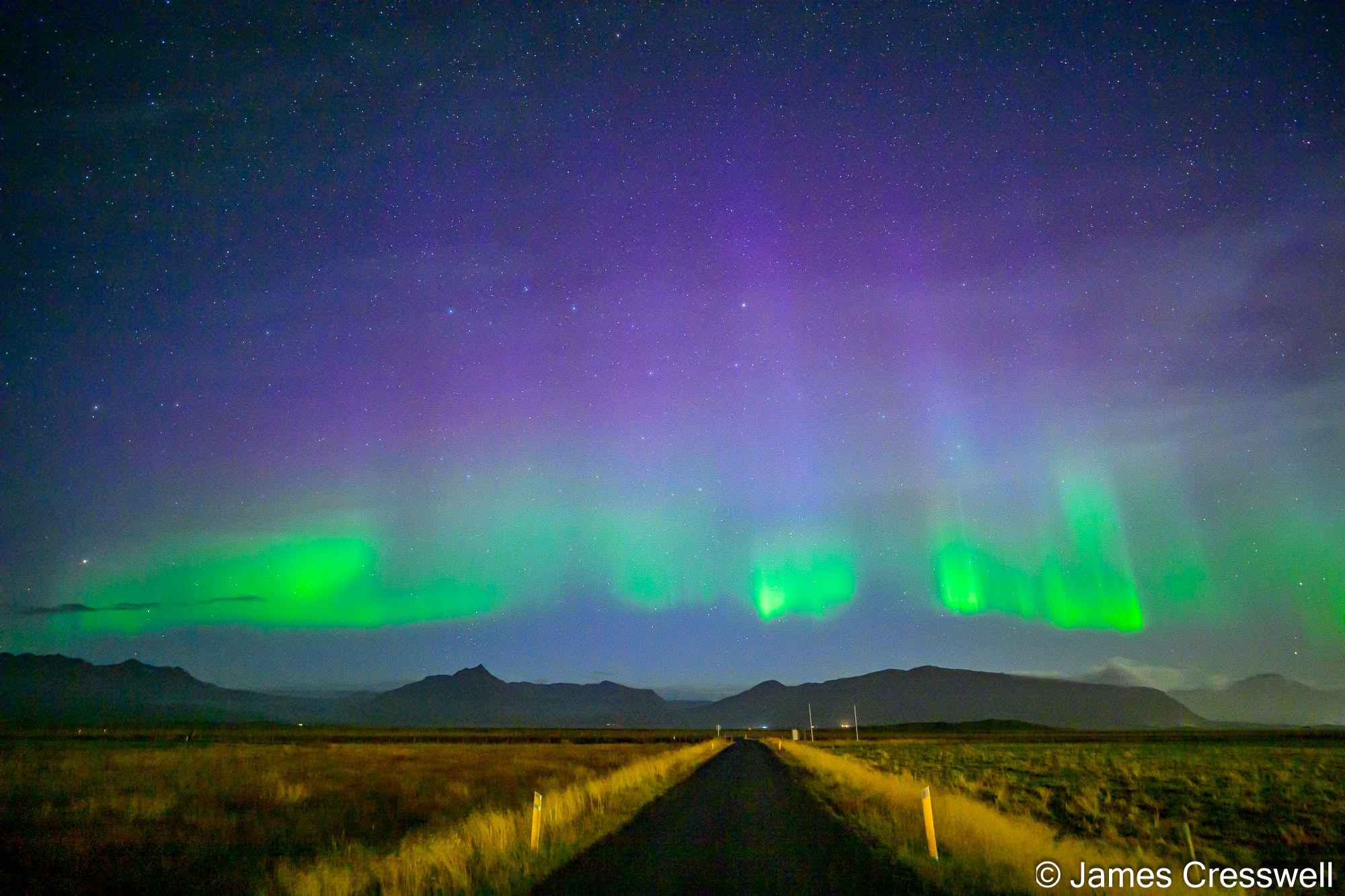
Bottom: The Northern Lights in front of Brunnhóll Country Guesthouse, near Höfn. The aurora is produced when charged particles from the Sun are guided by Earth’s magnetic field into the upper atmosphere, where they collide with gases such as oxygen and nitrogen and cause them to glow. Green is the most common colour, mainly produced by oxygen, while the purple and reddish colours seen here come from emissions at different altitudes and from nitrogen.
Day Five: Through East Iceland to Dettifoss
Our journey north took us through the deeply eroded remains of ancient volcanic systems in East Iceland. Around Eystrahorn we could see rocks that once formed deep within a volcano, while elsewhere the landscape revealed old eruptive vents, basaltic dykes and the internal architecture normally hidden beneath active volcanic landscapes. The day ended with one of Iceland’s great natural spectacles: Dettifoss, widely regarded as Europe’s most powerful waterfall. From there we continued to Lake Mývatn and a well-earned soak in geothermally heated water.
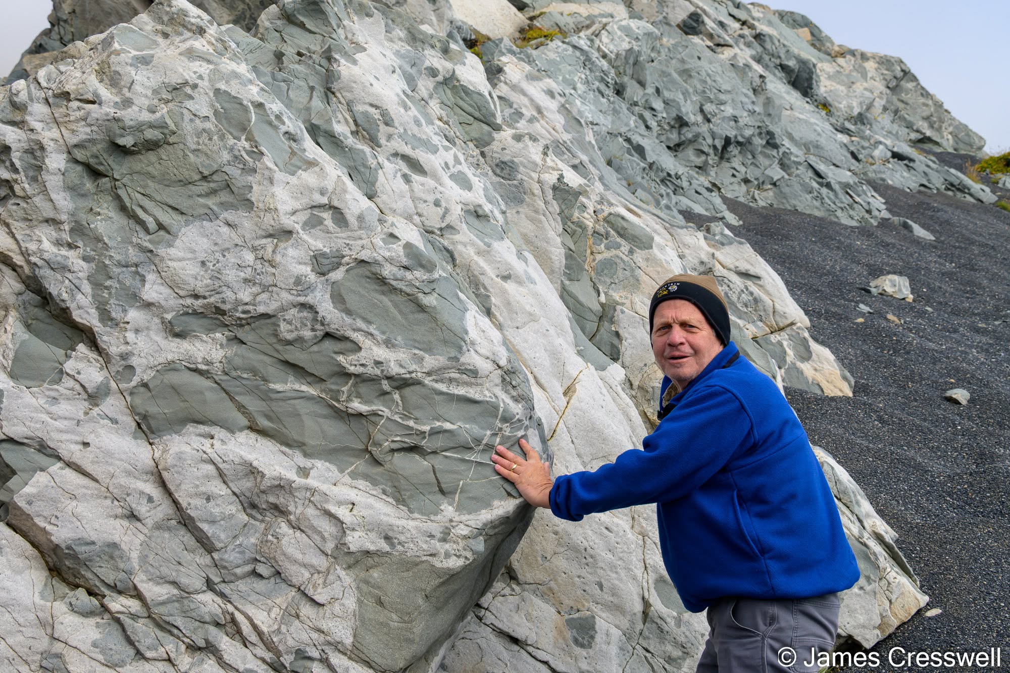
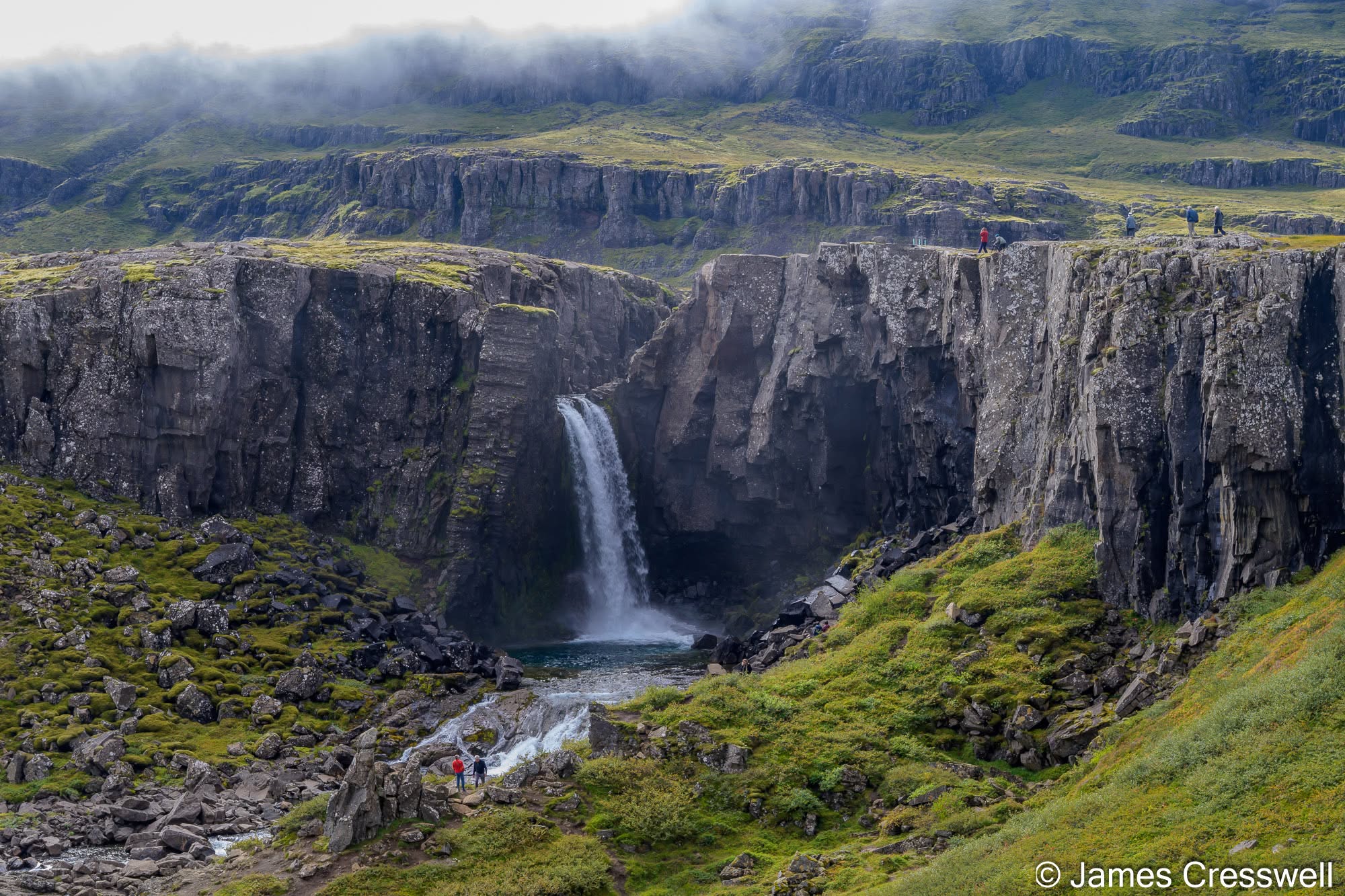
Left: Mixing magmas at Eystrahorn (the Austurhorn intrusive complex). This is an exposed section through an ancient magma chamber, where hotter mafic magma repeatedly intruded into still-molten or partly crystallised granophyric magma. The dark gabbroic and hybrid rocks occur as rounded to angular enclaves surrounded and cut by pale granophyre, recording magma mingling, mixing and hybridisation. The granophyre was emplaced first and displaced blocks of the surrounding country rock by stoping, before later injections of mafic magma produced the net-veined complex seen here.
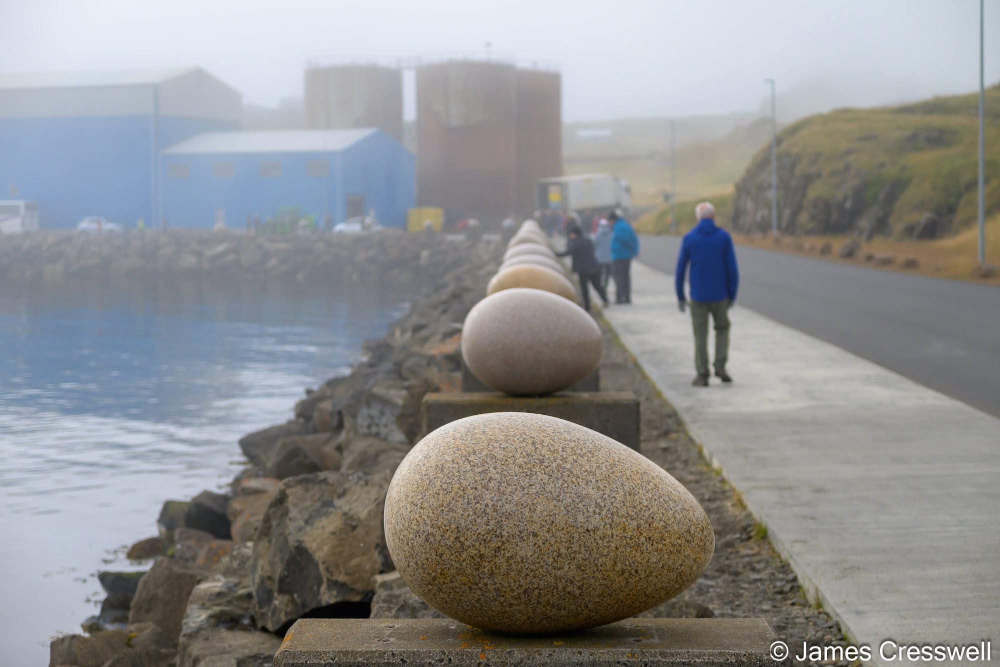
Top Right: Eggin í Gleðivík (“The Eggs of Merry Bay”), Djúpivogur. This outdoor artwork by Icelandic artist Sigurður Guðmundsson consists of 34 oversized stone eggs, each representing a bird species that nests around Djúpivogur. They stand on old concrete supports that once carried a landing pipe between the harbour and a former smelter, and have become one of the town’s best-known landmarks.
Bottom Right: Folaldafoss waterfall on the Berufjarðará river. The waterfall drops about 20m over a resistant volcanic dyke, with the surrounding cliffs exposing the layered volcanic rocks of eastern Iceland. Nearby, Breiðdalur is a classic deeply eroded extinct volcanic centre, where rhyolitic rocks contain amygdales that are locally filled with zeolite minerals.
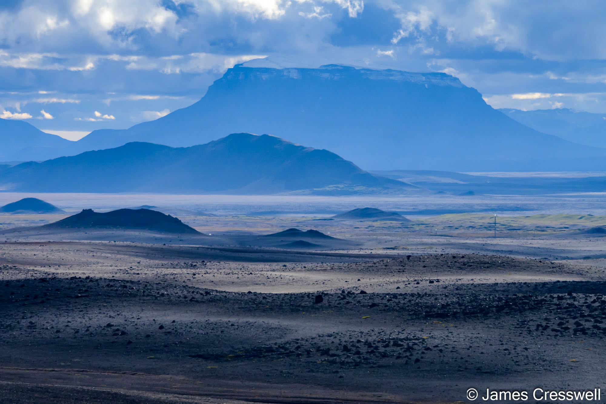
Top Left: Herðubreið, seen from Highway 1. Herðubreið is one of Iceland’s best-known móberg mountains. Its steep-sided lower edifice formed during eruptions confined by an ice sheet roughly 800m thick, producing pillow lavas and hyaloclastite. Once the volcano grew above the ice surface, eruptions became subaerial and built the uppermost ~300m of lava. This multi-stage history makes Herðubreið more complicated than a simple subglacial tuya. Known as the “Queen of Icelandic Mountains”, it is widely regarded as one of the country’s most beautiful peaks.
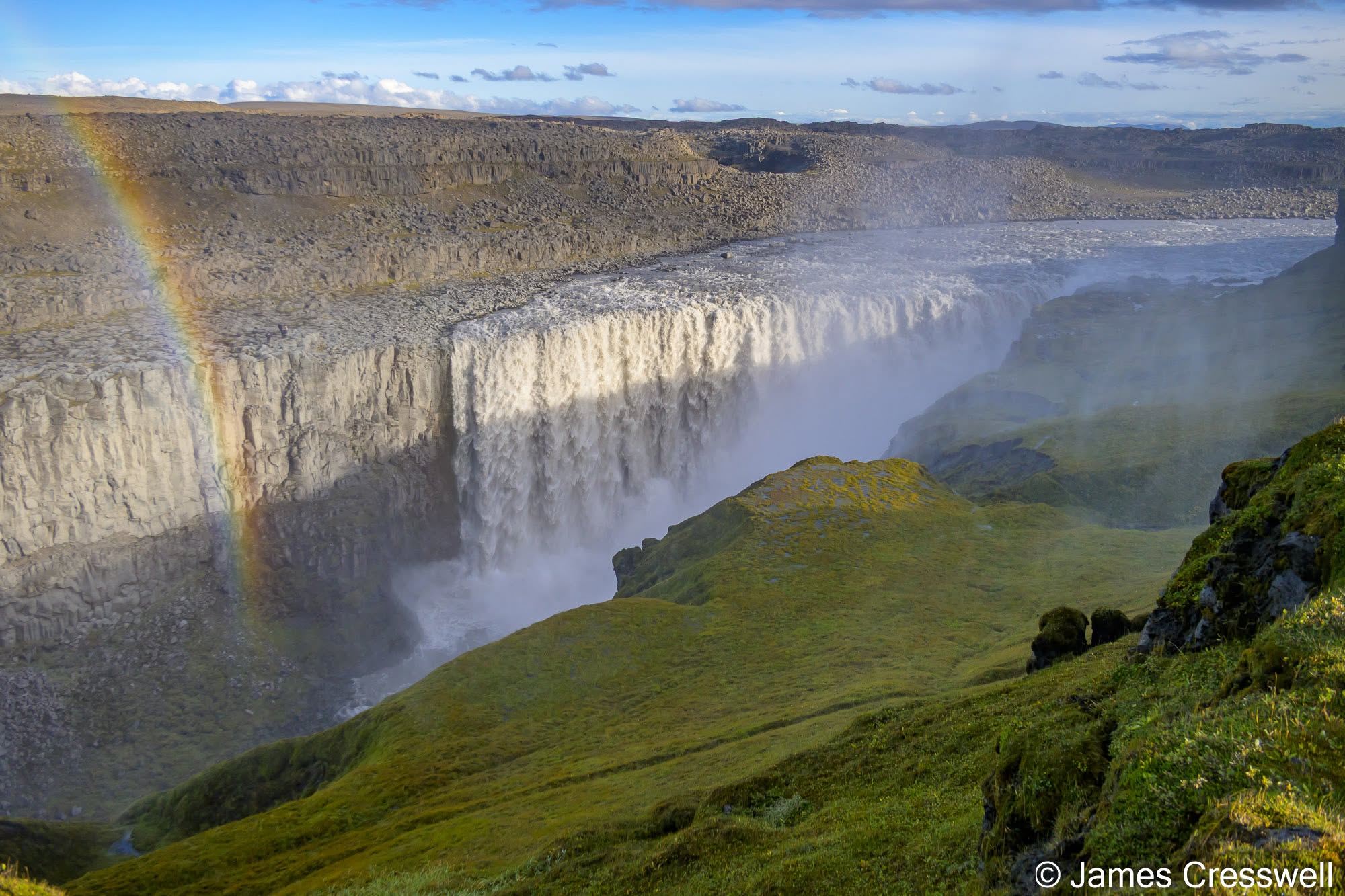
Top Right: Dettifoss, on the Jökulsá á Fjöllum. Around 100m wide and 45m high, Dettifoss is often described as the most powerful waterfall in Europe. It lies within Jökulsárgljúfur, a 25km-long canyon that was carved largely by a small number of enormous jökulhlaups rather than by gradual river erosion alone. The largest prehistoric floods may have reached peak discharges of around 900,000m³ per second – more than four times the average discharge of the Amazon. Research suggests that much of the canyon was excavated during just three major flood episodes, roughly 9,000, 5,000 and 2,000 years ago.
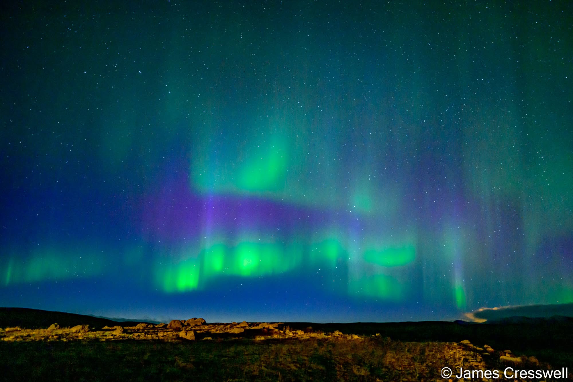
Bottom Right: Northern Lights behind our hotel at Lake Mývatn. This was our second good aurora display of the trip, with bright green curtains and patches of purple spreading across the sky above the volcanic landscape around Mývatn. Green aurora is mainly produced by excited oxygen high in the atmosphere, while the purple tones are associated largely with nitrogen emissions.
Day Six: Into the Wilderness at Askja
Askja was one of the great adventures of the trip. Travelling deep into Iceland’s interior by 4×4 took us through a vast volcanic wilderness to the Dyngjufjöll Mountains and the enormous Askja volcanic system. Its landscape was dramatically transformed by the powerful 1875 eruption, which expelled huge quantities of ash and pumice and created a new caldera within the older volcanic structure. Today, the caldera contains Öskjuvatn, one of Iceland’s deepest lakes, alongside the striking Víti crater. Remote, barren and unmistakably volcanic, Askja feels a very long way from everyday life.
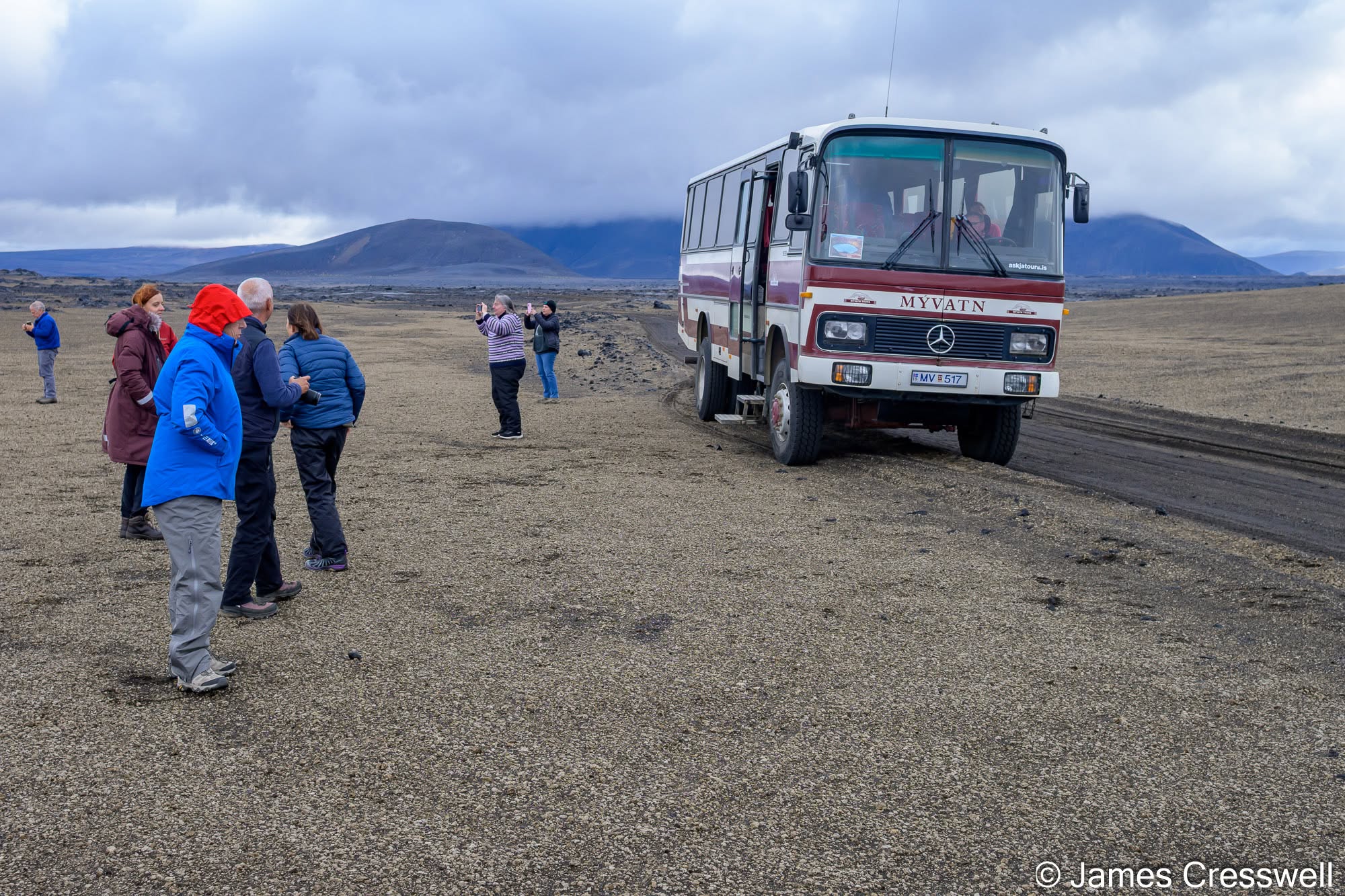
Left: En route to Askja. Here we stopped on a thick blanket of pumice from the 1875 Askja eruption, a major Plinian eruption (VEI 5) that formed part of the 1874-76 rifting episode on the Askja volcanic system. Reaching this remote part of Iceland requires a specially adapted high-clearance bus, fitted with large wheels and raised suspension for the rough highland tracks and river crossings.
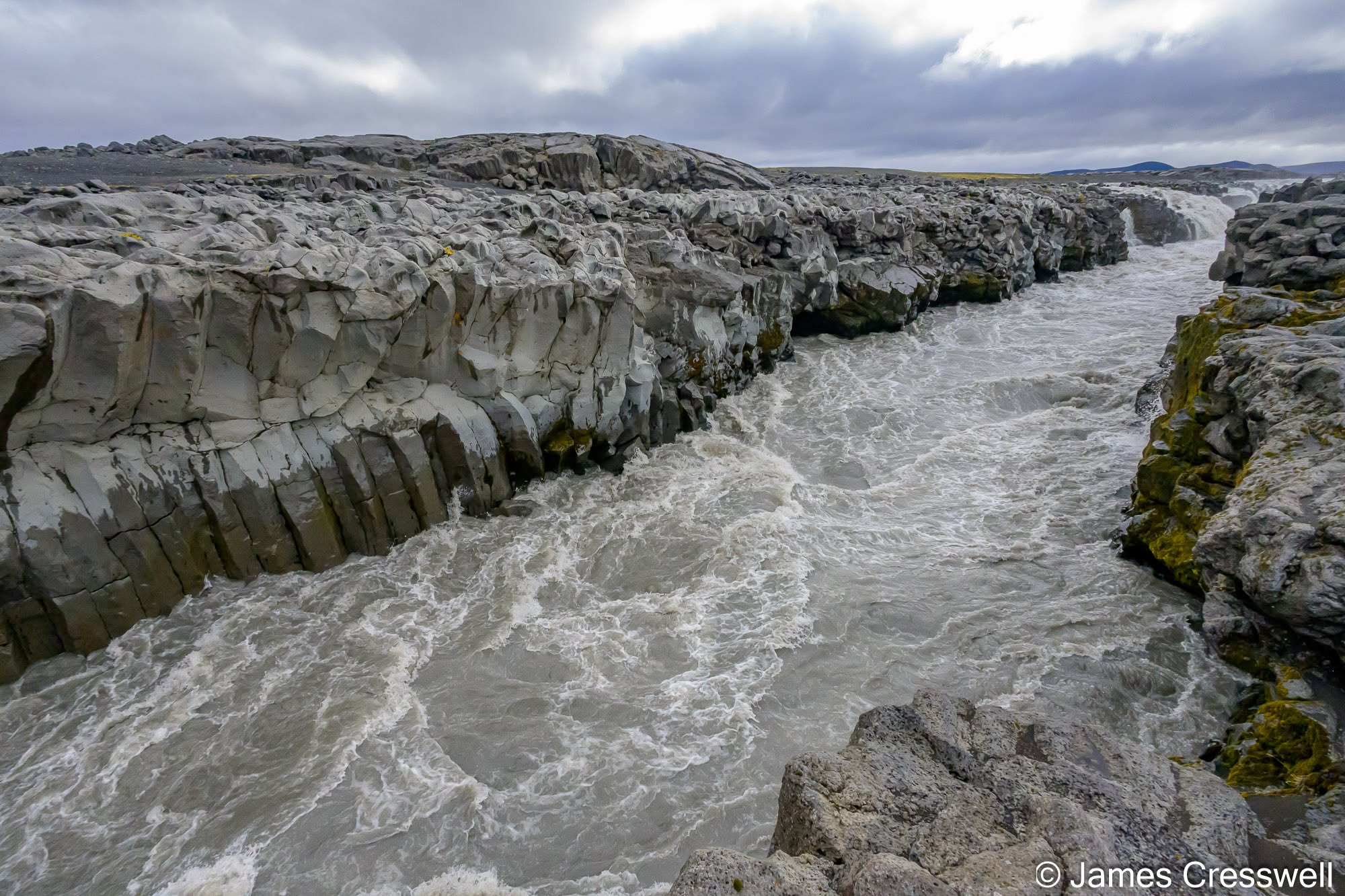
Top right: Gljúfrasmiður, on the Jökulsá á Fjöllum, en route to Askja. Here the same glacial river that later plunges over Dettifoss pours through a narrow basalt gorge, probably controlled by extension fractures associated with Iceland’s active rift zone. The gorge walls display well-developed columnar cooling structures, formed as the basalt contracted during cooling, and the river is channelled through them into a series of turbulent rapids and small waterfalls.
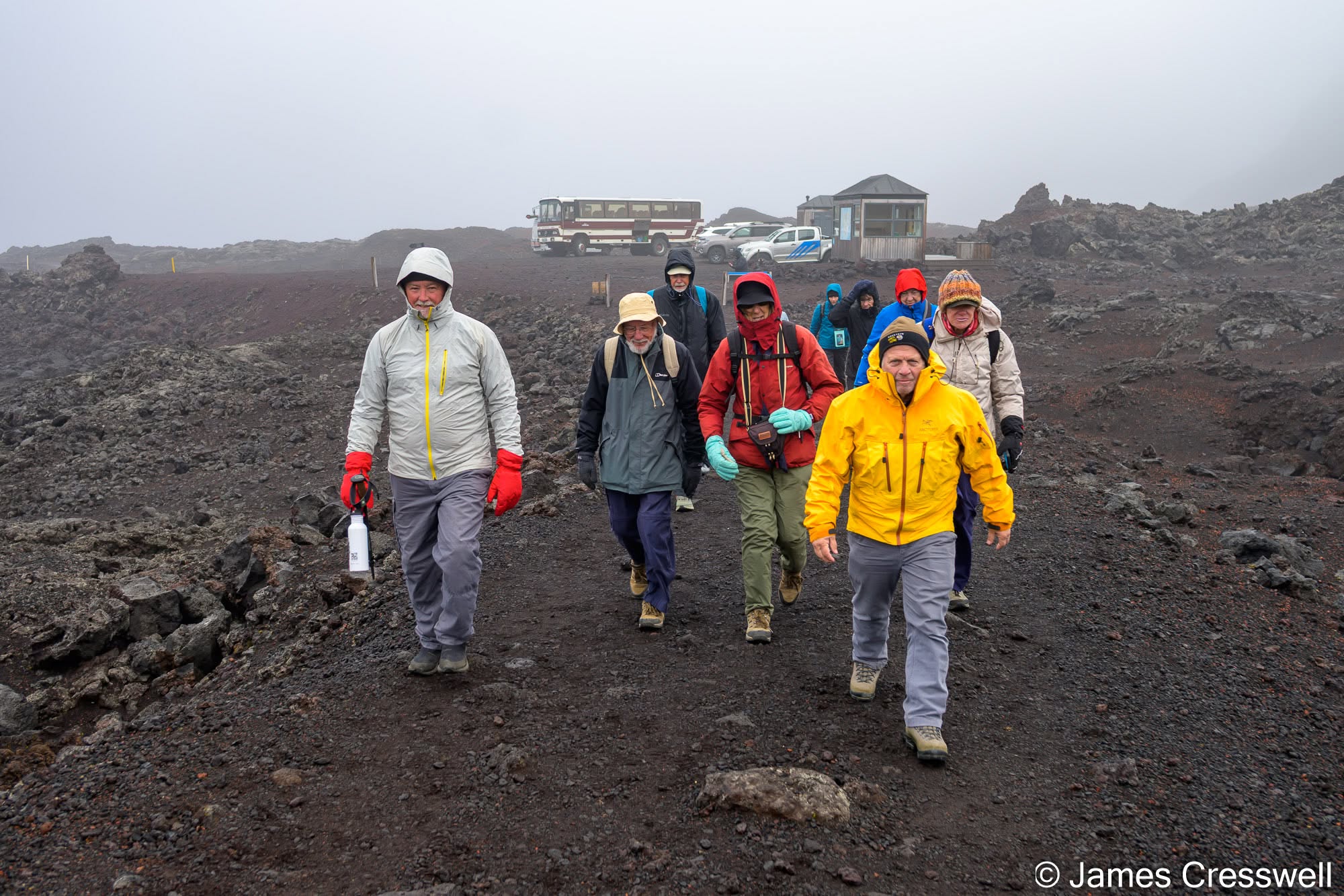
Bottom right: The group crossing the 1961 lavas at Askja. Askja is a complex of three nested calderas — Kollur, Askja and Öskjuvatn – developed within a hyaloclastite massif on Iceland’s active spreading plate boundary. Here we are walking across lava erupted from a 700m-long fissure at Öskjuop in 1961, on the faulted margin of the main Askja caldera. Lava fountains reportedly reached around 500m high, and within just 10 hours the eruption had produced a lava field about 7.5km long. From here we were about to pass into the main Askja caldera, with the younger Öskjuvatn caldera lying inside it.
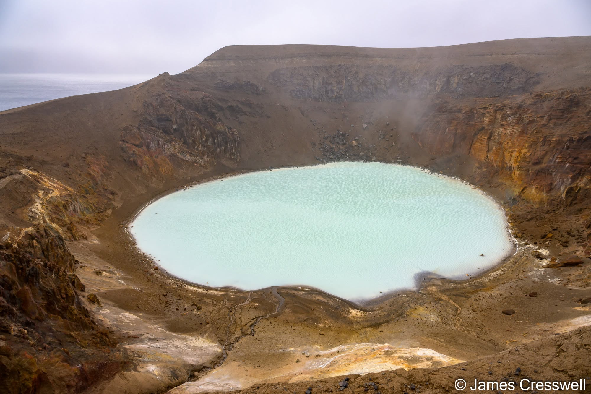
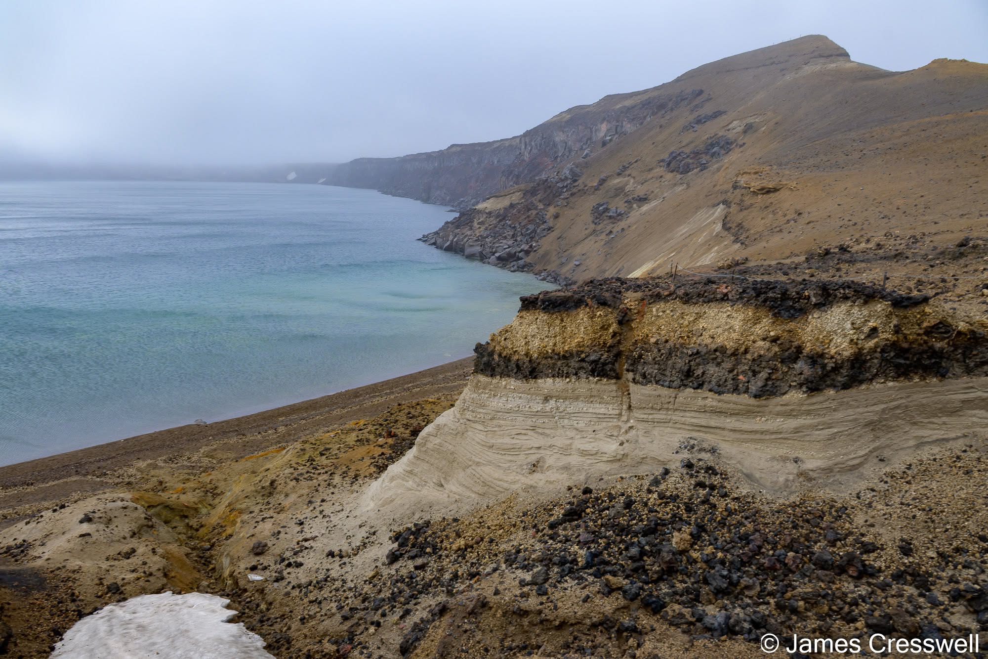
Left: Víti crater, Askja. Víti (meaning “hell” in Icelandic) is a roughly 200m-wide maar crater formed by phreatic explosions that followed Askja’s major rhyolitic Plinian eruption of 28-29 March 1875. The crater now contains a warm, turquoise geothermal lake.
Right: Öskjuvatn caldera, Askja. On the shore of the caldera, pale pyroclastic-flow deposits are overlain by contrasting dark, light and dark pumice layers from the 1875 eruption sequence. In the early hours of 29th March, a major Plinian eruption began, sending ash tens of kilometres across Iceland and carrying fine tephra as far as Scandinavia. The eruption initiated a collapse of the Öskjuvatn caldera, which continued to subside for decades; when Danish geologists visited in 1876 they were effectively witnessing a caldera forming in historic time. The depression later filled to form Lake Öskjuvatn, now more than 220m deep.
Day Seven: Volcanoes and Geothermal Landscapes at Mývatn
If there is one place that demonstrates just how volcanically active Iceland remains, it is the Mývatn region. We explored Krafla and Víti before visiting the steaming fumaroles, bubbling mud pools and intensely geothermal landscape of Hverir. At Grjótagjá we encountered more extension fractures associated with the Mid-Atlantic Ridge, while Hverfjall gave us the chance to climb an enormous tephra cone. We finished among the extraordinary lava formations of Dimmuborgir and the area’s rootless volcanic craters before continuing to Akureyri.
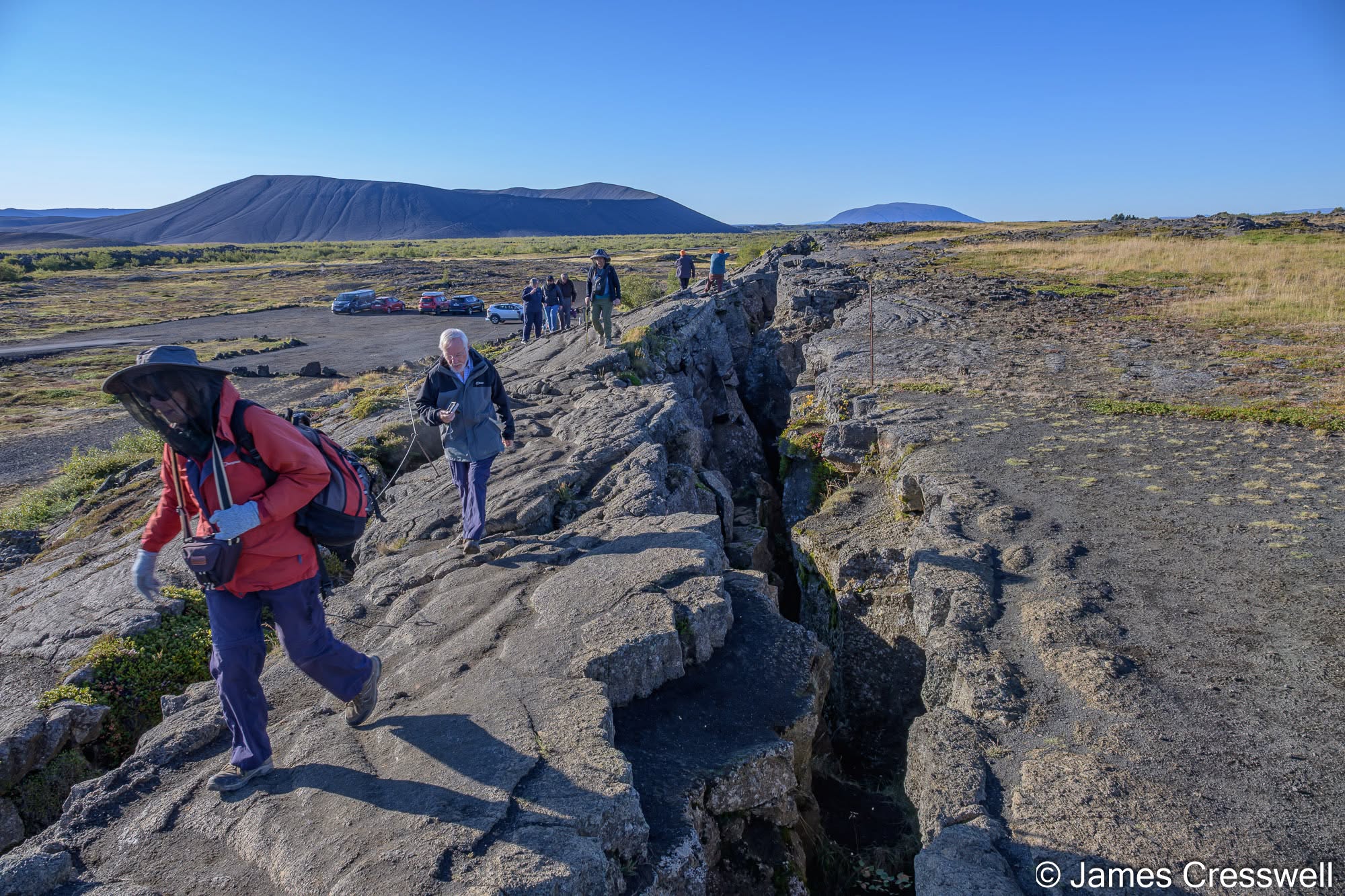
Left: Plate-boundary faulting at Grjótagjá, near Lake Mývatn. Here the North American and Eurasian plates are pulling apart within Iceland’s Northern Volcanic Zone. Unlike the conspicuous rift valley at Þingvellir, spreading here is distributed across broad, overlapping fissure swarms containing numerous extension fractures, normal faults and volcanic fissures. Grjótagjá itself lies on an open normal fault forming part of a small graben within the Krafla fissure swarm. The geothermal cave lies immediately nearby along the same fracture system, while Hverfjall (Hverfell), a large tuff ring formed by an explosive magma–water eruption around 2,500 years ago, rises in the background.
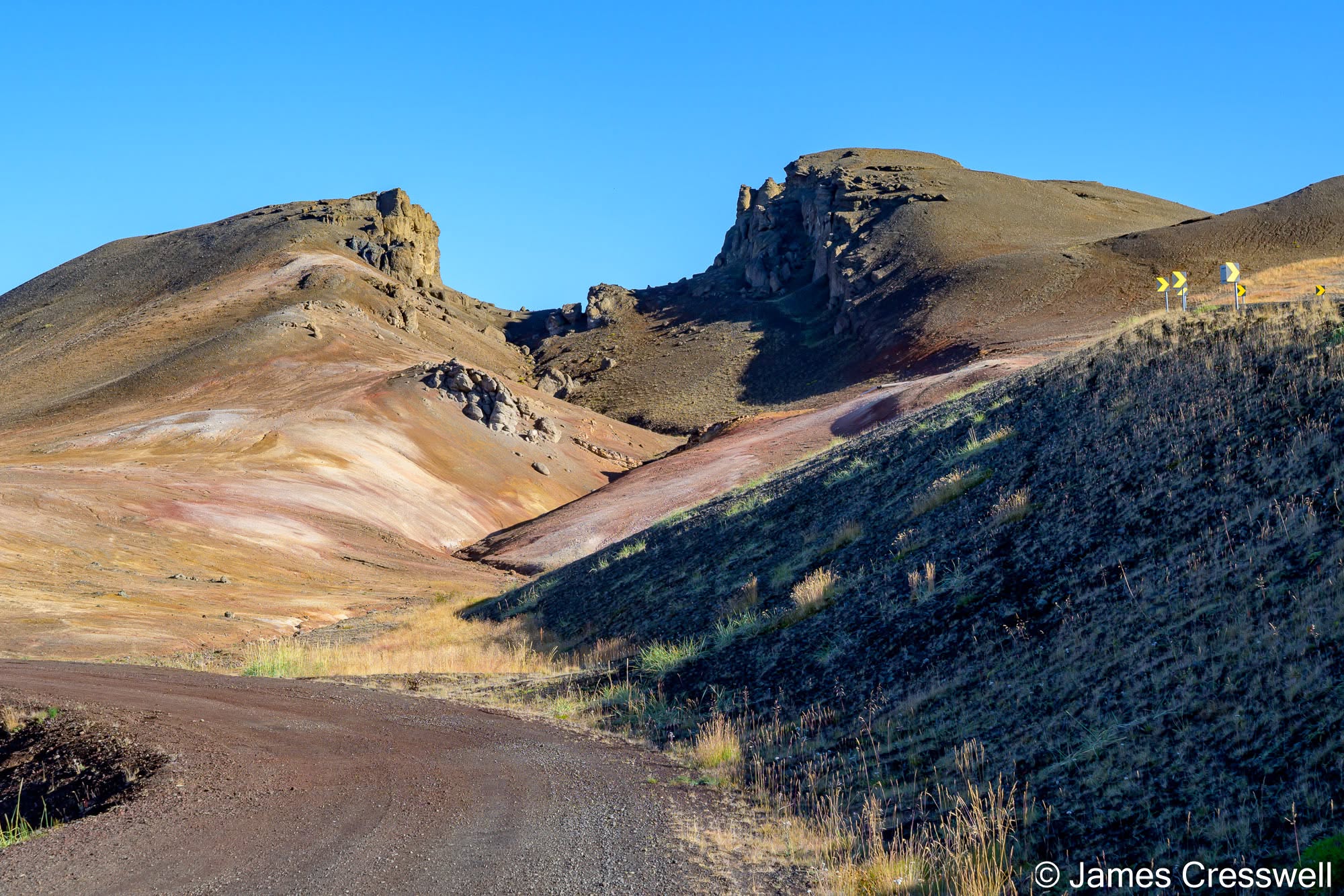
Right: Plate-boundary extension fracture at Námafjall, near Lake Mývatn. This open fissure forms part of the Krafla fissure swarm, within Iceland’s Northern Volcanic Zone. Here, spreading between the North American and Eurasian plates is distributed across a broad belt containing numerous extension fractures, normal faults and eruptive fissures rather than a single obvious rift valley. The Námafjall area was measurably stretched during the 1975-84 Krafla rifting episode, when repeated dyke intrusions opened the crust across this part of northern Iceland.
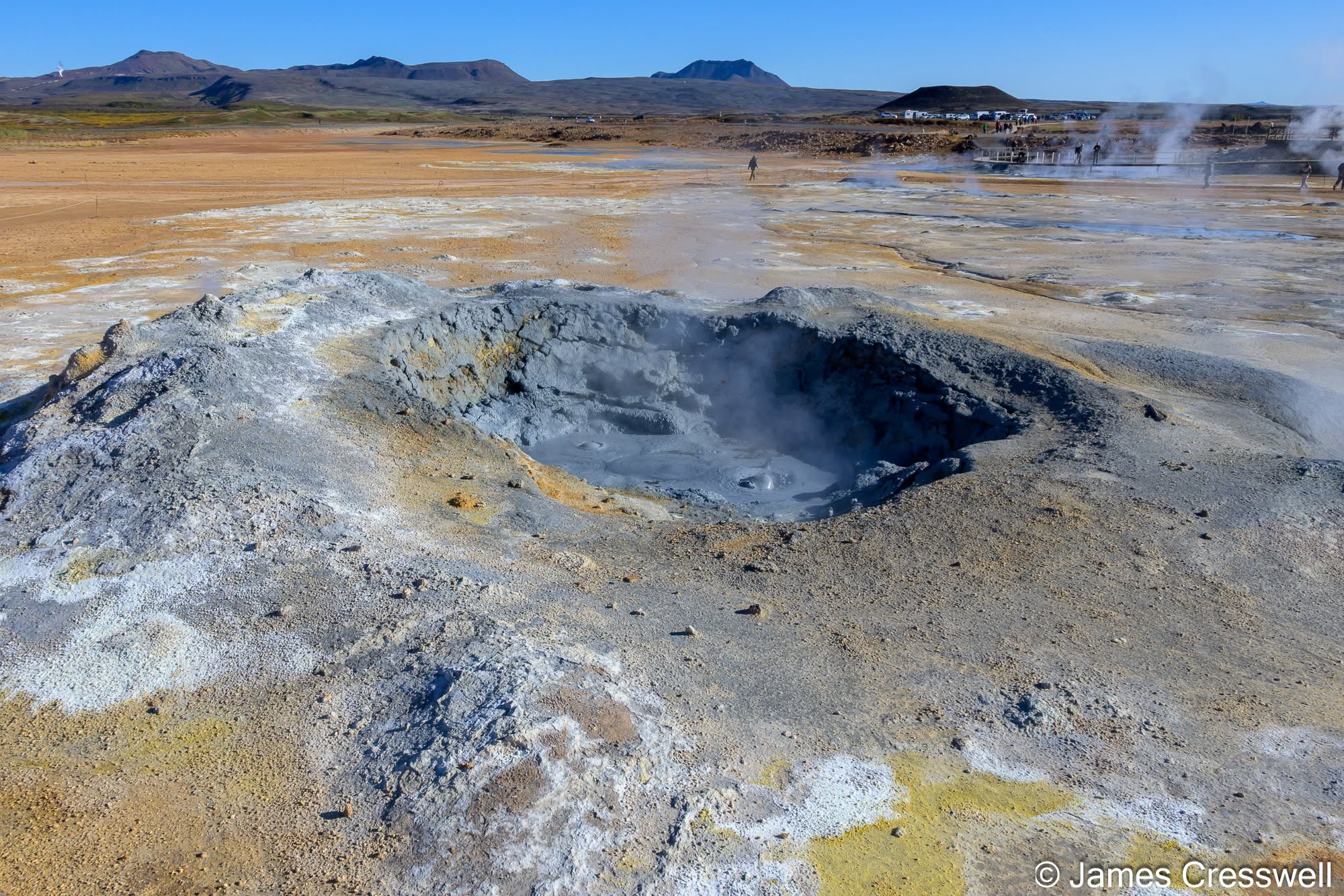
Left: Mudpot at Hverir, on the eastern side of Námafjall. Geothermal activity has affected this area for at least 11,000 years. Here, steam rising through shallow surface water produces a bubbling mudpot. Hydrogen sulphide gives the site its characteristic “rotten egg” smell; microbes oxidise the gas to sulphuric acid, which chemically breaks down the volcanic rock to clay, creating the thick grey mud.
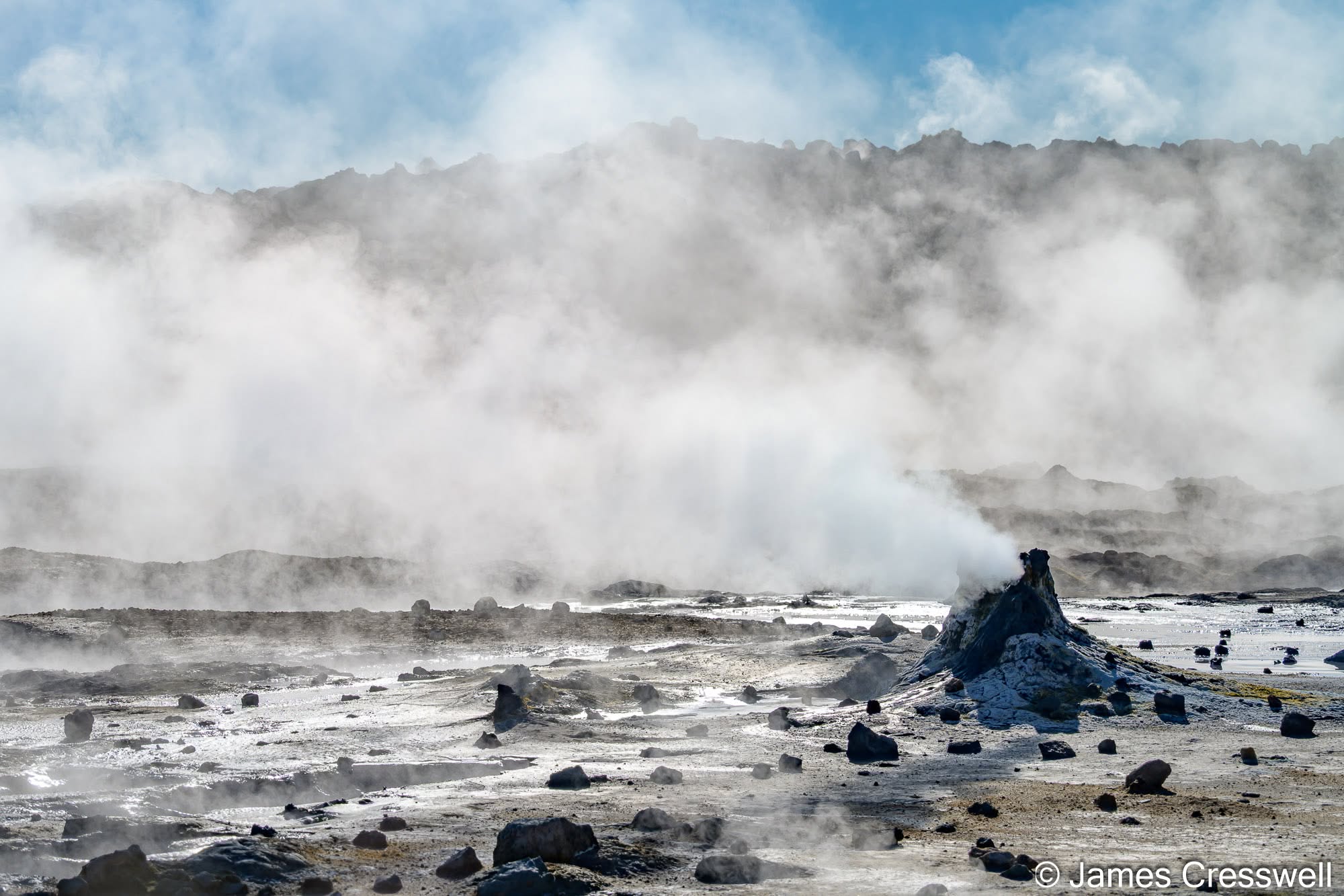
Top right: Fumarole at Hverir, Námafjall. Steam and volcanic gases rise through the fractured ground of this high-temperature geothermal field, depositing sulphur and other minerals around the vent. Hverir contains both natural fumaroles and artificial ones: in the 1950s, 16 shallow boreholes were drilled here during renewed attempts to exploit sulphur, and several subsequently developed into powerful steam vents. The fumarole shown here appears to be one of the natural features rather than one of the boulder-covered boreholes.
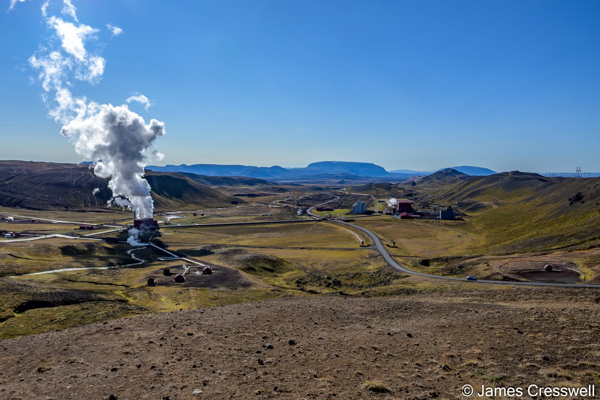
Bottom right: Krafla Geothermal Power Station, inside the Krafla caldera. The station exploits the intense geothermal heat beneath the Krafla volcanic system and has an installed capacity of 60 MW, producing about 465 GWh of electricity per year. The Krafla volcanic system extends for about 100km along Iceland’s Northern Volcanic Zone and contains a central volcano with a roughly 7 × 9km caldera, formed about 110,000 years ago. The caldera has subsequently been almost completely infilled by younger volcanic material, which is why its broad outline is much less obvious in the landscape than calderas such as Askja.
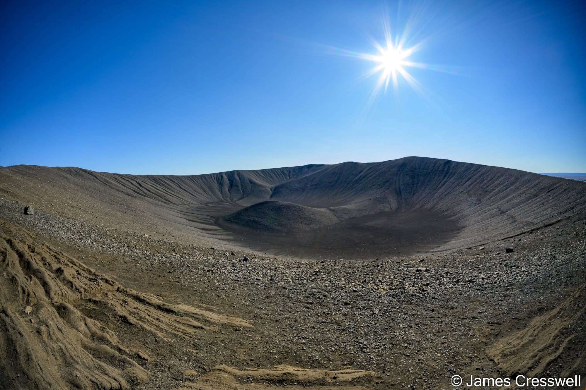
Left: Hverfjall crater, near Lake Mývatn. Hverfjall formed about 2,700 years ago during a powerful hydromagmatic eruption through an ancestral Lake Mývatn. The crater is roughly 1km across and up to 150m high and is the largest vent structure along a fissure about 2km long. The eruption produced both fallout tephra and pyroclastic surges; some surges were relatively dry and others water-rich, and deposits extend for several kilometres from the crater.
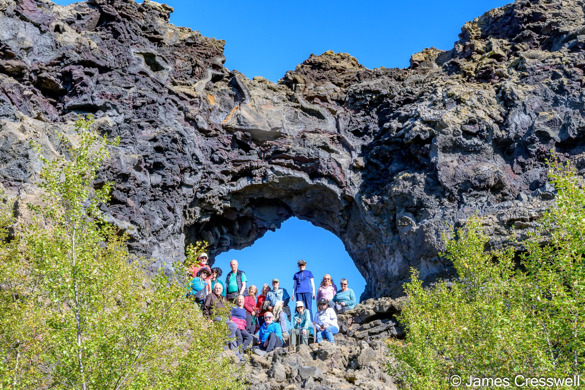
Right: The group poses in an old lava tube at Dimmuborgir. These strange lava formations developed about 2,300 years ago, when lava from eruptions along the Þrengslaborgir–Lúdentsborgir crater row flowed into an ancestral Lake Mývatn and ponded to form a temporary lava lake. Steam explosions produced rootless cones and vents, while lava solidified around them; when the still-molten interior later drained away, the hardened pillars, arches and cavities were left standing. Some preserve relict lava tubes, like the one seen here. Dimmuborgir means roughly “dark forts” or “dark castles”, and the landscape has long been associated with Icelandic folklore.
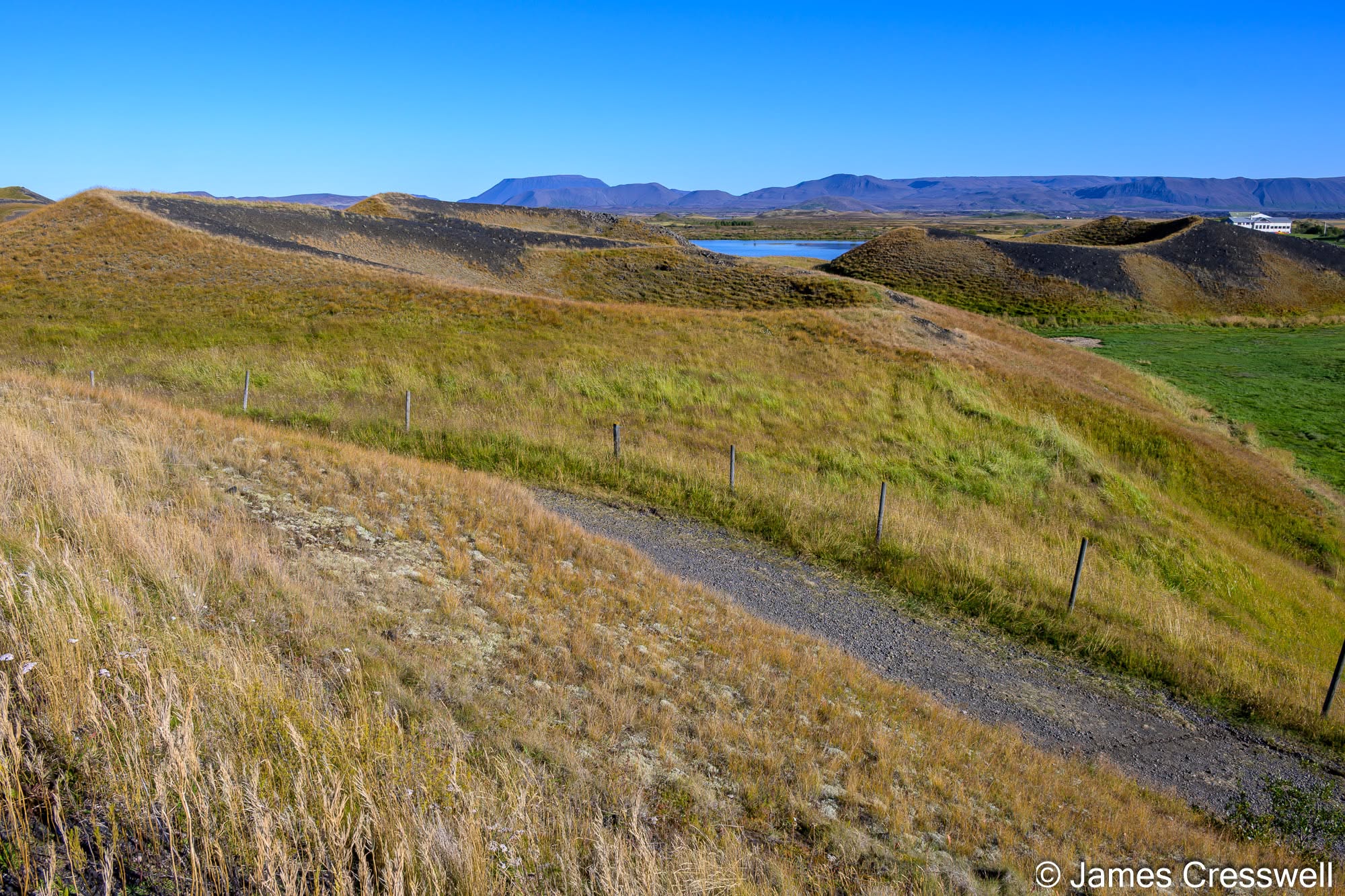
Left: Skútustaðagígar rootless cones, Lake Mývatn. More than 1,400 rootless cones occur around Mývatn. They formed when basaltic lava flowed over shallow water or waterlogged sediments, causing violent steam explosions as the trapped water was heated. The resulting craters resemble volcanic cones but have no underlying magma feeder, which is why they are known as rootless cones.
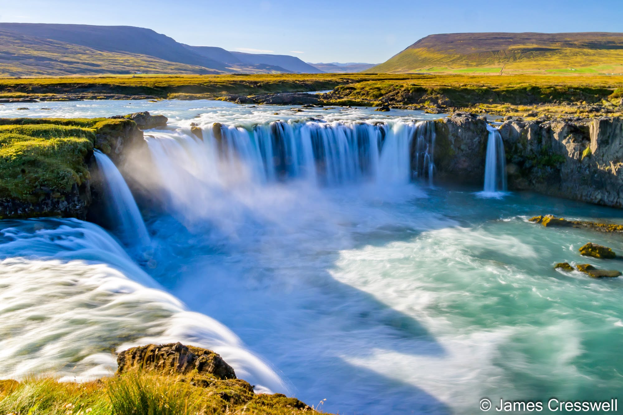
Right: Goðafoss, on the Skjálfandafljót river. The waterfall is about 12m high and 30m wide, cutting through a basalt lava field erupted from Trölladyngja around 7,000 years ago. As the river has cut down through the lava, it has exposed well-developed columnar joints and entablature, recording different cooling styles within the flow. The name Goðafoss can be translated as “waterfall of the gods” and is traditionally associated with Iceland’s conversion to Christianity around AD 1000.
Day Eight: Across West Iceland
Our final full day completed our circuit of Iceland. Travelling west and south, we stopped at the Grábrók volcanic craters before eventually returning to the Reykjanes Peninsula and Keflavik. By this point we had travelled through an extraordinary cross-section of Icelandic geology, from glaciers and ancient volcanic interiors to geothermal fields and landscapes created by some of the island’s youngest eruptions.
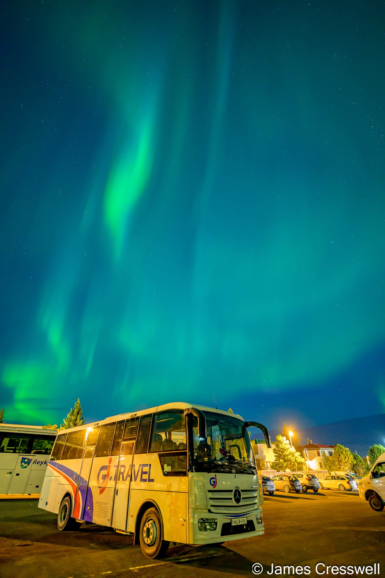
Left: Aurora over Akureyri on our penultimate night in Iceland. We were lucky enough to see the Northern Lights on three consecutive nights, and this display appeared over the city behind our tour coach. Even with the street lighting, the green curtains were bright enough to dominate the sky.
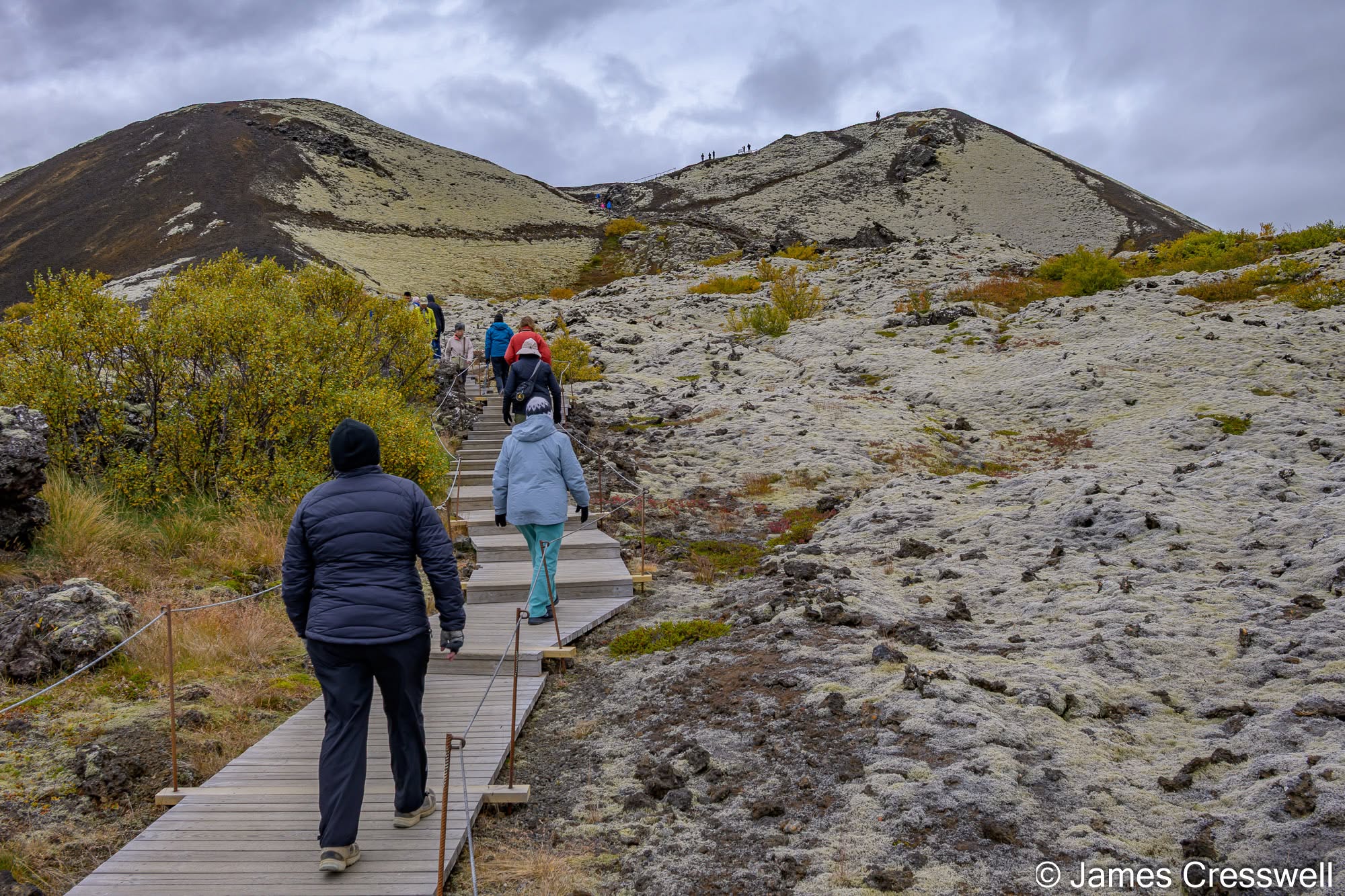
Right: Grábrók volcano, western Iceland. Grábrók is a basaltic scoria cone formed around 3,700 years ago, with lava spilling from its breached crater onto the surrounding plain. It belongs to the Ljósufjöll volcanic system, at the eastern end of the Snæfellsnes–Borgarfjörður volcanic zone. This is a flank volcanic zone west of Iceland’s present main spreading centres and is thought to preserve part of an older plate-boundary system abandoned as active rifting migrated eastwards.
Day Nine: Farewell to Iceland
After eight nights and a complete circuit of the island, it was time to say goodbye to Iceland. And somehow, alongside everything else, Iceland had treated us to the Northern Lights on three consecutive nights, adding one final spectacle to an already memorable journey.
Fire, Ice and a Restless Earth
Iceland is sometimes described as a land of fire and ice, but spending time exploring its geology reveals just how much lies behind that familiar description. Here, tectonic plates are separating, magma continues to create new land, geothermal systems bring heat towards the surface and glaciers simultaneously carve, erode and reshape the volcanic landscape. Few destinations allow you to experience geological processes on this scale while seeing so clearly how they connect.
Our 2027 GeoWorld Travel Iceland tour is already fully booked, but we are beginning to look ahead to Iceland 2028. If these photographs inspire you to experience Iceland’s geology for yourself, please get in touch to register your interest.
For information on our other tours, visit our Destinations Page.
Discussion about this post