









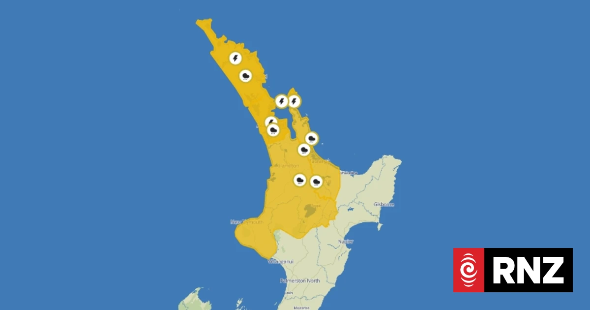
Severe Thunderstorm Warning for Parts of New Zealand
MetService has alerted residents of Western Bay of Plenty, Whakatane, and Rotorua to a severe thunderstorm warning. The forecast suggests that these thunderstorms will be accompanied by heavy rainfall.
Thunderstorm Activity Detected
On Monday at 11:15 PM, weather radar indicated the presence of severe thunderstorms near Te Puke and Paengaroa. The storms are moving in a south/southeast direction and are anticipated to impact areas near Rotorua, Rotoehu, Rotoiti, Lake Tarawera, and Okere Falls by 12:52 AM on Tuesday, and subsequently near Rotorua, Waiotapu, and Rerewhakaaitu at 1:22 AM.
Weather Advisory Duration
The warning is set to remain in effect until 1:22 AM, with additional thunderstorm watches issued for regions of Northland and Auckland. Heavy rain watches have also been established from Northland down to the central plateau.
Intense Weather Conditions Expected
According to MetService meteorologist John Law, Monday witnessed significant bursts of rainfall and lightning, with the potential for more severe weather events to follow. Most of the lightning activity occurred off the western coast of Auckland and Waikato, alongside rainfall stretching from Northland to Waitomo.
Contributing Weather Factors
Law noted that the warm and humid atmospheric conditions have created an ideal environment for the formation of intense rain showers.
Further Rain Warnings
A heavy rain watch is active for Northland from 9 PM on Monday until 10 PM on Tuesday. In Auckland and Great Barrier Island, this watch spans from 11 PM on Monday to 1 AM on Wednesday. Rainfall intensity may reach between 25 to 40 mm per hour, potentially resulting in localised downpours and thunderstorms.
Coromandel and Central North Island Watch
The severe thunderstorm watch for Coromandel commenced at 9 PM and is expected to last until at least 4 AM on Wednesday. Additionally, a heavy rain watch for the central North Island will be in effect from 3 AM Tuesday until early Wednesday across regions including Waikato, Waitomo, Taupō, Taranaki, Taumarunui, and Tongariro National Park, with an elevated risk of being upgraded to a warning.
Recent Weather Events
This forecast follows significant rainfall and storms that affected Auckland and Canterbury over the previous Friday and Saturday. Earlier on Monday, a severe thunderstorm warning was issued for the Far North, though it has since been lifted.
Potential Hazards
MetService warned of a moderate risk of severe thunderstorms with localized downpours (25 to 40 mm per hour) affecting Auckland and Great Barrier Island from late morning until evening. Such intense rainfall may lead to surface and flash flooding, particularly in low-lying areas such as streams, rivers, or narrow valleys, and could also result in land slips.
Driving Conditions Warning
Drivers are advised that hazardous conditions may arise due to surface flooding and reduced visibility during heavy rainfall.










Discussion about this post