...SEVERE THUNDERSTORM WARNING REMAINS IN EFFECT UNTIL 1215 AM CDT
FOR SOUTHEASTERN ALEXANDER, BALLARD, CARLISLE, NORTHWESTERN GRAVES,
NORTHERN HICKMAN, SOUTHWESTERN MCCRACKEN AND NORTHEASTERN MISSISSIPPI
COUNTIES...

At 1154 PM CDT, severe thunderstorms were located along a line from
over Barkley Regional Airport to over Clinton, or along a line from 6
miles southwest of Metropolis to over Clinton, moving east at 35 mph.

HAZARD...70 mph wind gusts and small hail.

SOURCE...Radar indicated.

IMPACT...Expect considerable tree damage. Damage is likely to mobile
homes, roofs, and outbuildings.

Locations impacted include...
Cairo, La Center, Bardwell, Wickliffe, Barlow, Wyatt,
Lovelaceville, Barkley Regional Airport, West Paducah, Kevil,
Arlington, Columbus, Wilson City and Blandville.

PRECAUTIONARY/PREPAREDNESS ACTIONS...

Anyone outdoors should move to shelter inside a well-built structure
and stay away from windows. These storms are capable of producing
widespread damaging winds.

Tornadoes can develop quickly from severe thunderstorms. Seek shelter
immediately in an interior room on the lowest floor of a well-built
structure.

Continuous cloud to ground lightning is occurring with these storms.
Lightning is one of nature's leading killers. Remember, if you can
hear thunder, you are close enough to be struck by lightning.

&&


TORNADO...POSSIBLE;
THUNDERSTORM DAMAGE THREAT...CONSIDERABLE;
HAIL THREAT...RADAR INDICATED;
MAX HAIL SIZE...

                            The National Weather Service in Paducah has issued a

* Severe Thunderstorm Warning for...
Calloway County in western Kentucky...
Graves County in western Kentucky...
East Central Hickman County in western Kentucky...
Southeastern McCracken County in western Kentucky...
Marshall County in western Kentucky...

* Until 1245 AM CDT.

* At 1151 PM CDT, severe thunderstorms were located along a line from
near Barkley Regional Airport to 7 miles north of Fulgham, or along
a line from 7 miles west of Lone Oak to 7 miles northeast of
Clinton, moving east at 45 mph.

HAZARD...60 mph wind gusts and small hail.

SOURCE...Radar indicated.

IMPACT...Expect damage to roofs, siding, and trees.

* Locations impacted include...
Paducah, Murray, Mayfield, Benton, Calvert City, Reidland, Lone
Oak, Sedalia, Lynnville, Fulgham, Wingo, Hardin, Hazel, Brewers,
Kirksey, Symsonia, Harris Grove, Fancy Farm, Lowes and Aurora.

PRECAUTIONARY/PREPAREDNESS ACTIONS...

Seek shelter inside a well-built structure and stay away from
windows. These storms are capable of producing damaging winds.

Tornadoes can develop quickly from severe thunderstorms. Seek shelter
immediately in an interior room on the lowest floor of a well-built
structure.

&&


TORNADO...POSSIBLE;
HAIL THREAT...RADAR INDICATED;
MAX HAIL SIZE...

                            ...TORNADO WARNING IS CANCELLED FOR SOUTHEASTERN BALLARD,
NORTHEASTERN CARLISLE AND SOUTH CENTRAL MCCRACKEN COUNTIES...

The tornado threat has diminished and the Tornado Warning has been
cancelled. However, large hail and damaging winds remain likely and a
Severe Thunderstorm Warning remains in effect for the area.

A Severe Thunderstorm Watch remains in effect until 300 AM CDT for a
portion of western Kentucky.

&&


SEVERE THUNDERSTORM WATCH 602 REMAINS VALID UNTIL 3 AM CDT
THURSDAY FOR THE FOLLOWING AREAS

IN ILLINOIS THIS WATCH INCLUDES 5 COUNTIES

IN SOUTHERN ILLINOIS

ALEXANDER             JOHNSON               MASSAC
PULASKI               UNION

IN KENTUCKY THIS WATCH INCLUDES 6 COUNTIES

IN WESTERN KENTUCKY

BALLARD               CARLISLE              FULTON
GRAVES                HICKMAN               MCCRACKEN

IN MISSOURI THIS WATCH INCLUDES 10 COUNTIES

IN SOUTHEAST MISSOURI

BOLLINGER             BUTLER                CAPE GIRARDEAU
CARTER                MISSISSIPPI           NEW MADRID
RIPLEY                SCOTT                 STODDARD
WAYNE

THIS INCLUDES THE CITIES OF BARDWELL, BLOOMFIELD, CAIRO,
CAPE GIRARDEAU, CHARLESTON, CLINTON, DONIPHAN, HICKMAN, JACKSON,
JONESBORO, MARBLE HILL, MAYFIELD, METROPOLIS, MOUND CITY,
NEW MADRID, PADUCAH, PIEDMONT, POPLAR BLUFF, SIKESTON, VAN BUREN,
VIENNA, AND WICKLIFFE.


...FLOOD WATCH IN EFFECT UNTIL 7 AM CDT THURSDAY...

* WHAT...Flash flooding caused by excessive rainfall is possible.

* WHERE...Portions of southern Illinois, including the following
areas, Alexander, Gallatin, Hardin, Jackson, Johnson, Massac, Pope,
Pulaski, Saline, Union and Williamson, western Kentucky, including
the following areas, Ballard, Caldwell, Calloway, Carlisle,
Christian, Crittenden, Daviess, Fulton, Graves, Henderson, Hickman,
Hopkins, Livingston, Lyon, Marshall, McCracken, McLean, Muhlenberg,
Todd, Trigg, Union KY and Webster, and southeast Missouri,
including the following areas, Bollinger, Butler, Cape Girardeau,
Carter, Mississippi, New Madrid, Perry MO, Ripley, Scott, Stoddard
and Wayne MO.

* WHEN...Until 7 AM CDT Thursday.

* IMPACTS...Excessive runoff may result in flooding of rivers,
creeks, streams, and other low-lying and flood-prone locations.

* ADDITIONAL DETAILS...
- Training thunderstorms are forecast to produce a swath of very
heavy rainfall across portions of our region from late this
evening through the overnight. Rainfall rates of at least 2" per
hour are possible. A swath of 2 to 5" storm total rainfall may be
observed through Thursday morning.
- http://www.weather.gov/safety/flood

PRECAUTIONARY/PREPAREDNESS ACTIONS...

You should monitor later forecasts and be prepared to take action
should Flash Flood Warnings be issued.

&&

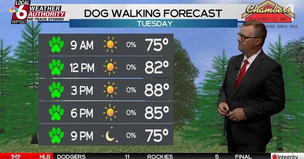
Dog Walking Forecast 8.18.26 | Weather


Customer Support
1251 Wilcrest Drive
Houston, Texas
77042 USA
Call-832.795.1420
e-mail – news@theinsightpost.com
Discussion about this post