
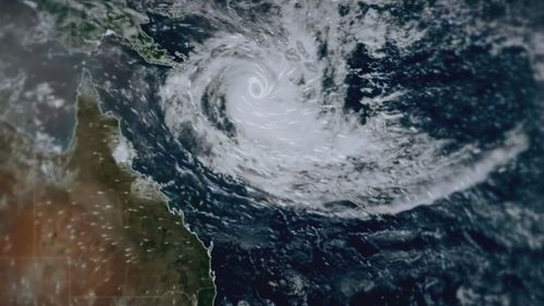
The category 4 storm was about 680 km east of Willis Island and 1130 km east of Cairns by 4 am this morning.
The Bureau of Meteorology said that Jasper has weakened overnight, however, it will still hit landfall as a tropical cyclone.
While it’s predicted Jasper may weaken to a category 2 by early next week, the BoM warns “there is a risk of re-intensification” as it approaches the coast, bringing “the potential for severe impacts”.

The BoM’s latest cyclone update said Jasper was likely to make landfall on Wednesday, with the most likely point of impact being Cape Melville and Townsville.
This could put dozens of towns and cities in the firing line between Cape Melville and Townsville, including Cairns and Cooktown.
“A tropical cyclone watch may be issued as early as Sunday but this will be highly dependent on the movement and development of the system,” David Grant from the Bureau of Meteorology said.
Emergency Services Minister Mark Ryan asked residents to prepare.
“This is not a practice, this is not a drill, this is the real deal,” Ryan said.
Fire and Emergency Services Inspector David Welsh said there were a range of things people could do to prepare their properties.
“Any loose items in the backyard to be secured or put away,” Welsh said.
“Check roofs and gutters, make sure there are no loose tiles.”
The Bureau of Meteorology is also scrambling to evacuate four Australian meteorologists on a remote island in the Coral Sea.
The weather station is in danger of being in the cyclone’s path.