









Researchers at The University of Texas have developed a technique called deformation imaging that uses surface mapping data to view Earth’s interior structures. This method improves our understanding of geological phenomena and has successfully imaged subsurface areas affected by the 2011 Tohoku earthquake. Credit: SciTechDaily.com
A new computational technique developed enables the use of surface mapping technologies like 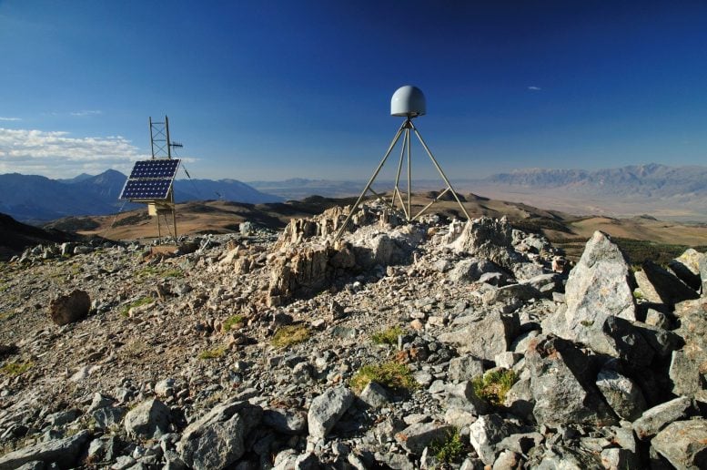
A GPS station atop the Sierra Nevada mountains. Researchers at The University of Texas at Austin used GPS networks to image the planet’s interior. Credit: UNAVCO/National Science Foundation
Advantages of Deformation Imaging
The new technique, described by researchers as “deformation imaging,” provides results comparable to seismic imaging but offers direct information about the rigidity of the planet’s crust and mantle. This property is essential for understanding how earthquakes and other large-scale geological processes work, said Simone Puel, who developed the method for a research project at the University of Texas Institute for Geophysics while in graduate school at the UT Jackson School of Geosciences.
“Material properties like rigidity are critical to understanding the different processes that occur in a subduction zone or in earthquake science in general,” Puel said. “When combined with other techniques like seismic, electromagnetic or gravity, it should be possible to actually produce a much more comprehensive mechanical model of an earthquake in a way that has never been done before.”
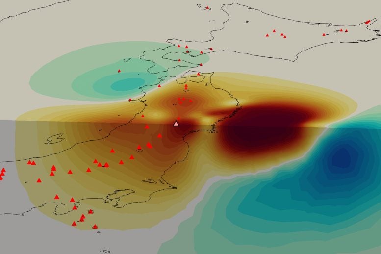
A graphic showing the stiffness of Earth’s crust beneath Japan. The image reveals the boundary where Japan’s continental plate (large dark red patch) collides with the stiffer oceanic plate (dark blue patch). The smaller dark red patches in the center of the image are likely a magma system feeding Japan’s volcanoes (red triangles). The image was created using data collected with a new deformation imaging technique developed by researchers at UT Austin. Credit: Simone Puel
Breakthrough Application and Methodology
Puel, who is now a postdoctoral scholar at the California Institute of Technology, published the theory behind his method earlier this year. A recent study published in June in DOI: 10.1126/sciadv.adl4264
The research was funded by the National Science Foundation and the U.S. Department of Energy. Other co-authors include Dunyu Liu, a computational geoscientist at UTIG, and Umberto Villa, a research scientist at the Oden Institute.










Discussion about this post