









Fresh severe thunderstorm warnings have been issued for Brisbane, with damaging winds and large hailstones likely.
”The Bureau of Meteorology (BoM) warns that, at 11.20pm, severe thunderstorms were detected on the weather radar near Boondall, Sandgate and Brisbane Airport.
“These thunderstorms are moving towards the northeast. They are forecast to affect Mud Island, southern Moreton Island and Tangalooma by 11.50pm and northern Moreton Island and waters off Moreton Island by 12.20am.”
Earlier in the night, the BoM issued another severe weather warning for Queensland for dangerous thunderstorms with giant hail.
That thunderstorm has now passed and the warning cancelled but not before delivering on its promise with nine to 11 centimetre hailstones recorded just east of Cecil Plains.
Even larger 11-12cm hailstones were recorded at Douglas (Goombungee) and some 8cm hailstones recorded at Haden.
Oakey recorded wind gusts of 104km/h at 5.28pm and at 6.35pm Blackwater recorded win gusts of 98km/h.
An earlier severe thunderstorm warning for NSW residents across the Hunter, Metropolitan, Illawarra and Central Tablelands Forecast Districts has now been cancelled.
The weather system, which has now passed, brought 59.8 millimetres of rainfall in the hour to 2.23pm at Grafton Airport.
There were also 6cm hailstones at Yass and 104 km/h wind gust recorded at Cabramurra around 5.06pm.

‘Mixed bag’ across Easter weekend
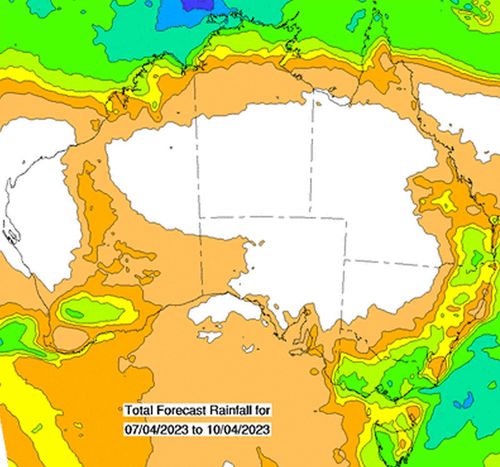
Looking ahead to the rest of the Easter long weekend, Australians across most of the country are forecast to get some rain – the only question is how much.
Senior bureau meteorologist Dean Narramore broke down what we can expect for the long weekend.
“We will have cold fronts moving through the southern and south-eastern parts of the country from Thursday through to Sunday, which will lead to showers through Tasmania and up through to southern NSW,” he told 9news.com.au.

Record heat in NSW sparks bushfires
“Warmer winds will drive up through mid to northern NSW and Queensland, while Western Australia will be dry and sunny.
“Southern parts of the country are looking at temperatures about four to 10 degrees below average by Sunday.
Here is the forecast for the capitals over the Easter long weekend:
Saturday: The chance of a thunderstorm in the early morning and some early showers before a sunny day, with highs of 30°C.
Sunday: Another sunny day is on the cards on Easter Sunday, as the mercury climbs to 29°C.
Monday: The run of clear skies will continue, with some light winds, and temperatures expected to reach 28°C.
Saturday: Mostly sunny, with tops of 25°C. Winds northwesterly 15 to 25 km/h turning westerly 30 to 45 km/h in the morning.
Sunday: This is the day the weather will turn windy but the showers have dropped off the forecast. Highs of 21°C expected.
Monday: Mostly sunny, with a maximum temperature of 21°C.
Saturday: Morning showers followed by sunny skies and a maximum of 19°C.
Sunday: Easter Sunday will be partly cloudy with slight chance of showers. A maximum of 15°C is on the cards.
Monday: It will be partly cloudy with a maximum of 16°C. However, temperatures will dip to just 2°C in the morning; the chilliest temperature of the entire Easter long weekend.
Saturday: There’s a very high chance of showers with about 2-8mm forecast for the gauges and temperatures of 17°C.
Sunday: Brace for the chill. The maximum temperature expected for Easter Sunday is 14°C, and there’s a high chance of showers but only a maximum of 4mm expected.
Monday: The mercury will only nudge up a point to 15°C and light showers will remain across the day.
Saturday: Possible evening hail forecast after showers across the day and highs of 17°C predicted.
Sunday: It’s going to be wet and chilly for that Easter egg hunt, with the maximum only getting to 13°C and more rain on the forecast.
Monday: Those hoping for a respite from the rain will have to wait for another day, as there’s a high chance of showers with a top of just 15°C.
Saturday: A partly cloudy day with a good chance of showers, most likely during the morning, and a high of just 20°C forecast.
Sunday: Cloudy with a slight chance of a shower about the hills and southern suburbs and highs of 19°C.
Monday: Monday will be much the same as Sunday, with a top of 20°C expected.
Saturday: There’s a slight chance of an early shower in the northeast and a partly cloudy day to follow but temperatures will be warm, sitting at highs of 25°C.
Sunday: Another partly cloudy one on Easter Sunday with winds getting lighter by the afternoon. Temperatures set to stay at 25°C.
Monday: Another 25°C day with a sunny morning set to be swapped for showers in the afternoon and evening.
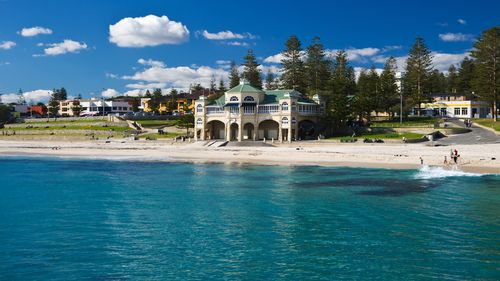
Saturday: Partly cloudy with very high chance of showers, most likely in the afternoon and evening with possible severe thunderstorm also forecast. Maximum temps of 32°C.
Sunday: Easter Sunday will again bring the chance of showers and storms, with a 31°C maximum.
Monday: It’s a rinse-and-repeat situation for tropical Darwin. A maximum of 31°C is again forecast, with showers and a possible storm.








Discussion about this post