
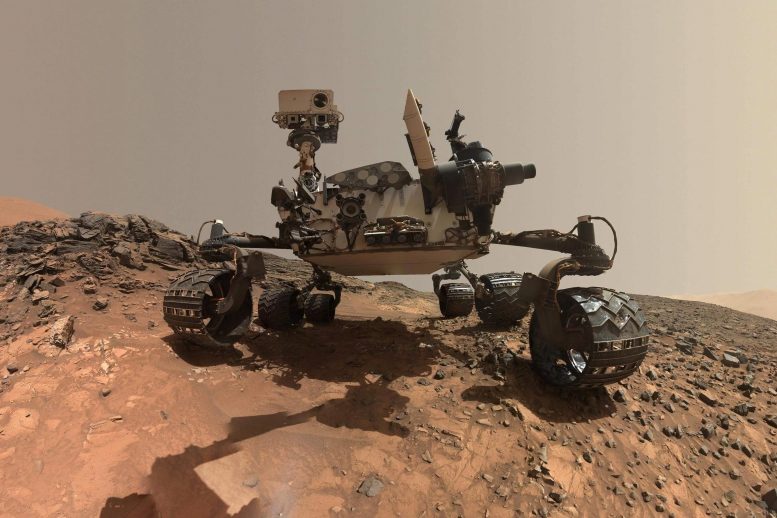
Curiosity’s exploration of the Gediz Vallis channel on Mars offers new insights into the planet’s past, revealing a potential history of water flows and climatic changes that challenge previous beliefs about Mars’ aridity. Credit: NASA/JPL-Caltech/MSSS
The rover has arrived at an area that may show evidence liquid water flowed on this part of 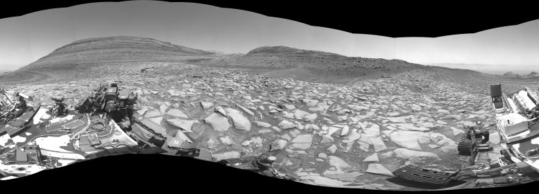
After arriving at Gediz Vallis channel, NASA’s Curiosity Mars rover captured this 360-degree panorama using one of its black-and-white navigation cameras on February 3. The formation has scientists intrigued because of what it might tell them about the history of water on the Red Planet. Credit: NASA/JPL-Caltech
Since 2014, Curiosity has been ascending the foothills of Mount Sharp, which stands 3 miles (5 kilometers) above the floor of Gale Crater. The layers in this lower part of the mountain formed over millions of years amid a changing Martian climate, providing scientists with a way to study how the presence of both water and the chemical ingredients required for life changed over time.
For example, a lower part of those foothills included a layer rich in clay minerals where a lot of water once interacted with rock. Now the rover is exploring a layer enriched with sulfates – salty minerals that often form as water evaporates.
Pan around inside this 360-degree video to see Gediz Vallis channel from the point of view of NASA’s Curiosity Mars rover. Credit: NASA/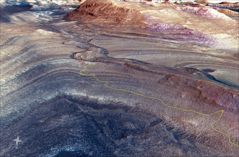
The steep path NASA’s Curiosity Mars rover took to reach Gediz Vallis channel is indicated in yellow in this visualization made with orbital data. At lower right is the point where the rover veered off to get an up-close look at a ridge formed long ago by debris flows from higher up on Mount Sharp. Credit: NASA/JPL-Caltech/UC Berkeley
“If the channel or the debris pile were formed by liquid water, that’s really interesting. It would mean that fairly late in the story of Mount Sharp – after a long dry period – water came back, and in a big way,” said Curiosity’s project scientist, Ashwin Vasavada of NASA’s Jet Propulsion Laboratory in Southern California.
That explanation would be consistent with one of the most surprising discoveries Curiosity has made while driving up Mount Sharp: Water seems to have come and gone in phases, rather than gradually disappearing as the planet grew drier. These cycles can be seen in evidence of mud cracks; shallow, salty lakes; and, directly below the channel, cataclysmic debris flows that piled up to create the sprawling Gediz Vallis ridge.
Last year, Curiosity made a challenging ascent to study the ridge, which drapes across the slopes of Mount Sharp and seems to grow out of the end of the channel, suggesting both are part of one geologic system.
Viewing the Channel Up Close
Curiosity documented the channel with a 360-degree black-and-white panorama from the rover’s left navigation camera. Taken on Feb. 3 (the 4,086th Martian day, or sol, of the mission), the image shows the dark sand that fills one side of the channel and a debris pile rising just behind the sand. In the opposite direction is the steep slope that Curiosity climbed to reach this area.
The rover takes these kinds of panoramas with its navigation cameras at the end of each drive. Now the science team is relying on the navcams even more while engineers try to resolve an issue that is limiting the use of one imager belonging to the color Mast Camera, or Mastcam.
