

Pictured in this artist’s concept, NISAR, short for NASA-ISRO Synthetic Aperture Radar, marks the first time the U.S. and Indian space agencies have cooperated on hardware development for an Earth-observing mission. Its two radar systems will monitor changes in nearly all of Earth’s land and ice surfaces twice every 12 days. Credit: NASA/JPL-Caltech
NISAR will study changes to ice sheets, glaciers, and sea ice in fine detail, as climate change warms the air and ocean.
NISAR, the soon-to-launch radar satellite from
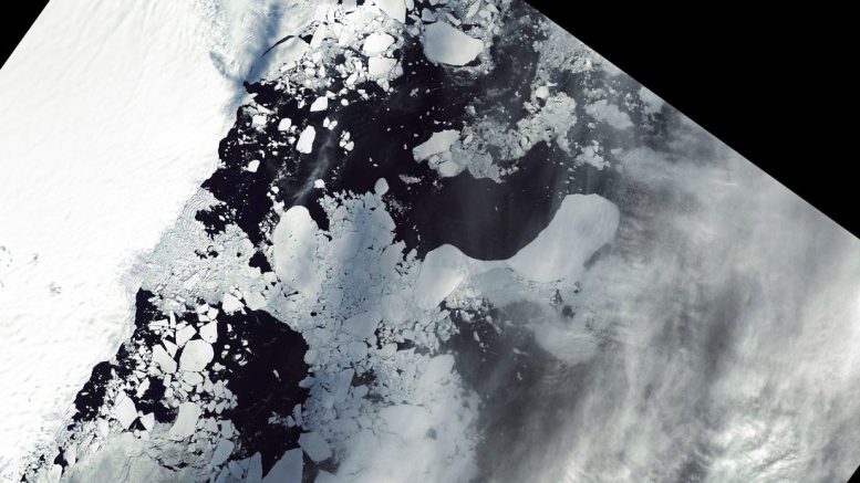
Set to launch in 2024, NISAR will use radar to monitor changes on Earth’s land and ice surfaces, including the breakup of ice shelves. These before (upper) and after (lower) satellite images from East Antarctica in January and March 2022 show the edges of the Glenzer and Conger glaciers collapsing as icebergs fell into the ocean. Credit: NASA
Set to be launched in 2024 by ISRO from southern India, NISAR will observe nearly all the planet’s land and ice surfaces twice every 12 days. The satellite’s unique insights into Earth’s cryosphere will come from the combined use of two radars: an L-band system with a 10-inch (25-centimeter) wavelength and an S-band system with a 4-inch (10-centimeter) wavelength.
L-band can see through snow, helping scientists better track the motion of ice underneath, while S-band is more sensitive to snow moisture, which indicates melting. Both signals penetrate clouds and darkness, enabling observations during monthslong polar winter nights.
‘Time-Lapse Movie’ of Ice Sheets
NISAR’s orientation in orbit will enable it to collect data from Antarctica’s far interior, close to the South Pole – unlike other large imaging radar satellites, which have more extensively covered the Arctic.
Antarctica’s ice sheets hold the planet’s largest reservoir of frozen fresh water, and the rate at which it may lose ice represents the greatest uncertainty in sea level rise projections. NISAR’s increased coverage will be crucial for studying the motion of ice flowing down from central Antarctica’s high elevations toward the sea.
NASA and ISRO (Indian Space Research Organisation) have teamed up to create a powerful new space mission that will track our changing Earth in fine detail. The satellite, called NISAR, will use an advanced radar system to deepen our understanding of deforestation, shrinking glaciers and sea ice loss, natural hazards, climate change, and other global vital signs. Credit: NASA/
