[ad_1]
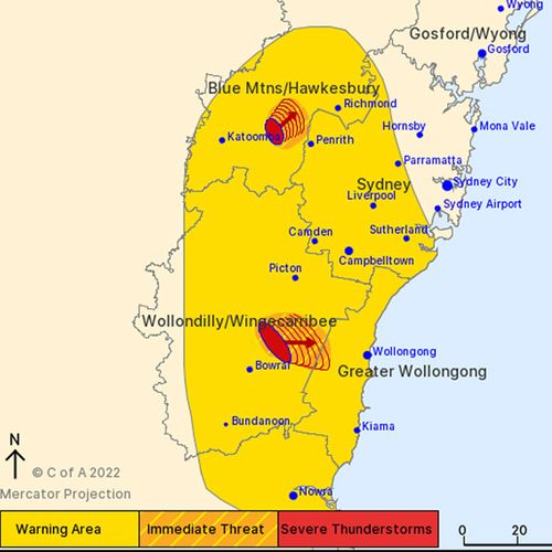
The Bureau of Meteorology (BoM) is warning of damaging winds, large hailstones and heavy rainfall for parts of NSW this afternoon.
The thunderstorms are moving towards the east to north-east, affecting the Blue Mountains, Hawkesbury, Wollondilly, Wingecarribee, Greater Wollongong and Sydney areas.
The BoM forecast the storms would affect Springwood and Lake Nepean by 3.45pm and Bargo and the area south of Wilton by 4.15pm.
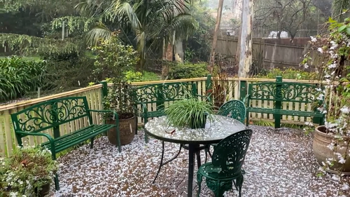
The Blue Mountains suburb of Springwood was coated in a blanket of hail this afternoon as the storm passed over.
A more general severe thunderstorm warning is also current for the Northern Rivers, Illawarra and parts of the Mid North Coast, Metropolitan, Central Tablelands, Northern Tablelands and Hunter districts.
Virtually all other parts of the country will also receive a soaking over the next ten days, with Weatherzone warning “a series of weather systems” loom.
The SES has carried out at least 13 rescues in the past 24 hours across the state.
More wet weather is set to drench the state, as a trough threatens to spill thunderstorms and heavy rain over the next three days.
The BoM said this will exacerbate flood risks.
“Flooding continues across many inland catchments and many other catchments are saturated,” it wrote.
“Showers and thunderstorms moving through with a trough over the next couple of days may exacerbate existing flooding and possibly lead to renewed riverine flooding.”
A strong wind warning is in place for Byron Coast and Coffs Coast until Wednesday at least.
Showers and a possible storm are forecast for Sydney, with falls between 3mm to 4mm possible.
Over the next three days, the heaviest rain is expected to fall over Victoria and southern NSW.
Up to 50mm is forecast for stretches of the coast, with isolated falls of 100mm possible.
That is just one of the systems to play out above Australia over the next week and a half.
‘Unseasonable’ rainfall coming for Top End
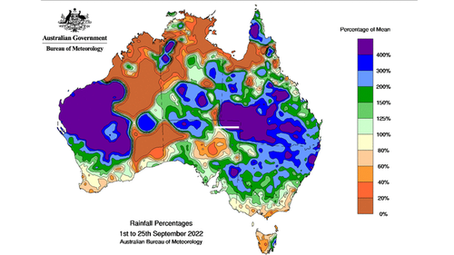
Weatherzone said north-west WA’s Kimberley and Pilbara districts will cop an “unseasonable drenching”.
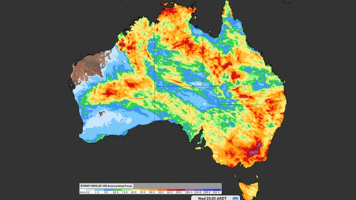
“Numerous weather systems are expected to impact the country in the next 10 days or so, including a low pressure trough which could deliver significant unseasonable rainfall to north-west WA’s Kimberley and Pilbara districts early next week,” it wrote, pointing to modelling of accumulated rainfall.
“Broome is located right where one of those reddish blobs sits, suggesting potential rainfall in the 50-80 mm range.
“Those two regions experience almost no rainfall on average at this time of year.”
Darwin will also receive an early October drenching.
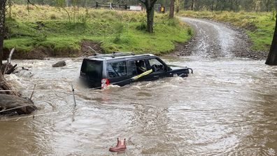
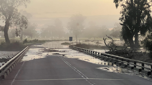
Drivers find themselves trapped in floodwaters as heavy rain hits two states
[ad_2]
Source link
