
[ad_1]
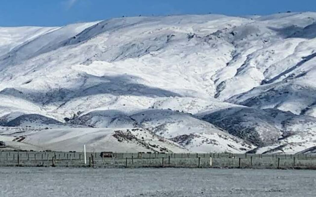
Snow-covered hills at Matakanui Station, Omakau, Central Otago.
Photo: Supplied / Andrew Paterson
A wintry blast has brought icy cold temperatures and snow in the South Island – and a second more intense front will make it even colder across the country later today.
The polar blast coming from Antarctica will bring most of the country to single digit temperatures overnight.
Heavy snow warnings and watches are in place in Otago, Southland, much of Canterbury and parts of Marlborough, and in the second more intense wave snow could fall to sea level in Christchurch.
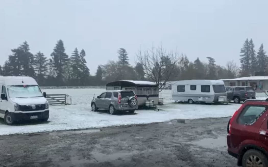
Snow at the Methven camping ground.
Photo: Supplied / Ali Jones
Temperatures in the South Island could feel like anywhere from -15C to -5C, NIWA said.
There was a real hypothermia risk for people and livestock, the forecaster said.
Scenes from Geraldine this morning ☃️ ( credit: Molly Johnson) pic.twitter.com/6bI96XKUEY
— NIWA Weather (@NiwaWeather) October 4, 2022
NIWA meteorologist Chris Brandolino told Morning Report the temperatures predicted for the South Island would be noteworthy even in mid-July, let alone in October.
“The effect of temperature and wind chill will make it feel sub-zero across much of the South Island overnight tonight and tomorrow morning, and that will sneak in to the North Island.”
In Christchurch, where it was 6C at the airport by 8am, snow was expected above 200m in the Port Hills and to reach sea level by the end of the day, MetService said.
Wellington could also have snow in hilly suburbs, there could be snowfall in Wairarapa.
The southerly change would hit Wellington in the afternoon, and by 7am Thursday temperatures would be around 3C, Brandolino said.
Auckland’s temperatures would be coldest on Friday morning, down near 1C-2C, he said.

Snow on the Lindis Pass on Wednesday morning.
Photo: Waka Kotahi / NZTA
MetService road snowfall warnings cover much of the country. In the North Island, the Napier-Taupo Road (SH5), the Desert Road (SH1) and Remutaka Hill Road (SH2) are likely to be affected by snow from overnight on Wednesday.
In the south, there are warnings for the Dunedin to Waitati Highway (SH1), Lewis Pass (SH7), Arthur’s Pass (SH73), Porters Pass (SH73), Haast Pass (SH6), Lindis Pass (SH8), Crown Range Road and the Milford Road (SH94).

Paddocks covered with snow at Matakanui Station, Omakau, Central Otago
Photo: Supplied / Andrew Paterson
Andrew Paterson, who farms sheep and beef at Matakanui Station at Central Otago, woke up to land covered in an inch of snow.
“We normally get a snow dump in the first week of October, so we try to time lambing around that, but that can be hard,” Paterson said.
“The lambing on the flat is well into it, so the snow hasn’t come at the best time, the team have been around to check on everything as much as they can, they’re just looking over the fences with binoculars to see if there’s any issues.”
A cold south-west wind forecast for later today would cause more issues for the lambs than the snow, but in the mean time a few hours of sun would help ewes and lambs, he said.
Reza Abdul Jabbar, whose dairy farm was close to sea level near Invercargill, said temperatures were “icy” so it was a relief the snow blast was short-lived.
Cows were fairly hardy but still needed to be prepared for bad weather, he said.
“Every farmer knows when there’s bad weather on the way you have to fatten cows them up even a day or two before we try to feed them as best we can with plenty of supplements. Today we are just making sure they have plenty of feed and shelter.”
The cold snap has not come at the best time for fruit growers either.
Cherry orchard operator 45 South oversees 200ha in Otago, and chief executive Tim Jones said with the worst of the weather expected tonight, he was most concerned about frost.
“It would be what we call a cold air mass frost rather than a radiation frost, so pretty hard to protect against with wind machines, which the bulk of the orchards in Central Otago use. If people have overhead water systems, I’m sure they’ll be setting them up today to get them running tonight.”
[ad_2]
Source link
